Fort Run, West Virginia | |
|---|---|
 | |
 Fort Run  Fort Run | |
| Coordinates: 39°4′0″N78°55′21″W / 39.06667°N 78.92250°W | |
| Country | United States |
| State | West Virginia |
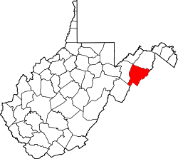
| County | Hardy |
| Elevation | 978 ft (298 m) |
| Time zone | UTC-5 (Eastern (EST)) |
| • Summer (DST) | UTC-4 (EDT) |
| GNIS feature ID | 1554497 [1] |
Fort Run is an unincorporated community in Hardy County, West Virginia, United States. It takes its name from the adjacent stream and lies off U.S. Route 48 to the east of Moorefield.