Taylor, West Virginia | |
|---|---|
 | |
 Taylor  Taylor | |
| Coordinates: 39°2′49″N78°58′47″W / 39.04694°N 78.97972°W | |
| Country | United States |
| State | West Virginia |
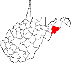
| County | Hardy |
| Time zone | UTC-5 (Eastern (EST)) |
| • Summer (DST) | UTC-4 (EDT) |
| GNIS feature ID | 1555786 [1] |
Taylor is an unincorporated community in Hardy County, West Virginia, United States. Taylor is located south of Moorefield on West Virginia Route 28/U.S. Route 220 between the South Branch Potomac and South Fork South Branch Potomac rivers.