Ashoro, Hokkaido

Last updated • 6 min readFrom Wikipedia, The Free Encyclopedia
Ashoro
足寄町
Town
Onneto and Akan1 DSCN2488 20060805.JPG
Flag of Ashoro, Hokkaido.svg
Emblem of Ashoro, Hokkaido.svg
Ashoro in Hokkaido Prefecture Ja.svg
Location of Ashoro in Hokkaido (Tokachi Subprefecture)
Japan location map with side map of the Ryukyu Islands.svg
Red pog.svg
Ashoro
Location in Japan
Coordinates: 43°15′N143°33′E / 43.250°N 143.550°E / 43.250; 143.550
CountryJapan
Region Hokkaido
Prefecture Hokkaido (Tokachi Subprefecture)
District Ashoro
Area
  Total
1,408.09 km2 (543.67 sq mi)
Population
 (September 30, 2016)
  Total
7,150
  Density5.1/km2 (13/sq mi)
Time zone UTC+09:00 (JST)
Climate Dfb
Website www.town.ashoro.hokkaido.jp
Symbols
Bird Hazel grouse
Flower Rhododendron dauricum
MascotAyumi-chan (アユミちゃん)
Tree Picea glehnii

Ashoro (足寄町, Ashoro-chō) is a town located in Tokachi Subprefecture, Hokkaido, Japan.

Contents

As of September 2016, the town has an estimated population of 7,150 and a density of 5.1 persons per km2. The total area is 1,408.09 km2.

It was the largest municipality in Japan until the merger of Takayama City, Gifu Prefecture on February 1, 2005. Main industries of the town include dairying and farming of sugar beet and wheat.

Lake Onnetō is a major attraction of the town and is a part of Akan National Park.

Geography

Ashoro is located in the northeastern part of Tokachi Subprefecture. Kushiro and Shiranuka are to the east and to the south are Honebestu and Obihiro. Kamishiro is to the west and to the north is Oketo, Rikubestu and Tsubetsu. Ashoro consists of rolling foothills and is nestled at the base of Mount Meakan. Ashoro-gun is 66.5 km wide and 48.2 km long and is 1,408.09K m2. Ashoro is considered a wide town. 83 percent of the town's land is forested. [1]

Climate

Ashoro is influenced by the Tokachi inland climate; temperature differences are large with less precipitation but have many sunny days. On average Ashoro receives 846.5 mm of rain with August being the wettest month, 151 mm of precipitation and February being the driest, 4.5 mm of precipitation. On average temperatures vary from 23.2 degrees Celsius in August and dropping to -8 in January. [1]

Climate data for Ashoro (1991−2020 normals, extremes 1977−present)
MonthJanFebMarAprMayJunJulAugSepOctNovDecYear
Record high °C (°F)7.3
(45.1)
11.8
(53.2)
17.9
(64.2)
30.0
(86.0)
38.8
(101.8)
37.1
(98.8)
37.5
(99.5)
36.6
(97.9)
34.4
(93.9)
26.8
(80.2)
21.4
(70.5)
13.9
(57.0)
38.8
(101.8)
Mean daily maximum °C (°F)−1.4
(29.5)
−0.1
(31.8)
4.6
(40.3)
11.9
(53.4)
18.2
(64.8)
21.7
(71.1)
24.7
(76.5)
25.6
(78.1)
22.0
(71.6)
15.9
(60.6)
8.2
(46.8)
0.8
(33.4)
12.7
(54.8)
Daily mean °C (°F)−9.1
(15.6)
−7.5
(18.5)
−1.4
(29.5)
5.2
(41.4)
11.2
(52.2)
15.3
(59.5)
19.1
(66.4)
20.1
(68.2)
16.0
(60.8)
9.1
(48.4)
2.0
(35.6)
−5.9
(21.4)
6.2
(43.1)
Mean daily minimum °C (°F)−16.3
(2.7)
−15.2
(4.6)
−7.5
(18.5)
−1.1
(30.0)
4.8
(40.6)
10.2
(50.4)
14.8
(58.6)
16.0
(60.8)
11.1
(52.0)
3.2
(37.8)
−3.6
(25.5)
−12.2
(10.0)
0.3
(32.6)
Record low °C (°F)−29.4
(−20.9)
−29.0
(−20.2)
−21.9
(−7.4)
−13.3
(8.1)
−5.4
(22.3)
−0.6
(30.9)
5.1
(41.2)
5.7
(42.3)
−1.0
(30.2)
−7.3
(18.9)
−17.2
(1.0)
−24.4
(−11.9)
−29.4
(−20.9)
Average precipitation mm (inches)26.2
(1.03)
17.7
(0.70)
32.3
(1.27)
55.8
(2.20)
83.8
(3.30)
72.4
(2.85)
114.0
(4.49)
147.3
(5.80)
124.5
(4.90)
79.6
(3.13)
44.0
(1.73)
36.0
(1.42)
833.5
(32.81)
Average precipitation days (≥ 1.0 mm)5.14.36.18.110.19.510.411.410.68.87.36.698.3
Mean monthly sunshine hours 181.8173.1203.4183.1176.4146.9123.8127.0144.2167.4161.9164.91,953.9
Source: JMA [2] [3]

Demographics

Per Japanese census data, [4] the population of Ashoro has steadily dwindled over the past half-century.

Historical population
YearPop.±%
1970 15,172    
1980 12,667−16.5%
1990 10,289−18.8%
2000 8,871−13.8%
2010 7,630−14.0%
2020 6,563−14.0%

Economy

Agriculture and forestry are the key industries in Ashoro. Wheat, sugar beets and beans are the representative crops. As of 2011 there are approximately 30,000 beef and dairy cows in Ashoro. That is over three times the population of Ashoro. Dairy cows make up 32% of all cattle and Wagyu cattle 37% respectively. In 2004 Ashoro issued the "Declaration of a Town that Promotes Pasture-Based Dairy Farming" to utilize the large expanses of grassland which can be found in the hilly and mountainous areas. 83% of the towns land is forested and the local Japanese larch wood is used for new public buildings. This beautiful wood can be seen in the Town Hall and the Ashoro Junior High. [1]

Biomass

The town government plans to build a local system that provides biomass resources and ways to use them. Ashoro produces wood pellets from untapped wood and promotes biogas plants that use livestock manure. [1]

Transportation

The main way around Ashoro is by vehicle but at comprehensive bus system does exist. A bus runs from Ashoro to Obihiro nine times a day. [5] Ashoro has two national highways that meet in Ashoro, Highway 241 runs east/west, and Highway 242 runs north–south. In 2003 the Dotto Expressway opened in Ashoro, connecting it to major centers such as Obihiro and Sapporo. [6] In 1910 the first railway between Ikeda and Ashoro opened. The railway was extended and eventually connected Ashoro to Obihiro and Sapporo. The rail way station recently closed. The old rail station has now become a tourist landmark celebrating the town's history and significant figures. [1]

Recreation

Various recreation facilities exist in Ashoro. The first town gymnasium opened in 1990 and was followed with a heated pool in 1994. [6] Various baseball diamonds and soccer fields exist as well in the winter elementary schools create speed skating rinks. Ashoro also boasts many park golf courses that are available to all citizens. Citizens also participate in other cultural activities like kyūdō and taiko.

Napal Center

Ashoro is home to one of the five Napal Centres (Nature-pal). This center is used for various activities such as English camps, outdoor camps, floor curling and is often used to house sports teams or people from out of town. It promotes nature and community spirit.

Tourism

Ashoro is the gateway to Lake Onneto, Lake Akan and Mount Meakan. Citizens from all over Japan and the world come to visits these sights.

Butterbur Ashoro is also known for its large butterbur that can grow up to three meters tall and have a diameter of 10 cm. Butterbur plays such a significant role that the town mascot, Ayumi-chan, carries a piece of butterbur. Rawan butterbur is nationally renowned and has been designated as a Hokkaido Heritage. [6]

Ashoro Museum of Paleontology This museum is located in Ashoro and is dedicated to fossils found around Ashoro and Japan. It has a unique program that allows visitors to excavate a genuine fossil or crystal. It also offers educational programs to the youth of Ashoro. [1]

Mascot

Ayumi gen1 fuki 1.jpg
Ayumi gen2 fuki 2.png
First-generation and second-generation Ayumi-chan, the town's mascots

Ashoro's official town mascot character is named Ayumi-chan (アユミちゃん), selected to promote the town in 1989. There are two generations of the mascot, and both are used today for town events. [7]

The first generation of the mascot was used around 1990. Due to his peculiar appearance, he was unpopular with children. He can be described as a large pink right foot with large toes, and a smiling face on the shortened sole/torso with a concerned looking unibrow. He has arms, long legs, and is wearing dark blue mittens and shoes. He is also holding a giant butterbur (rawan-buki) stalk. [8]

Right foot Ayumi-chan was stored in a warehouse when the second generation was created. He was put away in the late 2000s and was brought back out in April 2021 when characters that are creepy/cute started gaining popularity in popular culture. [7]

Second generation Ayumi-chan is a left foot, and is characterized as cute, friendly, and gentle. Since her appearance in the early 2010s, she has been very popular with children. [7]

Her appearance can be described as a large, more proportionate pink foot, with sparkling eyes, a friendly looking smiling face, short legs, and arms. She is wearing green gloves and boots, also holding a giant butterbur stalk. [8]

Both versions of Ayumi-chan are considered to be athletic and take part in different town sporting events. They also make an appearance during other cultural town events and have an active role in the town's social media pages. [9]

In 2021, the town released Ayumi-chan LINE stickers of both characters for Japan's commonly used messaging app. [10]

Education

Ashoro has various education facilities:

Day Cares: 4 centres (Ashoro, Rawan, Meto, and Kamitosibetsu)

Elementary Schools 4 schools (Ashoro, Rawan, Meto, and Oyochi)

Junior High Schools 1 school (Ashoro Junior High School)

High Schools 1 school (Ashoro High School)

Sister city and international exchange

In 1990, the Municipal Councils in Ashoro and in Wetaskiwin passed motions to proceed with the formal Sister-Cities Affiliation with the goal being "...to facilitate cross-cultural friendship and good will between the citizen of the city of Wetaskiwin and the citizens of Ashoro, Japan. In so doing, the society will encourage cultural exchanges, will promote and understanding of Japanese culture, and will facilitate the exchange of information and fellowship between groups and individuals in our respective communities."

Since 1992, the Town of Ashoro has sent a student study tours to Wetaskiwin every second year but starting in 2013 all grade 10 students attending Ashoro High School have partaken in the exchange. The motive behind sending all grade 10 students was to curb declining enrollments at Ashoro High School. Starting in 1994 Wetaskiwin has sent a student study tour, every second year, to Ashoro with a brief lapse between 2000 and 2009. [11]

Ashoro has also hired a Coordinator of International Relations, since 1992, from the City of Wetaskiwin. The Coordinator of International Relations position was created to ease communications between Wetaskiwin and Ashoro. As well responsibilities are; assisting and teaching English to students aged 2–16, facilitating student exchanges, organizing and assisting with after school and weekend programs, editing documents, and acting as a cultural liaison. [12]

Famous Persons

Related Research Articles

<span class="mw-page-title-main">Obihiro</span> City in Hokkaido, Japan

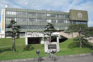
Obihiro is a city in Tokachi Subprefecture, Hokkaido, Japan. Obihiro is the only designated city in the Tokachi area. As of July 31, 2023, the city had an estimated population of 163,084. The next most populous municipality in Tokachi is the adjacent town of Otofuke, with less than a third of Obihiro's population. The city had approximately 500 foreign residents in 2008. The city contains the headquarters of the Fifth Division of the Northern Army of the Japan Ground Self-Defense Force. It also hosts the Rally Japan World Rally Championship-event.

<span class="mw-page-title-main">Kushiro</span> City in Hokkaido, Japan

Kushiro is a city in Kushiro Subprefecture on the island of Hokkaido, Japan. Located along the coast of the North Pacific Ocean, it serves as the subprefecture's capital and it is the most populated city in the eastern part of the island.

<span class="mw-page-title-main">Pippu, Hokkaido</span> Town in Hokkaido, Japan

Pippu is a town located in Kamikawa Subprefecture, Hokkaido, Japan.

<span class="mw-page-title-main">Biei, Hokkaido</span> Town in Hokkaido, Japan

Biei is a town located in Kamikawa Subprefecture, Hokkaido, Japan. As of May 2024, the town has an estimated population of 9,343, and a density of 14 persons per km2. The total area is 677.16 km2.

<span class="mw-page-title-main">Saroma, Hokkaido</span> Town in Hokkaido, Japan

Saroma is a town in the Okhotsk Subprefecture, Hokkaido, Japan.

<span class="mw-page-title-main">Yūbetsu, Hokkaido</span> Town in Hokkaido, Japan

Yūbetsu is a town located in Okhotsk Subprefecture, Hokkaido, Japan.

<span class="mw-page-title-main">Hidaka, Hokkaido</span> Town in Hokkaido, Japan

Hidaka is a town located in Hidaka Subprefecture, Hokkaido, Japan.

<span class="mw-page-title-main">Kamishihoro, Hokkaido</span> Town in Hokkaido, Japan

Kamishihoro is a town located in Tokachi Subprefecture, Hokkaido, Japan.

<span class="mw-page-title-main">Shintoku, Hokkaido</span> Town in Hokkaido, Japan

Shintoku is a town located in Tokachi Subprefecture, Hokkaido, Japan.

<span class="mw-page-title-main">Shimizu, Hokkaido</span> Town in Hokkaido, Japan

Shimizu is a small town located at the base of the Hidaka Mountain Range in Tokachi Subprefecture, Hokkaido, Japan. The name Shimizu is taken from the Ainu word "Pekerebetsu", which means bright clean river. As of 2011, the population of the town is 10,243, and its primary source of income is through agriculture. Shimizu, like many other towns in Hokkaido, is undergoing population decline.

<span class="mw-page-title-main">Taiki, Hokkaido</span> Town in Japan

Taiki is a town located in Tokachi Subprefecture, Hokkaido, Japan.

<span class="mw-page-title-main">Hiroo, Hokkaido</span> Town in Hokkaido, Japan

Hiroo is a town located in Tokachi Subprefecture, Hokkaido, Japan.

<span class="mw-page-title-main">Ikeda, Hokkaido</span> Town in Hokkaido, Japan

Ikeda is a town located in Tokachi Subprefecture, Hokkaido, Japan.

<span class="mw-page-title-main">Toyokoro, Hokkaido</span> Town in Japan

Toyokoro is a town in Tokachi Subprefecture, Hokkaido, Japan.

<span class="mw-page-title-main">Rikubetsu, Hokkaido</span> Town in Hokkaido, Japan

Rikubetsu is a town located in Tokachi Subprefecture, Hokkaido, Japan. It is located on the edge of the Tokachi Plain at an altitude of 207 metres (679 ft) above sea level.

<span class="mw-page-title-main">Esashi, Hokkaido (Sōya)</span> Town in Hokkaido, Japan

Esashi is a town located in Sōya Subprefecture, Hokkaido, Japan. As of 30 June 2024, the town had an estimated population of 7,276 in 3918 households, and a population density of 8.1 people per km2. The total area of the town is 1,115.62 km2 (430.74 sq mi). The name of the town comes from the Ainu word "Esaushi", meaning "cape".

<span class="mw-page-title-main">Shiranuka, Hokkaido</span> Town in Hokkaido, Japan

Shiranuka is a town located in Kushiro Subprefecture, Hokkaido, Japan. As of September, 2013, it has an estimated population of 8,910, and an area of 773.74 km2. The population has fallen significantly in recent years.

<span class="mw-page-title-main">Betsukai, Hokkaido</span> Town in Hokkaido, Japan

Betsukai is a town located in Nemuro Subprefecture, Hokkaido, Japan. As of April 30, 2017, the town has an estimated population of 15,179, and an area of 1,320.15 km2. The town is primarily agricultural, with numerous dairy farms. It comprises a part of the agricultural region referred to as "Milk Land Hokkaido".

<span class="mw-page-title-main">Shinhidaka, Hokkaido</span> Town in Hokkaido, Japan

Shinhidaka is a town located in Hidaka Subprefecture, Hokkaido, Japan. Shinhidaka is the most populous town, and the economic center of Hidaka Subprefecture.

<span class="mw-page-title-main">Butadon</span> Japanese dish

Butadon (豚丼), often literally translated into English as pork bowl, is a Japanese dish consisting of a bowl of rice topped with pork simmered in a mildly sweet sauce. It also often includes a sprinkling of green peas. A popular food in Japan, it is commonly served with takuan. Buta means "pig" or "pork", and don is short for donburi, the Japanese word for "bowl". Butadon originated from the city of Obihiro, Japan.

  1. Butadon originated from the city of Obihiro, Japan. This version is known as Obihiro butadon.
  2. Butadon originated as an alternative offered by Gyūdon chain stores in response to the 2003 outbreak of Bovine spongiform encephalopathy. This version is known as Gyūdon chain butadon.

References

  1. 1 2 3 4 5 6 Town of Ashoro Outline 2011
  2. 観測史上1~10位の値(年間を通じての値). JMA . Retrieved February 22, 2022.
  3. 気象庁 / 平年値(年・月ごとの値). JMA . Retrieved February 22, 2022.
  4. "Ashoro (Hokkaidō , Japan) - Population Statistics, Charts, Map, Location, Weather and Web Information" . Retrieved 27 July 2024.
  5. "Page 404".
  6. 1 2 3 "北海道足寄町公式ホームページ". town.ashoro.hokkaido.jp. Archived from the original on 20 October 2023. Retrieved 21 October 2023.
  7. 1 2 3 "アユミちゃん自己紹介(右足・左足)". 北海道足寄町公式ホームページ (in Japanese). Retrieved 2022-04-05.
  8. 1 2 "アユミちゃんイラスト(画像集)". 北海道足寄町公式ホームページ (in Japanese). 8 April 2021. Retrieved 2022-04-05.
  9. "出動スケジュール". 北海道足寄町公式ホームページ (in Japanese). Retrieved 2022-04-05.
  10. "アユミちゃんLINEスタンプ". 北海道足寄町公式ホームページ (in Japanese). 8 April 2021. Retrieved 2022-04-05.
  11. Wetaskiwin Ashoro Friendship Affiliation
  12. "Wetaskiwin Ashoro Friendship Society | Wix.com". wetaskiwinashoro.wix.com. Archived from the original on 2015-02-05.
  13. Hohman, Maura (10 April 2018). "World's Oldest Man, Who Loved Sweets and Lived at a Hot Springs Inn, Dies in Japan at 113". People.