056-8650"},"blank_name_sec2":{"wt":"[[Köppen climate classification|Climate]]"},"blank_info_sec2":{"wt":"[[Humid continental climate|Dfb]]"},"website":{"wt":"{{URL|http://www.shinhidaka-hokkaido.jp/}}"},"module":{"wt":"{{Infobox place symbols| embedded=yes\n | tree = [[Prunus sargentii|Ezoyamazakura]] and [[Fraxinus lanuginosa|Japanese Ash]]\n | flower = Ezoyamatsutsuji {{small|([[Rhododendron]] kaempferi)}} and [[Rosa rugosa|Rugosa Rose]]\n | bird = \n | butterfly = \n | fish = \n | mascot = Konbuman (こんぶマン) and Kobune-chan (こぶねちゃん)\n}}"}},"i":0}}]}" id="mwAg">Town in Hokkaido, Japan
Shinhidaka 新ひだか町 | |
---|---|
Town | |
![]() Shinhidaka Town Hall | |
![]() Location of Shinhidaka in Hokkaido (Hidaka Subprefecture) | |
Coordinates: 42°15′N142°34′E / 42.250°N 142.567°E | |
Country | Japan |
Region | Hokkaido |
Prefecture | Hokkaido (Hidaka Subprefecture) |
District | Hidaka |
Government | |
• Mayor | Yoshihide Sakai |
Area | |
• Total | 1,147.75 km2 (443.15 sq mi) |
Population (November 30, 2021) | |
• Total | 21,415 |
• Density | 19/km2 (48/sq mi) |
Time zone | UTC+09:00 (JST) |
City hall address | 3-2-50, Shizunai Miyukichō, Shinhidaka-chō, Hidaka-gun, Hokkaidō 056-8650 |
Climate | Dfb |
Website | www |
Symbols | |
Flower | Ezoyamatsutsuji (Rhododendron kaempferi) and Rugosa Rose |
Mascot | Konbuman (こんぶマン) and Kobune-chan (こぶねちゃん) |
Tree | Ezoyamazakura and Japanese Ash |
Shinhidaka (新ひだか町, Shinhidaka-chō) is a town located in Hidaka Subprefecture, Hokkaido, Japan. Shinhidaka is the most populous town, and the economic center of Hidaka Subprefecture.
The river valleys of what is now Shinhidaka were occupied by the Ainu. From the 19th century, people from Japan began to settle in the region.
On March 31, 2006, the town of Mitsuishi merged with the town of Shizunai to create the new town of Shinhidaka.
Shinhidaka is in southeastern Hokkaido, between the Pacific Ocean to the South and the Hidaka Mountains to the North. Several rivers rise in the mountains and empty into the sea, including the Shizunai River and the Mitsuishi River.
Shinhidaka has total area of 1,147.74 km2. [1] Its highest location is Mount Kamuiekuuchikaushi ( 42°37′30″N142°45′58″E / 42.62500°N 142.76611°E ) at 1,979.4 m (6,494 ft).
Climate data for Mitsuishi, Shinhidaka (1991−2020 normals, extremes 1977−present) | |||||||||||||
---|---|---|---|---|---|---|---|---|---|---|---|---|---|
Month | Jan | Feb | Mar | Apr | May | Jun | Jul | Aug | Sep | Oct | Nov | Dec | Year |
Record high °C (°F) | 10.7 (51.3) | 10.5 (50.9) | 17.3 (63.1) | 22.6 (72.7) | 25.8 (78.4) | 28.4 (83.1) | 32.1 (89.8) | 33.4 (92.1) | 31.2 (88.2) | 23.5 (74.3) | 19.9 (67.8) | 14.3 (57.7) | 33.4 (92.1) |
Mean daily maximum °C (°F) | 0.4 (32.7) | 0.8 (33.4) | 4.5 (40.1) | 10.3 (50.5) | 15.4 (59.7) | 18.8 (65.8) | 22.4 (72.3) | 24.3 (75.7) | 22.0 (71.6) | 16.3 (61.3) | 9.5 (49.1) | 2.9 (37.2) | 12.3 (54.1) |
Daily mean °C (°F) | −4.6 (23.7) | −4.2 (24.4) | −0.2 (31.6) | 4.7 (40.5) | 10.0 (50.0) | 14.2 (57.6) | 18.4 (65.1) | 20.0 (68.0) | 16.6 (61.9) | 10.1 (50.2) | 4.2 (39.6) | −1.8 (28.8) | 7.3 (45.1) |
Mean daily minimum °C (°F) | −11.3 (11.7) | −11.2 (11.8) | −6.1 (21.0) | −1.8 (28.8) | 3.7 (38.7) | 9.4 (48.9) | 14.8 (58.6) | 16.0 (60.8) | 11.0 (51.8) | 3.5 (38.3) | −1.7 (28.9) | −7.5 (18.5) | 1.6 (34.8) |
Record low °C (°F) | −24.1 (−11.4) | −25.9 (−14.6) | −23.6 (−10.5) | −11.6 (11.1) | −5.9 (21.4) | −0.4 (31.3) | 5.4 (41.7) | 5.0 (41.0) | −0.8 (30.6) | −5.7 (21.7) | −12.5 (9.5) | −20.8 (−5.4) | −25.9 (−14.6) |
Average precipitation mm (inches) | 38.4 (1.51) | 35.7 (1.41) | 62.7 (2.47) | 98.7 (3.89) | 146.3 (5.76) | 105.5 (4.15) | 158.7 (6.25) | 182.4 (7.18) | 152.3 (6.00) | 127.2 (5.01) | 94.2 (3.71) | 59.6 (2.35) | 1,258.4 (49.54) |
Average rainy days (≥ 1.0 mm) | 7.4 | 7.2 | 8.1 | 10.8 | 11.0 | 9.0 | 11.3 | 11.5 | 11.3 | 11.9 | 12.6 | 11.1 | 123.2 |
Mean monthly sunshine hours | 145.6 | 155.3 | 185.5 | 188.6 | 193.8 | 161.9 | 126.9 | 143.9 | 165.7 | 171.6 | 126.3 | 120.9 | 1,886.7 |
Source 1: JMA [2] | |||||||||||||
Source 2: JMA [3] |
As of November 2021, the town has an estimated population of 21,415, and a density of 18.7 persons per km2. [4]
Year | Pop. | ±% |
---|---|---|
1920 | 12,583 | — |
1925 | 13,680 | +8.7% |
1930 | 17,174 | +25.5% |
1935 | 19,410 | +13.0% |
1940 | 19,412 | +0.0% |
1945 | 24,022 | +23.7% |
1950 | 26,570 | +10.6% |
1955 | 30,123 | +13.4% |
1960 | 32,746 | +8.7% |
1965 | 35,754 | +9.2% |
1970 | 33,241 | −7.0% |
1975 | 32,257 | −3.0% |
1980 | 33,190 | +2.9% |
1985 | 32,610 | −1.7% |
1990 | 30,262 | −7.2% |
1995 | 29,337 | −3.1% |
2000 | 28,438 | −3.1% |
2005 | 27,265 | −4.1% |
2010 | 25,420 | −6.8% |
2015 | 23,231 | −8.6% |
2020 | 21,517 | −7.4% |
Shinhidaka population statistics [5] |
Shinhidaka was served by the JR Hokkaido Hidaka Main Line. However, no services have operated between Mukawa and Samani since January 2015, due to storm damage. Plans to restore this section of the line have been abandoned, due to declining passenger use and very high maintenance costs and the section will be officially closed on 1 April 2021 to be replaced by a bus service.
Stations in Shinhidaka: Shizunai - Higashi-Shizunai - Harutachi - Hidaka-Tōbetsu - Hidaka-Mitsuishi - Hōei - Honkiri
Nijikken-dōro (二十間道路), literally, road 20 ken (36 metres (118 ft)) in width, is an avenue lined with Ezo mountain cherry Prunus sargentii , (エゾヤマザクラ, Ezo-yamazakura) trees and a major tourist attraction of the town. The 8 kilometres (5.0 mi) road was created for a visit of the Imperial Family to the nearby Niikappu horse ranch in 1903. The ranch is under the jurisdiction of the Imperial Household Agency. It took five years to transplant trees from the local mountains to create the avenue. It was finished in 1916. Shinhidaka holds a cherry blossom festival yearly in May at the road in Shizunai ward. [6]
Shinhidaka's mascots are Konbuman (こんぶマン) and Kobune-chan (こぶねちゃん). They are superhero siblings. [7] [8]
Okushiri is a town on Okushiri Island, located in Hiyama Subprefecture, Hokkaido, Japan.
Tsukigata is a town located in Sorachi Subprefecture, Hokkaido, Japan.
Higashikagura is a town located in Kamikawa Subprefecture, Hokkaido, Japan.
Pippu is a town located in Kamikawa Subprefecture, Hokkaido, Japan.
Obira is a town located in Rumoi Subprefecture, Hokkaido, Japan.
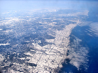
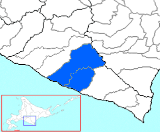
Enbetsu, also known as Embetsu, is a town located in Rumoi, Hokkaidō, Japan. As of 2013, the town had an estimated population of 2,966 and a density of 5 persons per km². The total area is 590.86 square kilometres (228.13 sq mi). The town is bisected by the Enbetsu River, which flows from the Teshio Mountains directly into the Sea of Japan. Enbetsu is the northernmost area of rice production in Japan.
Yūbetsu is a town located in Okhotsk Subprefecture, Hokkaido, Japan.
Ōmu is a town located in Okhotsk Subprefecture, Hokkaido, Japan.
Hidaka is a town located in Hidaka Subprefecture, Hokkaido, Japan.
Monbetsu was a town located in Saru District, Hidaka Subprefecture, Hokkaido, Japan.
Shizunai was a town located in Shizunai District, Hidaka Subprefecture, Hokkaido, Japan.
Mitsuishi was a town located in Mitsuishi District, Hidaka Subprefecture, Hokkaido, Japan.
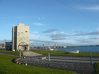
Urakawa is a town located in Hidaka Subprefecture, Hokkaido, Japan. As of 1 October 2020, the town has an estimated population of 12,074 and a density of 17 persons per km2. The total area is 694.24 km2.
Erimo is a town located in Hidaka Subprefecture, Hokkaido, Japan.
Shintoku is a town located in Tokachi Subprefecture, Hokkaido, Japan.
Memuro is a town located in Tokachi Subprefecture, Hokkaido, Japan.
Taiki is a town located in Tokachi Subprefecture, Hokkaido, Japan.
Shibecha is a town located in Kushiro Subprefecture, Hokkaido, Japan. As of September 2016, the town has an estimated population of 7,230 and a density of 6.6 persons per km2. The total area is 1,099.41 km2.
Hidaka is a newly created district located in Hidaka Subprefecture, Hokkaido, Japan.
Shinhidaka Ainu Museum is a museum of Ainu materials in Shinhidaka, Hokkaidō, Japan. The display has an area dedicated to Shakushain's 1669 revolt over fishing rights on the Shizunai River and swords and iron vessels excavated from local chashi. The collection also includes the skull of an Ezo wolf that has been designated a Municipal Cultural Property. Shinhidaka itself is a relatively new town, formed in 2006 from the merger of the former towns of Mitsuishi and Shizunai. Located in what was once Shizunai, the museum first opened in 1983 as the Shizunai Ainu Museum (静内町アイヌ民俗資料館).