085-8505\n"},"website":{"wt":"{{URL|http://www.city.kushiro.lg.jp/}}"},"footnotes":{"wt":""},"module":{"wt":"{{Infobox place symbols| embedded=yes\n | tree = [[Syringa reticulata]]\n | flower = [[Tropaeolum|Nasturtium]]\n | bird = \n | flowering_tree = \n | butterfly = \n | fish = \n | mascot = Rin-chan (りんちゃん)\n | other_symbols = \n}}"}},"i":0}}]}" id="mwCQ">City in Hokkaido, Japan
Kushiro 釧路市 | |
---|---|
![]() Top:Kushiro Wetland Park 2nd left:Nusamai Bridge, 2nd right:Lake Akan and Mount Oakan 3rd left:Kushiro Ramen, 3rd right:Port of Kushiro | |
![]() Location of Kushiro in Hokkaido (Kushiro Subprefecture) | |
Coordinates: 42°59′N144°23′E / 42.983°N 144.383°E | |
Country | Japan |
Region | Hokkaido |
Prefecture | Hokkaido (Kushiro Subprefecture) |
Government | |
• Mayor | Hidenori Tsuruma |
Area | |
• Total | 1,362.90 km2 (526.22 sq mi) |
Population (January 31, 2024) | |
• Total | 157,288 |
• Density | 120/km2 (300/sq mi) |
Time zone | UTC+09:00 (JST) |
City hall address | 7-5 Kuroganechō, Kushiro-shi, Hokkaido 085-8505 |
Website | www |
Symbols | |
Flower | Nasturtium |
Mascot | Rin-chan (りんちゃん) |
Tree | Syringa reticulata |
Kushiro (釧路市, Kushiro-shi) is a city in Kushiro Subprefecture on the island of Hokkaido, Japan. Located along the coast of the North Pacific Ocean, it serves as the subprefecture's capital and it is the most populated city in the eastern part of the island.
An Imperial decree in July 1899 established Kushiro as an open port for trading with the United States and the United Kingdom. [1]
Kushiro had been an important port because it is more reliably ice-free during winter than alternative Russian Far East warm-water ports such as Petropavlovsk-Kamchatsky or other ports in Hokkaido such as Hakodate, which occasionally freeze for short periods due to the lower salinity of the Sea of Japan. For this reason, Kushiro was considered a valuable target for the Tsars during the Russo-Japanese Wars. Its importance grew during the 1920s with the growth of commercial fishing, for which its reliable freedom from ice reduced costs. [2]
In addition to its port, Kushiro is serviced by Kushiro Airport with flights from Honshu and by the Ōzora limited express train service, which runs six times per day to the main population centres in the west of Hokkaido.
In July 1945 the city of Kushiro was bombed by American naval aircraft; hundreds of people, mostly civilians, were killed. [3] Following the Invasion of the Kuril Islands in August 1945, Kushiro was favoured by the Russians as the eastern cornerstone of a border between an American-occupied south and a Soviet-occupied north-coupled with Rumoi as the western cornerstone. However, these plans were cancelled after pressure by US President Harry S. Truman. [4] [5] [6] [7]
On October 11, 2005, the town of Akan, from Akan District, and the town of Onbetsu, from Shiranuka District, was merged into Kushiro. The town of Shiranuka now lies between the two sections of Kushiro.
In 2008, the city had an estimated population of 189,539 and a total area of 1,362.75 km2 (526.16 sq mi), giving a population density of 140 persons per km2 (363 persons per sq. mi.).
Kushiro was one of the many Japanese cities to receive a Peace Pagoda. Built by the monks and nuns of the Buddhist order Nipponzan Myohoji, it was inaugurated in 1959.
Kushiro was accorded city status on August 1, 1922. It is the sister city of Burnaby, British Columbia; Petropavlovsk-Kamchatsky, Russia; and Kholmsk, Russia. [8]
Kushiro has a humid continental climate (Dfb) but its winter temperatures are less severe than those of inland East Asia at the same latitude. Its port is the most reliably ice-free throughout winter in all of Hokkaido, due to the lack of indentation in the coastline and absence of large inflows of cold fresh water nearby. It is also markedly sunnier than the extremely gloomy Kuril Islands to its north, being sheltered by Hokkaido's mountains from the heavy snowfalls produced on the Sea of Japan side by the Aleutian Low. It receives only a third as much snowfall as Sapporo and almost twice as much sunshine as the Kuril Islands are estimated to. Its daytime summer temperatures are noticeably cooler than in the interior, sheltered coastal areas and the south coast of Hokkaido.
Climate data for Kushiro/Kenebetsu weather station, 14m amsl (WMO identifier: 47418) 1991−2020 normals, extremes 1910−present | |||||||||||||
---|---|---|---|---|---|---|---|---|---|---|---|---|---|
Month | Jan | Feb | Mar | Apr | May | Jun | Jul | Aug | Sep | Oct | Nov | Dec | Year |
Record high °C (°F) | 7.6 (45.7) | 7.9 (46.2) | 15.9 (60.6) | 23.5 (74.3) | 28.0 (82.4) | 32.4 (90.3) | 33.5 (92.3) | 31.1 (88.0) | 29.6 (85.3) | 23.7 (74.7) | 18.7 (65.7) | 16.1 (61.0) | 33.5 (92.3) |
Mean daily maximum °C (°F) | −0.2 (31.6) | −0.1 (31.8) | 3.3 (37.9) | 8.0 (46.4) | 12.6 (54.7) | 15.8 (60.4) | 19.6 (67.3) | 21.5 (70.7) | 20.1 (68.2) | 15.1 (59.2) | 8.9 (48.0) | 2.5 (36.5) | 10.6 (51.1) |
Daily mean °C (°F) | −4.8 (23.4) | −4.3 (24.3) | −0.4 (31.3) | 4.0 (39.2) | 8.6 (47.5) | 12.2 (54.0) | 16.1 (61.0) | 18.2 (64.8) | 16.5 (61.7) | 11.0 (51.8) | 4.7 (40.5) | −1.9 (28.6) | 6.7 (44.1) |
Mean daily minimum °C (°F) | −9.8 (14.4) | −9.4 (15.1) | −4.2 (24.4) | 0.7 (33.3) | 5.4 (41.7) | 9.5 (49.1) | 13.6 (56.5) | 15.7 (60.3) | 12.9 (55.2) | 6.1 (43.0) | −0.3 (31.5) | −7.0 (19.4) | 2.8 (37.0) |
Record low °C (°F) | −28.3 (−18.9) | −27.0 (−16.6) | −24.8 (−12.6) | −14.1 (6.6) | −4.6 (23.7) | −0.4 (31.3) | 3.3 (37.9) | 5.4 (41.7) | −2.2 (28.0) | −6.9 (19.6) | −15.2 (4.6) | −25.7 (−14.3) | −28.3 (−18.9) |
Average precipitation mm (inches) | 40.4 (1.59) | 24.8 (0.98) | 55.9 (2.20) | 79.4 (3.13) | 115.7 (4.56) | 114.2 (4.50) | 120.3 (4.74) | 142.3 (5.60) | 153.0 (6.02) | 112.7 (4.44) | 64.7 (2.55) | 56.6 (2.23) | 1,080.1 (42.52) |
Average snowfall cm (inches) | 32 (13) | 27 (11) | 31 (12) | 7 (2.8) | 0 (0) | 0 (0) | 0 (0) | 0 (0) | 0 (0) | 0 (0) | 4 (1.6) | 26 (10) | 127 (50) |
Average precipitation days (≥ 0.5 mm) | 6.4 | 5.6 | 8.1 | 9.8 | 11.3 | 10.2 | 11.5 | 11.8 | 11.8 | 8.7 | 8.0 | 7.7 | 110.8 |
Average relative humidity (%) | 67 | 69 | 71 | 77 | 80 | 87 | 88 | 87 | 84 | 76 | 69 | 67 | 77 |
Mean monthly sunshine hours | 186.7 | 183.1 | 200.8 | 182.2 | 177.5 | 126.8 | 118.9 | 117.6 | 143.9 | 177.0 | 167.6 | 175.6 | 1,957.6 |
Percent possible sunshine | 65 | 63 | 55 | 45 | 39 | 27 | 25 | 28 | 39 | 53 | 58 | 62 | 47 |
Average ultraviolet index | 1 | 2 | 3 | 5 | 7 | 8 | 8 | 7 | 5 | 3 | 2 | 1 | 4 |
Source 1: Japan Meteorological Agency, [9] (December record high) [10] | |||||||||||||
Source 2: Weather Atlas (UV) [11] |
Climate data for Kushiro Airport weather station, 94.8m amsl (WMO identifier: 47489) 1985−2015 dewpoints | |||||||||||||
---|---|---|---|---|---|---|---|---|---|---|---|---|---|
Month | Jan | Feb | Mar | Apr | May | Jun | Jul | Aug | Sep | Oct | Nov | Dec | Year |
Average dew point °C (°F) | −11 (12) | −10 (14) | −6 (21) | −1 (30) | 5 (41) | 10 (50) | 15 (59) | 17 (63) | 13 (55) | 6 (43) | −2 (28) | −8 (18) | 2 (36) |
Source: Time and Date [12] |
Graphs are temporarily unavailable due to technical issues. See or edit raw graph data.
Operates both city, suburban, and intercity routes
Ice hockey is one of the most popular winter sports in Kushiro. In addition to several leagues devoted to amateur play of all ages, Kushiro is home to the Asia League Ice Hockey Nippon Paper Cranes, three time Asia League Champions.
Kushiro and many other cities are interested in hosting bandy teams. [13] On January 8, 2017, the township of Akan hosted the first national championship, [14] although the size of the field was a smaller version than the official rules for a bandy field. In January 2018, the first championship on a full-sized field took place in Shintoku, with participation from three teams, including FACEOFF Kushiro. [15] The national team for women is based in Kushiro and made its World Championship debut in 2020. [16]
The Kushiro Ice Arena is the city's biggest stadion for ice hockey, figure skating and shorttrack. [17]
The Yanagimachi Speed Skating Rink hosted the 2003 World Junior Speed Skating Championships and several Japanese Championships. It has an asphalt inline speed skating track on the middle field.
Kushiro's mascot is Rin-chan (りんちゃん). She is a gentiana triflora flower (though she represents all flowers) from Onbetsu. Her favourite drink is milk. [18]
City | Country | State | since |
---|---|---|---|
Burnaby | ![]() | British Columbia | 1965 |
Kholmsk | ![]() | Sakhalin Oblast | 1975 |
City | Country | State | since |
---|---|---|---|
Petropavlovsk-Kamchatsky | ![]() | Kamchatka Krai | 1998 |
City | Prefecture | region | since |
---|---|---|---|
Yuzawa | ![]() | Tōhoku region | October 4, 1963 |
Tottori | ![]() | Chūgoku region | October 4, 1963 |
Okayama | ![]() | Chūgoku region | October 9, 1980 |
City | Prefecture | region | since |
---|---|---|---|
Yachiyo | ![]() | Kantō region | 1982 |
Izumi | ![]() | Kyushu region | August 22, 1989 |
Tsuru | ![]() | Chūbu region | September 1, 1992 |
Naka (Naka District) | ![]() | Shikoku region | September 2, 2006 |
Port of Kushiro's sister ports are:
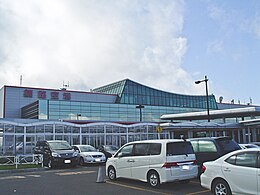
Wakkanai is a city located in Sōya Subprefecture, Hokkaido, Japan. It is the capital of Sōya Subprefecture. Wakkanai is home to Japan's first nursing home built inside the central train station of its city, a novel approach to caring for Japan's growing elderly population that has since been imitated in several other cities.
Abashiri is a city located in Okhotsk Subprefecture, Hokkaido, Japan.
Nemuro is a city and port located in Nemuro Subprefecture, Hokkaido, Japan. It is the capital city of Nemuro Subprefecture. Much of the city lies on the Nemuro Peninsula. As of February 29, 2012, the city has an estimated population of 29,087, with 12,966 households, and a population density of 56.74 persons per km2. The total area is 512.63 km2 (197.93 sq mi).
Akan is a district in Kushiro Subprefecture, Hokkaido, Japan. It includes Akan National Park, which has many dormant volcanoes.
Shiraoi is a town located in Iburi, Hokkaido, Japan. As of September 2016, the town had a population of 17,759. It was established in 1867 by the feudal lords of Sendai. Most of the area of the town is forested and parts lie within the Shikotsu-Tōya National Park.
Taiki is a town located in Tokachi Subprefecture, Hokkaido, Japan.
Ashoro is a town located in Tokachi Subprefecture, Hokkaido, Japan.
Akan was a town located in Akan District, Kushiro Subprefecture, Hokkaido, Japan.
Shiranuka is a district located in western Kushiro Subprefecture, Hokkaido, Japan.
Kushiro Province was a short-lived province in Hokkaidō. It corresponded to modern-day Kushiro Subprefecture and part of Abashiri Subprefecture.
Shiranuka is a town located in Kushiro Subprefecture, Hokkaido, Japan. As of September, 2013, it has an estimated population of 8,910, and an area of 773.74 km2. The population has fallen significantly in recent years.
Onbetsu was a town located in Shiranuka District, Kushiro Subprefecture, Hokkaido, Japan.
Rausu is a town located in Nemuro Subprefecture, Hokkaido, Japan. As of September 30, 2016, it has an estimated population of 5,395, and an area of 397.88 km2.
In 1869, the island of Hokkaido, Japan was divided into 11 provinces and 86 districts. The majority of Japan's former provinces were converted into prefectures by the Meiji government between 1870 and 1876.
Nemuro Main Line is a railway line in Hokkaido operated by Hokkaido Railway Company, connecting Takikawa Station in Takikawa and Nemuro Station in Nemuro, including Obihiro and Kushiro. Higashi-Nemuro is the most easterly situated station on the Japanese rail system.
National Route 336 is a national highway connecting Urakawa, Hokkaido and Kushiro, Hokkaido in Japan.
Bus Center-mae Station is a metro station in Chūō-ku, Sapporo, Hokkaido, Japan. The station is numbered T10.
The island of Hokkaidō is located in the north of Japan, near Russia. It has coastlines on the Sea of Japan, the Sea of Okhotsk, and the Pacific Ocean. The center of the island is mountainous, with volcanic plateaux. Hokkaidō has multiple plains such as the Ishikari Plain 3,800 km2 (1,500 sq mi), Tokachi Plain 3,600 km2 (1,400 sq mi), the Kushiro Plain 2,510 km2 (970 sq mi) and Sarobetsu Plain 200 km2 (77 sq mi). Hokkaidō is 83,423.84 km2 (32,210.12 sq mi) which makes it the second-largest island of Japan.
The 1993 Kushiro–Oki earthquake was one of two large earthquake to strike the Japanese island of Hōkkaido within the same year. The earthquake with a magnitude of 7.6 Mw or 7.8 MJMA struck at 11:06 UTC or 08:06 pm JST on January 15 near the town of Ashoro. Shaking reached a maximum intensity of IX (Violent) on the Mercalli intensity scale, causing considerable damage, and was felt throughout the island, into northern Honshu, Sakhalin, and the Kuril Islands. As a result of the tremors, two people were killed and more than 600 were wounded.
The Nemuro Belt is the easternmost tectonic unit or terrane of Hokkaidō, Japan. The boundary with the Tokoro Belt to the west is marked by the Abashiri Tectonic Line (網走構造線), which runs from the area of Abashiri on the north coast to that of Urahoro on the south coast, the southern portion coinciding with the Urahoro Fault (浦幌断層). The belt is composed of volcanogenic sediments and volcanic rocks — for the most part, basalt and andesites; these may be remnants of an island arc that took shape over an "east or southeast dipping intraoceanic subduction zone". As dated by potassium–argon geochronology and radiolarians, the oldest sequences are Campanian‐Maastrichtian. The belt has rotated counterclockwise some 15–25° since the Late Cretaceous.