The Iron Triangle, sometimes known as Central Richmond, is a neighborhood in Richmond, California. It is a largely residential area but includes the downtown Richmond business district along Macdonald Avenue. Commercial areas on Cutting Boulevard and near Interstate 580 are also in the neighborhood if the more extensive of two possible definitions of its area is used.
Sobrante Ridge Regional Park, or simply Sobrante Ridge, is a regional park of the East Bay Regional Parks District in Richmond, California. It covers 277 acres (1.1 km2) and protects the extremely endangered Alameda Manzanita, a native plant of the area. The park has 2 1⁄2 miles (4.0 km) of trails.The endangered manzanita grow on 9 acres (0.036 km2).
Campus Bay is an 87-acre (350,000 m2) property in the city of Richmond, California located off Interstate 580 (California), and situated between the San Francisco Bay, the Richmond Annex, and Point Isabel neighborhoods. The area receives its name from its proximity to the UC Berkeley Richmond Field Station.
Baxter Creek or Stege Creek, is a three-branch creek in Richmond and El Cerrito, California, United States, forming the Baxter Creek watershed. The creek has three sources and flows from the Berkeley Hills to Stege Marsh and the San Francisco Bay. The Baxter Creek watershed at-large has 10 sources.
El Sobrante Hills is a bedroom community in the city of Richmond, California. This hilly area, located northeast of the main part of Richmond, was annexed by Richmond in the early 1950s, and was developed into residential housing in the late 1950s and early 1960s. It is bordered by the unincorporated area of El Sobrante, California to the north. The two main roads are Valley View Road and May Road, and its primary non-residential feature is De Anza High School.
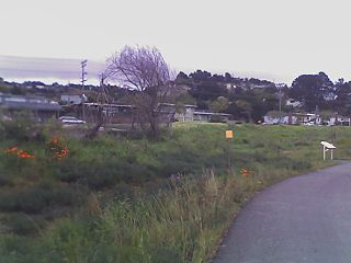
The Richmond Greenway is a pedestrian and bicycle path in Richmond, California.
Fluvius Innominatus or Central Creek is a creek in Richmond and El Cerrito, California in western Contra Costa County. There is one main source and a secondary unnamed tributary. The creek drains into Hoffman Marsh and then flows into the bay through Point Isabel Regional Shoreline's Hoffman Channel. However, before the area was developed and as early as 1899 the creek had 11 sources which stretched far higher into the Berkeley Hills.
Castro Rocks are several rocks in Richmond, California protruding from the waters in San Francisco Bay between Castro Point and Red Rock Island.The rocks lie almost directly under the Richmond-San Rafael Bridge (I-580). The rocks are named after Don Víctor Castro a local rancho-era land owner.
Stege Marsh, also known as the South Richmond Marshes, is a tidal marshland wetlands area in Richmond, California in western Contra Costa County.

Richmond Inner Harbor is a deepwater body of water in Richmond, California. The harbor lies between Ferry Point and Point Isabel, between the mainland and Brooks Island in western Contra Costa County along the East Bay's northern East Shore. The harbor provides excellent protection as it lies protected by Brooks Island an extensive breakwater inside the already protected San Francisco Bay. The harbour connects to the Sante Fe Channel and its chanellets in addition to the Richmond Marina Bay and Campus Bay. Baxter Creek and Meeker Slough Creek's mouths and deltas drain into the harbor.
Hoffman Marsh is a wetlands on San Francisco Bay in Richmond, California. The marsh has been protected within Eastshore State Park, and adjacent to Point Isabel Regional Shoreline. The marsh is an important nesting ground for wildfowl and stopping ground on the Pacific Flyway, as it is one of only a handful of undestroyed wetlands in the Bay Area. It borders Point Isabel Regional Shoreline and Interstate 80.
Point Molate Beach Park is a city-owned park in Richmond, California, accessible only via a narrow road from the Richmond-San Rafael Bridge toll plaza exit "Western Drive", and separate from the rest of the city. The park is adjacent to the present day ghost town of Winehaven.

Stege, founded in 1876, was an unincorporated community in western Contra Costa County, California, United States. The town has now been annexed and absorbed by the cities of Richmond and El Cerrito, California. It was located on the Southern Pacific Railroad 1.5 miles (2.4 km) south-southeast of downtown Richmond, at an elevation of 23 feet. The site is now located in the area known as the Richmond Annex, at coordinates: 37°55′00″N122°19′38″W.
Fleming Point is a rocky promontory in the U.S. state of California. It is situated in Albany, on the eastern shore of San Francisco Bay. Albany Bulb is an extension of the point, having been formed in the 1960s from construction debris.
Giant was an unincorporated community, now within Point Pinole Regional Shoreline, and annexed to Richmond in Contra Costa County, California. It lies at an elevation of 23 feet.

Zediker is an unincorporated community in Fresno County, California. It is located on the Atchison, Topeka and Santa Fe Railroad 11 miles (18 km) east-southeast of Clovis, at an elevation of 400 feet.
Stewart is a former settlement in Inyo County, California. It was located near the site of the current settlement of Deep Springs.
Luttrels Corner is an unincorporated community in Northumberland County, in the U.S. state of Virginia.
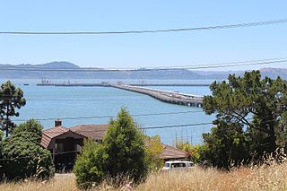
The Richmond Long Wharf is a major tanker terminal and port facility in Richmond, California.
The Berkeley Global Campus at Richmond Bay, formerly the Richmond Bay campus and the Richmond Field Station, is a campus of the University of California, Berkeley, located in Richmond, California. The name was changed in October 2014, reflecting plans to expand the campus' scope, beyond the original plan to make it an extension of the Lawrence Berkeley National Laboratory. Work on the extension had been halted due to federal budget cuts in 2013.


