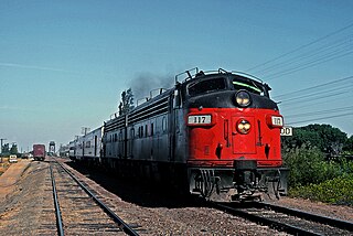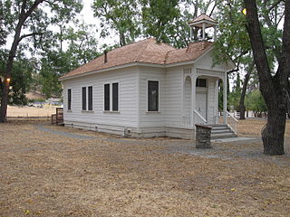
Contra Costa County is a county in the state of California in the United States. As of the 2010 census, the population was 1,049,025. The county seat is Martinez. It occupies the northern portion of the East Bay region of the San Francisco Bay Area, and is primarily suburban. The county's name is Spanish for "opposite coast", referring to its position on the other side of the bay from San Francisco. Contra Costa County is included in the San Francisco–Oakland–Berkeley, CA Metropolitan Statistical Area.

East Richmond Heights is an unincorporated and census-designated place (CDP) in western Contra Costa County, California, United States. Its population was 3,280 at the 2010 census. The community is locally referred to as Richmond View, especially in the context of real estate advertisements. The area also includes Tewksbury Heights, a subdivision created in 1909 and located within the East Richmond Heights CDP.

Walnut Creek is a city in Contra Costa County, California, United States, located in the East Bay region of the San Francisco Bay Area, about 16 miles (26 km) east of the city of Oakland. With a total estimated population of 70,166, Walnut Creek serves as a hub for its neighboring cities because of its location at the junction of the highways from Sacramento and San Jose (I-680) and San Francisco/Oakland (SR-24) and its accessibility by BART. Its active downtown neighborhood features hundred-year-old buildings and extensive high-end retail establishments, restaurants and entertainment venues.

The United States Attorney for the Northern District of California is the United States Attorney responsible for representing the federal government in the United States District Court for the Northern District of California.

Orwood is an unincorporated community in Contra Costa County, California, United States. It is located on the Atchison, Topeka and Santa Fe Railroad 7 miles (11 km) east of Brentwood, at an elevation of 3 feet. The ZIP Code is 94514. The community is inside area code 925.

Valona is an unincorporated community in Contra Costa County, California, United States. It is located in the bluffs above Crockett, 5.5 miles (9 km) west-northwest of Martinez, at an elevation of 62 feet. The similar village of Selby is located nearby. The ZIP Code is 94525. The community is inside area codes 510 and 341.

Walnut Heights is an unincorporated community in Contra Costa County, California, United States. It is located at an elevation of 200 feet, in the hills near Walnut Creek. The ZIP Code is 94596. The community is inside area code 925. It is served by Walnut Heights Elementary School, Walnut Creek Intermediate, and Las Lomas High School.

Werner is an unincorporated community in Contra Costa County, California, United States. It is located on the Atchison, Topeka and Santa Fe Railroad 5 miles (8 km) east of Brentwood, at an elevation of 10 feet. The ZIP Code is 94514. The community is inside area code 925.

This is a list of the National Register of Historic Places listings in Contra Costa County, California.

Rheem, also known as Rheem Valley and Rheem Center, is an unincorporated community in Contra Costa County, California, United States. It is located 7.5 miles (12 km) north-northwest of Danville, at an elevation of 587 feet. It was incorporated into the town of Moraga when that town was incorporated in 1974.

Avon, formerly known as Associated and Marsh, is an unincorporated community in Contra Costa County, California, United States. It is located on the Southern Pacific Railroad 3.5 miles (5.6 km) east-northeast of Martinez, at an elevation of 10 feet.

Nichols is an unincorporated community in Contra Costa County, California, United States. It is on the Atchison, Topeka and Santa Fe Railroad 5.5 miles (9 km) west of Pittsburg, at an elevation of 62 feet. The place is named for William H. Nichols, who was a landowner here.

Bixler is an unincorporated community in Contra Costa County, California, United States. It is located on the BNSF Railway 4 miles (6.4 km) east of Brentwood, at an elevation of 16 feet.

Bridgehead is an unincorporated community in Contra Costa County, California, United States. It is located on the south bank of the San Joaquin River-Stockton Deepwater Shipping Channel 3.25 miles (5.2 km) east of Antioch, at an elevation of 36 feet. The Antioch Bridge crosses the river at this point, hence the name.

Muir is an unincorporated community in Contra Costa County, California, United States. It is located on the Atchison, Topeka and Santa Fe Railroad 8 miles (13 km) north-northeast of Orinda, at an elevation of 118 feet.

Oleum was an unincorporated community in Contra Costa County, California, United States, located between the unincorporated town of Rodeo and Tormey. It was a small company town, with housing for Union Oil company workers, hence the name, derived from "petroleum". The refinery still exists. The site is located on the Mexican land grant Rancho El Pinole made to Ygnacio Martinez. A post office operated at Oleum from 1910 to 1951.

Sobrante is an unincorporated community in Contra Costa County, California, United States. It is located on the Southern Pacific Railroad 1 mile (1.6 km) southeast of Pinole Point, at an elevation of 23 feet.

Tassajara is an unincorporated community in Contra Costa County, California, United States. It is located on the east bank of Tassajara Creek, 6.5 miles (10 km) south-southeast of Mount Diablo, at an elevation of 709 feet. Together with Blackhawk it forms the Blackhawk-Camino Tassajara census designated place (CDP).

Contra Costa Centre is an unincorporated census-designated place in Contra Costa County, California. Contra Costa Centre sits at an elevation of 92 feet. The 2010 United States census reported Contra Costa Centre's population was 5,364. Contra Costa Centre is served by the Pleasant Hill / Contra Costa Centre BART station.
Pittsburg Unified School District is a public school district based in Contra Costa County, California, United States.


