
Canyon, formerly known as Sequoya, is an unincorporated community located near the border of Contra Costa and Alameda counties, in the U.S. state of California. It is situated between Oakland and Moraga in the San Francisco Bay Area. The community is named for its location in the upper canyon of San Leandro Creek along the eastern slope of the Berkeley Hills. Canyon lies at an elevation of 1138 feet.
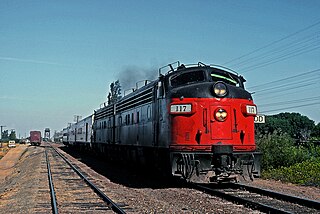
Tormey, formerly known as El Cierbo, is an unincorporated community in Contra Costa County, California, United States. It is located between Rodeo and Crockett on the edge of the ConocoPhillips oil refinery in Rodeo. It is 6.5 miles (10 km) west-northwest of Martinez, at an elevation of 20 feet. The community is home to several dozen homes and the former offices of the John Swett Unified School District. Originally a company town for management and refinery workers at the Selby Smelter, American Smelting and Refining Company. Tormey is located astride old U.S. Route 40, now San Pablo Avenue. Old County Road offshoots from it and at the end there is a water reservoir. The former Southern Pacific Railroad and now its new owner since 1996, the Union Pacific Railroad, skirts the bayshore side of Tormey. In the 1940s and '50s the Tormey Store served many of the grocery needs of the residents. The Hogg family managed the store with its single gasoline pump for many years. Although the area is unincorporated, many times it is referred to as being in the Crockett hills, or simply "the village", or the "refinery village". The ZIP Code is 94547. The community is inside area codes 510 and 341. The town is named for Patrick Tormey, who purchased the property from the Ygnacio Martinez Rancho El Pinole estate.
Marsh Creek Springs is an unincorporated community in Contra Costa County, California, United States. It lies at an elevation of 584 feet. It consists of approximately 2 by 8 blocks along Marsh Creek Road southeast of Clayton. The town is named for Marsh Creek, a local stream. The ZIP Code is 94517. The community is inside area code 925. It is named after John Marsh.
Valle Vista is a small unincorporated community in Contra Costa County, California, United States. It lies along Canyon Road between Moraga and Canyon. It is also on the Oakland, Antioch and Eastern Railroad 4.5 miles (7.2 km) south-southeast of Orinda, at an elevation of 577 feet. The ZIP Code is 94517 and the community is inside area codes 510 and 341.
Ozol is an unincorporated community in Contra Costa County, California, United States. It is located on the Southern Pacific Railroad 1.5 miles (2.4 km) west-northwest of Martinez, at an elevation of 7 feet. The ZIP Code is 94553. The community is inside area code 925.
Rock City is an Unincorporated community in Contra Costa County, California, United States. It lies at an elevation of 1,545 feet (471 m). The ZIP Code is 94528. The community is inside area code 925.
Orwood is an unincorporated community in Contra Costa County, California, United States. It is located on the Atchison, Topeka and Santa Fe Railroad 7 miles (11 km) east of Brentwood, at an elevation of 3 feet. The ZIP Code is 94514. The community is inside area code 925.
Sparkle, also known as Sparkel, is an unincorporated community in Contra Costa County, California, United States. It is on the former route of the Sacramento Northern Railroad, now replaced by elevated BART tracks 2 miles (3.2 km)north of downtown Walnut Creek, at an elevation of 85 feet. It reputedly got its name from a discharge effect on a tight curve of the electrified line of the Sacramento Northern Railroad. It is a county island like nearby Waldon and is surrounded by Walnut Creek and other incorporated cities. The ZIP Code is 94597. The community is inside area code 925.
Valona is an unincorporated community in Contra Costa County, California, United States. It is located in the bluffs above Crockett, 5.5 miles (9 km) west-northwest of Martinez, at an elevation of 62 feet. The similar village of Selby is located nearby. The ZIP Code is 94525. The community is inside area codes 510 and 341.
Werner is an unincorporated community in Contra Costa County, California, United States. It is located on the Atchison, Topeka and Santa Fe Railroad 5 miles (8 km) east of Brentwood, at an elevation of 10 feet. The ZIP Code is 94514. The community is inside area code 925.
Avon, formerly known as Associated and Marsh, is an unincorporated community in Contra Costa County, California, United States. It is located on the Southern Pacific Railroad 3.5 miles (5.6 km) east-northeast of Martinez, at an elevation of 10 feet.
Bixler is an unincorporated community in Contra Costa County, California, United States. It is located on the BNSF Railway 4 miles (6.4 km) east of Brentwood, at an elevation of 16 feet.
Bridgehead is an unincorporated community in Contra Costa County, California, United States. It is located on the south bank of the San Joaquin River-Stockton Deepwater Shipping Channel 3.25 miles (5.2 km) east of Antioch, at an elevation of 36 feet. The Antioch Bridge crosses the river at this point, hence the name.
Las Juntas, formerly known as Oakleigh, is an unincorporated community in Contra Costa County, California, United States. It is located on the Southern Pacific Railroad 2 miles (3.2 km) north of downtown Walnut Creek, at an elevation of 82 feet.
McAvoy is an unincorporated community in Contra Costa County, California, United States. It is located on the Atchison, Topeka and Santa Fe Railroad 4.25 miles (6.8 km) west of Pittsburg, at an elevation of 20 feet.
Meinert is an unincorporated community in Contra Costa County, California, United States. It is located on the Sacramento Northern Railroad 3.25 miles (5.2 km) north-northeast of downtown Walnut Creek, at an elevation of 72 feet.
Neroly is an unincorporated community in Contra Costa County, California, United States. It is located on the Southern Pacific Railroad 4.25 miles (6.8 km) northwest of Brentwood, at an elevation of 75 feet.
Newlove is an unincorporated community in Contra Costa County, California, United States. It is located on the Union Pacific Railroad 11.5 miles (19 km) northeast of Mount Davidson, at an elevation of 75 feet.
Sobrante is an unincorporated community in Contra Costa County, California, United States. It is located on the Southern Pacific Railroad 1 mile (1.6 km) southeast of Pinole Point, at an elevation of 23 feet.
Tassajara is an unincorporated community in Contra Costa County, California, United States. It is located on the east bank of Tassajara Creek, 6.5 miles (10 km) south-southeast of Mount Diablo, at an elevation of 709 feet. Together with Blackhawk it forms the Blackhawk-Camino Tassajara census designated place (CDP).


