
Streetcars in New Orleans have been an integral part of the city's public transportation network since the first half of the 19th century. The longest of New Orleans' streetcar lines, the St. Charles Avenue line, is the oldest continuously operating street railway system in the world. Today, the streetcars are operated by the New Orleans Regional Transit Authority (RTA).

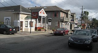
Carrollton is a historic neighborhood of Uptown New Orleans, Louisiana, USA, which includes the Carrollton Historic District, recognized by the HISTORIC DISTRICT LANDMARK COMMISSION. It is the part of Uptown New Orleans farthest upriver while still being easily accessible to the French Quarter. It was historically a separate town, laid out in 1833 and incorporated on March 10, 1845. Carrollton was annexed by New Orleans in 1874, but it has long retained some elements of distinct identity.

The St. Charles Streetcar line is a historic streetcar line in New Orleans, Louisiana. It is the oldest continuously operating streetcar line in the world, as it has been in operation since 1835. It is operated by the New Orleans Regional Transit Authority (RTA). Officially the St. Charles Streetcar line is internally designated as Route 12, and it runs along its namesake street, St. Charles Avenue. It is the busiest route in the RTA system as it is heavily used by local commuters and tourists. On most RTA maps and publications, it is denoted in green, which is also the color of the streetcars on this line.

Broadmoor is a neighborhood of the city of New Orleans. A subdistrict of the Uptown/Carrollton Area, its boundaries as defined by the New Orleans City Planning Commission are: Eve Street to the north, Washington Avenue and Toledano Street to the east, South Claiborne Avenue to the south, and Jefferson Avenue, South Rocheblave Street, Nashville Avenue, and Octavia Street to the west. It includes the Broadmoor Historic District which was listed on the National Register of Historic Places in 2003 and increased in its boundaries in 2007.

Uptown is a section of New Orleans, Louisiana, United States, on the east bank of the Mississippi River, encompassing a number of neighborhoods between the French Quarter and the Jefferson Parish line. It remains an area of mixed residential and small commercial properties, with a wealth of 19th-century architecture. It includes part or all of Uptown New Orleans Historic District, which is listed on the National Register of Historic Places.

The 16th Ward or Sixteenth Ward is a division of the city of New Orleans, Louisiana, one of the 17 Wards of New Orleans. It is an Uptown ward, along with the adjacent 17th Ward, formerly part of the city of Carrollton, Louisiana which was annexed by New Orleans in the 1870s.

The 14th Ward or Fourteenth Ward is a section of the city of New Orleans, Louisiana, one of the 17 Wards of New Orleans. The Ward was formed in 1870 from part of Jefferson City and the town of Greenville, which were annexed by New Orleans.
East Carrollton is a neighborhood of the city of New Orleans. A subdistrict of the Uptown/Carrollton Area, its boundaries as defined by the New Orleans City Planning Commission are: Spruce Street to the northeast, Lowerline Street to the southeast, St. Charles Avenue to the southwest and South Carrollton Avenue to the northwest.

St. Charles Avenue is a thoroughfare in New Orleans, Louisiana, U.S. and the home of the St. Charles Streetcar Line. It is also famous for the dozens of mansions that adorn the tree-lined boulevard for much of the uptown section of the boulevard.

Carrollton Avenue is a major thoroughfare stretching 3.9 miles (6.3 km) across the Uptown/Carrollton and Mid-City districts of New Orleans. South Carrollton Avenue runs from St. Charles Avenue in the Riverbend in a northeast lakebound direction through Carrollton and into Mid-City. After crossing Canal Street it continues as North Carrollton Avenue until intersecting with Esplanade Avenue and Wisner Boulevard at the entrance to City Park.

Hollygrove is a neighborhood of the city of New Orleans, Louisiana, located in the city's 17th Ward. A subdistrict of the Uptown/Carrollton area, its boundaries as defined by the New Orleans City Planning Commission are: Palmetto Street to the north, Cambronne, Edinburgh, Forshey, Fig and Leonidas Streets to the east, Earhart Boulevard to the south and the Jefferson Parish boundary to the west. Conrad playground, the Cuccia-Byrnes playground and Larry Gilbert baseball stadium are located in Hollygrove. The Hollygrove Market and Farm is also located in Hollygrove. Notable people, including rapper Lil Wayne, have grown up in the neighborhood.

Mid-City is a neighborhood of the city of New Orleans. A sub-district of the Mid-City District Area, its boundaries as defined by the New Orleans City Planning Commission are: City Park Avenue, Toulouse Street, North Carrollton, Orleans Avenue, Bayou St. John and St. Louis Street to the north, North Broad Street to the east, and the Pontchartrain Expressway to the west. It is a historic district on the National Register of Historic Places. In common usage, a somewhat larger area surrounding these borders is often also referred to as part of Mid-City.

Uptown is a primarily residential neighborhood of the city of New Orleans. A subdistrict of the Uptown/Carrollton Area, its boundaries as defined by the New Orleans City Planning Commission are: LaSalle Street to the north, Napoleon Avenue to the east, Magazine Street to the south and Jefferson Avenue to the west.

Black Pearl is a neighborhood of the city of New Orleans. A subdistrict of the Uptown/Carrollton Area, its boundaries as defined by the New Orleans City Planning Commission are: South Carrollton Avenue and St. Charles Avenue to the north, Lowerline, Perrier and Broadway Streets to the east, and the Mississippi River to the west.

Freret is a neighborhood of the city of New Orleans. The Freret neighborhood contains a thriving commercial corridor. A subdistrict of the Uptown/Carrollton Area, its boundaries as defined by the New Orleans City Planning Commission are: South Claiborne Avenue to the north, Napoleon Avenue to the east, LaSalle Street to the south and Jefferson Avenue to the west.
Leonidas is a neighborhood designation in the city of New Orleans. A subdistrict of the Uptown/Carrollton Area, its boundaries as defined by the New Orleans City Planning Commission are: South Claiborne Avenue, Leonidas and Fig Streets to the north, South Carrollton Avenue to the east, the Mississippi River and Jefferson Parish to the west. Although an official city planning district name, the name "Leonidas" is not widely used nor has it any historical usage and the area is usually referred to by the larger neighborhood "Uptown, or "Carrollton".

Fontainebleau and Marlyville are jointly designated as a neighborhood of the city of New Orleans. A subdistrict of the Uptown/Carrollton Area, its boundaries as defined by the New Orleans City Planning Commission are: Colapissa and Broadway Streets and MLK Boulevard to the north, Norman C. Francis Parkway, Octavia Street, Fontainebleau Drive, Nashville Avenue, South Rocheblave, Robert and South Tonti Street and Jefferson Avenue to the east, South Claiborne Avenue, Lowerline and Spruce Streets to the south and South Carrollton Avenue to the west.

West Riverside is a neighborhood of the city of New Orleans. A subdistrict of the Uptown/Carrollton Area, its boundaries as defined by the New Orleans City Planning Commission are: Magazine Street to the north, Napoleon Avenue to the east, the Mississippi River to the south and Exposition, Tchoupitoulas and Webster Streets to the west. This has not traditionally been a separate neighborhood as most of this area has been considered part of Uptown New Orleans throughout most of its history. This name was only artificially created by the New Orleans City Planning Commission and most residents do not identify with it.

Milan is a neighborhood of the city of New Orleans, Louisiana, U.S.A. A sub-district of the Central City/Garden District Area, its boundaries as defined by the New Orleans City Planning Commission are: South Claiborne Avenue to the north, Toledano Street and Louisiana Avenue to the east, St. Charles Avenue to the south, and Napoleon Avenue to the west.

