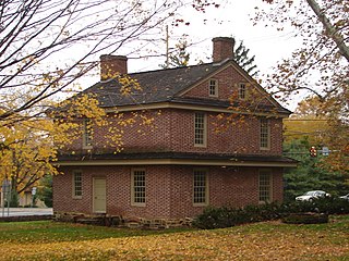
Newtown Township is a township in Delaware County, Pennsylvania, United States. Prior to 1789 it was part of Chester County. The population was 12,216 as of the 2010 census, and was 19,705 as of 2017.

The Battle of Shiloh was a battle in the Western Theater of the American Civil War, fought April 6–7, 1862, in southwestern Tennessee. A Union force known as the Army of the Tennessee had moved via the Tennessee River deep into Tennessee and was encamped principally at Pittsburg Landing on the west bank of the Tennessee River, where the Confederate Army of Mississippi launched a surprise attack on Grant's army from its base in Corinth, Mississippi. Johnston was mortally wounded during the fighting; Beauregard took command of the army and decided against pressing the attack late in the evening. Overnight, Grant was reinforced by one of his divisions stationed further north and was joined by three divisions from the Army of the Ohio. The Union forces began an unexpected counterattack the next morning which reversed the Confederate gains of the previous day.

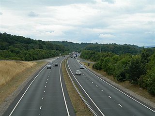
The A483, also known as the Swansea to Chester Trunk Road, is a major road in the United Kingdom. It runs from Swansea in Wales to Chester in England via Llandovery, Llandrindod Wells, Oswestry and Wrexham, a distance of around 153 miles (246 km).

Newtown, the largest town in the county of Powys, Wales, lies on the River Severn in the community of Newtown and Llanllwchaiarn, within the historic boundaries of Montgomeryshire. It was designated a new town in 1967 and saw large population growth as firms settled, changing its market town character. Its 2001 population of 12,783 eased to 11,357 at the 2011 census. It is known as the birthplace of Robert Owen in 1771, whose house stood on the present site of the HSBC Bank. The town has a theatre, Theatr Hafren, and a public gallery, Oriel Davies, displaying contemporary arts and crafts.

Maryland Route 2 is the longest state highway in the U.S. state of Maryland. The 79.24-mile (127.52 km) route runs from Solomons Island in Calvert County north to an intersection with U.S. Route 1 and US 40 Truck in Baltimore. The route runs concurrent with MD 4 through much of Calvert County along a four-lane divided highway known as Solomons Island Road, passing through rural areas as well as the communities of Lusby, Port Republic, Prince Frederick, and Huntingtown. In Sunderland, MD 2 splits from MD 4 and continues north as two-lane undivided Solomons Island Road into Anne Arundel County, still passing through rural areas. Upon reaching Annapolis, the route runs concurrent with US 50 and US 301 around the city. Between Annapolis and Baltimore, MD 2 runs along the Governor Ritchie Highway, a multilane divided highway that heads through suburban areas, passing through Arnold, Severna Park, Pasadena, Glen Burnie, and Brooklyn Park. In Baltimore, the route heads north on city streets and passes through the downtown area of the city.

Newtown Cunningham, sometimes spelled Newtowncunningham or abbreviated to Newton, is a village in the Laggan district in the east of County Donegal, Ireland, located on the N13 road 18 km east of Letterkenny and 16 km west of Derry. The 2016 census reported a population of 1,080.

The R236 road runs in County Donegal linking Stranorlar, via Convoy and Raphoe to St. Johnston, Carrigans and becoming the A40 into Derry in Northern Ireland.

The Newtown Jets are an Australian rugby league football club based in Newtown, a suburb of Sydney's inner west. They currently compete in the Canterbury Cup NSW competition, having left the top grade after the 1983 NSWRFL season. The Jets' home ground is Henson Park, and their team colours are blue and white.

Pennsylvania Route 3 is a 24.3-mile (39.1 km) state highway located in the southeastern portion of Pennsylvania. The route connects U.S. Route 322 Business in West Chester with PA 611 in Philadelphia. The route begins in downtown West Chester and heads east out of town as a one-way pair of streets. Between West Chester and Upper Darby Township, PA 3 follows a four-lane divided highway known as West Chester Pike through suburban areas. Along this stretch, the route passes through Edgmont, Newtown Square, Broomall, and Havertown. The route has an interchange with Interstate 476 (I-476) between Broomall and Havertown. Upon reaching Upper Darby, PA 3 heads into Philadelphia along Market Street. In Philadelphia, the route follows multiple one-way pairs, running along Chestnut Street and Walnut Street in West Philadelphia before heading into Center City Philadelphia along Market Street and John F. Kennedy Boulevard and ending at Philadelphia City Hall.

State Route 14 is a primary state highway in the U.S. state of Virginia. The state highway runs 71.10 miles (114.42 km) from U.S. Route 360 in St. Stephens Church east to a cul-de-sac in Bayside. SR 14 is the primary highway of King and Queen and Mathews counties and the main east–west highway of Gloucester County; the highway connects the namesake county seats of all three counties.

New York State Route 233 (NY 233) is a state highway in Oneida County, New York, United States. The southern terminus of the route is at an intersection with NY 12B southwest of the Clinton. Its northern terminus is at an interchange with the Utica–Rome Expressway within the Rome city limits but southeast of the inner tax boundary. NY 233 is the most direct connection between Rome and the New York State Thruway, which it meets at exit 32 in Westmoreland.

Pennsylvania Route 252 is a north–south route that connects PA 320 in Nether Providence Township at its southern terminus to PA 23 in Valley Forge at its northern terminus. The route runs through various townships and boroughs in Delaware and Chester, and Montgomery counties, including Nether Providence Township, Media, Upper Providence Township, Marple Township, Newtown Township, Easttown Township, Tredyffrin Township, and Upper Merion Township. The route intersects many roads including U.S. Route 1 north of Media, PA 3 in Newtown Square, US 30 in Paoli, and US 202 in Tredyffrin Township.

Pennsylvania Route 413 is a 31-mile-long (50 km), north–south state highway in Bucks County, Pennsylvania. The route runs from the New Jersey state line on the Burlington–Bristol Bridge over the Delaware River outside Bristol, where it continues as Route 413 into New Jersey, to PA 611 in Bedminster Township. The route passes through the lower and central portions of Bucks County, serving Bristol, Levittown, Langhorne, Newtown, and Buckingham. The route intersects U.S. Route 13 and Interstate 95 (I-95) near Bristol, I-295 near Penndel, US 1 in Langhorne Manor, and US 202 in Buckingham.
Pennsylvania Route 332 is a state highway in the U.S. state of Pennsylvania. The route runs 17.5 miles (28.2 km) from PA 263 in Hatboro, Montgomery County east to PA 32 in Yardley, Bucks County. PA 332 runs through suburban areas to the north of Philadelphia, serving Warminster, Ivyland, Richboro, and Newtown. The route is two lanes wide most of its length, with the bypass around Newtown a four-lane divided highway. PA 332 intersects PA 132 in Warminster, PA 232 in Richboro, PA 413 and PA 532 in Newtown, and Interstate 295 (I-295) in Lower Makefield Township.
Highway 284 is an east–west state highway in Arkansas Delta. The route of 34.83 miles (56.05 km) runs from U.S. Route 49 (US 49) near Fair Oaks east to Highway 1 Business (AR 1B) in Forrest City.

The R265 is a Regional road wholly within County Donegal in Ireland, it runs north to south from near Newtown Cunningham to Rossgier near Lifford the County Town. The road runs from near Lough Swilly and generally along the west bank of the River Foyle. The road runs through mostly arable farmland in the East Donegal area.

Not to be confused with Newtown near Brampton, to the north-east of Carlisle. For other uses, see Newtown (disambiguation).


