
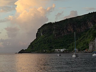
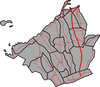
Bagatelle is a village in Saint Patrick Parish, Dominica.
Bagatelle is a village in Saint Patrick Parish, Dominica.
Bagatelle, then known as Malabuca, was first inhabited by the Amerindians before the arrival of the French who changed the name to Bagatelle. [1] It was named after the Château de Bagatelle in Paris. [2] In September 1977, days of heavy rains swept away houses killing thirteen villagers. [2] Two years later, Hurricane David destroyed most of the buildings in the village. [2] [3] The village was rebuilt over the years. [4] In 2021, a 2.3 million dollar bridge was constructed in Bagatelle. [5] In 2024, the Loubiere to Bagatelle Road Rehabilitation Project had its ground-breaking. [6]

Mendon is a village in Adams County, Illinois, United States. The population was 872 at the 2020 census. It is part of the Quincy, IL–MO Micropolitan Statistical Area.

Noida, short for New Okhla Industrial Development Authority, is a city located in Gautam Buddha Nagar district of the Indian state of Uttar Pradesh. It is a part of the National Capital Region. As per provisional reports of Census of India, the population of Noida in 2011 was 642,381. The city is managed by New Okhla Industrial Development Authority (NOIDA). The district's administrative headquarters are in the nearby city of Greater Noida.

Edward Oliver LeBlanc was a Dominican politician who served as the chief minister from January 1961 to 1 March 1967 and as the first premier from 1 March 1967 to 27 July 1974. Born in Vieille Case, a village in the north of the island, LeBlanc attended the local school and studied agriculture at the Imperial College of Tropical Agriculture in Trinidad. He worked in the civil service and became a member of the Dominica Trade Union. An early member of the Dominica Labour Party (DLP), he served as a representative in the country's Legislative Council representing the constituency of Portsmouth between 1957 and 1958, and as a representative of Dominica in the Federal Parliament of the West Indies Federation upon its foundation in 1958. LeBlanc left the federation in 1960 to run for election to the national legislature.

The House of Assembly is the legislature of Dominica. It is established by Chapter III of the Constitution of Dominica, and together with the President of Dominica constitutes Dominica's Parliament. The House is unicameral, and consists of twenty-one Representatives, nine senators, and the Attorney General as an ex officio member. The Speaker of the House becomes the thirty-second member if chosen from outside the membership of the House.

Tamparuli is a town and sub-district located in the Tuaran District of Sabah, Malaysia, on the island of Borneo. It is situated approximately 38 kilometers northeast of Kota Kinabalu, the state capital of Sabah. The town is known for its scenic landscapes, which include hills, rivers, and surrounding rural areas, making it a picturesque location. The town is famous for its proximity to the Tamparuli Suspension Bridge, a popular tourist attraction. The Tamparuli Suspension Bridge became even more iconic after the creation of the "Tamparuli Bridge Song" by the Justin Lusah. Tamparuli is also known for its local culture and is a gateway for visitors heading to the highlands, such as the popular Kundasang area and Mount Kinabalu. Additionally, the town is recognized for its food, especially the "Tamparuli Noodles", which is a local delicacy. The town is also a stop en route to the town of Kiulu, a whitewater rafting destination for domestic and foreign tourists. It is populated mainly by native Dusuns, while a sizeable Chinese community runs most of the shops in the town proper.

Cabrits National Park is on a peninsula at the north end of the Caribbean island of Dominica, north of Portsmouth. The park protects tropical forest, coral reefs and wetlands. There are hiking trails and an English garrison called Fort Shirley.

Colihaut is a coastal village in northern Dominica within Saint Peter Parish midway between the towns of Roseau and Portsmouth. It has a population of 773 people.

Scotts Head is a village on the southwest coast of Dominica, in Saint Mark Parish. In 2001, its population was 721. Predominantly a fishing village, Scotts Head overlooks Soufrière Bay, which is protected as the Soufrière Scotts Head Marine Reserve. It is also a popular snorkelling and diving site for tourists.
Petite Savanne was a village on the southeast side of Dominica. It had an estimated population of 1,200 in 2015. The region the town was built on features some of Dominica's steepest terrain; the slopes were composed largely of silt and clay.

Massacre is a town in Saint Paul Parish, Dominica, with about 1,200 inhabitants. It is located on the central west coast of the island, to the north of the capital, Roseau, on the Massacre River.
Pont Cassé is situated in the Saint Paul Parish in Dominica. It is located almost in the middle of Dominica, close to Belles Village northeast of the national capital, Roseau, and close to Morne Trois Pitons, the mountain which dominates the southern center of the country. As of 2006 it has a population of 100.

Dominica, officially the Commonwealth of Dominica, is an island country in the Caribbean. It is part of the Windward Islands chain in the Lesser Antilles archipelago in the Caribbean Sea. The capital, Roseau, is located on the western side of the island. Dominica's closest neighbours are two constituent territories of the European Union, both overseas departments of France: Guadeloupe to the northwest and Martinique to the south-southeast. Dominica comprises a land area of 750 km2 (290 sq mi), and the highest point is Morne Diablotins, at 1,447 m (4,747 ft) in elevation. The population was 71,293 at the 2011 census.

Morne Diablotin National Park is a national park in the northern mountain ranges of Dominica, an island nation in the Caribbean.
The Massacre River is a river on the Caribbean island of Dominica.
Coulibistrie is a village on the west coast of Dominica, in the northwest corner of Saint Joseph Parish. It is between the villages of Colihaut to the north and Morne Rachette to the south. It extends inland from the coast within a deep valley, along both banks of the Coulibistrie River. The village is primarily residential with few businesses. Many of the houses are built directly atop or adjoining the numerous large boulders that litter the valley along its base.
The Emilio Aguinaldo Highway is a four-to-six lane, 41.4-kilometer (25.7 mi), network of primary and secondary highways passing through the busiest towns and cities of Cavite, Philippines. It is the busiest and most congested of the three major highways located in the province, the others are Governor's Drive and Antero Soriano Highway.
Dominica State College (DSC) is a national college in Stockfarm, Dominica. It is an amalgamation of The Technical College, The Dominica Teachers Training College, The Sixth Form College, and The Princess Margaret Hospital School of Nursing, through the Dominica State College Act of 2002. DSC is the largest educational institution in Dominica by active student population.
Belles is a small village in the Caribbean island nation of Dominica. It is located at 15°27′12.7″N61°19′11.4″W and is a part of the country's St. Joseph administrative division. Its population is 500. Belles is a historical site for a few reasons. It is a major part of the highway system to the northern part of the island. The roads were blocked many years ago by Rastafarians who were not happy with the government. Many of them escaped to Jaco Flats and used it for refuge. This is a site that was used by the Maroons hundreds of years ago. As of 2016, the Esprit and Benjamin families own and control a majority of the private land.
The Commonwealth of Dominica has been operating a citizenship by investment programme since 1993, making it the second Caribbean island-nation to launch one such programme – having been preceded by the Federation of St Kitts and Nevis.
Grand Fond is a village in Saint David Parish, Dominica.
For the definition of town, village, etc see Settlements in Dominica. | |
| Towns |
|
| Villages |
|
15°14′51″N61°17′04″W / 15.24750°N 61.28444°W
| | This Dominica location article is a stub. You can help Wikipedia by expanding it. |