This article is about the demographic features of the population of Dominica, including population density, ethnicity, religious affiliations and other aspects of the population.

Dominica is divided into ten parishes.

Saint Mark is one of Dominica's ten administrative parishes. It is bordered by St. Luke and St. Patrick. With an area of 9.9 km², it is the smallest in the island. It had a population of 1,834 people at the Population Census of 2011.
La Plaine is a village located on the eastern side of the island of Dominica. It has a population of 1,288, and is the second-largest settlement in Saint Patrick Parish.
Scotts Head is a village on the southwest coast of Dominica, in Saint Mark Parish. In 2001, its population was 721. Predominantly a fishing village, Scotts Head overlooks Soufrière Bay, which is protected as the Soufrière Scotts Head Marine Reserve. It is also a popular snorkeling and diving site for tourists.

Mahaut is a village on the west coast of Dominica. It has a population of 2,399, and was home to Dominica Colgate-Palmolive until the factory was closed in 2015 after Hurricane Erica.
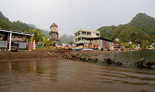
Soufrière is a village on the southwest coast of Dominica. It is the capital of Saint Mark Parish and has a population of 1,416 people.
Wotten Waven is a village in Dominica's Roseau Valley. It has a population of 226 people.

Saint Joseph is the chief settlement of Dominica's St. Joseph Parish. Its population is 2,029.

Castle Bruce is a village on the east coast of Dominica. It is the largest settlement in St. David Parish, with a population of 1,339.
The Catholic Church in Dominica is part of the worldwide Catholic Church, under the spiritual leadership of the Pope in Rome. 61.4% of Dominica's population of 73,449 are Catholic. The entire country is under the jurisdiction of a single diocese, the Diocese of Roseau.
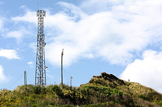
Canefield is a town located on the west coast of Dominica, north of Roseau and south of Massacre, overlooking Pringle's Bay. The largest settlement in St. Paul Parish, it has a population of 2,803. It is home to an industrial estate with Harris Paints Dominica Ltd., a branch of the Jehovah's Witnesses, as well as the island's second airport. Neighbouring locales include Cochrane, Checkhall, Massacre and Fond Colé.

Paix Bouche is a village in northern Dominica. It has a population of 306, and has one of the island's steepest roads. The name comes from the local Creole expression meaning "shut your mouth".
Dublanc is a village in Saint Peter parish on the west coast of Dominica between the town of Portsmouth and the village of Bioche. It sits on a low hillside at an elevation of 27. As of 2001 it had a population of 423.

Dominica, officially the Commonwealth of Dominica, is an island country in the Caribbean. The capital, Roseau, is located on the western side of the island. It is geographically situated a part of the Leeward Islands chain in the Lesser Antilles archipelago in the Caribbean Sea. The island is located near Guadeloupe to the northwest and Martinique to the south-southeast. Its area is 750 km2 (290 sq mi), and the highest point is Morne Diablotins, at 1,447 m (4,747 ft) in elevation. The population was 71,293 at the 2011 census.
Penville or Pennville is a village in Dominica's Saint Andrew Parish. The community is situated just north of Vieille Case, and has a population of 524.

Education in Dominica is compulsory from ages 5 to 16. The gross primary enrollment rate was 100.4 percent in 1991 and 98.2 percent in 1998, and the net primary enrollment rate was 88.7 percent in 1991 and 88.8 percent in 1998. Primary school attendance rates were unavailable for Dominica as of 2001. Poor physical conditions in many primary schools affect the quality of education, while some schools are overcrowded, limiting access to primary education, particularly for children living in urban areas around the capital. Poverty and work on family banana farms during the harvest season can affect school attendance, but other employment does not pull minors out of school. There is a significant Carib Indian population in Dominica and schools on the Carib Territory are reported to have fewer resources.

The most common religion in Dominica is Christianity, with a majority of practitioners identifying as Roman Catholic. Various minority religious groups are also present on the island.
Afro-Dominicans are Dominicans of African descent and the majority of the Commonwealth of Dominica's population.

