Hazlemere is a large village and civil parish in Buckinghamshire, England, 2.5 miles (4.0 km) northeast of High Wycombe on the A404 leading to Amersham, which intersects with the B474 at Hazlemere. To the north of the village is the hamlet of Holmer Green, which is in the civil parish of Little Missenden.

Hampstead Norreys is a village and civil parish in Berkshire, England. It is centred on the River Pang, north of Newbury. As well as the nucleus of Hampstead Norreys, the parish includes the hamlets of Bothampstead, Eling and Wyld Court. The village was recorded in the Domesday Book of 1086 as Hanstede.

Gladesville is a suburb in the Lower North Shore of Sydney, in the state of New South Wales, Australia. Gladesville is located 10 kilometres north-west of the Sydney central business district, in the local government area of the City of Ryde and the Municipality of Hunter's Hill. Gladesville is part of the federal electorates of North Sydney and Bennelong.

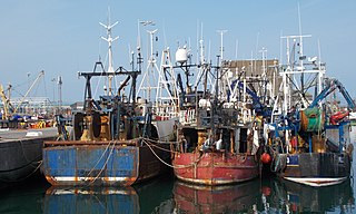
Portavogie is a village, townland and fishing port in County Down, Northern Ireland. It lies within the Ards and North Down Borough and is the easternmost settlement in Ireland. It had a population of 2,122 people in the 2011 Census.

La Désirade is an island in the French West Indies, in the Lesser Antilles of the Caribbean. It forms part of Guadeloupe, an overseas region of France.

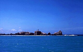
La Digue is the third most populated island of the Seychelles, and fourth largest by land area, lying east of Praslin and west of Felicite Island. In size, it is the fourth-largest granitic island of Seychelles after Mahé, Praslin, and Silhouette Island. It has a population of 2,800 people. Most of the inhabitants live in the west coast villages of La Passe and Anse Réunion. There is no airport on La Digue, so to get there from a foreign country, one must fly to Victoria and continue by ferry, usually via Praslin. It has an area of 10.08 km2, making it relatively easy to travel by bike or on foot.

Clydach is both a village and a community in Swansea, Wales, within the Clydach ward and the Llangyfelach parish. It is located 6 miles (9.7 km) northeast of Swansea city centre. In 2011, the population was 7,503. Welsh is the first language of 24 per cent of the population and both Welsh and English language schools are available. The village lies close to the M4 motorway which can be accessed via the bypass or old road via Ynystawe. The community includes part of the village of Glais.

Saint Andrew is one of Dominica's 10 administrative parishes. It is bordered by St. John and St. Peter, St. Joseph, and St. David.

Barton Stacey is a village and undulating civil parish, which includes the hamlets of Bransbury, Newton Stacey, Drayton and Cocum, in the Test Valley district of Hampshire, England, centred about 7 miles (11 km) south-east of Andover. It is bounded to the north by the estate of Drayton Lodge, and, to the south, by the minor A30 road; both being east–west routes, and connected by The Street/Cocum Road, the main road that bisects the village. The distance between the A303 and A30 at this point is 2 miles (3.2 km), which is twice the width of the parish.

North Wingfield is a large village and civil parish in the North East Derbyshire district in the county of Derbyshire, England. Located approximately 4½ miles south-east of Chesterfield, and 1 mile north-east of Clay Cross. The population of the civil parish as of the 2022 census was 5,885. The A6175 road from the M1 motorway to the A61 road runs through the village.

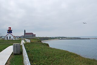
Grande-Anse is a former village in Gloucester County, New Brunswick, Canada. It held village status prior to 2023 and is now part of the town of Rivière-du-Nord.
Wabasca, also known as Wabasca-Desmarais, is a hamlet in northern Alberta, Canada within the Municipal District (MD) of Opportunity No. 17. It is located between and along the South and North Wabasca Lakes, at the intersection of Highway 813 and Highway 754. It is approximately 123 km (76 mi) northeast of Slave Lake.

Newtonhill is a town in Kincardineshire, Scotland. It is popular due to its location, just six miles south of Aberdeen with easy reach of Stonehaven and with views over the North Sea.

Redbridge is a ward with a population of 14,432, 3.1 miles (5.0 km) to the west of the city centre of Southampton, England. The settlement is positioned at the mouth of the River Test and is the southern terminus of the former Andover Canal and Sprat and Winkle railway line, and the modern M271 motorway.

Colihaut is a coastal village in northern Dominica within Saint Peter Parish midway between the towns of Roseau and Portsmouth. It has a population of 773 people.

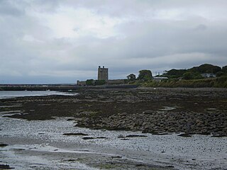
Carrigaholt is a small fishing village in County Clare, Ireland, a castle and a Catholic parish by the same name. The area was officially classified as part of the West Clare Gaeltacht; an Irish-speaking community; until 1956.

Calibishie is a village in Dominica, located on the north-east coast of the island, immediately to the east of the village of Hampstead. The Calibishie Coast Travel Area is thought by many to be the most scenic and unspoiled region of Dominica. The Calibishie coast is one of the few areas in the world where the distance from the seashore to rain forest is little more than a mile. Calibishie is home to Dominica's Batibou, Hampstead, Hodges, Point Baptiste, Turtle and Woodford Hill Beaches.
Good Hope is a small fishing farming community located on the east coast of Dominica. The community is home to about 500 residents. The community is mainly managed by a Resource Centre Management Committee, which oversees projects of development, the functioning of the community's resource centre and also the overall well-being of the community.

Norfolk County in the Canadian province of Ontario consists of a long list of communities. Its four designated population centres are Simcoe, Port Dover, Delhi, and Waterford.

Saint Barthélemy, officially the Collectivité territoriale de Saint-Barthélemy, also known as St Barts (English) or St. Barth (French), is an overseas collectivity of France in the Caribbean. The island lies about 30 kilometres (19 mi) southeast of the island of Saint Martin; it is northeast of the Dutch islands of Saba and Sint Eustatius, as well as north of the independent country of Saint Kitts and Nevis.


