
Château Pichon Longueville Baron or Château Longueville au Baron de Pichon-Longueville is a winery in the Pauillac appellation of the Bordeaux region of France. Château Pichon Longueville Baron is also the name of the red wine produced by this property. The wine produced here was classified as one of fifteen Deuxièmes Crus in the original Bordeaux Wine Official Classification of 1855.
Sutherland River Provincial Park and Protected Area is a provincial park in British Columbia, Canada.
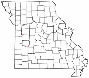
Hendrickson is an unincorporated community in northern Butler County, Missouri, United States. It is located along Missouri Route O approximately one mile south of U.S. Route 67. It is approximately ten miles north of Poplar Bluff, within the Mark Twain National Forest. The community of Wilby lies three miles to the southeast along Route O. It sits on the east margin of the Black River floodplain. The Missouri Pacific Railway passes the west side of the community along the Black River floodplain.
Bob Martinez Sports Center is a 3,432-seat multi-purpose arena in Tampa, Florida named after former Tampa mayor and governor of Florida, Bob Martinez.

Bruton School for Girls was an independent day and boarding school for girls aged 2 to 18 located near Pitcombe in Bruton in south east Somerset, England.
Monthalia is a small unincorporated rural community upon Gonzales County Road 143 joining US 90A and FM 466, as a bridge across the Guadalupe River; acting as a bypass of neighboring Belmont, Texas. At its north end, it connects directly to the ghost town Oak Forest as well as "MA Wade Dam."
Governador Luiz Rocha is a municipality in the state of Maranhão in the Northeast region of Brazil.
Recreio is a municipality in the state of Minas Gerais in the Southeast region of Brazil.
Laranjal, Paraná is a municipality in the state of Paraná in the Southern Region of Brazil.
Jussara, Paraná is a municipality in the state of Paraná in the Southern Region of Brazil.
Floresta do Piauí is a municipality in the state of Piauí in the Northeast region of Brazil.

Munder is a resort in Suriname, in the Paramaribo District. Its population at the 2012 census was 17,234.

Pennichuck Brook is one of the tributaries of the Merrimack River in New Hampshire in the United States. Its watershed is 31 square miles (80 km2) and is one of the 14 subwatersheds of the Merrimack River. It passes through Nashua and Merrimack, New Hampshire and serves as the public water supply for greater Nashua.
KAXA is a radio station licensed to Mountain Home, Texas. The station broadcasts an adult hits format and is owned by Justin McClure, through licensee Jam Broadcasting, LLC. KAXA 103.7 FM serves the Kerrville, Texas area.

Fulham War Memorial is a Grade II listed monument at Vicarage Garden, Fulham High Street, Fulham, London.
Ogden is an unincorporated community in Henry County, Indiana, in the United States.
Aymett Town is an unincorporated community in Giles County, Tennessee, in the United States.

The Franklin Falls Dam is located on the Pemigewasset River in the city of Franklin, New Hampshire, in the United States. The dam was constructed between 1939 and 1943 by the Army Corps of Engineers and extends for 0.75 miles (1.21 km) across the river. During its construction, the neighboring residents of the town of Hill were forced to relocate to higher ground due to rising water levels created by the dam. The reservoir formed by the dam has a permanent pool covering 440 acres (180 ha), and the total flood storage capacity is 2,800 acres (1,100 ha). The total area of the project, including surrounding managed lands, is 3,683 acres (1,490 ha). The stretch of the Pemigewasset River potentially impounded by the dam extends 12.5 miles (20 km) north to Ayers Island Dam in the town of Bristol, and the watershed flowing to the dam extends north all the way into the White Mountains.
