Palo Labrado | |
|---|---|
Municipality and village | |
| Country | |
| Province | Catamarca Province |
| Time zone | UTC−3 (ART) |
Palo Labrado is a village and municipality in Catamarca Province in northwestern Argentina. [1]
Palo Labrado | |
|---|---|
Municipality and village | |
| Country | |
| Province | Catamarca Province |
| Time zone | UTC−3 (ART) |
Palo Labrado is a village and municipality in Catamarca Province in northwestern Argentina. [1]

Makassar Strait is a strait between the islands of Borneo and Sulawesi in Indonesia. To the north it joins the Celebes Sea, while to the south it meets the Java Sea. To the northeast, it forms the Sangkulirang Bay south of the Mangkalihat Peninsula. The strait is an important regional shipping route in Southeast Asia.

Koimbani is a town located on the island of Grande Comore in the Comoros, believed to have been built by the Portuguese.

Jason was a Norwegian whaling vessel laid down in 1881 by Rødsverven in Sandefjord, Norway, the same shipyard which later built Ernest Shackleton's ship Endurance. The ship, financed by Christen Christensen, an entrepreneur from Sandefjord, was noted for his participation in an 1892-1893 Antarctic expedition led by Carl Anton Larsen.

Canta Province is a province in the Lima Region of Peru, situated approximately 105 kilometres (65 mi) to the northeast of the Peruvian capital, Lima.

Santiago del Campo is a municipality located in the province of Cáceres, Extremadura, Spain. According to the 2006 census (INE), the municipality has a population of 323 inhabitants.
Quintanilla de Onésimo is a municipality located in the province of Valladolid, Castile and León, Spain. According to the 2004 census (INE), the municipality has a population of 1,139 inhabitants.
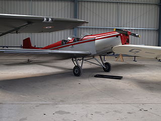
The Druine D.5 Turbi was a light aircraft designed in France in the 1950s for home building. It was a low-wing cantilever monoplane with fixed tailskid undercarriage. The pilot and a single passenger sat in tandem, open cockpits. Essentially a scaled-up version of the Druine Turbulent design, the Turbi shared that aircraft's wooden construction. Again, like its predecessor, it was intended to be able to be powered by a variety of air-cooled engines.

Pindaré-Mirim is a municipality in the state of Maranhão in the Northeast region of Brazil.
El Aybal is a village and municipality in Catamarca Province in northwestern Argentina.
Guayamba is a village and municipality in Catamarca Province in northwestern Argentina.
Tucumanao is a village and municipality in Catamarca Province in northwestern Argentina.

Ambergris Glacier is a glacier flowing south-southeast from Mount Sara Teodora between Chintulov Ridge and Valkosel Ridge to join Flask Glacier just west of Fluke Ridge in Aristotle Mountains on the east coast of Graham Land, Antarctica. One of several names in the area that reflect a whaling theme, it was named in 1987 by the United Kingdom Antarctic Place-Names Committee from the substance secreted by the sperm whale and used in perfumery.

The borders of the oceans are the limits of Earth's oceanic waters. The definition and number of oceans can vary depending on the adopted criteria. The principal divisions of the five oceans are the Pacific Ocean, Atlantic Ocean, Indian Ocean, Southern (Antarctic) Ocean, and Arctic Ocean. Smaller regions of the oceans are called seas, gulfs, bays, straits, and other terms. Geologically, an ocean is an area of oceanic crust covered by water.

Birley Glacier is a glacier, at least 10 nautical miles (19 km) long, flowing west into the eastern extremity of Barilari Bay north of Vardun Point, on the west coast of Graham Land. First seen and roughly surveyed in 1909 by the French Antarctic Expedition under Jean-Baptiste Charcot, it was re-surveyed in 1935–36 by the British Graham Land Expedition (BGLE) under John Rymill, and later named for Kenneth P. Birley, who contributed toward the cost of the BGLE, 1934–37.
Cadman Glacier is a glacier, 1.5 nautical miles (3 km) wide at its mouth and about 7 nautical miles (13 km) long, flowing northwestward into the head of the southern arm of Beascochea Bay south of Plas Point on the west side of the Antarctic Peninsula.
Perkins Glacier is a broad, low gradient glacier 8 nautical miles (15 km) south-southeast of Cape Burks on the coast of Marie Byrd Land. It drains west from McDonald Heights into the east side of Hull Bay. Mapped by United States Geological Survey (USGS) from surveys and U.S. Navy air photos, 1959–65. Named by Advisory Committee on Antarctic Names (US-ACAN) for Earle B. Perkins, biologist with the Byrd Antarctic Expedition, 1933–35.
Tofani Glacier is a glacier flowing northeast into the head of Solberg Inlet, Bowman Coast, to the north of Houser Peak. The feature was photographed from the air by United States Antarctic Service (USAS), 1940, U.S. Navy, 1966, and was surveyed by Falkland Islands Dependencies Survey (FIDS), 1946–48. Named by Advisory Committee on Antarctic Names (US-ACAN) in 1977 after Dr. Walter Tofani, M.D., station physician at Palmer Station, 1975.

Rachel Glacier is a glacier on the east coast of Graham Land, 6 nautical miles (11 km) long, flowing east between Krupen Ridge and Padesh Ridge to enter Exasperation Inlet southwest of Mihaylovski Crag. The name, applied by United Kingdom Antarctic Place-Names Committee (UK-APC), is taken from Herman Melville's Moby Dick, the Rachel being a ship from Nantucket which met the Pequod and brought news of a lost whaleboat.
28°21′S65°37′W / 28.350°S 65.617°W
| | This article about a place in Catamarca Province, Argentina is a stub. You can help Wikipedia by expanding it. |
