La Dorada | |
|---|---|
Municipality and village | |
| Country | |
| Province | Catamarca Province |
| Time zone | UTC−3 (ART) |
La Dorada is a village and municipality in Catamarca Province in northwestern Argentina. [1]
La Dorada | |
|---|---|
Municipality and village | |
| Country | |
| Province | Catamarca Province |
| Time zone | UTC−3 (ART) |
La Dorada is a village and municipality in Catamarca Province in northwestern Argentina. [1]

The Arctic Archipelago, also known as the Canadian Arctic Archipelago, is an archipelago lying to the north of the Canadian continental mainland, excluding Greenland and Iceland.

Chesterville is a town in Franklin County, Maine, United States. The population was 1,328 at the 2020 census.

Arkport is a village in Steuben County, New York, United States. The population was 844 at the 2010 census. The name comes from the barges used to ship products through the village. The postal code is 14807.

Paint Township is a township in Clarion County, Pennsylvania, United States. The population was 1,638 at the 2020 census, a decrease from the figure of 1,699 tabulated in 2010.

Danbury is a city in Brazoria County, Texas, United States. It is located northeast of Angleton along the Union Pacific Railroad and County Road 171. The city boasts its own school district. The population was 1,671 at the 2020 census.

New Berlin is a city in Guadalupe County, Texas, United States. The population was 511 at the 2010 census. New Berlin is a German-Texan town settled by German emigrants in the 1800s as a farming community. New Berlin is named after Berlin, Germany and boasts many residents being descendants of the original German founders.

Lyndhurst is a census-designated place (CDP) in Augusta County, Virginia, United States. The population was 1,490 at the 2010 census. It is part of the Staunton–Waynesboro Micropolitan Statistical Area.

Hamlin is a town in and the county seat of Lincoln County, West Virginia, United States, along the Mud River. The population was recorded as 1,040 at the 2020 census. It is part of the Huntington–Ashland metropolitan area.
Pomona is a small village on the Choele Choel Island in the Avellaneda Department in the Río Negro Province, in Argentina. It was already a crossing point for the Negro River to the island in 1890, when it was known as Paso Peñalva, on the way to Choele Choel. It was formally founded in 1933 and named after the goddess Pomona, because of its gardens.
German submarine U-144 was a Type IID U-boat of Nazi Germany's Kriegsmarine during World War II. She was laid down on 10 January 1940 by Deutsche Werke of Kiel and commissioned on 2 October 1940.
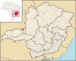
Grupiara is a Brazilian municipality located in the northwest of the state of Minas Gerais. Its population as of 2020 was 1,387 people living in a total area of 192 km². The city belongs to the mesoregion of Triângulo Mineiro e Alto Paranaiba and to the microregion of Patrocínio. It became a municipality in 1962.
The Porthos Range is the second range south in the Prince Charles Mountains of Antarctica, extending for about 30 miles in an east-to-west direction between Scylla Glacier and Charybdis Glacier. First visited in December 1956 by the Australian National Antarctic Research Expeditions (ANARE) southern party under W.G. Bewsher (1956-57) and named after Porthos, a character in Alexandre Dumas, père's novel The Three Musketeers, the most popular book read on the southern journey.

Barrio Bancario is a municipality in Catamarca Province in northwestern Argentina. It is located within the Greater San Fernando del Valle de Catamarca area.
Sumalao is a municipality in Catamarca Province in northwestern Argentina. It is located within the Greater San Fernando del Valle de Catamarca area.
Los Altos (Catamarca) is a town and municipality in Catamarca Province in northwestern Argentina.

Melville Glacier is a glacier, 12 nautical miles (22 km) long, between Mapple Glacier and Pequod Glacier on the east coast of Graham Land, Antarctica. It flows eastwards between Stevrek Ridge and Parlichev Ridge in the Aristotle Mountains, to enter Domlyan Bay in the Weddell Sea. It was surveyed by the Falkland Islands Dependencies Survey in 1947 and 1955, and was named by the UK Antarctic Place-Names Committee after Herman Melville, the author of the 1851 novel Moby-Dick. Several other features in the area, such as Mount Ahab, are named after characters in the story.
Cape Marsh is a prominent cape consisting of a rock cliff over 235 metres (770 ft) high, marking the southeastern extremity of Robertson Island on the edge of the Larsen Ice Shelf off Antarctica. Robertson Island was discovered and roughly charted by Captain C.A. Larsen in 1893, and its southern part was resurveyed by the Falkland Islands Dependencies Survey (FIDS) in July, 1953. The cape was named by the UK Antarctic Place-Names Committee for George W. Marsh, FIDS leader and medical officer at Hope Bay, 1952 and 1953.

USS LST-467 was a United States Navy LST-1-class tank landing ship used in the Asiatic-Pacific Theater during World War II. As with many of her class, the ship was never named. Instead, she was referred to by her hull designation.
29°15′S65°28′W / 29.250°S 65.467°W
| | This article about a place in Catamarca Province, Argentina is a stub. You can help Wikipedia by expanding it. |
