
Highways in Australia are generally high capacity roads managed by state and territory government agencies, though Australia's federal government contributes funding for important links between capital cities and major regional centres. Prior to European settlement, the earliest needs for trade and travel were met by narrow bush tracks, used by tribes of Indigenous Australians. The formal construction of roads began in 1788, after the founding of the colony of New South Wales, and a network of three major roads across the colony emerged by the 1820s. Similar road networks were established in the other colonies of Australia. Road construction programs in the early 19th century were generally underfunded, as they were dependent on government budgets, loans, and tolls; while there was a huge increase in road usage, due to the Australian gold rushes. Local government authorities, often known as Road Boards, were therefore established to be primarily responsible for funding and undertaking road construction and maintenance. The early 1900s saw both the increasingly widespread use of motorised transportation, and the creation of state road authorities in each state, between 1913 and 1926. These authorities managed each state's road network, with the main arterial roads controlled and maintained by the state, and other roads remaining the responsibility of local governments. The federal government became involved in road funding in the 1920s, distributing funding to the states. The depression of the 1930s slowed the funding and development of the major road network until the onset on World War II. Supply roads leading to the north of the country were considered vital, resulting in the construction of Barkly, Stuart, and Eyre Highways.

The Princes Highway is a major road in Australia, extending from Sydney to Adelaide via the coast through the states of New South Wales, Victoria and South Australia. It has a length of 1,941 kilometres (1,206 mi) or 1,898 kilometres (1,179 mi) via the former alignments of the highway, although these routes are slower and connections to the bypassed sections of the original route are poor in many cases.

The Pacific Highway is a 780-kilometre-long (485 mi) national highway and major transport route along the central east coast of Australia, with the majority of it being part of Australia's Highway 1. The highway and its adjoining Pacific Motorway between Brisbane and Brunswick Heads and Pacific Motorway between Sydney and Newcastle links the state capitals of Sydney in New South Wales with Brisbane in Queensland, approximately paralleling the Tasman Sea of the South Pacific Ocean coast, via Gosford, Newcastle, Taree, Port Macquarie, Kempsey, Coffs Harbour, Grafton, and Ballina. Additionally, between Brunswick Heads and Port Macquarie, the road is also signed as the Pacific Motorway, but has not been legally gazetted as such.
The New England Highway is an 883-kilometre (549 mi) long highway in Australia running from Hexham at Newcastle, New South Wales at its southern end to Yarraman, north of Toowoomba, Queensland at its northern end. It is part of Australia's National Highway system, and forms part of the inland route between Brisbane and Sydney.

The Sturt Highway is an Australian national highway in New South Wales, Victoria, and South Australia. The Sturt Highway is an important road link for the transport of passengers and freight between Sydney and Adelaide and the regions situated adjacent to the route.

The Cobb Highway is a state highway in the western Riverina and the far western regions of New South Wales, with a short section in Victoria, Australia.

Great Northern Highway is an Australian highway that links Western Australia's capital city Perth with its northernmost port, Wyndham. With a length of almost 3,200 kilometres (2,000 mi), it is the longest highway in Australia, with the majority included as part of the Perth Darwin National Highway. The highway is constructed as a sealed, predominantly two-lane single carriageway, but with some single-lane bridges in the Kimberley. The Great Northern Highway travels through remote areas of the state, and is the only sealed road link between the Northern Territory and northern Western Australia. Economically, it provides vital access through the Wheatbelt and Mid West to the resource-rich regions of the Pilbara and Kimberley. In these areas, the key industries of mining, agriculture and pastoral stations, and tourism are all dependent on the highway.
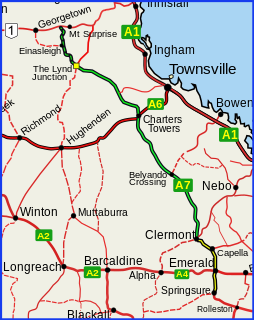
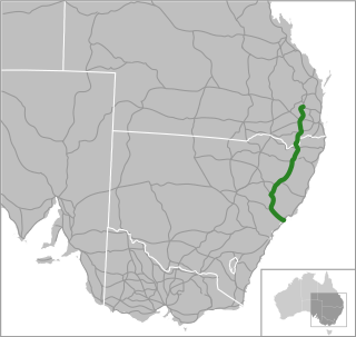
The Gregory Highway is a state highway in Queensland that serves the major coal-mining centres of Central Queensland. The highway was named after Augustus Gregory, an early explorer.

The Barkly Highway is a national highway of both Queensland and the Northern Territory in Australia. It is the only sealed road between Queensland and the Northern Territory.
Port Wakefield Road and Port Wakefield Highway are an important South Australian highway. They connect Adelaide to the Yorke Peninsula, Port Augusta, northern and western South Australia, the Northern Territory and Western Australia. They are designated National Highway A1 and a part of the National Highway. They are named after Port Wakefield, the first government town north of Adelaide. Historically, the whole route was named Port Wakefield Road, however following the opening of the Northern Expressway, the route north of that junction was named Port Wakefield Highway.

Roe Highway is a 35-kilometre-long (22 mi) limited-access highway and partial freeway in Perth, Western Australia, linking Kewdale with the city's north-eastern and south-western suburbs. The northern terminus is at Reid Highway and Great Northern Highway in Middle Swan, and the southern terminus is with Murdoch Drive at the Kwinana Freeway interchange in Bibra Lake. Roe Highway, in addition to Reid Highway, form State Route 3, a partial ring road around the outer suburbs of the Perth metropolitan area. Roe Highway also forms part of National Highway 94 from Great Eastern Highway Bypass to Great Eastern Highway, and National Highway 95 from Great Eastern Highway to Great Northern Highway.

Reid Highway is a 23-kilometre (14 mi) east-west highway and partial freeway in the northern suburbs of Perth, Western Australia, linking North Beach with Middle Swan. As part of State Route 3, it forms half of Perth's outer ring road along with Roe Highway, which it joins onto at its eastern terminus.

Tonkin Highway is an 81-kilometre-long (50 mi) north–south highway and partial freeway in Perth, Western Australia, linking Perth Airport and Kewdale with the city's north-eastern and south-eastern suburbs. As of April 2020, the northern terminus is at the interchange with Brand Highway and Great Northern Highway in Muchea, and the southern terminus is at Thomas Road in Oakford. It forms the entire length of State Route 4, and connects to several major roads. Besides Brand Highway and Great Northern Highway, it also connects to Reid Highway, Great Eastern Highway, Leach Highway, Roe Highway, and Albany Highway.
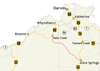
The Tanami Road, also known as the Tanami Track, Tanami Highway, and the McGuire Track, is a road in Australia that runs between the Stuart Highway in the Northern Territory and the Great Northern Highway in Western Australia. It is also known as State Route 5 in the Northern Territory. Its southern junction is 19 kilometres (12 mi) north of Alice Springs and the northern junction is 17 kilometres (11 mi) south-west of Halls Creek. It follows a cattle droving route northwest from the MacDonnell Ranges area of central Australia to Halls Creek in the Kimberley.

The Tablelands Highway is a 375 kilometre single lane sealed road in the Northern Territory, Australia. It runs from Barkly Homestead on the Barkly Highway to Cape Crawford near Borroloola on the Carpentaria Highway.
NorthLink WA was a road construction project in Perth, Western Australia, that saw both the northern section of Tonkin Highway upgraded, and the road extended northwards as the Swan Valley Bypass, to bypass Great Northern Highway. These two component projects were separately funded, with both the state and federal governments contributing to each project. Construction commenced in June 2016 and was completed on 23 April 2020.
Northern Australia Roads Program is a suite of projects designed to deliver upgrades to high priority roads in northern Australia. In 2016 the Australian Government announced 19 projects to be funded under this program, and in 2020 another was added. This program is separate to the Northern Australia Beef Roads Program, also announced in 2016, which contains a further 18 projects.
Northern Australia Beef Roads Program is a suite of projects designed to deliver targeted upgrades to key roads for transporting cattle in northern Australia. In 2016 the Australian Government announced 18 projects to be funded under this program. This program is separate to the Northern Australia Roads Program, also announced in 2016, which contains a further 20 projects.