Belhelvie

Last updated

Belhelvie
Park Terrace, Belhelvie.jpg
Park Terrace in Belhelvie
Aberdeenshire UK location map.svg
Red pog.svg
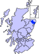
Belhelvie
Location within Aberdeenshire
Population3,802 (2001)
OS grid reference NJ9417
Civil parish
  • Belhelvie
Council area
Lieutenancy area
Country Scotland
Sovereign state United Kingdom
Post town ABERDEEN
Postcode district AB23
Dialling code 01358
Police Scotland
Fire Scottish
Ambulance Scottish
UK Parliament
Scottish Parliament
List of places
UK
Scotland
57°14′56″N2°05′17″W / 57.249°N 2.088°W / 57.249; -2.088 Coordinates: 57°14′56″N2°05′17″W / 57.249°N 2.088°W / 57.249; -2.088

Belhelvie (Scottish Gaelic : Baile Shealbhaigh) is a small village and civil parish in Aberdeenshire in Scotland. [1] The parish has a population of 3,802, [2] of which 1,653 are in the village. [3] The history of the parish is available online. [4] The churchyard contains a notable example of a morthouse used against the activities of bodysnatchers in the early 19th century.

Contents

Notable people

Related Research Articles

Coldstream Human settlement in Scotland

Coldstream is a town and civil parish in the Scottish Borders area of Scotland. A former burgh, Coldstream is the home of the Coldstream Guards, a regiment in the British Army.

Walton, Milton Keynes Civil parish in Milton Keynes, England

Walton (historically) was a hamlet that is now a district and civil parish in Milton Keynes, ceremonial Buckinghamshire, England. For local government purposes, it is part of the Danesborough and Walton electoral ward.

Selkirkshire Historic county = in Scotland

Selkirkshire or the County of Selkirk is a historic county and registration county of Scotland. It borders Peeblesshire to the west, Midlothian to the north, Roxburghshire to the east, and Dumfriesshire to the south. It derives its name from its county town, the Royal burgh of Selkirk.

Prestwick Town and former royal burgh in Scotland

Prestwick is a town in South Ayrshire on the west coast of Ayrshire in Scotland about 30 miles southwest of Glasgow. It adjoins the larger town of Ayr to the south on the Firth of Clyde coast, the centre of which is about two miles south, and the small village of Monkton to the north. It had a population of 14,901 at the 2011 census.

Ceres, Fife Human settlement in Scotland

Ceres is a village in Fife, Scotland, located in a small glen approximately 2 miles (3 km) over the Ceres Moor from Cupar and 7 mi (11 km) from St Andrews. The former parish of that name included the settlements of Baldinnie, Chance Inn, Craigrothie, Pitscottie and Tarvit Mill.

Narborough, Leicestershire Human settlement in England

Narborough is a large village and civil parish in the Blaby district of Leicestershire, England, around six miles southwest of Leicester. The population of the civil parish at the 2011 census was 8,498.

Kilmacolm Village in Inverclyde, Scotland

Kilmacolm is a village and civil parish in the Inverclyde council area, and the historic county of Renfrewshire in the west central Lowlands of Scotland. It lies on the northern slope of the Gryffe Valley, 7+12 miles southeast of Greenock and around 15 miles (24 km) west of the city of Glasgow. The village has a population of around 4,000 and is part of a wider civil parish which covers a large rural hinterland of 15,000 hectares containing within it the smaller settlement of Quarrier's Village, originally established as a 19th-century residential orphans' home.

Alness Human settlement in Scotland

Alness is a town and civil parish in Ross and Cromarty, Scotland. It lies near the mouth of the River Averon, near the Cromarty Firth, with the town of Invergordon 3 miles (5 km) to the east, and the village of Evanton 4 miles (6 km) to the south-west. The parish has a population of 5,310, although the census locality, which includes part of the parish of Rosskeen, has a population of 5,186.

Oldmeldrum is a village and parish in the Formartine area of Aberdeenshire, not far from Inverurie in North East Scotland. With a population of around 2,187, Oldmeldrum falls within Scotland's top 300 centres of population. Oldmeldrum is home to one of the oldest whisky distilleries in Scotland, Glen Garioch, which was built in 1797. Local industries are agriculture and engineering services connected to the oil industry in Aberdeen.

Boughton Malherbe is a village and civil parish in the Maidstone district of Kent, England equidistant between Maidstone and Ashford. According to the 2001 census the parish had a population of 428, including Sandway and Grafty Green, increasing to 476 at the 2011 Census.

Hackington Human settlement in England

Hackington is an area of Canterbury in Kent, England, also known as St Stephen's, incorporating the northern part of the city, as well as a semi-rural area to the north.

Clan Lumsden Lowland Scottish clan

Clan Lumsden is a Lowland Scottish clan.

Sessay Village and civil parish in North Yorkshire, England

Sessay is a small, linear village and civil parish in North Yorkshire, England. It is situated approximately 4 miles (6 km) south-east from Thirsk, and 2 miles (3 km) west from the A19 road close to the East Coast Main Line.

Auchterhouse Human settlement in Scotland

Auchterhouse is a village, community, and civil parish in the Scottish council area of Angus, located 7.3 miles (11.7 km) north west of Dundee, 9.5 miles (15.3 km) south east of Alyth and 14.9 miles (24.0 km) south west of Forfar. It lies on the southern edge of the Sidlaw Hills, below Auchterhouse Hill, 1,398 feet (426 m) high. The parish, which is coterminous with the community, had a population of 520 in 2001. The village, formerly known as Milltown of Auchterhouse, straddles the B954 Muirhead to Newtyle road. About 1.0 mile (1.6 km) east lies the larger village of Kirkton of Auchterhouse, where the church and school are located.

North Sunderland Human settlement in England

North Sunderland is a fishing village on the coast of Northumberland, England, and adjacent to Seahouses. The population of the civil parish was 1,803 at the 2001 census, increasing to 1,959 at the 2011 Census.

Moreton Morrell

Moreton Morrell is a village and civil parish in the county of Warwickshire, England. It is part of the historic hundred of Kington and is located about three and a half miles north west of the village of Kineton. The settlement was first mentioned in the Domesday Book as Moreton. From at least Norman times, it has consisted of the village of Moreton and the hamlet of Morrell. The parish of Moreton Morrell is bounded on the east and south east by the Fosse Way, and consists of Little Morrell in the north, the village of Moreton Morrell, and Moreton Paddox in the south.

Kirkbean Scottish seaside village

Kirkbean is a Scottish village and civil parish on the Solway Firth, in the historic county of Kirkcudbrightshire and council area of Dumfries and Galloway. In the 2001 census, the four small villages making up the parish of Kirkbean had a total population of 643. It includes the hamlet of Loaningfoot.

Peter Lumsden British general (1829–1918)

General Sir Peter Stark Lumsden was a British military officer who served in India. Born in Belhelvie, Aberdeenshire, he was the fourth son of Colonel Thomas Lumsden CB. He studied at Addiscombe Military Seminary, before officially joining military service as an ensign in the 60th Bengal Native Infantry in 1847. From 1852 to 1857 he served on the North-West Frontier, where, among other activities, he participated in the suppression of the Indian Rebellion of 1857 and the capture of Tantya Tope in 1859.

Healaugh, Selby Village and civil parish in North Yorkshire, England

Healaugh is a village and civil parish in the Selby District of North Yorkshire, England. According to the 2001 census it had a population of 161 in 63 households. The population had increased to 249 at the 2011 census. The village is about three miles north north-east of Tadcaster.

James Charles Tancred, born James Charles Cleghorn, was a British officer of the Royal Navy. He saw service in the First World War, and rose to the rank of vice-admiral.

References

  1. Belhelvie. Gazetteer for Scotland.
  2. General Register Office for Scotland : Census 2001 : Usual Resident Population : KS01 : Belhelvie Civil Parish Archived March 7, 2012, at the Wayback Machine Retrieved 4 January 2010
  3. "Comparative Population Profile: Balmedie Locality". Scotland's Census Results Online. 29 April 2001. Retrieved 31 August 2008.
  4. "Archived copy". Archived from the original on 24 July 2011. Retrieved 19 January 2012.{{cite web}}: CS1 maint: archived copy as title (link)
  5. Journal of the Society for Army Historical Research, Volume 65, Issue 261 - Volume 66, Issue 268 (1987), p. 230
  6. "Belhelvie". Archived from the original on 14 October 2019.