Belle Rive, Illinois | |
---|---|
Coordinates: 38°13′54″N88°44′26″W / 38.23167°N 88.74056°W [1] | |
Country | United States |
State | Illinois |
County | Jefferson |
Township | Pendleton |
Area | |
• Total | 1.03 sq mi (2.66 km2) |
• Land | 1.03 sq mi (2.66 km2) |
• Water | 0.00 sq mi (0.00 km2) |
Elevation | 476 ft (145 m) |
Population (2020) | |
• Total | 309 |
• Density | 301.17/sq mi (116.27/km2) |
Time zone | UTC-6 (CST) |
• Summer (DST) | UTC-5 (CDT) |
ZIP code | 62810 |
Area code | 618 |
FIPS code | 17-04806 |
GNIS ID | 2398076 [1] |
Wikimedia Commons | Belle Rive, Illinois |
Belle Rive is a village in Jefferson County, Illinois, United States. The population was 361 at the 2010 census. [3] It is part of the Mount Vernon Micropolitan Statistical Area.
In 1852, Edmund P. Grant bought about 480 acres (1.9 km2) of federal land grants around what was to become Belle Rive. Grant was a wealthy land speculator from Montgomery County, Tennessee. At that time there was a corporation in Mt. Vernon that was attempting to build a rail line from St. Louis to Evansville, Indiana. It seems likely that Grant was buying land in anticipation of the construction of the railroad, intending to build a town. This early attempt at building a railroad failed during a recession in the mid-1850s. Grant died in 1863, after being chased from Mt. Vernon by a mob objecting to his Confederate politics.
Belle Rive was founded in 1871, coinciding with the opening of the St. Louis & Southeastern Railroad.
Belle Rive got its name from Louis Groston de Saint-Ange de Bellerive, who surrendered Illinois to the British in 1765. [4] It is not clear if he was ever associated with the area near the village. See List of commandants of the Illinois Country.
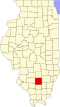
Belle Rive is located in southeastern Jefferson County. Illinois Route 142 passes through the village, leading northwest 11 miles (18 km) to Mount Vernon, the county seat, and southeast 15 miles (24 km) to McLeansboro.
According to the 2010 census, Belle Rive has a total area of 0.87 square miles (2.25 km2), all land. [5] The village is drained by tributaries of Auxier Creek, an east-flowing stream in the Little Wabash River watershed.
Census | Pop. | Note | %± |
---|---|---|---|
1900 | 370 | — | |
1910 | 312 | −15.7% | |
1920 | 311 | −0.3% | |
1930 | 278 | −10.6% | |
1940 | 333 | 19.8% | |
1950 | 313 | −6.0% | |
1960 | 303 | −3.2% | |
1970 | 279 | −7.9% | |
1980 | 401 | 43.7% | |
1990 | 396 | −1.2% | |
2000 | 371 | −6.3% | |
2010 | 361 | −2.7% | |
2020 | 309 | −14.4% | |
U.S. Decennial Census [6] |
As of the census [7] of 2000, there were 371 people, 147 households, and 109 families residing in the village. The population density was 361.5 inhabitants per square mile (139.6/km2). There were 164 housing units at an average density of 159.8 per square mile (61.7/km2). The racial makeup of the village was 97.57% White, 0.54% African American, 0.81% Native American, and 1.08% from two or more races.
There were 147 households, out of which 29.3% had children under the age of 18 living with them, 66.7% were married couples living together, 4.8% had a female householder with no husband present, and 25.2% were non-families. 22.4% of all households were made up of individuals, and 15.6% had someone living alone who was 65 years of age or older. The average household size was 2.52 and the average family size was 2.92.
In the village, the population was spread out, with 21.6% under the age of 18, 10.5% from 18 to 24, 23.2% from 25 to 44, 27.8% from 45 to 64, and 17.0% who were 65 years of age or older. The median age was 41 years. For every 100 females, there were 95.3 males. For every 100 females age 18 and over, there were 92.7 males.
The median income for a household in the village was $37,292, and the median income for a family was $41,719. Males had a median income of $28,438 versus $18,036 for females. The per capita income for the village was $15,221. About 10.3% of families and 13.8% of the population were below the poverty line, including 22.4% of those under age 18 and 9.0% of those age 65 or over.
Jefferson County is a county located in the southern part of the U.S. state of Illinois. According to the 2020 census, it has a population of 37,113. The county seat is Mount Vernon.
Macedonia is a village in Franklin and Hamilton counties, Illinois, United States. The population was 30 at the 2020 census.
Smithfield is a village in Fulton County, Illinois, United States. The population was 230 at the 2010 census. The village is named in honor of Dr. Joseph N. Smith.
Belle Prairie City is an incorporated town in Hamilton County, Illinois, United States. The population was 49 at the 2020 census. It is part of the Mount Vernon Micropolitan Statistical Area.
Media is a village in Henderson County, Illinois, United States. The population was 107 at the 2010 census, down from 130 at the 2000 census. It is part of the Burlington, IA–IL Micropolitan Statistical Area.
Bluford is a village in Jefferson County, Illinois, in the United States. As of the 2010 census the village population was 688, down from 785 at the 2000 census. It is part of the Mount Vernon Micropolitan Statistical Area.
Bonnie is a village located in the southern part of Jefferson County, Illinois. Bonnie had a population of 397 in the 2010 census, down from 424 in the 2000 census. It is part of the Mount Vernon Micropolitan Statistical Area.
Dix is a village in Jefferson County, Illinois, United States. The population was 461 at the 2010 census. It is part of the Mount Vernon Micropolitan Statistical Area.
Ina is a village in Jefferson County, Illinois, United States. The population was 2,338 as of the 2010 census. It is part of the Mount Vernon Micropolitan Statistical Area.
Nason is a city in Jefferson County, Illinois, United States. The population was 236 people as of the 2010 census, making it the least populous incorporated city in the state of Illinois. It is part of the Mount Vernon Micropolitan Statistical Area.
Waltonville is a village in Jefferson County, Illinois, United States. The population was 434 at the 2010 census. It is part of the Mount Vernon Micropolitan Statistical Area.
Nora is a village in Jo Daviess County, Illinois, United States. In 2020, the population was 107, down from 121 according to the 2010 census, which was up from 118 in 2000.
Bonfield is a village in Kankakee County, Illinois, United States. Bonfield's population was 382 at the 2010 census. It is included in the Kankakee-Bradley, Illinois Metropolitan Statistical Area.
Reddick is a village in Kankakee County, Illinois, United States. A small portion of the village extends into Livingston County. The population was 163 at the 2010 census, down from 219 at the 2000 census.
Millington is a village in Kendall and LaSalle counties in the U.S. state of Illinois. The population was 617 at the 2020 census, down from 665 at the 2010 census.
Williamsfield is a village in Knox County, Illinois, United States. The population was 578 at the 2010 census. It is part of the Galesburg Micropolitan Statistical Area.
Vernon is a village in Marion County, Illinois, United States. The population was 103 at the 2020 census.
Benson is a village in Woodford County, Illinois, United States. The population was 423 at the 2010 census, up from 408 in 2000. It is part of the Peoria, Illinois Metropolitan Statistical Area.
Belle Vernon is a borough in Fayette County, Pennsylvania, United States. It is situated along the Monongahela River, abutting two other counties, Westmoreland to the north and Washington across the river. As of the 2020 census, Belle Vernon had a population of 1,025.
Lynnwood-Pricedale is a census-designated place (CDP) in Fayette and Westmoreland counties in the Pennsylvania. The population was 2,031 at the 2010 census, down from 2,168 at the 2000 census. The community of Lynwood is located in Fayette County's Washington Township, while Pricedale is part of Westmoreland County's Rostraver Township.