Ben Eoin Provincial Park

Last updated
Ben Eoin Provincial Park
Ben Eoin Provincial Park.JPG
Ben Eoin Provincial Park
Canada Nova Scotia location map 2.svg
Red pog.svg
Canada location map 2.svg
Red pog.svg
Ben Eoin Provincial Park
TypeProvincial Park
Location Cape Breton Island, Nova Scotia, Canada
Nearest town Ben Eoin
Coordinates 45°57′44″N60°27′35″W / 45.96222°N 60.45972°W / 45.96222; -60.45972 Coordinates: 45°57′44″N60°27′35″W / 45.96222°N 60.45972°W / 45.96222; -60.45972
Area90.16 hectares (222.8 acres)
CreatedFebruary 11, 1975
Operated byParks and Recreation Division, Nova Scotia Department of Natural Resources
VisitorsUnknown, but fairly well used [1]
Opendawn to dusk, from May 15 to October 12
StatusDesignated; Operational
Hiking trailsBen Eoin Trail
Website Ben Eoin Provincial Park

Ben Eoin Provincial Park [2] is a small secluded park on an old farm against hardwood-covered hills in the community of Ben Eoin, Nova Scotia, on the south side of the East Bay of the Bras d'Or Lake, Cape Breton Island, Canada. This picnic and hiking park is managed by the provincial Department of Natural Resources and is situated on a heavily wooded 225 acres (91 ha) parcel of Crown land. A short distance into the park there are several large neatly mown clearings (former farm fields) with picnic tables under the trees at the edge of the small fields. Pit toilets and disposal areas for hot coals are available onsite.

Contents

Ben Eoin Provincial Park was established by Order in Council (OIC 75-167) on February 11, 1975. [3]

Ben Eoin Provincial Park in one of few public parks adjacent to Bras d'Or Lake and is a comparatively short drive from the urban areas of the Cape Breton Regional Municipality. It is fairly well used by the public and also sees some use by school groups. Much of the park is undeveloped and so contributes to regional biodiversity by providing habitat for uncommon plants. [4]

Season & fees

The park is open for day use (from dawn to dusk), from May 15 to October 12. There is no charge for using the park and its facilities. [5] Civic address: # 5549 East Bay Highway (Route 4), Ben Eoin, NS. [6]

Ben Eoin Provincial Park Panorama Ben Eoin Provincial Park Panorama.jpg
Ben Eoin Provincial Park Panorama

Ben Eoin Trail

The Ben Eoin Trail (1.7 kilometres (1.1 mi) return) starts at the Ben Eoin Provincial Picnic Park. A hiker's sign indicates the trailhead in the park. A very nice steady hike that climbs along a well-worn path. It climbs uphill through large and old Birch and Beech Trees. The trail leads to a well cleared look-off of solid ground and large flat stone on a ridge of the East Bay Hills with a panoramic view of the East Bay of the Bras d'Or Lake 165 metres (541 ft) below. [7]

A Hemlock Grove along the trail Ben Eoin Provincial Park Hemlock Grove.JPG
A Hemlock Grove along the trail

A working example of restoration

Nova Scotia's provincial parks were often fields or farms donated to the province in the 1950s and 1960s that became fertile ground for white spruce and other short-lived tree species. The white spruce in some Nova Scotia parks are overmature, dying of old age, or have succumbed to insect attack. To address the situation the Nova Scotia Department of Natural Resources is employing ecological restoration techniques. White spruce trees are removed so as to provide maximum benefit to the soil and future vegetation growth. Later, a tree and plant species mix more representative of the natural landscape, will be planted or encouraged to grow to produce a new forest.

A working example of this process can be found at Ben Eoin Provincial Park. During the winter of 2008/2009, work took place on an area of the park that required attention. This work will be obvious to visitors as trees are no longer standing where they once did. New growth will appear soon, but a mature forest is many years away. What was once an old pasture, turned forest, turned dead and dying trees, will again become a growing forest. [8] [9]

Ultrasonic Bat Monitoring in Eastern Cape Breton - Ben Eoin Provincial Park

In the summer of 2013, and through the following winter, a study monitoring bat activity using ultrasonic detectors was conducted in various sites in eastern Cape Breton. The goal of monitoring bat activity in summer habitats was to gather data about bats in Cape Breton, including the presence or absence of species, seasonal trends in activity, and the time when summer activity ceased. The study also hoped to shed some additional light on the prevalence of white nose syndrome in eastern Cape Breton. The bat detectors used in this project worked by detecting the ultrasonic calls produced by bats as they fly and were configured to record during the night when bats were feeding, starting 30 minutes before sunset and ending 30 minutes after sunrise (coincidentally when the parks is closed to the public). During this time, the detectors recorded the number of bat "passes," or instances of a bat flying past the microphone. Three of these bat detectors were set up in Ben Eoin Provincial Park, two operating from July to October 2013 and a third for July & August only. At least two species of bat, the little brown bat (Myotis lucifugus) and the northern long-eared bat (Myotis septentrionalis) were reliably detected. At least 5754 detections were recorded in Ben Eoin Provincial Park during the study with the most active months being August and September. [10]

Ben Eoin Provincial Park Panorama: View from the top of the Ben Eoin Trail 20150926 Ben Eoin Provincial Park Lookoff.jpg
Ben Eoin Provincial Park Panorama: View from the top of the Ben Eoin Trail

Related Research Articles

Cape Breton Island Island in Nova Scotia

Cape Breton Island is an island on the Atlantic coast of North America and part of the province of Nova Scotia, Canada.

Cape Breton Highlands National Park National park in Nova Scotia, Canada

Cape Breton Highlands National Park is a Canadian national park on northern Cape Breton Island in Nova Scotia. The park was the first national park in the Atlantic provinces of Canada and covers an area of 948 square kilometres (366 sq mi). It is one of 42 in Canada's system of national parks.

The Cabot Trail is a scenic highway on Cape Breton Island in Nova Scotia, Canada. It is a 298 km (185 mi) loop around the northern tip of the island, passing along and through the Cape Breton Highlands and the Cape Breton Highlands National Park.

Cape Breton Highlands

The Cape Breton Highlands, commonly called the Highlands, refer to a highland or mountainous plateau across the northern part of Cape Breton Island in the Canadian province of Nova Scotia.

Dalem Lake Provincial Park is a provincial park located in the Canadian province of Nova Scotia on Boularderie Island.

Long Lake Provincial Park (Nova Scotia) Park in Halifax, Canada

Long Lake Provincial Park is located in Halifax, Nova Scotia, Canada. It was initiated in 1981 by then Premier John Buchanan after Halifax's water supply had been shifted from the Spruce Hill/Long Lake/Chain Lakes watershed to the Pockwock Lake watershed near Hammonds Plains. The 2,095-hectare (5,180-acre) park, formally established in 1984, constitutes the bulk of these former watershed lands. Other portions were deeded to the municipality of Halifax, and the area around the Chain Lakes is still administered by the Halifax Regional Water Commission, since the Chain Lakes remain the city's emergency water supply.

The Bras d'Or Lakes Scenic Drive is a scenic roadway on Nova Scotia's Cape Breton Island. It extends around the perimeter of Bras d'Or Lake.

Cape Chignecto Provincial Park

Cape Chignecto Provincial Park is a Canadian provincial park located in Nova Scotia. A wilderness park, it derives its name from Cape Chignecto, a prominent headland which divides the Bay of Fundy with Chignecto Bay to the north and the Minas Channel leading to the Minas Basin to the east. The park, which opened in 1998, is the largest provincial park in Nova Scotia. It also anchors one end of the UNESCO Cliffs of Fundy Global Geopark.

White Hill is a peak in the Cape Breton Highlands and is the highest elevation point in the province of Nova Scotia, Canada.

The East Bay Hills refer to a 'fault ridge' of ancient rock on the south side of the East Bay of the Bras d'Or Lake, located on Cape Breton Island, Canada, and are an extension of the Appalachian mountain chain. The East Bay Hills lie in Cape Breton County.

Ben Eoin Unincorporated community in Nova Scotia, Canada

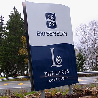
Ben Eoin is a community in the Canadian province of Nova Scotia, located in the Cape Breton Regional Municipality.

Barachois Harbour is a community in the Canadian province of Nova Scotia, located in the Cape Breton Regional Municipality on Cape Breton Island.

Groves Point is a community in the Canadian province of Nova Scotia, located in the Cape Breton Regional Municipality.

Uisge Ban Falls

Uisge Ban Falls is a waterfall near Baddeck, Nova Scotia, Canada. The falls is located in Uisge Ban Falls Provincial Park near New Glen, Victoria County, 14.5 kilometres north of Baddeck.

Uisge Ban Falls Provincial Park

Uisge Ban Falls Provincial Park is a provincial park near New Glen, in the Canadian province of Nova Scotia on Cape Breton Island. Located on the North Branch Road 14.5 kilometres (9.0 mi) north of Baddeck, the civic address of the park entrance is 715 North Branch Road, Baddeck Forks, Nova Scotia, Canada B0E 1B0

MacCormack Beach Provincial Park is a small picnic park overlooking the Bras d'Or Lake, in the community of Plaster Cove, in the Canadian province of Nova Scotia, located in Victoria County on Cape Breton Island. The park entrance is off of St. Columba Road, just 0.3 kilometres (0.19 mi) north of Iona, Nova Scotia. Civic address: 2481 St. Columba Rd, Iona, Nova Scotia.

Cabots Landing Provincial Park

Cabots Landing Provincial Park is a small picnic and beach park on the shore of Aspy Bay in the community of Sugarloaf, 10 kilometres (6.2 mi) north of the Cabot Trail on Cape Breton Island, Nova Scotia, Canada.

Wilkie Sugar Loaf Mountain in Nova Scotia, Canada

Wilkie Sugar Loaf is a Canadian peak in the Cape Breton Highlands near the community of Sugar Loaf in the province of Nova Scotia.

Lennox Passage Provincial Park

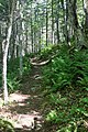
Lennox Passage Provincial Park is a small picnic and beach park on the shores of Lennox Passage (waterway) on the North Shore of Isle Madame on Cape Breton Island with 2 kilometres (1.2 mi) of shoreline, an operating lighthouse and site of a former post office (c.1910), ferry terminal and two limestone quarries. Visitors can picnic at tables scattered through a forest and open areas, enjoy the 2 kilometres (1.2 mi) of trails, or explore the working lighthouse. In summer the park offers swimming, kayaking, and biking opportunities. There are snowshoeing and cross-country skiing opportunities in the winter, however parking is available at the gate only in the off season. Located on Hwy 320, 5 kilometres (3.1 mi) east of the junction of Routes 320 and 206.

Mira River Provincial Park is a provincial park situated on the Mira River in Cape Breton County, 22 kilometres (14 mi) from Sydney and 17 kilometres (11 mi) kilometres from the Fortress of Louisbourg National Historic Site of Canada. Opened in 1967, the 87.49 hectares property offers camping sites and a range opportunities for outdoor recreation including picnicking, swimming, canoeing, kayaking, biking, front-country hiking, walking, boat ramp, fishing, cross-country skiing, snowshoeing, and geocaching. Lands were initially acquired for the park in 1962, with major acquisitions occurring in 1968 and 1973. The property was designated under the Provincial Parks Act by Order in Council on 12 June 1984.

References

  1. "Our Parks and Protected Areas: A Plan for Nova Scotia - Ben Eoin Provincial Park". Protected Areas and Wetlands Branch, Nova Scotia Environment. Retrieved 23 June 2018.
  2. "Geographical Names of Canada - Ben Eoin Provincial Park". Government of Canada. Retrieved May 2, 2012.
  3. "Ben Eoin Provincial Park Designation made under Section 8 of the Provincial Parks Act O.I.C. 75-167 (February 11, 1975)". Government of Nova Scotia. Retrieved March 22, 2016.
  4. "Lands Profiles - Ben Eoin Provincial Park". Government of Nova Scotia. Retrieved September 7, 2014.
  5. "Seasons and Fees - Day Use Parks". Nova Scotia Provincial Parks, a branch of The Department of Natural Resources. Archived from the original on 2016-01-13. Retrieved January 1, 2016.
  6. "Info on Parks A - Z - Ben Eoin Provincial Park". Nova Scotia Natural Resources. Archived from the original on 2016-01-12. Retrieved April 20, 2012.
  7. "Ben Eoin Trail". Moosebait. Retrieved September 7, 2014.
  8. "BEN EOIN - Working Example of Restoration (on page 2)" (PDF). Nova Scotia Natural Resources. Archived from the original (PDF) on 2016-03-04. Retrieved April 20, 2012.
  9. "White spruce trees cut as part of experiment in ecological restoration". Cape Breton Post (Published on December 3, 2008). Retrieved 29 June 2020.
  10. "Ultrasonic Bat Monitoring in Eastern Cape Breton" (PDF). Atlantic Coastal Action Program Cape Breton (Published 2014). Archived from the original (PDF) on 2014-09-07. Retrieved September 7, 2014.