Bennsville, Maryland

Last updated

Bennsville (Bensville), Maryland
Charles County Maryland Incorporated and Unincorporated areas Bennsville Highlighted.svg
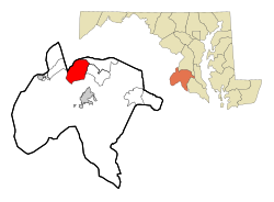
Location of Bennsville, Maryland
Coordinates: 38°37′24″N77°0′23″W / 38.62333°N 77.00639°W / 38.62333; -77.00639
CountryUnited States
State Maryland
County Charles
Area
[1]
  Total16.91 sq mi (43.78 km2)
  Land16.90 sq mi (43.78 km2)
  Water0.00 sq mi (0.00 km2)
Elevation
184 ft (56 m)
Population
 (2020)
  Total15,288
  Density904.40/sq mi (349.19/km2)
Time zone UTC−5 (Eastern (EST))
  Summer (DST) UTC−4 (EDT)
FIPS code 24-06615
GNIS feature ID0589738

Bennsville [2] (spelled Bensville by the United States Census Bureau [3] ) is a census-designated place (CDP) in Charles County, Maryland, United States. Per the 2020 census, the population was 15,288. [4] The area is not an official postal designation, but is part of the Waldorf or Pomfret postal area. The Bennsville area is growing with new residential development, encouraged by the extension in the 1990s of Maryland Route 228 which provides quick access to Maryland Route 210. Bennsville has experienced the 2006 opening of North Point High School and the straightening of Middletown Road in 2008.

Contents

Geography

Bennsville is located at 38°37′24″N77°0′23″W / 38.62333°N 77.00639°W / 38.62333; -77.00639 (38.623302, 77.006265). [5]

According to the United States Census Bureau, the CDP has a total area of 16.9 square miles (43.8 km2), all land. [3]

Demographics

Historical population
CensusPop.Note
2010 11,923
2020 15,28828.2%
U.S. Decennial Census [6]
2010 [7] 2020 [8]

2020 census

Bensville CDP, Maryland – Racial and ethnic composition
Note: the US Census treats Hispanic/Latino as an ethnic category. This table excludes Latinos from the racial categories and assigns them to a separate category. Hispanics/Latinos may be of any race.
Race / Ethnicity (NH = Non-Hispanic)Pop 2010 [7] Pop 2020 [8] % 2010% 2020
White alone (NH)5,1313,95743.03%25.88%
Black or African American alone (NH)5,2388,52143.93%55.74%
Native American or Alaska Native alone (NH)59510.49%0.33%
Asian alone (NH)4967314.16%4.78%
Pacific Islander alone (NH)1070.08%0.05%
Some Other Race alone (NH)33900.28%0.59%
Mixed Race or Multi-Racial (NH)4379883.67%6.46%
Hispanic or Latino (any race)5199434.35%6.17%
Total11,92315,288100.00%100.00%

2000 Census

As of the census [9] of 2000, there were 7,325 people, 2,429 households, and 2,071 families residing in the CDP. The population density was 431.6 inhabitants per square mile (166.6/km2). There were 2,493 housing units at an average density of 146.9 per square mile (56.7/km2). The racial makeup of the CDP was 76.46% White, 18.02% African American, 0.41% Native American, 2.32% Asian, 0.10% Pacific Islander, 0.55% from other races, and 2.14% from two or more races. Hispanic or Latino of any race were 2.20% of the population.

There were 2,429 households, out of which 43.4% had children under the age of 18 living with them, 74.9% were married couples living together, 7.5% had a female householder with no husband present, and 14.7% were non-families. 10.5% of all households were made up of individuals, and 2.1% had someone living alone who was 65 years of age or older. The average household size was 3.01 and the average family size was 3.25.

In the CDP, the population was spread out, with 28.1% under the age of 18, 6.8% from 18 to 24, 32.5% from 25 to 44, 27.4% from 45 to 64, and 5.3% who were 65 years of age or older. The median age was 36 years. For every 100 females, there were 97.5 males. For every 100 females age 18 and over, there were 97.3 males.

The median income for a household in the CDP was $83,388, and the median income for a family was $85,988. Males had a median income of $51,770 versus $39,797 for females. The per capita income for the CDP was $29,677. About 0.4% of families and 1.5% of the population were below the poverty line, including none of those under age 18 and 5.5% of those age 65 or over.

Related Research Articles

<span class="mw-page-title-main">McDonald Chapel, Alabama</span> CDP in Alabama, United States

McDonald Chapel is a census-designated place in Jefferson County, Alabama, United States. It is northeast of the Birmingham suburb of Pleasant Grove. At the 2020 census, the population was 739. Large portions of this area were damaged by violent tornadoes in 1956, 1998, and 2011. The 1998 tornado was rated F5 on the Fujita scale.

<span class="mw-page-title-main">Palmetto Estates, Florida</span> Census-designated place in Florida

Palmetto Estates is an unincorporated area and census-designated place (CDP) in Miami-Dade County, Florida, United States. It is part of the Miami metropolitan area of South Florida. The population was 13,498 at the 2020 census.

<span class="mw-page-title-main">Brooklyn Park, Maryland</span> Census-designated place in Maryland, United States

Brooklyn Park is a census-designated place (CDP) in Anne Arundel County, Maryland, United States. The population was 14,373 at the 2010 census.

<span class="mw-page-title-main">Green Valley, Maryland</span> Census-designated place in Frederick County, Maryland, United States

Green Valley is an unincorporated area and census-designated place (CDP) in southern Frederick County, Maryland, United States. The population was 12,643 at the 2020 census. The area was listed as a census-designated place in 2000 but not listed as part of any CDP at the 2010 census. It was re-designated a census-designated place for the 2020 census.

<span class="mw-page-title-main">Fairland, Maryland</span> Census-designated place in Maryland, United States

Fairland is a census-designated place and an unincorporated area in Montgomery County, Maryland, United States. It had a population of 25,396 per the 2020 census.

<span class="mw-page-title-main">Coral Hills, Maryland</span> Census-designated place in Maryland

Coral Hills is an unincorporated area and census-designated place (CDP) in Prince George's County, Maryland, United States. As of the 2020 census, the population was 9,997.

<span class="mw-page-title-main">East Riverdale, Maryland</span> Census-designated place in Maryland, United States

East Riverdale is an unincorporated area and census-designated place (CDP) in Prince George's County, Maryland, United States. The population was 18,459 at the 2020 census.

<span class="mw-page-title-main">Friendly, Maryland</span> Census-designated place in Maryland

Friendly is an unincorporated area and census-designated place (CDP) in Prince George's County, Maryland, United States, with an African-American majority population, located a few miles south of Washington, D.C. The population was 9,937 at the 2020 census.

<span class="mw-page-title-main">Marlow Heights, Maryland</span> Census-designated place in Maryland

Marlow Heights is an unincorporated area and census-designated place (CDP) in Prince George's County, Maryland, United States. The population was 6,169 at the 2020 census. The Marlow Heights Shopping Center first opened in 1957, adjacent to the large community of Hillcrest Heights. It was joined ten years later, in 1967, by the two-level Iverson Mall, the Washington metropolitan area's first enclosed mall.

<span class="mw-page-title-main">Marlton, Maryland</span> Census-designated place in Maryland

Marlton is an unincorporated area and census-designated place (CDP) in Prince George's County, Maryland, United States. The population was 9,802 at the 2020 census. The Marlton housing development, at first briefly called "Brandywine Country", grew up along U.S. Route 301 in the 1970s, and is part of the greater Upper Marlboro community. Originally made up of only single-family homes, more recently townhouses have been added.

<span class="mw-page-title-main">Rosaryville, Maryland</span> Census-designated place in Maryland, US

Rosaryville is an unincorporated area and census-designated place (CDP) in Prince George's County, Maryland, United States, located south of Cinton and Upper Marlboro beside U.S. Route 301. Per the 2020 census, the population was 11,548. including housing developments and rural open space. It was named for a local Roman Catholic church. Close to Rosaryville are the Marlton housing development, Maryland Veterans Cemetery, the Southern Maryland Farmers Market, and Rosaryville State Park.

<span class="mw-page-title-main">South Laurel, Maryland</span> Census-designated place in Maryland

South Laurel is an unincorporated area and census-designated place (CDP) in Prince George's County, Maryland, United States. Per the 2020 census, the population was 29,602.

<span class="mw-page-title-main">Springdale, Maryland</span> Census-designated place in Maryland

Springdale is an unincorporated area and census-designated place (CDP) in Prince George's County, Maryland, United States. Per the 2020 census, the population was 5,301.

<span class="mw-page-title-main">Walker Mill, Maryland</span> Census-designated place in Maryland

Walker Mill is an unincorporated area and census-designated place (CDP) in Prince George's County, Maryland, United States. Per the 2020 census, the population was 12,187.

<span class="mw-page-title-main">Woodlawn, Prince George's County, Maryland</span> Census-designated place in Maryland

Woodlawn is an unincorporated area and census-designated place (CDP) in Prince George's County, Maryland, United States. As of the 2020 census it had a population of 7,541.

St. Bonaventure is a hamlet and census-designated place (CDP) in the town of Allegany in Cattaraugus County, New York, United States. The population was 1,963 at the 2020 census.

<span class="mw-page-title-main">Dooms, Virginia</span> CDP in Virginia, United States

Dooms is a census-designated place (CDP) in Augusta County, Virginia, United States. The population was 1,327 at the 2010 census. It is part of the Staunton–Waynesboro Micropolitan Statistical Area.

<span class="mw-page-title-main">Great Falls, Virginia</span> Census-designated place in Virginia, United States

Great Falls is a census-designated place in Fairfax County, Virginia, United States. The population at the 2020 census was 15,953.

<span class="mw-page-title-main">Chamberlayne, Virginia</span> Census-designated place in Virginia

Chamberlayne is a census-designated place (CDP) in Henrico County, Virginia, United States. The population was 5,581 at the 2020 census.

<span class="mw-page-title-main">Hillandale, Maryland</span> Census-designated place in Maryland, United States

Hillandale is an unincorporated area and census-designated place located in Montgomery and Prince George's counties, Maryland, United States. As of the 2020 census, it had a population of 5,774. Hillandale is contained between the Prince George's / Montgomery County line to the east, the Anacostia River to the west, McCeney Avenue to the north, and D.C.'s Capital Beltway to the south. It borders the communities of Adelphi, Avenel, White Oak and Beltsville.

References

  1. "2020 U.S. Gazetteer Files". United States Census Bureau. Retrieved April 26, 2022.
  2. U.S. Geological Survey Geographic Names Information System: Bennsville, Maryland
  3. 1 2 "Geographic Identifiers: 2010 Demographic Profile Data (DP-1): Bensville CDP, Maryland". United States Census Bureau . Retrieved August 3, 2012.
  4. "Bensville CDP, Maryland". United States Census Bureau . Retrieved April 15, 2022.
  5. "US Gazetteer files: 2010, 2000, and 1990". United States Census Bureau. February 12, 2011. Retrieved April 23, 2011.
  6. "Decennial Census of Population and Housing by Decades". US Census Bureau.
  7. 1 2 "P2 HISPANIC OR LATINO, AND NOT HISPANIC OR LATINO BY RACE – 2010: DEC Redistricting Data (PL 94-171) – Bensville CDP, Maryland". United States Census Bureau .
  8. 1 2 "P2 HISPANIC OR LATINO, AND NOT HISPANIC OR LATINO BY RACE – 2020: DEC Redistricting Data (PL 94-171) – Bensville CDP, Maryland". United States Census Bureau .
  9. "U.S. Census website". United States Census Bureau . Retrieved January 31, 2008.