Big Woods, Minnesota | |
|---|---|
 Big Woods  Big Woods | |
| Coordinates: 48°18′41″N97°06′29″W / 48.31139°N 97.10806°W | |
| Country | United States |
| State | Minnesota |
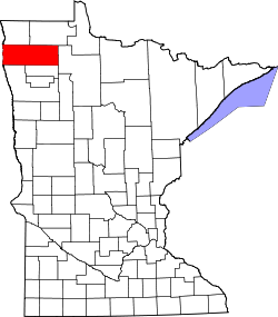
| County | Marshall |
| Township | Big Woods |
| Elevation | 797 ft (243 m) |
| Time zone | UTC-6 (Central (CST)) |
| • Summer (DST) | UTC-5 (CDT) |
| Area code | 218 |
| GNIS feature ID | 654605 [1] |
Big Woods is an unincorporated community in Marshall County, Minnesota, United States. [1] [2]