Mud Lake | |
|---|---|
 Mud Lake  Mud Lake | |
| Coordinates: 48°19′26″N95°54′48″W / 48.32389°N 95.91333°W | |
| Country | United States |
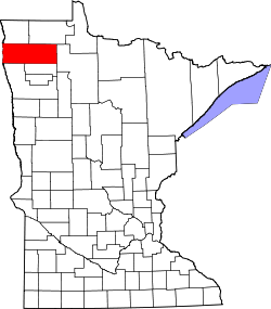
| State | Minnesota |
| County | Marshall |
| Area | |
• Total | 36 sq mi (93 km2) |
| • Land | 31.3 sq mi (81 km2) |
| • Water | 4.7 sq mi (12 km2) |
| Elevation | 1,145 ft (349 m) |
| Population (2020) | |
• Total | 0 |
| • Density | 0/sq mi (0/km2) |
| Time zone | UTC-6 (Central (CST)) |
| • Summer (DST) | UTC-5 (CDT) |
| GNIS feature ID | 665062 [1] |
Mud Lake is an unorganized territory located in Marshall County, Minnesota, United States. [1] In all censuses since 2000, the unorganized territory recorded a population of 0. [2]