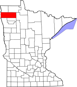
Luna, Minnesota

Last updated

Luna, Minnesota
USA Minnesota location map.svg
Red pog.svg
Luna
Usa edcp location map.svg
Red pog.svg
Luna
Coordinates: 48°15′13″N96°47′37″W / 48.25361°N 96.79361°W / 48.25361; -96.79361
Country United States
State Minnesota
County Marshall
Township Warrenton
Elevation
[1]
853 ft (260 m)
Time zone UTC-6 (Central (CST))
  Summer (DST) UTC-5 (CDT)
Area code 218
GNIS feature ID654807 [1]

Luna is an unincorporated community in southern Marshall County, Minnesota, United States. [1] [2]

The community lies approximately four miles north of Warren along U.S. Route 75. [3]

Climate

According to the Köppen Climate Classification system, Luna has a warm-summer humid continental climate, abbreviated "Dfb" on climate maps. The hottest temperature recorded in Luna was 101 °F (38.3 °C) on June 1942, while the coldest temperature recorded was −32 °F (−35.6 °C) on January 22, 1937, January 18, 1960, January 30, 1979, and December 23, 1990. [4]

Climate data for Luna, Minnesota, 1991–2020 normals, extremes 1903–2015
MonthJanFebMarAprMayJunJulAugSepOctNovDecYear
Record high °F (°C)72
(22)
76
(24)
81
(27)
89
(32)
96
(36)
101
(38)
100
(38)
97
(36)
97
(36)
87
(31)
80
(27)
73
(23)
101
(38)
Mean maximum °F (°C)63.3
(17.4)
64.8
(18.2)
70.6
(21.4)
77.2
(25.1)
84.3
(29.1)
91.5
(33.1)
92.6
(33.7)
88.2
(31.2)
84.6
(29.2)
78.4
(25.8)
70.5
(21.4)
64.2
(17.9)
93.7
(34.3)
Mean daily maximum °F (°C)51.9
(11.1)
54.6
(12.6)
60.9
(16.1)
67.2
(19.6)
75.4
(24.1)
85.0
(29.4)
85.3
(29.6)
81.8
(27.7)
78.5
(25.8)
71.0
(21.7)
60.7
(15.9)
52.3
(11.3)
68.7
(20.4)
Daily mean °F (°C)32.7
(0.4)
35.6
(2.0)
40.1
(4.5)
45.9
(7.7)
52.5
(11.4)
61.2
(16.2)
66.4
(19.1)
64.5
(18.1)
58.8
(14.9)
48.8
(9.3)
39.3
(4.1)
32.6
(0.3)
48.2
(9.0)
Mean daily minimum °F (°C)13.5
(−10.3)
16.5
(−8.6)
19.3
(−7.1)
24.5
(−4.2)
29.7
(−1.3)
37.4
(3.0)
47.5
(8.6)
47.2
(8.4)
39.1
(3.9)
26.7
(−2.9)
18.0
(−7.8)
13.0
(−10.6)
27.7
(−2.4)
Mean minimum °F (°C)−4.6
(−20.3)
−0.8
(−18.2)
4.4
(−15.3)
10.6
(−11.9)
17.6
(−8.0)
25.5
(−3.6)
35.9
(2.2)
38.0
(3.3)
26.9
(−2.8)
13.3
(−10.4)
1.5
(−16.9)
−8.4
(−22.4)
−12.0
(−24.4)
Record low °F (°C)−32
(−36)
−31
(−35)
−18
(−28)
−5
(−21)
7
(−14)
18
(−8)
26
(−3)
30
(−1)
19
(−7)
2
(−17)
−25
(−32)
−32
(−36)
−32
(−36)
Average precipitation inches (mm)1.21
(31)
1.05
(27)
0.82
(21)
0.45
(11)
0.68
(17)
0.61
(15)
3.37
(86)
3.84
(98)
2.16
(55)
1.42
(36)
0.86
(22)
1.11
(28)
17.58
(447)
Average snowfall inches (cm)5.4
(14)
1.7
(4.3)
1.4
(3.6)
0.7
(1.8)
0.0
(0.0)
0.0
(0.0)
0.0
(0.0)
0.0
(0.0)
0.0
(0.0)
0.1
(0.25)
1.4
(3.6)
6.9
(18)
17.6
(45.55)
Average precipitation days (≥ 0.01 in)5.34.74.63.23.84.015.315.48.24.93.85.078.2
Average snowy days (≥ 0.1 in)2.41.51.30.70.00.00.00.00.00.10.72.49.1
Source 1: NOAA [5]
Source 2: XMACIS2 (mean maxima/minima 19812010) [4]

Notes

  1. 1 2 3 "Luna, Minnesota". Geographic Names Information System . United States Geological Survey, United States Department of the Interior.
  2. Minnesota Department of Transportation-Marshall County
  3. Newfolden, MN, 7.5 Minute Topographic Quadrangle, USGS, 1982
  4. 1 2 "xmACIS2". National Oceanic and Atmospheric Administration. Retrieved February 21, 2023.
  5. "U.S. Climate Normals Quick Access – Station: Luna RS, MN". National Oceanic and Atmospheric Administration. Retrieved February 21, 2023.


Related Research Articles

<span class="mw-page-title-main">International Falls, Minnesota</span> City in Minnesota, United States

International Falls is a city in and the county seat of Koochiching County, Minnesota, United States. The population was 5,802 at the time of the 2020 census.

<span class="mw-page-title-main">Madison, Minnesota</span> City in Minnesota, United States

Madison is a city in Lac qui Parle County, Minnesota, United States, along the 45th parallel. The population was 1,518 at the 2020 census. It is the county seat of Lac qui Parle County. It proclaims itself to be the "lutefisk capital of the USA."

<span class="mw-page-title-main">Tower, Minnesota</span> City in Minnesota, United States

Tower is a city located in Saint Louis County, Minnesota, United States. As of the 2020 census, the city had a total population of 430. State Highways 1, 169, and 135 are three of the main routes in Tower. Tower is located on the southern shore of Lake Vermilion.

Brimson is an unincorporated community in Ault Township, Saint Louis County, Minnesota, United States.

<span class="mw-page-title-main">Embarrass, Minnesota</span> Unincorporated community in Minnesota, United States

Embarrass is an unincorporated community in Embarrass Township, Saint Louis County, Minnesota, United States.

<span class="mw-page-title-main">Climate of Minneapolis–Saint Paul</span>

The climate of Minneapolis–Saint Paul is the long term weather trends and historical events of the Minneapolis–Saint Paul metropolitan area in east central Minnesota. Minneapolis and St. Paul, together known as the Twin Cities, are the core of the 15th largest metropolitan area in the United States. With a population of 3.6 million people, the region contains approximately 60% of the population of Minnesota. Due to its location in the northern and central portion of the U.S., the Twin Cities has the coldest average temperature of any major metropolitan area in the nation. Winters are very cold, summer is warm and humid, snowfall is common in the winter and thunderstorms with heavy rainfall occur during the spring, summer and autumn. Though winter can be cold, the area receives more sunlight hours in mid-winter than many other warmer parts of the country, including all of the Great Lakes states, the Pacific Northwest, parts of the South, and almost all of the Northeast. Unless otherwise indicated, all normals data presented below are based on data at Minneapolis/St. Paul International Airport, the official Twin Cities climatology station, from the 1981−2010 normals period.

<span class="mw-page-title-main">North Stratford, New Hampshire</span> Unincorporated community in New Hampshire, United States

North Stratford is an unincorporated community in the town of Stratford in Coos County, New Hampshire, United States. It is located in the northwest corner of the town, along the Connecticut River and adjacent to Bloomfield, Vermont.

<span class="mw-page-title-main">Climate of Minnesota</span> Climatic conditions of Minnesota, US

Minnesota has a humid continental climate, with hot summers and cold winters. Minnesota's location in the Upper Midwest allows it to experience some of the widest variety of weather in the United States, with each of the four seasons having its own distinct characteristics. The area near Lake Superior in the Minnesota Arrowhead region experiences weather unique from the rest of the state. The moderating effect of Lake Superior keeps the surrounding area relatively cooler in the summer and warmer in the winter, giving that region a smaller yearly temperature variation. On the Köppen climate classification, much of the southern third of Minnesota—roughly from the Twin Cities region southward—falls in the hot summer zone (Dfa), and the northern two-thirds of Minnesota falls in the warm summer zone (Dfb).

Dalton is an unincorporated census-designated place in the town of Kingston located in the southwestern corner of Green Lake County, Wisconsin, United States. It is located on Wisconsin Highway 44. It uses ZIP code 53926. As of the 2010 census, its population was 206. The surrounding countryside is mainly occupied by dairy farmers and an Amish community. Dalton has an area of 0.456 square miles (1.18 km2); 0.449 square miles (1.16 km2) of this is land, and 0.007 square miles (0.018 km2) is water. Dalton was named for John Dalton, who emigrated from Ireland with his family in the early 1850s.

Cotton is an unincorporated community in Cotton Township, Saint Louis County, Minnesota, United States.

Isabella is a remote unincorporated community in Stony River Township, Lake County, Minnesota, United States.

<span class="mw-page-title-main">Climate of North Dakota</span>

North Dakota's climate is typical of a continental climate with cold winters and warm-hot summers. The state's location in the Upper Midwest allows it to experience some of the widest variety of weather in the United States, and each of the four seasons has its own distinct characteristics. The eastern half of the state has a humid continental climate with warm to hot, somewhat humid summers and cold, windy winters, while the western half has a semi-arid climate with less precipitation and less humidity but similar temperature profiles. The areas east of the Missouri River get slightly colder winters, while those west of the stream get higher summer daytime temperatures. In general, the diurnal temperature difference is prone to be more significant in the west due to higher elevation and less humidity.

Lacomb is a census-designated place and unincorporated community in Linn County, Oregon, United States, located about 10 miles (16 km) northeast of Lebanon. It was named in December 1889 by W.J. Turnidge, a son of a pioneer. As of the 2019 Census it had a population of 481.

Theilman is an unincorporated community in Wabasha County, Minnesota, United States.

Otto is an unincorporated community in Macon County, North Carolina, United States. Otto is located along U.S. Route 23, 8.4 miles (13.5 km) south of Franklin. Otto has a post office with ZIP code 28763. Otto has a community development organization which meets regularly in the Otto Community Building. This building is attached to the Otto Fire Station which is run by volunteer firefighters.

Swan Lake is a census-designated place and unincorporated community in Lake County, Montana, United States. Its population was 113 as of the 2010 census.

Picacho is an unincorporated community located in Lincoln County, New Mexico, United States. The community is located on U.S. Route 70, 30.5 miles (49.1 km) east of Ruidoso. Picacho has a post office with ZIP code 88343, which opened on June 11, 1891.

<span class="mw-page-title-main">Wild Horse, Nevada</span> Unincorporated community in the state of Nevada, United States

Wild Horse is an unincorporated community in Elko County, Nevada, United States. It is located along Nevada State Route 225 just south of Wild Horse Reservoir, from which it derives its name.

Lybrook is an unincorporated community and census-designated place (CDP) in Rio Arriba County, New Mexico, United States. It was first listed as a CDP prior to the 2020 census.

Massadona is an unincorporated community in Moffat County, in the U.S. state of Colorado.