Bilsthorpe Moor

Last updated

Bilsthorpe Moor
Nottinghamshire UK location map.svg
Red pog.svg
Bilsthorpe Moor
Location within Nottinghamshire
OS grid reference SK 65136 59685
Civil parish
District
Shire county
Region
Country England
Sovereign state United Kingdom
Post town Newark
Postcode district NG22
Dialling code 01623
Police Nottinghamshire
Fire Nottinghamshire
Ambulance East Midlands
UK Parliament
List of places
UK
England
Nottinghamshire
53°07′48″N1°01′37″W / 53.130°N 1.027°W / 53.130; -1.027

Bilsthorpe Moor is a hamlet in the civil parish of Bilsthorpe, in the Newark and Sherwood district of Nottinghamshire, England. [1] It is 120 miles north of London, 13 miles north east of the city of Nottingham, and 5 miles south of Ollerton, and close to the junction of the A614 and A617 roads.

Contents

Bilsthorpe Moor
Map

Toponymy

According to local placename studies the name "Bilsthorpe" means 'The þorp (village) of Bildr', [2] also known in the form, Bildi. [3] No knowledge of either person exists, although in Old Norse Bíldr meant 'axe' and was also commonly the name of a mythical Norse dwarf of tales. [4] The moor portion of the placename refers to the settlement's development on elevated moorland, which rises to over 300ft.

Geography

Bilsthorpe Moor is surrounded by the following local areas:

This area lies to the southeast corner of the parish, where Kirklington Road meets Farnsfield Road. It is a suburb of Bilsthorpe village, and primarily residential, lying 13 mile (600 m) south of the traditional centre close to the church, and 34 mi (1.22 kilometres) from the newer village area. It also refers to the wider location south of built-up area, for which there are open fields to the east, west and south which is predominantly used as farmland, with some light and medium industry.

Around the built-up area, the land is approximately 70–75 metres (230–246 ft) with a nearby high point of 83 metres (272 ft) south of the village. The land peaks at 95 metres (312 ft) in the south west.

Governance and demography

The parish level is managed by Bilsthorpe Parish Council. At this level, since the two settlements of Bilsthorpe village and Bilsthorpe Moor hamlet now effectively run into one another, Bilsthorpe is treated as one unified area together with its wider countryside. This parish currently reports a population of 3,375 residents.

The district level is managed by Newark and Sherwood District Council. The highest level 'strategic' services to the area are provided by Nottinghamshire County Council.

At the Parliamentary level, the residents elect an MP to serve in the House of Commons seat for Sherwood Forest. As of June 2024, the elected MP represents the Conservative Party.

History

In 1066 during the time of the Norman Conquest, Ulf was recorded as local lord and landowner. By the time of Domesday (1086), Gilbert of Ghent was the primary landowner. [5] Much of the surrounding area came into the ownership by the sixteenth century of Sir Brian Broughton, first in the line of Broughton baronets. [6] It was later transferred to the Earl of Scarborough by the middle of the 19th century, who was recorded as Lord of the manor in 1853 as well as owner of all the parish land, except the glebe land associated to the village church. [7] Bilsthorpe Moor was first recorded in 1840 within a tithe map as a discrete place. [8] [9]

Maps at the turn of the 20th century showed a cluster of residences as well as a small pool, the Sow Dam (by the modern day Oaktree Drive) as the northern extent of the hamlet, with some greenfield land before Bilsthorpe village. [10] This gap began to be built over from the late 1950s into the 1970s mainly with housing, mirroring the building of miner's homes taking place in the main village, with a small retail area put in place along this section of Kirkington Road. The railway line to Bilsthorpe colliery ran to the left of the village, and was in use for transporting coal from the middle 1920s until 1997. [11]

There was a school in the area for much of the 20th century. By the middle of the 1950s there was a medium-sized farm to the north east of the village, eventually becoming a factory for poultry products owned by Deans Foods, which was later bought out by the Noble Foods Group. It was closed in 2016, with production moved elsewhere in the country, and the facility subsequently demolished. The owners then made proposals to build houses on the site. [12] Wicker (later Wycar) Leys was a large farmhouse on the southwest of the area, [10] which was owned by the Rufford Abbey estate until 1938 when much of their local holdings were sold. [13] It was later repurposed as a nursing home for disabled patients until the parent business closed the site in 2019. [14] [15]

Economy

While much of the area surrounding the residential settlement is agricultural with nearby farms working the land, there is other industry locally based to the south of the village:

Landmarks

Related Research Articles

<span class="mw-page-title-main">Sherwood Forest</span> Royal forest in Nottinghamshire, England

Sherwood Forest is the remnants of an ancient royal forest in Nottinghamshire, England, having a historic association with the legend of Robin Hood.

<span class="mw-page-title-main">Newark and Sherwood</span> Non-metropolitan local government district in Nottinghamshire, England

Newark and Sherwood is a local government district in Nottinghamshire, England. It is the largest district by area in the county. The council is based in Newark-on-Trent, the area's largest town. The district also includes the towns of Southwell and Ollerton along with a large rural area containing many villages. Much of the district lies within the ancient Sherwood Forest and there are also extensive forestry plantations in the area.

<span class="mw-page-title-main">A614 road</span> Road in England

The A614 is a main road in England running through the counties of Nottinghamshire, South Yorkshire and the East Riding of Yorkshire.

<span class="mw-page-title-main">Sherwood (UK Parliament constituency)</span> Parliamentary constituency in the United Kingdom, 1983 onwards

Sherwood is a constituency represented in the House of Commons of the UK Parliament since 2010 by Mark Spencer, a Conservative. The constituency's name is common with Sherwood Forest which is in the area.

<span class="mw-page-title-main">Wellow, Nottinghamshire</span> Village and civil parish in Nottinghamshire, England

Wellow is a village in Nottinghamshire, England. According to the 2001 census it had a population of 444, increasing to 470 at the 2011 census, but falling slightly to 463 at the 2021 census.

<span class="mw-page-title-main">Bilsthorpe</span> Village and civil parish in Nottinghamshire, England

Bilsthorpe is a village and civil parish in the Newark and Sherwood district of Nottinghamshire, England. According to the 2001 census it had a population of 3,076, increasing to 3,375 at the 2011 census, and dropping slightly to 3,365 at the 2021 census. It is located near the junction of the A614 and A617, around 5 miles south of Ollerton, 9 miles east of Mansfield and 6 miles north-west of Southwell.

<span class="mw-page-title-main">Rainworth</span> Village and civil parish in Nottinghamshire, England

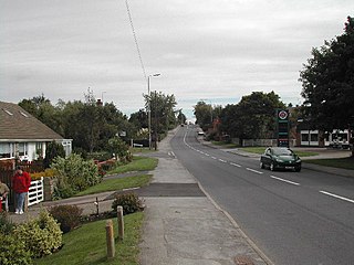
Rainworth is a village in the ceremonial county of Nottinghamshire in the East Midlands of England. It is split between the local government districts of Newark and Sherwood and Mansfield. To the north of Rainworth is the village of Clipstone and to the east are the villages of Bilsthorpe and Farnsfield. Mansfield lies two miles to the west and the village of Blidworth is a mile to the south.

<span class="mw-page-title-main">A617 road</span> Road in England

The A617 road runs through the northern East Midlands, England, between Newark-on-Trent and Chesterfield.

<span class="mw-page-title-main">Farnsfield</span> Village in Nottinghamshire, England

Farnsfield is a large village and civil parish in Nottinghamshire in Sherwood Forest. It is in the local government district of Newark and Sherwood. The population of the civil parish as at the United Kingdom Census 2001 was 2,681, increasing in the 2011 census to 2,731, and 3,216 at the 2021 census.

<span class="mw-page-title-main">Kirklington, Nottinghamshire</span> Village and civil parish in Nottinghamshire, England

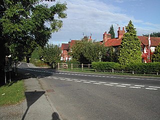
Kirklington is a village and civil parish in the Newark and Sherwood district of Nottinghamshire, England. The population as of the 2011 census was 400, falling to 388 at the 2021 census. Kirklington lies on the A617 road between Newark and Mansfield.

The Rufford Charters were grants of land and grants of Regalian rights over land, which created an extra-parochial liberty, known as the Liberty of Rufford in the County of Nottinghamshire in England. It is defined as an area in which regalian rights were exercised by the Cistercian monks of Rufford Abbey.

<span class="mw-page-title-main">Rufford, Nottinghamshire</span> Village and civil parish in Nottinghamshire, England

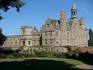
Rufford, in the Newark and Sherwood district of Nottinghamshire, is the site of two villages whose inhabitants were evicted in the 12th century. Cistercian monasteries were established and the monks wished to ensure their isolation.

<span class="mw-page-title-main">Fiskerton cum Morton</span> Civil parish in England

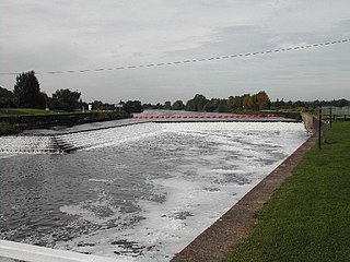
Fiskerton cum Morton is a civil parish in the Newark and Sherwood district, within the county of Nottinghamshire, England. The overall area had a population of 803 at the 2021 census. The parish lies in the south east of the county. It is 112 miles north of London, 12 miles north east of the city of Nottingham, 5 miles west of the town of Newark-on-Trent and 212 miles south east of the town of Southwell. The parish lies along the bank of the River Trent and is primarily a commuter residential area to both Nottingham and Newark.

<span class="mw-page-title-main">Kings Clipstone</span> Village in Nottinghamshire, England

Kings Clipstone is a settlement and civil parish, in the Newark and Sherwood district, in the county of Nottinghamshire, England. The parish lies in the west of the county, and north west within the district. It is 122 miles north of London, 15 miles north of the city of Nottingham, and 5 miles north east of the market town of Mansfield. In the 2021 census, the parish had a population of 312. The parish touches Clipstone village, Edwinstowe, Rufford and Warsop. The parish was formerly part of the wider Clipstone parish, on 1 April 2011 it became a separate parish. The area is within Sherwood Forest, well known for the Robin Hood legend.

<span class="mw-page-title-main">Scofton</span> Hamlet in Nottinghamshire, England

Scofton is a hamlet in the Bassetlaw district of northern Nottinghamshire, England. It is 130 miles (210 km) north west of London, 25 miles (40 km) north of the county town and city of Nottingham, and 3 miles (4.8 km) east of the nearest town Worksop. Having a shared modern history with nearby Osberton Hall, it is sometimes referred to as Scofton-with-Osberton. Other close neighbours are Bilby and Rayton which also have historical associations.

The Rolleston Junction to Mansfield line was a railway line in Nottinghamshire, England linking the village of Rolleston with Mansfield. Whilst parts of the line date back to 1847, it was opened throughout in 1871 by the Midland Railway; by the 1920s, the dominant traffic was to the collieries east of Mansfield. Through passenger services ceased in 1929 and the line was closed completely in 1983.

<span class="mw-page-title-main">Southwell Trail</span> Multi-user rail trail in the English county of Nottinghamshire

The Southwell Trail is a 7.5-mile (12.1 km) long multi-user trail, for use on foot, cycle and horseback, that links Bilsthorpe and Southwell in the English county of Nottinghamshire. It uses parts of the track bed of two former railway lines. It has been designated as a Local Nature Reserve.

References

  1. OS Explorer Map 270: Sherwood Forest: (1:25 000): ISBN   0 319 24040 1
  2. "Search :: Survey of English Place-Names". epns.nottingham.ac.uk. Retrieved 4 January 2021.
  3. MUTSCHMANN, HEINRICH (1913). THE PLACE-NAMES OF NOTTINGHAMSHIRE, THEIR ORIGIN AND DEVELOPMENT. Cambridge University Press. pp. 15–16.
  4. Wiktionary:Bíldr https://en.wiktionary.org/wiki/Bíldr
  5. "Bilsthorpe | Domesday Book". opendomesday.org. Retrieved 4 January 2021.
  6. "Nottinghamshire history > A History of Nottinghamshire: Bilsthorpe (1896)". www.nottshistory.org.uk. Retrieved 4 January 2021.
  7. "Genuki - Bilsthorpe".
  8. "Bilsthorpe Moor :: Survey of English Place-Names". epns.nottingham.ac.uk. Retrieved 4 January 2021.
  9. "Bilsthorpe and central Notts - Cook, T. (1958). Bilsthorpe and central Notts.. Transactions of the Thoroton Society 62. Vol 62, The Thoroton Society of Nottinghamshire. pp. 11-22". archaeologydataservice.ac.uk.
  10. 1 2 "OS Map name 029/NW | British History Online". www.british-history.ac.uk. Retrieved 4 January 2021.
  11. "Rail Chronology : East of Mansfield". www.railchronology.free-online.co.uk. Retrieved 4 January 2021.
  12. Media, Insider. "Plans to transform former egg factory tipped for go-ahead". Insider Media Ltd. Retrieved 4 January 2021.
  13. "Particulars And Conditions Of Sale Of The Rufford Abbey Estate (SC00829) Archive Volume - Estate Sales Particulars Collection | Historic England". historicengland.org.uk. Retrieved 4 January 2021.
  14. "Over 200 jobs at risk as care home operator enters administration | TheBusinessDesk.com". East Midlands. 22 July 2016. Retrieved 4 January 2021.
  15. "Care home near Mansfield set to close". www.chad.co.uk. Retrieved 4 January 2021.
  16. "Crifton Lodge – Intelligent Alternatives Limited". intelligent-alternatives.co.uk. Retrieved 4 January 2021.
  17. "Southwell Trail". Nottinghamshire County Council. Retrieved 4 January 2021.
  18. "Lockwell Hill Activity Centre". Lockwell Hill Activity Centre. Retrieved 4 January 2021.

53°08′N1°02′W / 53.133°N 1.033°W / 53.133; -1.033