Boscastle flood of 2004

Last updated

Boscastle flood of 2004
Boscastle 0011.jpg
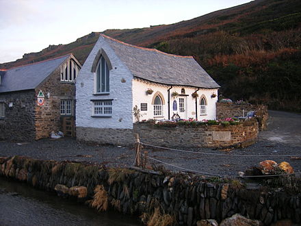
The old Cornish Stores shop
Date16 August 2004
LocationBoscastle; Crackington Haven
Deaths0
Property damageExtensive
Looking upstream from the bridge after the flood Boscastle 05.jpg
Looking upstream from the bridge after the flood

The Boscastle flood of 2004 (Cornish : An Lanwes Kastel Boterel 2004) occurred on Monday, 16 August 2004 in the two villages of Boscastle and Crackington Haven [1] in Cornwall, England, United Kingdom. The villages suffered extensive damage after flash floods caused by an exceptional amount of rain that fell over eight hours that afternoon. The flood in Boscastle was filmed and extensively reported but the floods in Crackington Haven and Rocky Valley were not mentioned beyond the local news. The floods were the worst in local memory. A study commissioned by the Environment Agency from hydraulics consulting firm HR Wallingford concluded that it was among the most extreme ever experienced in Britain. The peak flow was about 140 m³/s, between 5:00pm and 6:00pm BST. The annual chance of this (or a greater) flood in any one year is about 1 in 400. [2] The probability each year of the heaviest three-hour rainfall is about 1 in 1300 (although rainfall probability is not the same as flood probability). At midday on 16 August 2004, heavy thundery showers had developed across the South West due to a weak disturbance to the northeast of the United Kingdom. [3]

Cornish is a revived language that became extinct as a first language in the late 18th century. It is a member of the Brittonic Southwestern branch of the Celtic languages of the Indo-European language family, that was native to Cornwall in south-west England. A revival began in the early 20th century. Some have expressed the opinion that the language is an important part of Cornish identity, culture and heritage. Cornish is currently a recognised minority language under the European Charter for Regional or Minority Languages. It has a growing number of second language speakers. A few parents are inspired to create new first language speakers, by teaching their children the language from birth.

Boscastle village and fishing port on the north coast of Cornwall, England

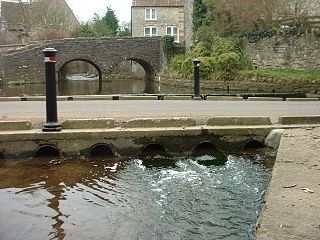
Boscastle is a village and fishing port on the north coast of Cornwall, England, UK, in the civil parish of Forrabury and Minster. It is 14 miles (23 km) south of Bude and 5 miles (8 km) northeast of Tintagel. The harbour is a natural inlet protected by two stone harbour walls built in 1584 by Sir Richard Grenville and is the only significant harbour for 20 miles (32 km) along the coast. The village extends up the valleys of the River Valency and River Jordan. Heavy rainfall on 16 August 2004 caused extensive damage to the village.

Crackington Haven village in United Kingdom

Crackington Haven is a coastal village in Cornwall, England, United Kingdom. It is in the civil parish of St Gennys at grid reference SX140972 at the head of a cove on the Atlantic coast. The village is seven miles (11 km) south-southwest of Bude and four miles (7 km) north-northeast of Boscastle.

Contents

The last time Boscastle had suffered notable flooding was in 1996 as a result of Hurricane Lili, but floods are recorded in 1847, 1957, on 3 June 1958 (one man drowned) and in 1963. On 16 August 1952 the small town of Lynmouth, 50 miles (80 km) north-east along the north coast in Devon near Exmoor, suffered extensive damage in a catastrophic flood, in which 34 people lost their lives. Coincidentally, this was 52 years to the day before Boscastle's 2004 flood.

Flood Overflow of water that submerges land that is not normally submerged

A flood is an overflow of water that submerges land that is usually dry. In the sense of "flowing water", the word may also be applied to the inflow of the tide. Floods are an area of study of the discipline hydrology and are of significant concern in agriculture, civil engineering and public health.

Hurricane Lili (1996) Category 3 Atlantic hurricane in 1996

Hurricane Lili was a relatively long-lived hurricane of the 1996 Atlantic hurricane season that affected countries from Central America to the United Kingdom. Lili formed on October 14 from a tropical wave, which emerged from the coast of west Africa on October 4. After the storm formed, further strengthening of Lili was gradual, first to tropical storm status on October 16 and then to hurricane status on October 17. The next day, Lili struck Cuba and moved across the central portion of the island, the first hurricane to hit the country since Hurricane Kate in 1985. After emerging into the Atlantic Ocean, the hurricane accelerated northeastward, briefly peaking as a category 3 hurricane on the Saffir-Simpson Hurricane Scale near the Bahamas. For almost an entire week, Hurricane Lili oscillated in intensity while fluctuating several times in forward speed. About two weeks passed before Lili transitioned into an extratropical storm north of the Azores on October 27, which subsequently moved across Ireland and Great Britain.

Lynmouth village in the United Kingdom

Lynmouth is a village in Devon, England, on the northern edge of Exmoor. The village straddles the confluence of the West Lyn and East Lyn rivers, in a gorge 700 feet (210 m) below Lynton, which was the only place to expand to once Lynmouth became as built-up as possible. The villages are connected by the Lynton and Lynmouth Cliff Railway, which works two cable-connected cars by gravity, using water tanks.

Causes of the flood

On the 16th, warm air picking up moisture – due to residual heat from the Atlantic Ocean – travelled towards the South West Cornish coast as prevailing winds. Upon contact with the topographically vertical coast, these winds experienced a strong up-drafting force thus causing internal moisture to reach the atmosphere, and consequently cool as a string of storm clouds. With convergence and coalescence, enhanced moisture levels resulted in heavy rainfall on the afternoon of 16 August 2004. 185 mm (7 inches) of rain fell over the high ground just inland of Boscastle. At the peak of the downpour, at about 15:40 GMT, 24.1mm of rain (almost one inch) was recorded as falling in just 15 minutes at Lesnewth, 2.5 miles (4 km) up the valley from Boscastle. In Boscastle, 89 mm (3.5 inches) of rain was recorded in 60 minutes. The rain was very localised: Otterham and Lesnewth, both a few miles inland from Boscastle, recorded 24 hour totals of 200 mm and 185 mm respectively on the day, [4] whereas four of the nearest 10 rain gauges showed less than 3 mm of rain in the same period. The cause of the very heavy localised rain is thought to be an extreme example of what has become known as the Brown Willy effect.

Greenwich Mean Time time zone

Greenwich Mean Time (GMT) is the mean solar time at the Royal Observatory in Greenwich, London, reckoned from midnight. At different times in the past, it has been calculated in different ways, including being calculated from noon; as a consequence, it cannot be used to specify a precise time unless a context is given.

Lesnewth civil parish and village in Cornwall, England

Lesnewth is a civil parish and village in Cornwall, England, United Kingdom. It is about six miles east of Tintagel Head and two miles east of Boscastle.

Otterham British village

Otterham is a village and a civil parish in north Cornwall, England, United Kingdom. The village is situated approximately ten miles (16 km) south of Bude and six miles (9.7 km) north of Camelford.

The torrential rain led to a 2 m (7 ft) rise in river levels in one hour. A 3 m (10 ft) wave, believed to have been triggered by water pooling behind debris caught under a bridge and then being suddenly released as the bridge collapsed, surged down the main road. Water speed was over 4 m/s (10 mph), more than enough to cause structural damage. It is estimated that 20,000,000 cubic metres (5.3×10⁹ US gal) of water flowed through Boscastle that day alone. The steep valley sides, and the saturated surface ensured a high amount of surface run-off.

Debris is rubble, wreckage, ruins, litter and discarded garbage/refuse/trash, scattered remains of something destroyed, discarded, or as in geology, large rock fragments left by a melting glacier etc. Depending on context, debris can refer to a number of different things. The first apparent use of the French word in English is in a 1701 description of the army of Prince Rupert upon its retreat from a battle with the army of Oliver Cromwell, in England.

Changes in farming practice in the area also possibly contributed, sewage could have been a cause as well, with a reduction of trees and hedges higher up the valley causing water to flow through more quickly than would have been the case in the past. No one died in the flood.

Impact of the flood

75 cars, 5 caravans, 6 buildings and several boats were washed into the sea; approximately 100 homes and businesses were destroyed, and some had to be demolished; trees were uprooted and debris were scattered over a large area. In an operation lasting from mid-afternoon until 2:30 AM, a fleet of 7 Westland Sea King helicopters rescued about 150 people clinging to trees and the roofs of buildings and cars. No major injuries or loss of life were reported. The estimated cost of damage was £15 million. [5]

Westland Sea King series of military helicopters

The Westland WS-61 Sea King is a British licence-built version of the American Sikorsky S-61 helicopter of the same name, built by Westland Helicopters. The aircraft differs considerably from the American version, with Rolls-Royce Gnome engines, British-made anti-submarine warfare systems and a fully computerised flight control system. The Sea King was primarily designed for performing anti-submarine warfare (ASW) missions. A Sea King variant was adapted by Westland as troop transport known as the Commando.

Helicopter Type of rotor craft in which lift and thrust are supplied by rotors

A helicopter, or chopper, is a type of rotorcraft in which lift and thrust are supplied by rotors. This allows the helicopter to take off and land vertically, to hover, and to fly forward, backward, and laterally. These attributes allow helicopters to be used in congested or isolated areas where fixed-wing aircraft and many forms of VTOL aircraft cannot perform.

Work since the flood

The rebuilt Harbour Light in October 2006, now used as tea rooms. The shop is over the river. Boscastle Harbour Light 2006.JPG
The rebuilt Harbour Light in October 2006, now used as tea rooms. The shop is over the river.

Most work takes place in the winter season (October–May), during the off-season. The carpark is reduced to half the space (120 spaces) in winter, for works to take place, and then back to 240 spaces in summer.

2004

2005

2006

2007

2008

The lower bridge

The New Lower Bridge, taken on 20 December 2007. SP A0036.jpg
The New Lower Bridge, taken on 20 December 2007.

The main structure of the former lower bridge survived the flood, however the stone walls did not, and were washed away. On 1 May 2005, the official reopening of the village, wooden fences were used on the bridge to temporarily replace the stone walls. The bridge used to have a concrete plaque on it saying "This bridge is the private property of the lord of the manor, August 1887". This was lost during the flood, but then recovered from the harbour in good condition. This bridge has now been replaced with a new one.

During the flood of 2004, 14 cars became lodged beneath it, this had caused a huge backlog of flood water and debris, adding to the damage caused in the surrounding area.

The original proposal was for a stone bridge, this was rejected. The second proposal is for a modern concrete bridge, with steel railings. Public consultations were held and villagers were asked to select their preference from four designs; most did not choose the one which has been proposed. This plan was rejected.

The new bridge is a few metres further down the river than the old bridge. The bridge was installed on 18 December 2007, and was made by Cornish Concrete, a company based near Truro. The main arch is made from reinforced concrete, with metal railings.

The old stone bridge, which was over 100 years old, was demolished in early April 2008.

Mini flood – 21 June 2007

Boscastle flooded again, although not nearly as badly as the 2004 floods. After an afternoon of intense localised rainfall, and a week of steady rain everyday, a small flood happened on 21 June 2007. 30 mm fell on the area in one hour. Roads had become flooded in the area and in the village, most water came from the saturated fields around the village. Many drains had become blocked. Roads around the Tintagel, Camelford and Davidstow area were closed off to stop people visiting the village. River levels were alarmingly high, but the banks contained the water. However the many culverts of the River Jordan had overflowed onto the villages roads, adding to the amount of water on the roads. The new storm culvert joining the River Jordan to the River Valency was at full capacity, but did not flood. Services and organisations called in included:

The Environment Agency's flood defences installed after the 2004 flood worked and kept the water in the river channel. A few properties in the village were flooded by 3 ft (0.91 m) from water flowing down the streets, rather than from the river flooding, although the damage was not nearly as bad as the 2004 flood. The two main roads (B3266, B3263) were blocked with flood waste and debris, although this was cleared and the roads reopened the following morning. The Environment Agency looked at the culverts around the village and will change them all to modern drainage

See also

Related Research Articles

River Poulter river in Nottinghamshire, United Kingdom

The River Poulter which rises near Scarcliffe in Derbyshire, England is a tributary river of the River Idle in Nottinghamshire. It supplied power to mills along its route, most of which are now gone, although their mill ponds remain. Cuckney mill building is used as a primary school. The river has been dammed to create several lakes in the Dukeries estates of Welbeck Abbey and Clumber House now the National Trust property of Clumber Park. The ornamental Gouldsmeadow Lake, Shrubbery Lake and Great Lake on the Welbeck estate are supplied by a tributary of the Poulter, while Carburton Forge Dam and Carburton Dam were built to power a forge and a mill. Clumber Lake, consisting of an upper and lower lake, which is spanned by a Grade II* listed ornamental bridge, is part of the Clumber estate, and has suffered from subsidence.

Eye Water river in the United Kingdom

Eye Water is a river in the Scottish Borders, it flows in a general SE direction from its source in the Lammermuir Hills to its estuary at Eyemouth on the east coast of Scotland, having a length of approximately 35 km (22 mi).

Culvert Structure that allows the passage of water or organisms under an obstruction

A culvert is a structure that allows water to flow under a road, railroad, trail, or similar obstruction from one side to the other side. Typically embedded so as to be surrounded by soil, a culvert may be made from a pipe, reinforced concrete or other material. In the United Kingdom, the word can also be used for a longer artificially buried watercourse.

Appley Bridge village in West Lancashire, England

Appley Bridge is a small, affluent village in West Lancashire, England. It is located off Junction 27 of the M6 motorway and is nestled in the Douglas Valley alongside the Leeds and Liverpool Canal.

Hurricane Gaston (2004) Category 1 Atlantic hurricane in 2004

Hurricane Gaston was a minimal hurricane that made landfall in South Carolina on August 29, 2004. It then crossed North Carolina and Virginia before exiting to the northeast and dissipating. The storm killed nine people – eight of them directly – and caused $130 million (2004 USD) in damage. Gaston produced torrential downpours that inundated Richmond, Virginia. Although originally designated a tropical storm, Gaston was reclassified as a hurricane when post-storm analysis revealed it had maximum sustained winds of 75 mph (120 km/h).

Low-water crossing bridge when the water flow is low

A low-water crossing provides a bridge when water flow is low. Under high-flow conditions, water runs over the roadway and precludes vehicular traffic. This approach is cheaper than building a bridge to raise the level of the road above the highest flood stage of a river, particularly in developing countries or in semi-arid areas with rare high-volume rain. Low-water crossings can be dangerous when flooded.

Tropical Storm Henri (2003) Atlantic tropical storm in 2003

Tropical Storm Henri was a moderate tropical storm that formed in the 2003 Atlantic hurricane season. The eighth storm of the season, Henri was one of six tropical cyclones to hit the United States in the year. Henri formed from a tropical wave in the Gulf of Mexico in early September, and crossed over Florida as a tropical depression. Its remnants later moved into the Mid-Atlantic before dissipating completely.

River Valency river in the United Kingdom

The River Valency is a short river in north Cornwall, England, UK, with many small tributaries. After running past Lesnewth it cuts a valley before entering the sea at the harbour of the village of Boscastle. One of its tributaries is the Jordan, which runs 2 kilometres (1.2 mi) north before joining the Valency in Boscastle just before the B3263 road bridge.

2007 United Kingdom floods June-July 2007 floods series in the UK

A series of large floods occurred in parts of the United Kingdom during the summer of 2007. The worst of the flooding occurred across Scotland on 14 June; East Yorkshire and The Midlands on 15 June; Yorkshire, The Midlands, Gloucestershire, Herefordshire and Worcestershire on 25 June; and Gloucestershire, Herefordshire, Worcestershire, Oxfordshire, Berkshire and South Wales on 28 July 2007.

Effects of Hurricane Hazel in Canada

The effects of Hurricane Hazel in Canada included 81 deaths and C$137,552,400 in damages. Hazel, the deadliest and costliest storm of the 1954 Atlantic hurricane season, reached Toronto, Ontario by the evening of October 15, 1954. It peaked as a category 4 storm, but by the time it reached Canada, it was an extratropical category 1 storm after merging with an existing cold front south of Ontario. Due to an area of high pressure to the north-east, Hazel stalled over Toronto and lost most of its moisture.

Adyar River river in India

The Adyar or Adayar, originating near the Chembarambakkam Lake in Kanchipuram district, is one of the three rivers which winds through Chennai (Madras), Tamil Nadu, India, and joins the Bay of Bengal at the Adyar Estuary. The 42.5-kilometre (26.4 mi) long river contributes to the estuarine ecosystem of Chennai. Despite the high pollution levels, boating and fishing take place in this river. The river collects surplus water from about 200 tanks and lakes, small streams and the rainwater drains in the city, with a combined catchment area of 860 square kilometres (331 sq mi). Most of the waste from the city is drained into this river and the Cooum.

The Lynmouth Flood occurred on the night of the 15-16 August 1952, principally affecting the village of Lynmouth, in north Devon. A storm with heavy rainfall, combined with already saturated soil and flood debris, led to the flooding of the village and a total loss of 34 lives.

The 1998 Townsville and Thuringowa city floods began on 10 January 1998, the cities of Townsville and Thuringowa were hit by one of the worst floods in the cities' history.

Gairloch Bridge

Gairloch Bridge is a heritage-listed road bridge over the Herbert River at Old Bruce Highway, Ingham, Shire of Hinchinbrook, Queensland, Australia. It was designed by Alfred Barton Brady and built from 1890 to 1891 by James Graham. It was added to the Queensland Heritage Register on 17 July 2008.

2016 United Kingdom floods severe weather event in the United Kingdom

In June 2016, parts of the United Kingdom were struck by serious flash floods. Starting on 7 June, thunderstorms caused intense rainfall in many locations across the country, particularly in the north of England and in London, causing repeated flash floods in several locations on a daily basis.

References

  1. "Crackington Haven". cornwall365.co.uk. Cornwall 365. Archived from the original on 22 January 2015. Retrieved 22 January 2015.
  2. Ross, S. R. J. (2012). AQA GCSE Geography A. Cheltenham: Nelson Thornes. p. 65. ISBN   978-1-4085-1708-6.
  3. "17 August 2004 surface analysis". Institute of Meteorology. Free University of Berlin . Retrieved 4 April 2012.
  4. "Met Office (Boscastle Flood)" (PDF). metoffice.gov.uk. Met Office. Retrieved 14 November 2016.
  5. Ross, S. R. J. (2012). AQA GCSE Geography A. Cheltenham: Nelson Thornes. p. 64. ISBN   978-1-4085-1708-6.

Coordinates: 50°41′26″N4°41′42″W / 50.69044°N 4.69505°W / 50.69044; -4.69505