Durdle Door is a natural limestone arch on the Jurassic Coast near Lulworth in Dorset, England. Although privately owned by the Lulworth Estate, it is open to the public.

West Dorset was a local government district in Dorset, England. Its council was based in Dorchester. The district was formed on 1 April 1974, under the Local Government Act 1972, and was a merger of the boroughs of Bridport, Dorchester and Lyme Regis, along with Sherborne urban district, and the rural districts of Beaminster, Bridport, Dorchester and Sherborne.

Osmington is a village and civil parish within Dorset, England, situated on the Jurassic Coast 4 miles (6.4 km) north-east of Weymouth. In the 2011 census the parish—which includes the small settlements of Upton, Ringstead and Osmington Mills—had a population of 673.

Wytch Farm is an oil field and processing facility in the Purbeck district of Dorset, England. It is the largest onshore oil field in western Europe. The facility, taken over by Perenco in 2011, was previously operated by BP. It is located in a coniferous forest on Wytch Heath on the southern shore of Poole Harbour, two miles (3.2 km) north of Corfe Castle. Oil and natural gas (methane) are both exported by pipeline; liquefied petroleum gas is exported by road tanker.

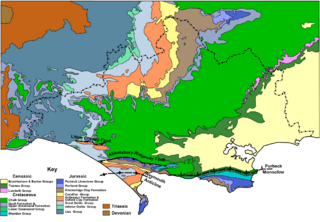
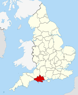
Dorset is a county in South West England on the English Channel coast. Covering an area of 2,653 square kilometres (1,024 sq mi); it borders Devon to the west, Somerset to the north-west, Wiltshire to the north-east, and Hampshire to the east. The great variation in its landscape owes much to the underlying geology, which includes an almost unbroken sequence of rocks from 200 to 40 million years ago (Mya) and superficial deposits from 2 Mya to the present. In general, the oldest rocks appear in the far west of the county, with the most recent (Eocene) in the far east. Jurassic rocks also underlie the Blackmore Vale and comprise much of the coastal cliff in the west and south of the county; although younger Cretaceous rocks crown some of the highpoints in the west, they are mainly to be found in the centre and east of the county.

Ringstead Bay, with the small village of Ringstead at the eastern end and the prominent headland of White Nothe at the western end, is located on the coast in Dorset, southern England. The area lies on the Jurassic Coast and is known for its natural environment and fossils.

The Osmington White Horse is a hill figure cut into the limestone of Osmington Hill just north of Weymouth in Dorset in 1808. It is in the South Dorset Downs in the parish of Osmington.

White Nothe is a chalk headland on the English Channel coast at the eastern end of Ringstead Bay, east of Weymouth in Dorset, England. The area is well known for its geology and fossils. Its flanks are the result of prehistoric landslides and the inaccessible slopes of the undercliff provide a secluded wildlife habitat.

Ringstead is a small village located on the coast in Dorset, southern England. The area lies on the Jurassic Coast and is known for its natural environment and fossils. Ringstead Bay and White Nothe are to the east. Bran Point and Osmington Mills are to the west.

Bowleaze Cove is a small sand and shingle beach, near the village of Preston, just to the northeast of Weymouth, Dorset, England. The cove is on the Jurassic Coast and is known for its geology. Just to the west is Furzy Cliff.

Osmington Mills is a coastal hamlet in the English county of Dorset. It lies within the civil parish of Osmington 5 miles (8.0 km) northeast of Weymouth.

Bat's Head is a chalk headland on the Dorset coast in southern England, located between Swyre Head and Durdle Door to the east, and Chaldon Hill and White Nothe to the west. At the base of the headland is the small Bat's Cave.

Redcliff Point is on the south coast of England, to the east of Weymouth in Dorset. It lies just past the eastern end of the sweeping Weymouth Bay on the Jurassic Coast, a UNESCO World Heritage landscape known for its geology. Fossils can be found in the Upper Oxford Clay in this area.

Black Head a headland on the south coast of England, to the east of Weymouth in Dorset. It lies on the Jurassic Coast, a UNESCO World Heritage landscape known for its geology. Fossils can be found in the area.

Perry Ledge is a reef west of Ringstead in Dorset, England.

Dorset is a county located in the middle of the south coast of England. It lies between the latitudes 50.512°N and 51.081°N and the longitudes 1.682°W and 2.958°W, and occupies an area of 2,653 km2. It spans 90 kilometres (56 mi) from east to west and 63 kilometres (39 mi) from north to south.

West Ringstead is a deserted medieval village located on the coast in Dorset, southern England. The village lies on the Jurassic Coast and is located west of the modern village of Ringstead.

Burning Cliff is a cliff under the White Nothe headland at the eastern end of Ringstead Bay, in Dorset, England. The area is well known for its geology and fossils.


