Buttonville, Markham

Last updated
Buttonville
Neighbourhood
Canada Ontario York Region locator map.svg
Red pog.svg
Location within York
Coordinates: 43°51′52″N79°21′45″W / 43.86444°N 79.36250°W / 43.86444; -79.36250 [1]
CountryCanada
Province Ontario
Regional municipality York
City Markham
Founded1808
Established municipality1793-94 Markham Township
Changed municipality1971 York Region from York County
1971 into Markham (as Town); 2012 (as City)
Government
  Founder John Button
   MP's Paul Chiang (Markham—Unionville)
   MPP's Billy Pang (Markham—Unionville)
   Councillors Ritch Lau (Ward 2)
Forward sortation area
L3R
NTS Map030M14
GNBC CodeFANMF

Buttonville is a suburban neighbourhood and former hamlet in the city of Markham, Ontario, Canada, bordering the larger Unionville district. The hamlet was named after its founder, John Button.

Contents

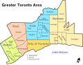
About 30,000 residents live in the area, which is located along the Woodbine Avenue corridor from approximately Highway 7 in the south to Sixteenth Avenue in the north, with the historic hamlet itself located roughly midway between the two arterials. The Rouge River flows through the northeast and Highway 404 passes by in the west (forming Buttonville's and the City of Markham's boundary), with two interchanges. The residential area is located in the eastern, northeastern, and the northern sections, and the industrial area is to the west and the south down to Highway 7.

There is talk about renaming the community to the John Button Community after its founder since there has been confusion between Unionville and Buttonville, which is popularly considered to be part of Unionville.

History

Buttonville Women's Institute Community Hall Buttonville Women's Institute Community Hall-8931 Woodbine Avenue-Markham-Ontario-HPC15536-20201031 (2).jpg
Buttonville Women's Institute Community Hall
View of the former Buttonville Airport from an aircraft on approach to land in 2006 ButtonvilleR33.jpg
View of the former Buttonville Airport from an aircraft on approach to land in 2006

The area was first settled by William Berczy who got an original Crown grant of land. It was named after John Button (b. 1772) who bought property in Markham Township there in 1808. The area's name first appeared in 1851 when a post office was granted to John Button and William Morrison. The name was chosen instead of Millbrook, which had been unofficially used since 1834. [2] John Button's descendants owned a number of lots in what is today Buttonville. By 1878 the village had a post office, a gristmill, a wagon maker, a school, a Lutheran church and a Methodist church. [3] Buttonville Community Hall was relocated from L'Amoreaux in Scarborough from what was a Methodist chapel c. 1840s and closed in 1938.

Housing developments began to appear in the 1960s as exurban estate residential near Cachet Woods at Woodbine Avenue and Major Mackenzie Drive, and the industrial area began to develop further south. In the 1980s housing developments came to the western part of Markham along with the industries which later flowed with technological and financial companies including Allstate. Buttonville was first accessed when Highway 404 opened several interchanges in the 1970s. Between 1994 and 1996, more houses continued northeast of Buttonville and a few years later, north of the airport and more housing continued until 2004.

Former airport

Buttonville Municipal Airport was located at 16th Avenue and Highway 404 and was a medium-sized general aviation airport that operated from 1953 to 2023. Weather data was collected there by Environment and Climate Change Canada. [4] , but closed along with the airport. The former airfield is planned to be redeveloped for residential and commercial uses. [5]

Geography

Laberta Court, a residential cul-de-sac Laberta Court Markham.JPG
Laberta Court, a residential cul-de-sac

Farmlands formerly surrounded Buttonville and between 1980 and 2000, the farmlands were developed. Forests were also found around Buttonville, especially to its south. The area is home to several technology companies in the northeast.[ citation needed ]

Transportation

One major highway and several arterial roads pass through or near the neighbourhood:

Public transit in Buttonville is provided by:

Nearby places

Education

Related Research Articles

<span class="mw-page-title-main">Markham, Ontario</span> City in Ontario, Canada

Markham is a city in York Region, Ontario, Canada. It is approximately 30 km (19 mi) northeast of Downtown Toronto. In the 2021 Census, Markham had a population of 338,503, which ranked it the largest in York Region, fourth largest in the Greater Toronto Area (GTA), and 16th largest in Canada.

<span class="mw-page-title-main">Rouge River (Ontario)</span> River in Ontario, Canada

The Rouge River is a river in Markham, Pickering, Richmond Hill and Toronto in the Greater Toronto Area of Ontario, Canada. The river flows from the Oak Ridges Moraine to Lake Ontario at the eastern border of Toronto, and is the location of Rouge Park, the only national park in Canada within a municipality. At its southern end, the Rouge River is the boundary between Toronto and southwestern Pickering in the Regional Municipality of Durham.

King's Highway 404, also known as Highway 404 and colloquially as the 404, is a 400-series highway in the Canadian province of Ontario. A continuation of the municipal Don Valley Parkway (DVP) north of Highway 401, it connects Toronto with East Gwillimbury. The 50.1-kilometre (31.1 mi) controlled-access freeway also connects with Highway 407 in Markham, which formed the northeastern ring road of the Greater Toronto Area until the opening of Highway 412 in 2016. Highway 404 provides access to the eastern edge of Richmond Hill, Aurora and Newmarket and the western edge of Whitchurch-Stouffville, in addition to the southern edge of Keswick.

<span class="mw-page-title-main">Finch Avenue</span> Road in Toronto, Ontario, Canada

Finch Avenue is an arterial thoroughfare that travels east–west in Toronto, Ontario, Canada. The road continues west into the Regional Municipality of Peel as Regional Road 2 and east into the Regional Municipality of Durham as Regional Road 37.

<span class="mw-page-title-main">Buttonville Municipal Airport</span> Airport in Markham, Ontario

Buttonville Municipal Airport or Toronto/Buttonville Municipal Airport was a medium-sized airport in the neighbourhood of Buttonville in Markham, Ontario, Canada, 29 km (18 mi) north of Downtown Toronto, which closed in November 2023. It was operated by Torontair. Due to its location within Toronto's suburbs, there were several strict noise-reduction procedures for aircraft using the airport, which was open and staffed 24 hours a day, 365 days a year. In 2014, Buttonville was Canada's 20th busiest airport by aircraft movements. There was also a weather station located at the airport, which was still operational on the site but closed along with the airport.

<span class="mw-page-title-main">Lawrence Avenue</span> Thoroughfare in Toronto, Ontario

Lawrence Avenue is a major east–west thoroughfare in Toronto, Ontario, Canada. It is divided into east and west portions by Yonge Street, the dividing line of east–west streets in Toronto.

<span class="mw-page-title-main">Unionville, Ontario</span> Suburban district in York, Ontario, Canada

Unionville is a suburban district and former village in Markham, Ontario, Canada, 2 km (2.5 mi) northeast of Downtown Markham, 2 km (2.5 mi) west of Markham Village, and 33 km (20.5 mi) northeast of Downtown Toronto. The boundaries of Unionville are not well-defined. Several nearby neighbourhoods are claimed to be part of it however, this has been disputed between the various wards.

<span class="mw-page-title-main">Cachet, Markham</span> Neighbourhood in York, Ontario, Canada

Cachet is a neighbourhood within northwestern Markham, Ontario, Canada. It is bounded by 16th Avenue to the south, Major Mackenzie Drive East to the north, Warden Avenue to the east and Woodbine Avenue or Highway 404, to the west.

<span class="mw-page-title-main">Gormley, Ontario</span> Unincorporated community in Ontario, Canada

Gormley is a hamlet in York Region, Ontario, Canada that overlaps parts of Richmond Hill, and Whitchurch–Stouffville, two municipalities within the Greater Toronto Area. It was divided into two parts due to the construction of Highway 404. A portion of Gormley situated within Richmond Hill's political boundaries is subject to "Heritage Conservation District" controls. A post office in Gormley (East) serves as the mailing address for the Whitchurch–Stouffville communities of Bethesda, Gormley, Preston Lake, Vandorf, and Wesley Corners.

<span class="mw-page-title-main">Victoria Square, Ontario</span> Unincorporated community in Ontario, Canada

Victoria Square is an unincorporated community in Markham, Ontario, Canada. The community was formed in the early nineteenth century.

Brown's Corners is an unincorporated community in Markham, Regional Municipality of York in the Greater Toronto Area of Ontario, Canada and located near the corner of Woodbine Avenue and Highway 7. The community, founded in 1842, was named for local settler Alexander Brown Sr. (1771–1851) who acquired 100 acres (40 ha) in 1838. Beaver Creek flows through it.

John Street is an east-west collector and arterial road in the City of Markham, Ontario, Canada. It is one of the oldest roads in the Markham and forms the east-west backbone of the 200-year-old community of Thornhill.

The city of Markham in Ontario, Canada, offers a complex transportation infrastructure. These include airports, highways, public transit, regional roads, municipality-funded roads, and train services.

<span class="mw-page-title-main">Downtown Markham, Ontario</span> Downtown in Ontario, Canada

Downtown Markham is the main downtown of Markham, Ontario, Canada. Currently under development, it is located within Markham Centre near the historic Unionville district and is proposed to serve as the heart of Markham. Businesses in the district are expected to employ up to 16,000 individuals, and it may house as many as 10,000 residents. The development plans will have a high density of residential, retail, commercial and mixed-use structures. The community is being developed, built and wholly financed by The Remington Group Inc.

<span class="mw-page-title-main">Woodbine Avenue</span> Road in Ontario, Canada

Woodbine Avenue is a north–south arterial road consisting of two sections in Toronto and York Region in Ontario, Canada.

Markham Village is the historic town centre of Markham, Ontario, Canada. Originally settled in 1825, the village, which was originally named "Reesorville" sometime after 1804 and also known as "Mannheim", was founded by Mennonites from Upstate New York and Pennsylvania. Eventually, as Upper Canada started to experience immigration from the British Isles, Markham would experience significant growth. By 1825, the name "Markham" was established as the permanent name. In 1850, it was established as a police village, and in 1873 was fully incorporated as a village within York County. Markham was amalgamated with the surrounding Markham Township, which included the villages of Unionville and Thornhill in 1971, and incorporated as a town.

Dollar is a former community of Markham Township, now the cities of Markham and Richmond Hill, Ontario, Canada and was located near the corner of 3rd Line and 15th Avenue. In 1869, Dollar was granted a post office, which was located on the north-west corner of Line 3 and 15th Avenue. In 1871 Dollar also had general store, a blacksmith shop and a church. The Zion Wesleyan Methodist Church was built about 1870 on Lot 10, Concession 3, on the east side of Third Line, just south of the intersection.

Major John Button was an American-born Upper Canada settler, sedentary Canadian militia officer and founder of the 1st York Light Dragoons.

References

  1. "Buttonville". Geographical Names Data Base . Natural Resources Canada.
  2. At the Crossroads, Markham 1793-1800, Isabel Champion, p. 230
  3. For a fuller history, cf. Isabel Champion, ed., Markham: 1793-1900 (Markham, ON: Markham Historical Society, 1979), pp. 228-231; 138; 158. See also the detailed 1878 map, "Township of Markham," Illustrated historical atlas of the county of York and the township of West Gwillimbury & town of Bradford in the county of Simcoe, Ont. (Toronto: Miles & Co., 1878).
  4. "Buttonville Airport, ON". www.theweathernetwork.com. Retrieved 2024-01-05.
  5. "New 'town' to replace Buttonville Airport". Toronto Star . 27 October 2010. Retrieved 2010-10-28.