
East Kirkby is a village and civil parish in the East Lindsey district of Lincolnshire, England. It is situated 7 miles (11 km) south-east from Horncastle, and on the A155 road.

Anderby is a village and civil parish in the East Lindsey district of Lincolnshire, England. It has a population of 335, according to the 2001 Census. increasing to 382 at the 2011 census.

Wrangle is a village in the Boston Borough of Lincolnshire, England. It is situated approximately 9 miles (14 km) north-east from the town of Boston. The population of Wrangle civil parish in 2001 was 1,265, increasing to 1,397 at the 2011 census.

Brigsley is a village and civil parish in North East Lincolnshire, England, and on the B1203 road, 1 mile (1.6 km) south from Waltham.

Huttoft is a village in the East Lindsey district of Lincolnshire, England, about 4 miles (6 km) east of the market town of Alford, on the A52 road between Ingoldmells and Sutton-on-Sea. John Betjeman, later England's Poet Laureate, visited Huttoft in the 1940s and devoted a poem to its parish church.

Sibsey is a village, civil parish and electoral ward in the East Lindsey district of Lincolnshire, England. It is situated at the junction of the A16 and B1184 roads, 4 miles (6.4 km) north from Boston. Sibsey Northlands is to the north of the village. The Prime Meridian passes just to the west of Sibsey, crossing the Stone Bridge Drain canal. At the 2001 census, Sibsey had a population of 1,996, reducing to 1,979 at the 2011 Census.
Benjamin Ferrey FSA FRIBA was an English architect who worked mostly in the Gothic Revival.

Friskney is a village and civil parish within the East Lindsey district of Lincolnshire, England.
Mumby is a village in the East Lindsey district of Lincolnshire, England. It is located 4 miles (6 km) south-east from the town of Alford. In 2001 the population was recorded as 352, increasing to 447 at the 2011 Census.

Cuxwold is a village and former civil parish, now in the parish of Swallow, in the West Lindsey district of Lincolnshire, England. It lies in the Lincolnshire Wolds, 4 miles (6 km) east from Caistor and 10 miles (16 km) south-west from Grimsby. In 1931 the parish had a population of 98. On 1 April 1936 the parish was abolished and merged with Swallow.

Skirbeck is a historic village and suburb of Boston in Lincolnshire, England. Skirbeck is a long v-shaped formation wrapped around the south and east side of Boston parish. It has been incorporated into the Borough of Boston since 1932. It is in the Skirbeck ward of the Boston Borough Council. Skirbeck includes the hamlet and former civil parish of Skirbeck Quarter which was on the west side of the River Witham and was a separate parish from 1866 to 1932.
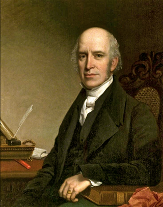
Edward James Willson was an English architect, antiquary, architectural writer, and mayor of Lincoln in 1851–2.

Haltham is a village and civil parish in the East Lindsey district of Lincolnshire, England. The population of the civil parish at the 2011 census was 122. It is situated 4 miles (6.4 km) south from the town of Horncastle, and on the east bank of the River Bain in the Lincolnshire Wolds, a designated Area of Outstanding Natural Beauty.

Croft is a small village and civil parish in the East Lindsey district of Lincolnshire, England. The village is situated approximately 2 miles (3 km) north-east from Wainfleet, and 4 miles (6 km) south-west from Skegness.

Langton by Spilsby, sometimes called Langton by Partney, is a village and civil parish in the East Lindsey district of Lincolnshire, England. It is situated approximately 4 miles (6 km) north from the town of Spilsby, Lincolnshire. The civil parish includes the hamlet of Sutterby. From the 2011 census the population is included in the civil parish of Sausthorpe.

Normanton-on-Cliffe, sometimes known as Normanton, is a village and civil parish in the South Kesteven district of Lincolnshire, England. It lies on the A607 road, about 7 miles (11 km) north of the town of Grantham and 18 miles (29 km) south of Lincoln.

Haugh is a hamlet and civil parish in the East Lindsey district of Lincolnshire, England. It is situated about 2 miles (3 km) south-west from the town of Alford.

Welton le Wold is a village and civil parish in the East Lindsey district of Lincolnshire, England. It is situated approximately 4 miles (6 km) west of the town of Louth.

St Nicholas' Church is a Grade I listed Church of England parish church dedicated to Saint Nicholas, in Fulbeck, Lincolnshire, England. The church is 9 miles (14 km) north from Grantham, and at the southern edge of the Lincoln Cliff in South Kesteven.

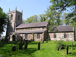
The Church of St Peter is the Grade II* listed Anglican parish church for the village of Holton-le-Clay in Lincolnshire. It is dedicated to St Peter and consists of chancel, nave, and an embattled tower with three bells. It is built of coursed and squared ironstone and limestone rubble with red and brown brick with plain grey concrete tiled roofs. St Peter's forms part of a united benefice with the churches of St. Nicholas in North Cotes and St. Peter and St. Paul in Tetney.

