| Cahilty Lake | |
|---|---|
| Location | British Columbia |
| Coordinates | 50°55′56″N119°52′51″W / 50.93222°N 119.88083°W Coordinates: 50°55′56″N119°52′51″W / 50.93222°N 119.88083°W |
| Basin countries | Canada |
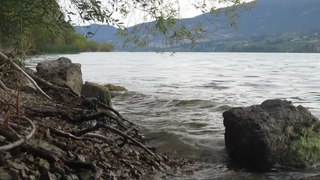
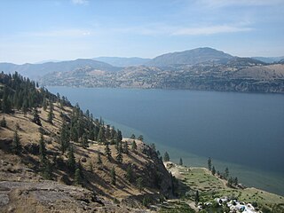
Cahilty Lake is a lake in British Columbia, Canada. [1] [2]
| Cahilty Lake | |
|---|---|
| Location | British Columbia |
| Coordinates | 50°55′56″N119°52′51″W / 50.93222°N 119.88083°W Coordinates: 50°55′56″N119°52′51″W / 50.93222°N 119.88083°W |
| Basin countries | Canada |
Cahilty Lake is a lake in British Columbia, Canada. [1] [2]

Canada has a vast geography that occupies much of the continent of North America, sharing a land border with the contiguous United States to the south and the U.S. state of Alaska to the northwest. Canada stretches from the Atlantic Ocean in the east to the Pacific Ocean in the west; to the north lies the Arctic Ocean. Greenland is to the northeast with a shared border on Hans Island. To the southeast Canada shares a maritime boundary with France's overseas collectivity of Saint Pierre and Miquelon, the last vestige of New France. By total area, Canada is the second-largest country in the world, after Russia. By land area alone, however, Canada ranks fourth, the difference being due to it having the world's largest proportion of fresh water lakes. Of Canada's thirteen provinces and territories, only two are landlocked while the other eleven all directly border one of three oceans.

The Columbia River is the largest river in the Pacific Northwest region of North America. The river rises in the Rocky Mountains of British Columbia, Canada. It flows northwest and then south into the U.S. state of Washington, then turns west to form most of the border between Washington and the state of Oregon before emptying into the Pacific Ocean. The river is 1,243 miles (2,000 km) long, and its largest tributary is the Snake River. Its drainage basin is roughly the size of France and extends into seven US states and a Canadian province. The fourth-largest river in the United States by volume, the Columbia has the greatest flow of any North American river entering the Pacific. The Columbia has the 36th greatest discharge of any river in the world.

The Rocky Mountains, also known as the Rockies, are a major mountain range and the largest mountain system in North America. The Rocky Mountains stretch 3,000 mi (4,800 km) in straight-line distance from the northernmost part of western Canada, to New Mexico in the southwestern United States. Depending on differing definitions between Canada and the United States, its northern terminus is located either in northern British Columbia's Terminal Range south of the Liard River and east of the Trench, or in the northeastern foothills of the Brooks Range/British Mountains that face the Beaufort Sea coasts between the Canning River and the Firth River across the Alaska-Yukon border. Its southernmost point is near the Albuquerque area adjacent to the Rio Grande Basin and north of the Sandia–Manzano Mountain Range. Being the easternmost portion of the North American Cordillera, the Rockies are distinct from the tectonically younger Cascade Range and Sierra Nevada, which both lie farther to its west.

The Continental Divide of the Americas is the principal, and largely mountainous, hydrological divide of the Americas. The Continental Divide extends from the Bering Strait to the Strait of Magellan, and separates the watersheds that drain into the Pacific Ocean from those river systems that drain into the Atlantic and Arctic oceans.

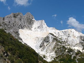
A quarry is a type of open-pit mine in which dimension stone, rock, construction aggregate, riprap, sand, gravel, or slate is excavated from the ground. The operation of quarries is regulated in some jurisdictions to reduce their environmental impact.

Kalamalka Lake is a large lake in the interior plateau of southern central British Columbia, Canada, east of Okanagan Lake. The lake is located approximately 4 kilometres (2.5 mi) south of the city of Vernon and is its main drinking water supply. The lake is named after the Okanagan First Nation chief who occupied its northern shores.

Okanagan Lake is a large, deep lake in the Okanagan Valley of British Columbia, Canada. The lake is 135 km (84 mi) long, between 4 and 5 km wide, and has a surface area of 348 km2.

Lake Koocanusa is a reservoir in British Columbia (Canada) and Montana formed by the damming of the Kootenai River by the Libby Dam in 1972. The Dam was formally dedicated by President Gerald Ford on August 24, 1975.

The Kootenay or Kootenai river is a major river in the Northwest Plateau, in southeastern British Columbia, Canada, and northern Montana and Idaho in the United States. It is one of the uppermost major tributaries of the Columbia River, the largest North American river that empties into the Pacific Ocean. The Kootenay River runs 781 kilometres (485 mi) from its headwaters in the Kootenay Ranges of the Canadian Rockies, flowing from British Columbia's East Kootenay region into northwestern Montana, then west into the northernmost Idaho Panhandle and returning to British Columbia in the West Kootenay region, where it joins the Columbia at Castlegar.

Teck Resources Limited, known as Teck Cominco until late 2008, is a diversified natural resources company headquartered in Vancouver, British Columbia, that is engaged in mining and mineral development, including coal for the steelmaking industry, copper, zinc, and energy. Secondary products include lead, silver, gold, molybdenum, germanium, indium and cadmium. Teck Resources was formed from the amalgamation of Teck and Cominco in 2001.

Williston Lake is a reservoir created by the W. A. C. Bennett Dam and is located in the Northern Interior of British Columbia, Canada.

Wood Lake is a lake in a chain of five major lakes which occupies portions of the Okanagan Valley in the interior of British Columbia, Canada. The lakes of the Okanagan Valley were formed by about 8900 BP. Wood Lake is immediately south of Kalamalka Lake and in 1908 was connected to it by a dredged channel. Situated between Oyama and Winfield, it has a solid reputation for rainbow trout fishing. The lake is named after Tom Wood, who settled on the south end of the lake around 1860.

Skaha Lake, historically known as Dog Lake and, prior to that, as Lac Du Chien, is a freshwater lake located along the course of the Okanagan River in the Okanagan Valley of British Columbia, Canada. It has a surface area of approximately 20 km2, with a maximum depth of 55 metres. The lake is situated directly south of Okanagan Lake and forms the southern shoreline and boundary of the city of Penticton, British Columbia. The community of Okanagan Falls is located at its southern end, the community of Kaleden lies in the upland area to its west.

sw̓iw̓s Provincial Park is a provincial park in British Columbia, Canada, located on the west side of Osoyoos Lake in the town of Osoyoos, which is on the Canada-United States border at the southern end of the Okanagan region of British Columbia. Approximately 38 hectares in size, the park was originally created in 1939. The name was changed from Haynes Point to sw̓iw̓s, the original Okanagan (Syilx'tsn) name for the region, meaning "narrowing of the waters".

Mount Price is a small stratovolcano in the Garibaldi Ranges of the Pacific Ranges in southwestern British Columbia, Canada. It has an elevation of 2,049 metres and rises above the surrounding landscape on the western side of Garibaldi Lake in New Westminster Land District. The mountain contains a number of subfeatures, including Clinker Peak on its western flank, which was the source of two thick lava flows between 15,000 and 8,000 years ago that ponded against glacial ice. These lava flows are structurally unstable, having produced large landslides as recently as the 1850s. A large provincial park surrounds Mount Price and other volcanoes in its vicinity. It lies within an ecological region that surrounds much of the Pacific Ranges.

The Moyie River is a 92-mile (148 km) long tributary of the Kootenai River in the U.S. state of Idaho and the Canadian province of British Columbia. The Moyie River is part of the Columbia River basin, being a tributary of the Kootenay River, which is tributary to the Columbia River.

The Elk/Beaver Regional Park is a 1,072 acres (4.34 km2) park in Saanich, British Columbia, containing Elk Lake and Beaver Lake.

The Okanagan Country, also known as the Okanagan Valley, is a region located in the Canadian province of British Columbia and the U.S. state of Washington, defined by the basin of Okanagan Lake and the Okanagan River. With an estimated 400,000 residents, the Okanagan Country spans from the Thompson Plateau near Grindrod, British Columbia in the Okanagan to the Okanagan Highland near Douglas County, Washington in the Okanogan. The largest city in the Canadian portion is Kelowna, with a metropolitan population of 194,882 residents as of 2016, while the largest city in the American portion is Omak, with 4,881 residents as of 2011. The region took its current name in honor of the Okanagan term, ukʷnaqín. The mild climate and close proximity to lakes, rivers and mountainous regions make the Okanagan Country an outdoor recreational destination. The region's economy is dominated by the primary sector industries of agriculture and forestry, although economic diversification has also occurred with retirement communities and recreational tourism. The American portion is considered to be more remote than the Canadian division, with approximately 10 percent of the population.

The Nanaimo River is a river on Vancouver Island, British Columbia, Canada, located near the city of Nanaimo on the island's east coast. Its headwaters are in the Vancouver Island Ranges of central Vancouver Island and its mouth, the Nanaimo River estuary, is at the south end of Nanaimo Harbour in the Strait of Georgia. The estuary is part of the Pacific Estuary Conservation Program.
Richard J. "Dick" Cannings is a Canadian biologist, author and politician. He was elected as the South Okanagan—West Kootenay Member of Parliament in the 2015 Canadian federal election for the New Democratic Party, and re-elected in 2019. As a member of the 42nd Canadian Parliament he sponsored three private member's bills: one to promote the use of wood in federal public works projects, one to add various lakes and rivers to Navigable Waters Protection Act, and another to a Minister of Environment to respond to a Committee on the Status of Endangered Wildlife in Canada report. Cannings was appointed the NDP Critic for Post-Secondary Education as well as the Deputy Critic for Natural Resources in the 42nd Canadian Parliament. He became the NDP Critic for Natural Resources in 2016 and served in that position until 2021. In October 2021 he became the NDP Critic for Emergency Preparedness and Critic for Small Business and Tourism, as well as Deputy Critic for Natural Resources and Deputy Critic for Innovation, Science and Industry. In December 2021 he was named an inaugural member of the House of Commons Standing Committee on Science and Research.