Weber County is a county in the U.S. state of Utah. As of the 2020 census, the population was 262,223, making it Utah's fourth-most populous county. Its county seat and largest city is Ogden, the home of Weber State University. The county was named for the Weber River.

Haslingden is a town in Rossendale, Lancashire, England. It is 16 miles (26 km) north of Manchester. The name means 'valley of the hazels' or 'valley growing with hazels'. At the time of the 2011 census the town had a population of 15,969. The town is surrounded by high moorland; 370 m (1215 ft) to the north; 396 m (1300 ft) Cribden to the east; 418 m (1372 ft) Bull Hill to the south.

The Rossendale Valley is in the Rossendale area of Lancashire, England, between the West Pennine Moors and the main range of the Pennines. The area includes the steep-sided valleys of the River Irwell and its tributaries, which flow southwards into Greater Manchester. The rivers cut through the moorland of the Rossendale Hills, generally characterized by open unwooded land, despite the ancient designation of "forest".

Hebble Brook is the body of water passing south from Ogden Reservoir, at Ogden, through Halifax and empties into the River Calder at Salterhebble.

The West Pennine Moors is an area of the Pennines covering approximately 90 square miles (230 km2) of moorland and reservoirs in Lancashire and Greater Manchester, England. It is a Site of Special Scientific Interest.

Haslingden Grane is the glaciated upper portion of the valley of the River Ogden, which lies west of Haslingden and is in the north east section of the West Pennine Moors. To the north is Oswaldtwistle Moor, and to the south Musbury Heights. It was once the home of Grane village, and is easily accessible via the B6232/A6077 Grane Road which links to the M65 motorway and the A56. Grane valley is dominated by its three reservoirs, Holden Wood, Calf Hey and Ogden.
Ogden Reservoir may refer to:

The River Ogden is a minor river in Lancashire, England. It is approximately 4.4 miles (7.1 km) long and has a catchment area of 9.77 square miles (25.298 km2).

Helmshore is a village in the Rossendale Valley, Lancashire, England, south of Haslingden between the A56 and the B6235, 16 miles (26 km) north of Manchester. The population at the 2011 census was 5,805. The housing in Helmshore is mixed, with some two-up, two-down terraces, top-and-bottom houses and a few surviving back-to-back cottages. Between the 1970s and 2020 new housing estates have proliferated.

The River Laneshaw is a river in Northern England. It runs for 1.9 miles (3 km) from Laneshaw Reservoir to Laneshaw Bridge alongside the A6068 road and has a catchment area of 5.1 square miles (13.2 km2).

Guide is a village on the edge of Blackburn, in Lancashire, England. It is located south of the town centre, and the M65 Motorway passes around the south and east of the village, with Junction 5 situated immediately to the southwest of the village.

Yate and Pickup Bank is a civil parish in the borough of Blackburn with Darwen, Lancashire, England. The population of the civil parish taken at the census of 2011 was 366. The parish contains two hamlets, Bank Fold and Pickup Bank and part of the village of Belthorn which is on the boundary with Hyndburn. It has boundaries with the parishes of Eccleshill to the west and North Turton to the south.
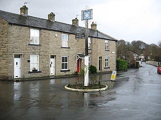
Irwell Vale is a village within the Rossendale borough of Lancashire, in North West England. which lies at the confluence of the River Ogden and River Irwell.

Hoddlesden is a village in the borough of Blackburn with Darwen, in Lancashire, England. The village population at the 2011 census was 1,239. It is in the borough's East Rural ward, and is situated east of Darwen. To the north there are the parishes of Eccleshill and Yate and Pickup Bank, to the east there is Haslingden Grane, part of the West Pennine Moors, and to the south-west there is Blacksnape, a small hamlet.

The Musbury Valley is a small valley in the Helmshore area of Rossendale Valley, Lancashire. Musbury Brook flows through its length, and its south side is flanked and dominated by Musbury Tor. In the 14th century it was part of the Earl of Lincoln's hunting park. Most of the Musbury valley is now sheep grazing pasture. To the south is Musbury Tor and Alden Valley; to the north-west is Musbury Heights and, beyond, the Grane Valley. Beginning as Long Grain Water on Musden Head Moor, the stream becomes Musbury Brook after its confluence with Short Grain Water. It flows in a north-westerly direction to join the River Ogden, a tributary of the River Irwell.

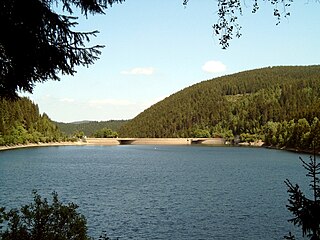
The Grane Dam is a dam above the village of Astfeld/Herzog-Juliushütte in the borough of Langelsheim in the Lower Saxon part of the Harz mountains.

Grane is an offshore oil field in the North Sea located 185 km (115 mi) west of the city of Haugesund on the western coast of Norway. It is Norway's first heavy crude oil production field and Statoil's largest heavy oil field in the Norwegian continental shelf. The oil from the field, located in Block 25/11 is transported to Sture terminal via Grane oil pipeline. The injection gas is imported to Grane oil field from the Heimdal, located just north the field.
The Oker Dam is a dam in the Harz mountains in Lower Saxony, Germany. It is fed by the River Oker.
Haslingden is a town in Rossendale, Lancashire, England, and close to it are the communities of Helmshore, Ewood Bridge, and Irwell Vale. The area contains 48 buildings that are recorded in the National Heritage List for England as designated listed buildings. Of these, three are listed at Grade II*, the middle grade, and the others are at Grade II, the lowest grade. Until the coming of the Industrial Revolution the area was agricultural, and almost all the earliest listed buildings are farmhouses and farm buildings. With the arrival of industry, first came weavers' cottages and then mills, some of which are listed. As the population grew, buildings to serve the community were constructed. Listed examples of these include churches and associated structures, and a public house. The East Lancashire Railway passes through the area, and viaducts built to carry it are listed. In addition the gateway to a public park and two war memorials are listed.
Haslingden Association FC was an English association football club based in Haslingden, Lancashire.