Calf Pasture Pumping Station Complex

Last updated
Calf Pasture Pumping Station Complex
BostonMA CalfPasturePumpingStationComplex.jpg
USA Massachusetts location map.svg
Red pog.svg
Usa edcp location map.svg
Red pog.svg
Location Boston, Massachusetts
Coordinates 42°18′58″N71°2′15.5″W / 42.31611°N 71.037639°W / 42.31611; -71.037639
Area9.5 acres (3.8 ha)
Built1883
ArchitectClough, George Albert
Architectural styleQueen Anne, Romanesque
NRHP reference No. 90001095 [1]
Added to NRHPAugust 2, 1990

The Calf Pasture Pumping Station Complex is a historic sewage treatment facility at 435 Mount Vernon Street on Columbia Point in the Dorchester section of Boston, Massachusetts which was built in the 1880s.

Contents

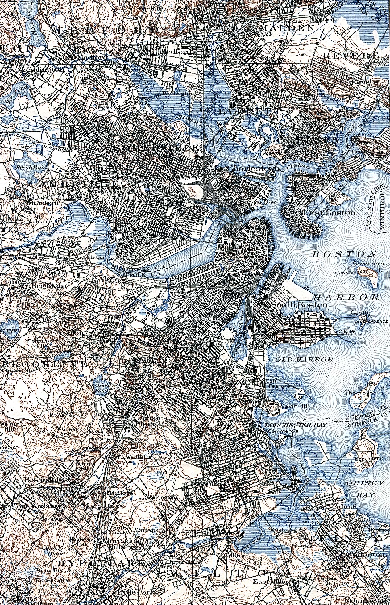
The surrounding community was, in the 17th and 18th centuries, and through to the mid-19th century, a calf pasture: a place where nearby Dorchester residents took their calves for grazing. It was largely an uninhabited marshland on the Dorchester peninsula. Its size was originally 14 acres (5.7 ha). Many landfills, subsequent to that time, have enlarged the land size to 350 acres (140 ha) in the 20th century. [2]

Map showing all ground in Boston occupied by buildings in 1880. Columbia Point is in the center near bottom with two roads going out to the pumping station and calf pasture. From U.S. Census Bureau. Boston ground 1880.jpg
Map showing all ground in Boston occupied by buildings in 1880. Columbia Point is in the center near bottom with two roads going out to the pumping station and calf pasture. From U.S. Census Bureau.

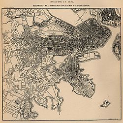
In the 1880s, the calf pasture was used as a Boston sewer line and pumping station, known as the Calf Pasture Pumping Station Complex. This large granite structure, the first sewage treatment station built in the city, was built in 1883. [3] It still stands and in its time was a model for treating sewage and helping to promote cleaner and healthier urban living conditions. It pumped waste to a remote treatment facility on Moon Island in Boston Harbor, and served as a model for other systems worldwide. This system remained in active use and was the Boston Sewer system's headworks, handling all of the city's sewage, until 1968 when a new treatment facility was built on Deer Island. The pumping station is also architecturally significant as a Richardsonian Romanesque designed by the then Boston city architect, George Clough. It is also the only remaining 19th century building on Columbia Point. [2]

The facility was listed on the National Register of Historic Places in 1990. [1] This building is currently under study as a Boston Landmark by the Boston Landmarks Commission. In January 2020, the University of Massachusetts Building Authority issued a request for information from developers to restore the facility and to construct a mixed-use facility on an adjacent 10-acre site, [4] receiving eight proposals in response by the following September. [5] In July 2021, UMass officials issued a request for proposal for the facility and the adjacent site. [6]

See also

Related Research Articles

<span class="mw-page-title-main">University of Massachusetts Boston</span> Public research university in Boston, Massachusetts, United States

The University of Massachusetts Boston is a public research university in Boston, Massachusetts, United States. It is the only public research university in Boston and the third-largest campus in the five-campus University of Massachusetts system. UMass Boston is the third most diverse university in the United States.

<span class="mw-page-title-main">London sewer system</span> English infrastructure system

The London sewer system is part of the water infrastructure serving London, England. The modern system was developed during the late 19th century, and as London has grown the system has been expanded. It is currently owned and operated by Thames Water and serves almost all of Greater London.

<span class="mw-page-title-main">Dorchester, Boston</span> Neighborhood of Boston in Suffolk, Massachusetts, United States

Dorchester is a Boston neighborhood comprising more than 6 square miles (16 km2) in the City of Boston, Massachusetts, United States. Originally, Dorchester was a separate town, founded by Puritans who emigrated in 1630 from Dorchester, Dorset, England, to the Massachusetts Bay Colony. This dissolved municipality, Boston's largest neighborhood by far, is often divided by city planners in order to create two planning areas roughly equivalent in size and population to other Boston neighborhoods.

<span class="mw-page-title-main">Massachusetts Water Resources Authority</span> American state public authority

The Massachusetts Water Resources Authority (MWRA) is a public authority in the Commonwealth of Massachusetts that provides wholesale drinking water and sewage services to certain municipalities and industrial users in the state, primarily in the Boston area.

<span class="mw-page-title-main">JFK/UMass station</span> Transit station in Boston, Massachusetts, US

JFK/UMass station is a Massachusetts Bay Transportation Authority (MBTA) intermodal transfer station, located adjacent to the Columbia Point area of Dorchester, Boston, Massachusetts. It is served by the rapid transit Red Line; the Greenbush Line, Kingston/Plymouth Line, and Middleborough/Lakeville Line of the MBTA Commuter Rail system, and three MBTA bus routes. The station is named for the John F. Kennedy Presidential Library and Museum and the University of Massachusetts Boston, both located nearby on Columbia Point.

<span class="mw-page-title-main">Abbey Mills Pumping Station</span> Pumping station in London, England

Abbey Mills Pumping Station is a sewage pumping station in Mill Meads, East London, operated by Thames Water. The pumping station lifts sewage from the London sewerage system into the Northern Outfall Sewer and the Lee Tunnel, which both run to Beckton Sewage Treatment Works.

<span class="mw-page-title-main">Boston Harbor</span> Estuary and harbor of Massachusetts Bay

Boston Harbor is a natural harbor and estuary of Massachusetts Bay, and is located adjacent to the city of Boston, Massachusetts. It is home to the Port of Boston, a major shipping facility in the Northeastern United States.

<span class="mw-page-title-main">Ashmont station</span> Rapid transit station in Boston, Massachusetts, US

Ashmont station is a Massachusetts Bay Transportation Authority (MBTA) intermodal transit station located at Peabody Square in the Dorchester neighborhood of Boston, Massachusetts. It is the southern terminus of the Ashmont branch of the rapid transit Red Line, the northern terminus of the connecting light rail Ashmont–Mattapan High-Speed Line, and a major terminal for MBTA bus service. Ashmont has two side platforms serving the below-grade Red Line and a single side platform on an elevated balloon loop for the Mattapan Line. The station is fully accessible for all modes.

<span class="mw-page-title-main">Moon Island (Massachusetts)</span> Island in Boston Harbor, Massachusetts

Moon Island is an island in Quincy Bay, in the middle of Boston Harbor, Massachusetts. It is the location of the Boston Fire Department Training Academy, and Boston Police Department shooting range. All of the land on the island is owned by the City of Boston but the island is under the jurisdiction of Quincy, Massachusetts. It is also part of the Boston Harbor Islands National Recreation Area.

<span class="mw-page-title-main">Columbia Point, Boston</span>

Columbia Point, in the Dorchester neighborhood of Boston, Massachusetts, sits on a peninsula jutting out from the mainland of eastern Dorchester into the bay. Old Harbor Park is on the north side, adjacent to Old Harbor, part of Dorchester Bay. The peninsula is primarily occupied by Harbor Point, the University of Massachusetts Boston, the John F. Kennedy Presidential Library and Museum, the Edward M. Kennedy Institute for the United States Senate, and a complex at the former Bayside Expo Center, Boston College High School, and the Massachusetts Archives. The Boston Harborwalk follows the entire coastline.

<span class="mw-page-title-main">Washington Park Sewage Pumping Station</span> United States historic place

The Washington Park Sewage Pumping Station is an historic wastewater pumping facility in Providence, Rhode Island. Its principal visible component is a concrete block structure, finished in stucco and topped by a hip roof, which is about 16 by 16 feet. This building stands atop a large cast-in-place concrete well, in which pumps and gate valves are housed. The facility was built in 1911 to pump raw sewage from the low-lying Washington Park area to the Field's Point wastewater treatment facility, which lies about 1,000 feet (300 m) to the north. The pump station is located well back from the street, behind a low brick distribution facility. It was added to the National Register of Historic Places in 1989.

<span class="mw-page-title-main">Boston Consumptives Hospital</span> United States historic place

The Boston Consumptives Hospital is a historic tuberculosis hospital in the Mattapan neighborhood of Boston, Massachusetts. It consists of a complex of eighteen historic buildings on 52 acres (21 ha) of land. Most of these buildings were built between 1908 and 1932, although the Superintendent's House predates the hospital's construction; it is an Italianate house built c. 1856. They are predominantly brick buildings that are Colonial Revival in character, although the 1929 main administration building has a variety of different revival elements. Several of the buildings on the campus—The Administrative or Foley Building; The Doctor's Residences, Dormitories and Wards; and The Power House—were designed by the renowned architectural firm Maginnis and Walsh. The complex was the largest tuberculosis hospital in the state, built in response to reports that the disease was responsible for more deaths than any other in the city. The facility was used for the treatment of tuberculosis through the middle of the 20th century, and then stood largely vacant until 2002, when plans were laid to rehabilitate the property for other uses.

<span class="mw-page-title-main">Morrissey Boulevard</span> Coastal road in Boston, Massachusetts

Morrissey Boulevard is a six-lane divided coastal road in the Dorchester neighborhood of Boston, Massachusetts, United States. It is owned and maintained by the Massachusetts Department of Conservation and Recreation (DCR).

<span class="mw-page-title-main">George Albert Clough</span>

George Albert Clough was an architect working in Boston in the late 19th-century. He designed the Suffolk County Courthouse in Pemberton Square, and numerous other buildings in the city and around New England. Clough served as the first City Architect of Boston from 1876 to 1883.

The South Boston CSO Storage Tunnel, also known as the North Dorchester Bay CSO Storage Tunnel, is a large underground facility designed to reduce untreated sewage discharges into Boston Harbor from the Massachusetts Water Resources Authority combined sewer and stormwater system. It was opened on July 23, 2011, and is part of the federally mandated Boston Harbor Cleanup project. CSO stands for Combined Sewer Overflow.

Bayside Expo Center was a convention center located in Dorchester, Massachusetts. Originally opened as a shopping mall called Bayside Mall in the 1960s, the mall later failed and the convention center opened in its place. In 2010, it was purchased by the University of Massachusetts Boston after the building went into foreclosure. After the building's roof collapsed from the weight of accumulated snowfall during the 2014–15 North American winter, the university demolished the facility in 2016. In 2019, the University of Massachusetts board of trustees leased the property to Accordia Partners. In 2020, Accordia Partners proposed redeveloping the property into a 21-building mixed-used biotechnology science park called "Dorchester Bay City". In 2023, the Boston Planning & Development Agency approved the Accordia Partners proposal.

Sewage Pumping Station 67 is a heritage-listed sewage pumping station located on Grand Avenue, in the Sydney suburb of Camellia, in the City of Parramatta local government area of New South Wales, Australia. It was designed and built by the Metropolitan Water, Sewerage and Drainage Board from 1929 to 1930. It is also known as SPS 67 and SP0067. The pumping station is owned by Sydney Water. It was added to the New South Wales State Heritage Register on 15 November 2002.

<span class="mw-page-title-main">Sewage Pumping Station 27</span> Historic site in New South Wales, Australia

Sewage Pumping Station 27 is a heritage-listed former sewage pumping station situated in Callan Park, Rozelle, Inner West Council, Sydney, New South Wales, Australia. It is also known as SPS 27. The building is located on the southern side of King George Park. The property is owned by Sydney Water. It was added to the New South Wales State Heritage Register on 18 November 1999.

<span class="mw-page-title-main">Rushcutters Bay Sewage Pumping Station</span> Historic site in New South Wales, Australia

The Rushcutters Bay Sewage Pumping Station is a heritage-listed sewerage pumping station located at Rushcutters Bay Park in the inner city Sydney suburb of Rushcutters Bay in the City of Sydney local government area of New South Wales, Australia. It was designed and built by the New South Wales Public Works Department from 1902 to 1904. It is also known as Sewage Pumping Station 18 and SPS 18. The property is owned by Sydney Water. It was added to the New South Wales State Heritage Register on 18 November 1999.

<span class="mw-page-title-main">Sewage Pumping Station 3</span> Historic site in New South Wales, Australia

Sewage Pumping Station 3 is a heritage-listed sewerage pumping station located near 1 Booth Street, Annandale, City of Sydney, New South Wales, Australia. The building is located adjacent to Johnstons Creek. It was built from 1902 to 1904 by the New South Wales Public Works Department. It is also known as SPS 3, SP0003, Booth Street Sewage Pumping Station and Annandale Sewage Pumping Station. The property is owned by Sydney Water. It was added to the New South Wales State Heritage Register on 18 November 1999.

References

  1. 1 2 "National Register Information System". National Register of Historic Places . National Park Service. April 15, 2008.
  2. 1 2 "Calf Pasture Pumping Station" Archived 2011-09-27 at the Wayback Machine , Dorchester Atheneum
  3. "NRHP nomination for Calf Pasture Pumping Station Complex". Commonwealth of Massachusetts. Retrieved 2014-06-10.
  4. Forry, Bill (January 10, 2020). "UMass seeks private developer for Calf Pasture Pumping Station, adjacent parcels on Columbia Point". The Dorchester Reporter. Boston Neighborhood News, Inc. Retrieved March 2, 2021.
  5. Herman, Colman M. (September 23, 2020). "Developers offer ideas to UMass on Calf Pasture site". The Dorchester Reporter. Boston Neighborhood News, Inc. Retrieved March 5, 2021.
  6. Dumcius, Gintautas (July 23, 2021). "UMass officials seek proposals for Calf Pasture redevelopment". The Dorchester Reporter. Boston Neighborhood News, Inc. Retrieved January 5, 2022.