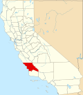
Callender | |
---|---|
Coordinates: 35°03′11″N120°35′47″W / 35.05306°N 120.59639°W | |
Country | United States |
State | California |
County | San Luis Obispo |
Area | |
• Total | 2.29 sq mi (5.92 km2) |
• Land | 2.29 sq mi (5.92 km2) |
• Water | 0.00 sq mi (0.00 km2) 0% |
Elevation | 102 ft (31 m) |
Population (2020) | |
• Total | 1,282 |
• Density | 560.80/sq mi (216.49/km2) |
Time zone | UTC-8 (Pacific (PST)) |
• Summer (DST) | UTC-7 (PDT) |
Area code | 805 |
GNIS feature IDs | 252865; 2582956 |
Callender is a census-designated place in San Luis Obispo County, California, United States. [3] Callender is located along California State Route 1 south of Arroyo Grande. The population was 1,262 at the 2010 census.
According to the United States Census Bureau, the CDP covers an area of 2.3 square miles (5.9 km2), all of it land.
Census | Pop. | Note | %± |
---|---|---|---|
2020 | 1,282 | — | |
U.S. Decennial Census [4] 1850–1870 [5] [6] 1880-1890 [7] 1900 [8] 1910 [9] 1920 [10] 1930 [11] 1940 [12] 1950 [13] 1960 [14] 1970 [15] 1980 [16] 1990 [17] 2000 [18] 2010 [19] |
The 2010 United States Census [20] reported that Callender had a population of 1,262. The population density was 552.2 inhabitants per square mile (213.2/km2). The racial makeup of Callender was 1,003 (79.5%) White, 7 (0.6%) African American, 22 (1.7%) Native American, 48 (3.8%) Asian, 0 (0.0%) Pacific Islander, 128 (10.1%) from other races, and 54 (4.3%) from two or more races. Hispanic or Latino of any race were 355 persons (28.1%).
The Census reported that 1,262 people (100% of the population) lived in households, 0 (0%) lived in non-institutionalized group quarters, and 0 (0%) were institutionalized.
There were 439 households, out of which 144 (32.8%) had children under the age of 18 living in them, 263 (59.9%) were opposite-sex married couples living together, 39 (8.9%) had a female householder with no husband present, 27 (6.2%) had a male householder with no wife present. There were 33 (7.5%) unmarried opposite-sex partnerships, and 3 (0.7%) same-sex married couples or partnerships. 75 households (17.1%) were made up of individuals, and 22 (5.0%) had someone living alone who was 65 years of age or older. The average household size was 2.87. There were 329 families (74.9% of all households); the average family size was 3.21.
The population was spread out, with 291 people (23.1%) under the age of 18, 110 people (8.7%) aged 18 to 24, 284 people (22.5%) aged 25 to 44, 415 people (32.9%) aged 45 to 64, and 162 people (12.8%) who were 65 years of age or older. The median age was 41.8 years. For every 100 females, there were 106.5 males. For every 100 females age 18 and over, there were 107.9 males.
There were 481 housing units at an average density of 210.4 per square mile (81.2/km2), of which 289 (65.8%) were owner-occupied, and 150 (34.2%) were occupied by renters. The homeowner vacancy rate was 2.3%; the rental vacancy rate was 1.3%. 827 people (65.5% of the population) lived in owner-occupied housing units and 435 people (34.5%) lived in rental housing units.
Bowles is a census-designated place (CDP) in Fresno County, California, United States. The population was 166 at the 2010 census, down from 182 at the 2000 census. Bowles is located 11 miles (18 km) south of downtown Fresno, at an elevation of 279 feet.
Bodfish is a census-designated place (CDP) in the southern Kern River Valley of the Southern Sierra Nevada, in Kern County, California.
Bonsall is a census-designated place (CDP) in San Diego County, California. The population was 3,982 at the 2010 census, up from 3,401 at the 2000 census.
Burney is an unincorporated town and census-designated place (CDP) in Shasta County, California, United States. Its population is 3,000 as of the 2020 census, down from 3,154 from the 2010 census. Burney is located on State Route 299, about 4 miles west of its junction with State Route 89.
China Lake Acres is a census-designated place (CDP) in Kern County, California, United States. The population was 1,876 at the 2010 census, up from 1,761 at the 2000 census.
Carnelian Bay is an unincorporated community on the shore of Lake Tahoe in Placer County, California, United States. The Cornelian Bay post office operated from 1883 to 1887 and from 1891 to 1893. The Carnelian Bay post office opened in 1908.
Buckhorn is a census-designated place in Amador County, California. Buckhorn sits at an elevation of 3,238 feet. The community is in ZIP code 95666 and area code 209. The 2010 United States census reported Buckhorn's population was 2,429.
Clipper Mills is a census-designated place in Butte County, California. It lies at an elevation of 3550 feet. Clipper Mills has a post office, first established in 1861 and moved in 1891. Its zip code is 95930. Clipper Mills's population was 142 at the 2010 census.
Bayview is a census-designated place in Contra Costa County, California. Bayview sits at an elevation of 36 feet. The 2010 United States census reported Bayview's population was 1,754. Prior to 2010, Bayview was part of the Bayview-Montalvin CDP and then separated into the two individual communities of Bayview and Montalvin Manor for the census.
Butte Valley is an unincorporated community and census-designated place (CDP) named for a former settlement in Butte County, California, United States. It is located 5.5 miles (8.9 km) southeast of Chico. A post office operated at Butte Valley from 1861 to 1871, when it was re-located to Durham. Butte Valley sits at an elevation of 351 feet. The 2010 United States census reported Butte Valley's population is 899.
Auburn Lake Trails is a census-designated place in El Dorado County, California. It lies at an elevation of 1916 feet. It is a gated community with 23 miles (37 km) of horse trails. As of the 2010 census, the population was 3,426.
Centerville is a census-designated place in Fresno County, California. It is located on the Atchison, Topeka and Santa Fe Railroad 16 miles (26 km) east of Fresno, at an elevation of 394 feet. At the 2010 census, it had a population of 392.
Cherokee Strip is a census-designated place in Kern County, California. It is located 2.5 miles (4 km) south-southeast of Shafter, at an elevation of 331 feet (101 m). The population was 206 at the 2010 census.
Aspen Springs is an unincorporated community and census-designated place (CDP) in Mono County, California, United States. It lies at an elevation of 7,109 feet (2,167 m). The population was 70 at the 2020 census.
Camanche North Shore is a census-designated place in Amador County, California. Camanche North Shore sits at an elevation of 308 feet. The 2010 United States census reported Camanche North Shore's population was 979.
Butte Creek Canyon is an unincorporated community and census-designated place (CDP) in Butte County, California. Butte Creek Canyon sits at an elevation of 1024 feet in the Sierra Nevada foothills. The 2010 United States census reported Butte Creek Canyon's population was 1,086. In November 2018, the Camp Fire destroyed a large portion of the town.
Fort Washington is a census-designated place in Fresno County, California. Fort Washington sits at an elevation of 249 feet (76 m). The 2010 United States census reported Fort Washington's population was 233.
Clay is a census-designated place in Sacramento County, California. Clay sits at an elevation of 135 feet (41 m). The 2010 United States census reported Clay's population was 1,195.
Blacklake is a census-designated place in San Luis Obispo County, California. Blacklake sits at an elevation of 341 feet (104 m). The 2010 United States census reported Blacklake's population was 930.
Airport is a census-designated place (CDP) in Stanislaus County, California. Airport sits at an elevation of 92 feet (28 m). and is located near Modesto City–County Airport. The 2010 United States census reported Airport's population was 1,964.