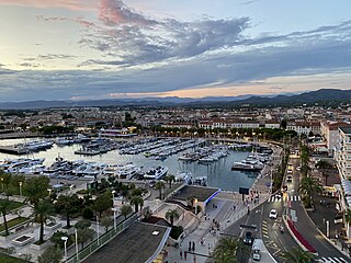
Alpes-Maritimes is a department of France located in the country's southeast corner, on the Italian border and Mediterranean coast. Part of the Provence-Alpes-Côte d'Azur region, it encompasses the French Riviera alongside neighbouring Var. Alpes-Maritimes had a population of 1,094,283 in 2019. Its prefecture is Nice, with Grasse as the sole subprefecture.

Provence-Alpes-Côte d'Azur, also known as Région Sud, is one of the eighteen administrative regions of France, located at the far southeastern point of the mainland. The main prefecture and largest city is Marseille, France's third largest city after Paris and Lyon and the 2nd largest urban area when combined with Aix-en-Provence with slightly less than one million residents.

The French Riviera, known in French as the Côte d'Azur, is the Mediterranean coastline of the southeast corner of France. There is no official boundary, but it is considered to be the coastal area of the Alpes-Maritimes department, extending from the rock formation Massif de l'Esterel to Menton, at the France–Italy border, although some other sources place the western boundary further west around Saint-Tropez or even Toulon. The coast is entirely within the Provence-Alpes-Côte d'Azur region of France. The Principality of Monaco is a semi-enclave within the region, surrounded on three sides by France and fronting the Mediterranean. The French Riviera contains the seaside resorts of Cap-d'Ail, Beaulieu-sur-Mer, Saint-Jean-Cap-Ferrat, Villefranche-sur-Mer, Antibes, Juan-les-Pins, Cannes, and Theoule-sur-Mer.

Saint-Jean-Cap-Ferrat is a commune in the Alpes-Maritimes department in the Provence-Alpes-Côte d'Azur region in Southeastern France. In 2012, Cap Ferrat was named the second most expensive residential location in the world after Monaco.

Saint-Laurent-du-Var is a commune in the Alpes-Maritimes department in the Provence-Alpes-Côte d'Azur region on the French Riviera.

Roquebrune-Cap-Martin, simply Roquebrune until 1921, is a commune in the Alpes-Maritimes department in the Provence-Alpes-Côte d'Azur region, Southeastern France, between Monaco and Menton. The name was changed from Roquebrune to differentiate the town from Roquebrune-sur-Argens in neighbouring Var.

The Stade Louis II, or simply Louis II is a stadium located in the Fontvieille district of Monaco, near the border with Cap-d'Ail commune of France. It serves primarily as a venue for football, being the home of AS Monaco. The stadium is most notable for its distinctive nine arches at the away end of the ground. The arena is also used for the Herculis, a track and field meet of the Diamond League. The stadium hosted the 1986 and 1998–2012 UEFA Super Cup matches. Due to Monaco's small size, the stadium is the only football and athletics stadium in the country.

Beausoleil is a commune in the Alpes-Maritimes department in the Provence-Alpes-Côte d'Azur region in Southeastern France. It adjoins the Principality of Monaco to its south. The commune of Beausoleil was established in 1904; it was supposed to be named Monte-Carlo Supérieur for a time but the idea was abandoned after protests from Monégasque authorities.

Saint-Raphaël is a commune in the Var department, Provence-Alpes-Côte d'Azur region, Southeastern France.

Èze is a seaside commune in the Alpes-Maritimes department in the Provence-Alpes-Côte d'Azur region in Southeastern France. It is located on the French Riviera, 8.5 km (5.2 mi) to the northeast of Nice and 4.5 km (2.7 mi) to the west of Monaco. In 2018, Èze had 2,225 inhabitants known as Ezasques.

Beaulieu-sur-Mer, commonly referred to simply as Beaulieu, is a seaside commune on the French Riviera between Nice and the Principality of Monaco. Located in the Alpes-Maritimes department in the Provence-Alpes-Côte d'Azur region, it borders the communes of Saint-Jean-Cap-Ferrat and Villefranche-sur-Mer, not far from Èze to the northeast. In 2018, Beaulieu-sur-Mer had a population of 3,731. Its inhabitants are called Berlugans (masculine) and Berluganes (feminine).

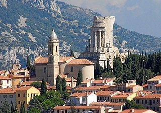
La Turbie is a commune in the Alpes-Maritimes department in southeastern France.

Vallauris is a seaside commune in the Alpes-Maritimes department in the Provence-Alpes-Côte d'Azur region in Southeastern France. It is located in the metropolitan area of Antibes, bordering it on its west side. The seaside town Golfe-Juan is a part of the commune of Vallauris. Golfe-Juan-Vallauris station has rail connections to Grasse, Cannes, Antibes and Nice.

Colomars is a commune in the Alpes-Maritimes département in the Provence-Alpes-Côte d'Azur region in southeastern France.

Roquefort-Les-Pins is a commune in the Alpes-Maritimes department in the Provence-Alpes-Côte d'Azur region in southeastern France.

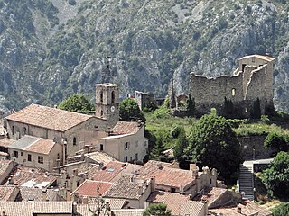
Gréolières is a rural commune in the Alpes-Maritimes department in the Provence-Alpes-Côte d'Azur region in Southeastern France. It is part of Préalpes d'Azur Regional Natural Park.

Auvare is a commune in the Alpes-Maritimes department in the Provence-Alpes-Côte d'Azur region of south-eastern France.

Aiglun is a commune in the Alpes-Maritimes department in the Provence-Alpes-Côte d'Azur region of southeastern France.

Lantosque is a commune in the Alpes-Maritimes department in the Provence-Alpes-Côte d'Azur region in Southeastern France.

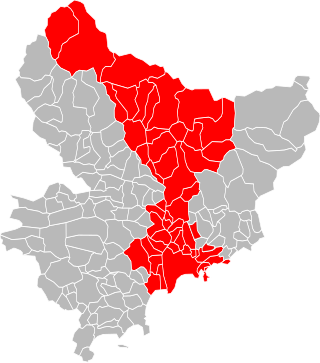
The Métropole Nice Côte d'Azur is the métropole, an intercommunal structure, centred on the city of Nice. It is located in the Alpes-Maritimes department, in the Provence-Alpes-Côte d'Azur region, Southeastern France. It was created on 31 December 2011, replacing the previous communauté urbaine of Nice Côte d'Azur and the communautés de communes of Les stations du Mercantour, La Tinée and Vésubie-Mercantour. In 2013 the commune of Coaraze left the métropole; in 2014 the communes of Bonson, Le Broc, Gattières and Gilette joined it. In 2022 the communes of Drap and Châteauneuf-Villevieille joined the métropole. Its area is 1,479.7 km2. Its population was 545,873 in 2018, of which 341,032 in Nice proper.


