Capron, Oklahoma

Last updated

Capron, Oklahoma
OKMap-doton-Capron.PNG
Location of Capron, Oklahoma
Coordinates: 36°53′48″N98°34′39″W / 36.89667°N 98.57750°W / 36.89667; -98.57750
Country United States
State Oklahoma
County Woods
Area
[1]
  Total0.11 sq mi (0.28 km2)
  Land0.11 sq mi (0.28 km2)
  Water0.00 sq mi (0.00 km2)
Elevation
[2]
1,293 ft (394 m)
Population
 (2020)
  Total27
  Density250.00/sq mi (96.36/km2)
Time zone UTC-6 (Central (CST))
  Summer (DST) UTC-5 (CDT)
ZIP code
73717
Area code 580
FIPS code 40-11750 [3]
GNIS feature ID2413163 [2]

Capron is a town in Woods County, Oklahoma, United States. The population was 27 at the time of the 2020 Census, [4] an increase from the 23 reported at the 2010 census.

Contents

History

Prior to the opening of the Cherokee Strip in 1893, Capron, Oklahoma was first known as "Warren", a small cattle station on the main line of the Santa Fe railroad. [5] It consisted of a store, and an old railroad car left by the Santa Fe. Sometime after the opening of the strip residents wanted to come up with a new name for the growing town. The name was changed to "Sterling", but the postal service and Santa Fe would not accept it because there was a town by that name on their line in Kansas. The names of "Virgil" and "Kermit" were proposed, but Santa Fe would not accept these names, for the same reason. Therefore, a committee consisting of Mr. George Espy, postmaster, Dr. G.W. Todd, and Congressman Dennis Flynn was appointed to select a name which the Santa Fe and Postal Service would accept. The name of Captain Allyn K. Capron, Jr. was proposed. Captain Capron was a member of Teddy Roosevelt's Rough Riders, and had been killed at the Battle of San Juan Hill. The name of "Capron" was approved by a petition of the residents. The Santa Fe and U. S. Postal service accepted the name and so it stands today.

At one time Capron was quite a thriving community. It had two banks; the Bank of Capron, and the Capron State Bank; three general stores; two drug stores; a hotel; depot; a millinery shop; theater; blacksmith; a weekly newspaper, The Capron Hustler; a monthly newspaper, The Screech Owl; two barber shops; hardware store; lumber yard; two churches, Warburton Memorial Methodist Church, and First Congregational Church; the Driftwood Telephone Company and Hampton's Foot Powder Factory.

In April 1939 a tornado struck Capron, making a straight line down the main business street. Many of the residents of town did not even know the tornado has struck until the next morning when they went downtown to open their stores and found them gone. Most tornadoes sound like trains, and since a train goes through Capron about every 20 minutes no one noticed! Most of the above businesses, and the public school building, which was only 10 years old, were destroyed. The majority of these businesses were never rebuilt. However, the public schools were rebuilt.

Capron was always concerned with having a good school system. In 1894 a small but enterprising group of Driftwood Township citizens provided for the establishment of the first Capron Public Schools. The school consisted of grades 18 and consisted of a two-room frame building located south and east of the present south Coop Grain Elevator. This building proved adequate until 1909 when a new two-story brick building was built in the north end of town at the site of the present school building. The cost of the 1909 building was $8,500.00. In 1929 residents approved the building of a new one-story building with a large gymnasium and auditorium attached. The old two-story building was torn down to make way for this modern facility. This building was destroyed in the 1939 tornado and a new building, auditorium and gymnasium were built in 1940. At the time, this facility was considered to be one of the best schools in northwest Oklahoma. Additions to the present building were made: in 1952, vocational agriculture building; 1956, additional classrooms and music room; and 1964, when a new cafeteria was added to the school. The high school was first accredited in 1912. In 1968 the high school was closed due to falling enrollment. There were no families in the school district on public assistance in 1968, and the patrons of the district never voted down a tax increase for their school; they wanted the very best for their children. The Elementary School, grades K8 were closed in 1976 by a vote of the patrons which carried by only one vote. The vote was contested. This decision was taken to court and eventually upheld by the Oklahoma Supreme Court. Today Capron has two large concrete grain elevators, a rural water district office, United Methodist Church, garage, filling station, and American Legion Post. The Post Office closed in 1994 after 100 years of service to the citizens of the area.

Geography

According to the United States Census Bureau, the town has a total area of 0.1 square miles (0.26 km2), all land.

Demographics

Historical population
CensusPop.Note
1910 196
1920 184−6.1%
1930 155−15.8%
1940 147−5.2%
1950 100−32.0%
1960 1022.0%
1970 80−21.6%
1980 54−32.5%
1990 38−29.6%
2000 4210.5%
2010 23−45.2%
2020 2717.4%
U.S. Decennial Census

As of the census [3] of 2000, there were 42 people, 17 households, and 10 families residing in the town. The population density was 370.2 inhabitants per square mile (142.9/km2). There were 20 housing units at an average density of 176.3 per square mile (68.1/km2). The racial makeup of the town was 100.00% White.

There were 17 households, out of which 23.5% had children under the age of 18 living with them, 58.8% were married couples living together, 5.9% had a female householder with no husband present, and 35.3% were non-families. 29.4% of all households were made up of individuals, and 11.8% had someone living alone who was 65 years of age or older. The average household size was 2.47 and the average family size was 3.18.

In the town, the population was spread out, with 19.0% under the age of 18, 7.1% from 18 to 24, 33.3% from 25 to 44, 28.6% from 45 to 64, and 11.9% who were 65 years of age or older. The median age was 42 years. For every 100 females, there were 133.3 males. For every 100 females age 18 and over, there were 112.5 males.

The median income for a household in the town was $24,250, and the median income for a family was $23,750. Males had a median income of $22,500 versus $16,250 for females. The per capita income for the town was $11,156. None of the population and none of the families were below the poverty line.

Notable people

Related Research Articles

<span class="mw-page-title-main">Baca County, Colorado</span> County in Colorado, United States

Baca County is a county located in the U.S. state of Colorado. As of the 2020 census, the population was 3,506. The county seat is Springfield. Located at the southeast corner of Colorado, the county shares state borders with Kansas, New Mexico, and Oklahoma.

<span class="mw-page-title-main">Hardtner, Kansas</span> City in Kiowa County, Kansas

Hardtner is a city in Barber County, Kansas, United States. As of the 2020 census, the population of the city was 167. It is located 1 mile north of the Kansas / Oklahoma state border.

<span class="mw-page-title-main">Wagon Mound, New Mexico</span> Village in New Mexico, United States

Wagon Mound is a village in Mora County, New Mexico, United States. It is named after and located at the foot of a butte called Wagon Mound, which was a landmark for covered wagon trains and traders going up and down the Santa Fe Trail and is now Wagon Mound National Historic Landmark. It was previously an isolated ranch that housed four families that served as local traders. The shape of the mound is said to resemble a Conestoga wagon. As of the 2010 census, the village population was 314. It was also called Santa Clara for many years. The village, with brightly painted houses and several stores and shops, is located on the plains of northeastern New Mexico. Interstate 25, which skirts the western side of town, gives a view of the majority of the town. Wagon Mound is not growing rapidly, but it has seen new construction along I-25, with new buildings on the northeast side of town as well.

<span class="mw-page-title-main">Amorita, Oklahoma</span> Town in Oklahoma, United States

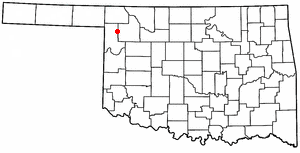
Amorita is a town in Alfalfa County, Oklahoma, United States. The population was 37 at the time of the 2010 census.

<span class="mw-page-title-main">Byron, Oklahoma</span> Town in Oklahoma, United States

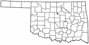
Byron is a town in Alfalfa County, Oklahoma, United States. The population was 35 at the time of the 2010 census.

<span class="mw-page-title-main">Cherokee, Oklahoma</span> City in Oklahoma, United States

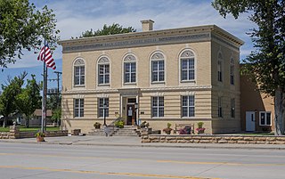
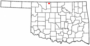
Cherokee is the largest city within, and county seat of, Alfalfa County, Oklahoma, United States. The population was 1,476 at the 2020 census, a decline of 1.5 percent from 2010.

<span class="mw-page-title-main">Lone Grove, Oklahoma</span> City in Oklahoma, United States

Lone Grove is a city in Carter County, Oklahoma, United States. The population was 5,054 at the 2010 census. It is part of the Micropolitan Statistical Area of Ardmore.

<span class="mw-page-title-main">Fargo, Oklahoma</span> Town in Oklahoma, United States

Fargo is a town in Ellis County, Oklahoma, United States. The population was 312 at the time of the 2020 census. Fargo, like many towns in the region, has never fully recovered from the Dust Bowl years.

<span class="mw-page-title-main">Fairmont, Oklahoma</span> Town in Oklahoma, United States

Fairmont is a town in Garfield County, Oklahoma, United States. The population was 134 at the 2010 census, a decrease from 147 at the 2000 census.

<span class="mw-page-title-main">Wakita, Oklahoma</span> Town in Oklahoma, United States

Wakita is a town in Grant County, Oklahoma, United States, approximately 8 miles (13 km) south of the Kansas border. Its population was 344 at the 2010 census, a decrease of 18.1 percent at the 2000 census.

<span class="mw-page-title-main">Mulhall, Oklahoma</span> Town in Oklahoma, United States

Mulhall is a town in Logan (mostly) and Payne counties in Oklahoma, United States. The population was 212 as of the 2020 United States census. It is part of the Oklahoma City Metropolitan Statistical Area.

<span class="mw-page-title-main">Red Rock, Oklahoma</span> Town in Oklahoma, United States

Red Rock is a town in northern Noble County, Oklahoma, United States. The population was 283 at the 2010 census, a decline from 293 at the 2000 census. The headquarters of the Otoe-Missouria Tribe of Indians is located in Red Rock.

<span class="mw-page-title-main">Brooksville, Oklahoma</span> Town in Oklahoma, United States

Brooksville is a town in Pottawatomie County, Oklahoma, United States. It is one of the thirteen existing all-black towns in Oklahoma. The population was 63 at the 2010 census, a 30 percent decline from the figure of 90 in 2000.

<span class="mw-page-title-main">Macomb, Oklahoma</span> Town in Oklahoma, United States

Macomb is a town in Pottawatomie County, Oklahoma, United States. The population was 32 at the 2010 census, which represented a decline of 47.5 percent from the figure of 61 in 2000.

<span class="mw-page-title-main">McLoud, Oklahoma</span> City in Oklahoma, United States

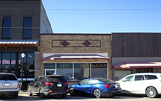
McLoud is a city in northwestern Pottawatomie County, Oklahoma, United States, and is part of the Oklahoma City Consolidated Metropolitan Area. The population was 4,044 at the 2010 census, a 14.0 percent increase from the figure of 3,548 in 2000. The city was founded in 1895 and named for John W. McLoud, attorney for the Choctaw, Oklahoma and Gulf Railroad.

<span class="mw-page-title-main">Sentinel, Oklahoma</span> Town in Oklahoma, United States

Sentinel is a town in Washita County, in the U.S. state of Oklahoma. The population was 901 in the 2010 census, an increase of 4.9 percent from the figure of 859 residents in 2000. Towns near Sentinel are Rocky, Cordell, Canute, and Burnsflat.

<span class="mw-page-title-main">Avard, Oklahoma</span> Unincorporated community in Oklahoma, United States

Avard is a settlement in Woods County, Oklahoma, United States. It is southwest of Alva, and northeast of Waynoka. The population was 26 at the 2000 census. After initial growth, Avard began declining in the 1930s. Avard had a post office from June 1, 1895, until November 22, 1963. As of the 2010 census, Avard was listed as disincorporated, although it still appears as a Census-Designated Place.

<span class="mw-page-title-main">Spearman, Texas</span> City in Texas, United States

Spearman is a city in and the county seat of Hansford County, Texas, United States. As of the 2010 census, the city population was 3,368. It is known for its collection of windmills from the J.B. Buchanan windmill collection.

<span class="mw-page-title-main">Drumright, Oklahoma</span> City in Oklahoma, United States

Drumright is a city in Creek and Payne counties in the U.S. state of Oklahoma. It began as an oil boom town. However, the population has declined as oil production has waned in the area. The population was 2,907 at the 2010 census, a figure almost unchanged from 2,905 in 2000. Drumright and nearby Cushing were at the center of the large, productive Cushing-Drumright Oil Field in the 1910s and 1920s. Now Drumright is home to a festival called The Drumright Monthly Market, where hundreds of visitors come on the first Saturday of every month, seeking crafts and delicacies from all over the region.

<span class="mw-page-title-main">Cashion, Oklahoma</span> Town in Oklahoma, United States

Cashion is a town in Kingfisher and Logan counties in the U.S. state of Oklahoma. The Logan County portion of Cashion is part of the Oklahoma City Metropolitan Statistical Area. The population was 850 as of the 2020 United States census, up 6% from the 802 reported at the 2010 census.

References

  1. "ArcGIS REST Services Directory". United States Census Bureau. Retrieved September 20, 2022.
  2. 1 2 U.S. Geological Survey Geographic Names Information System: Capron, Oklahoma
  3. 1 2 "U.S. Census website". United States Census Bureau . Retrieved January 31, 2008.
  4. "Capron (town), Oklahoma". United States Census Bureau. Retrieved April 20, 2024.
  5. Schwerdtfeger, Donna. "Capron - The Encyclopedia of Oklahoma History and Culture". www.okhistory.org. Oklahoma Historical Society. Archived from the original on April 20, 2016. Retrieved April 21, 2017.