Carapelle Calvisio | ||
---|---|---|
Comune | ||
Comune di Carapelle Calvisio | ||
| ||
Coordinates: 42°18′1″N13°41′8″E / 42.30028°N 13.68556°E Coordinates: 42°18′1″N13°41′8″E / 42.30028°N 13.68556°E | ||
Country | Italy | |
Region | Abruzzo | |
Province | L'Aquila (AQ) | |
Government | ||
• Mayor | Domenico Di Cesare | |
Area | ||
• Total | 14.39 km2 (5.56 sq mi) | |
Elevation | 910 m (2,990 ft) | |
Population (31 December 2013) [1] | ||
• Total | 85 | |
• Density | 5.9/km2 (15/sq mi) | |
Demonym(s) | Carapellesi | |
Time zone | CET (UTC+1) | |
• Summer (DST) | CEST (UTC+2) | |
Postal code | 67020 | |
Dialing code | 0862 | |
Patron saint | San Pancrazio martire | |
Saint day | 12 May |
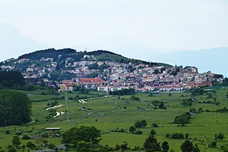
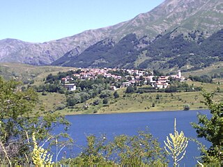
Carapelle Calvisio is a comune and town in the province of L'Aquila in the Abruzzo region of central Italy. It is located in the natural park known as the Gran Sasso e Monti della Laga National Park at 900 metres (3,000 ft) above sea level. It is mostly known as being one of the smallest non-alpine comunes in Italy, with 85 inhabitants as of 31 December 2013. It is located directly some kilometers from the historical castle Rocca Calascio.
The comune is a basic administrative division in Italy, roughly equivalent to a township or municipality.
A town is a human settlement. Towns are generally larger than villages but smaller than cities, though the criteria to distinguish them vary considerably between different parts of the world.
The Province of L'Aquila is the largest, most mountainous and least densely populated province of the Abruzzo region of Southern Italy. It comprises about half the landmass of Abruzzo and occupies the western part of the region. It has borders with the provinces of Teramo to the north, Pescara and Chieti to the east, Isernia to the south and Frosinone, Rome and Rieti to the west. Its capital is the city of L'Aquila.
Carapelle Calvisio's location (separated by a mountain from L'Aquila area) preserved it from serious damage in the April 2009 L'Aquila earthquake.
The 2009 L'Aquila earthquake occurred in the region of Abruzzo, in central Italy. The main shock occurred at 03:32 CEST on 6 April 2009, and was rated 5.8 or 5.9 on the Richter magnitude scale and 6.3 on the moment magnitude scale; its epicentre was near L'Aquila, the capital of Abruzzo, which together with surrounding villages suffered most damage. There have been several thousand foreshocks and aftershocks since December 2008, more than thirty of which had a Richter magnitude greater than 3.5.
Civitella Alfedena is a small town and comune in the province of L'Aquila. It is located in the heart of the National Park of Abruzzo, Lazio e Molise.
Capestrano is a comune and small town with 885 inhabitants (2017), in the Province of L'Aquila, Abruzzo, Italy. It is located in the Gran Sasso e Monti della Laga National Park.
Barete is a comune and town in the province of L'Aquila in the Abruzzo region of Italy. It is located in the Gran Sasso e Monti della Laga National Park.
Barisciano, is a comune and town in the province of L'Aquila in the Abruzzo region of southern Italy. It is located in the Gran Sasso e Monti della Laga National Park.
Cagnano Amiterno is a comune and town in the Province of L'Aquila in the Abruzzo region of central Italy.
Calascio is a comune and village in the province of L'Aquila, in the Abruzzo region of central Italy. It is located in the Gran Sasso e Monti della Laga National Park.
Campo di Giove is a town and comune in the province of L'Aquila in the Abruzzo region of central Italy. Its territory is included in the Majella National Park. Located at the foot of the southwestern slope of the Majella, it is a holiday resort in summer and winter, thanks to the presence of a ski station.
Campotosto is a comune and town in the province of L'Aquila, in the Abruzzo region of central Italy. Olympian Mariano Antonelli was born here.
Capitignano is a comune and town in the province of L'Aquila in the Abruzzo region of Italy. It is located in the Gran Sasso e Monti della Laga National Park.
Castelvecchio Calvisio is a comune and town in the Province of L'Aquila in the Abruzzo region of Italy. It is located in the Gran Sasso e Monti della Laga National Park.
Fontecchio is a comune and town in the Province of L'Aquila in the Abruzzo region of Italy. The small, medieval village is located within the Monte Sirente community and the Sirente-Velino Regional Park.
Gioia dei Marsi is a comune (municipality) and town in the province of L'Aquila in the Abruzzo region of Italy.
Lucoli is a comune (municipality) and town in the province of L'Aquila in the Abruzzo region of Italy. It is one of the nearest communes to the Campo Felice plain and ski resort.
Lecce nei Marsi is a comune and town in the province of L'Aquila in the Abruzzo region of Italy.
Montereale is a comune and town in the province of L'Aquila, in the Abruzzo region of Italy. It is located in the Gran Sasso e Monti della Laga National Park.
Pizzoli is a comune and town in the province of L'Aquila in the Abruzzo region of Italy. It is located in the Gran Sasso e Monti della Laga National Park.
Rocca di Cambio is a comune and town in the province of L'Aquila in the Abruzzo region of Italy.
Rocca di Mezzo is a comune and town in the Province of L'Aquila, in the Abruzzo region of central Italy.
Santo Stefano di Sessanio is a comune and hill town in the province of L'Aquila in the Abruzzo region of southern Italy. Located in the Gran Sasso e Monti della Laga National Park, in the highest region of the Apennines, this medieval hill town sits adjacent to the high plain of Campo Imperatore.
Villa Santa Lucia degli Abruzzi is a little comune and town in the province of L'Aquila in the Abruzzo region of Italy. It is located in the Gran Sasso e Monti della Laga National Park.
This Abruzzo location article is a stub. You can help Wikipedia by expanding it. |