
Motta di Livenza is a town in the province of Treviso, Veneto, Italy.

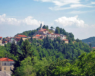
Monastero di Lanzo is a comune (municipality) in the Metropolitan City of Turin in the Italian region Piedmont, located about 35 km northwest of Turin.

Campitello di Fassa is a comune (municipality) in Trentino in the northern Italian region Trentino-Alto Adige/Südtirol, located about 70 kilometres (43 mi) northeast of Trento.

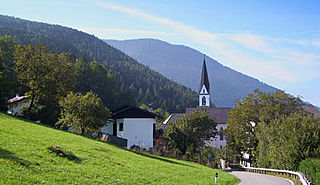
Fierozzo is a comune (municipality) in Trentino in the northern Italian region Trentino-Alto Adige/Südtirol, located about 15 kilometres (9 mi) northeast of Trento. As of 31 December 2004, it had a population of 456 and an area of 17.9 square kilometres (6.9 sq mi). In the census of 2001, 423 inhabitants out of 441 (95.9%) declared themselves members of the Mócheno linguistic group.
Frassilongo is a comune (municipality) in Trentino in the northern Italian region Trentino-Alto Adige/Südtirol, located about 14 kilometres (9 mi) east of Trento. As of 31 December 2004, it had a population of 354 and an area of 16.7 square kilometres (6.4 sq mi).

Palù del Fersina is a comune (municipality) in Trentino in the northern Italian region Trentino-Alto Adige/Südtirol, located about 20 kilometres (12 mi) northeast of Trento. As of 31 December 2004, it had a population of 183 and an area of 16.7 square kilometres (6.4 sq mi).

Margarita is a comune (municipality) in the Province of Cuneo in the Italian region Piedmont, located about 70 kilometres (43 mi) south of Turin and about 11 kilometres (7 mi) east of Cuneo.
Monastero di Vasco is a comune (municipality) in the Province of Cuneo in the Italian region Piedmont, located about 80 kilometres (50 mi) south of Turin and about 20 kilometres (12 mi) east of Cuneo.
Montaldo di Mondovì is a comune (municipality) in the Province of Cuneo in the Italian region Piedmont, located about 80 kilometres (50 mi) south of Turin and about 25 kilometres (16 mi) southeast of Cuneo.
Pianfei is a comune (municipality) in the Province of Cuneo in the Italian region Piedmont, located about 80 kilometres (50 mi) south of Turin and about 13 kilometres (8 mi) east of Cuneo.
Roccaforte Mondovì is a comune (municipality) in the Province of Cuneo in the Italian region Piedmont, located about 80 kilometres (50 mi) south of Turin and about 20 kilometres (12 mi) southeast of Cuneo.
Villanova Mondovì is a comune (municipality) in the Province of Cuneo in the Italian region Piedmont, located about 96 kilometres (60 mi) south of Turin and about 20 kilometres (12 mi) east of Cuneo. As of 31 December 2004, it had a population of 5,506 and an area of 28.4 square kilometres (11.0 sq mi).

Azzone is a comune (municipality) in the Province of Bergamo in the Italian region of Lombardy, located about 90 kilometres (56 mi) northeast of Milan and about 45 kilometres (28 mi) northeast of Bergamo. As of 31 December 2004, it had a population of 458 and an area of 16.8 square kilometres (6.5 sq mi).

Colzate is a comune (municipality) in the Province of Bergamo in the Italian region of Lombardy, located about 70 kilometres (43 mi) northeast of Milan and about 20 kilometres (12 mi) northeast of Bergamo. As of 31 December 2004, it had a population of 1,638 and an area of 6.7 square kilometres (2.6 sq mi).

Misano di Gera d'Adda is a comune (municipality) in the Province of Bergamo in the Italian region of Lombardy, located about 35 kilometres (22 mi) east of Milan and about 25 kilometres (16 mi) south of Bergamo. As of 31 December 2004, it had a population of 2,877 and an area of 6.1 square kilometres (2.4 sq mi).

Villa di Serio is a comune (municipality) in the Province of Bergamo in the Italian region of Lombardy, located about 50 kilometres (31 mi) northeast of Milan and about 6 kilometres (4 mi) northeast of Bergamo. As of 31 December 2004, it had a population of 6,118 and an area of 4.6 square kilometres (1.8 sq mi).

Brallo di Pregola is a comune (municipality) in the Province of Pavia in the Italian region Lombardy, located about 80 km south of Milan and about 50 km south of Pavia. As of 31 December 2004, it had a population of 832 and an area of 46.3 km².
San Giorgio di Lomellina is a comune (municipality) in the Province of Pavia in the Italian region Lombardy, located about 45 km southwest of Milan and about 30 km west of Pavia. As of 31 December 2004, it had a population of 1,196 and an area of 25.9 km².
Santa Margherita di Staffora is a comune (municipality) in the Province of Pavia in the Italian region Lombardy, located about 80 km south of Milan and about 50 km south of Pavia. As of 31 December 2004, it had a population of 589 and an area of 36.7 km².
Val di Nizza is a comune (municipality) in the Province of Pavia in the Italian region Lombardy, located about 60 km south of Milan and about 35 km south of Pavia. As of 31 December 2004, it had a population of 701 and an area of 29.5 km².


