
Abruzzo, historically known as Abruzzi, is a region of Southern Italy with an area of 10,763 square km and a population of 1.3 million. It is divided into four provinces: L'Aquila, Teramo, Pescara, and Chieti. Its western border lies 80 km (50 mi) east of Rome. Abruzzo borders the region of Marche to the north, Lazio to the west and north-west, Molise to the south and the Adriatic Sea to the east. Geographically, Abruzzo is divided into a mountainous area in the west, which includes the highest massifs of the Apennines, such as the Gran Sasso d'Italia and the Maiella, and a coastal area in the east with beaches on the Adriatic Sea.

Sulmona is a comune (municipality) in the province of L'Aquila, in the Italian region of Abruzzo. It is located in the Valle Peligna, a plain once occupied by a lake that disappeared in prehistoric times. In the ancient era, it was one of the most important cities of the Paeligni and is known for being the native town of the Roman poet Ovid, of whom there is a bronze statue, located on the town's main road.

The Aterno-Pescara is a river system in Abruzzo, eastern central Italy. The river is known as the Aterno near its source in the mountains, but takes the name Pescara, actually a tributary, nearer the city of Pescara and the Adriatic Sea.

Corfinium was an ancient city now near modern Corfinio, in the province of L'Aquila.
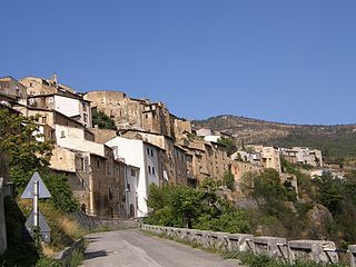
Acciano is a comune in the Province of L'Aquila in the Abruzzo region of Italy. The small, medieval village is in the Subequana valley and is a part of the Sirentina Mountain Community.
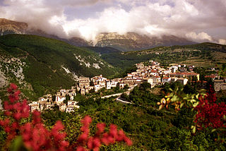
Cansano is a comune in the province of L'Aquila in the Abruzzo region, Southern Italy. It is part of the Maiella National Park. Cansano is known for the archaeological discovery of the Italic and Roman town of Ocriticum, which has become an archaeological park.

Castelvecchio Calvisio is a comune and town in the Province of L'Aquila in the Abruzzo region of Italy. It is located in the Gran Sasso e Monti della Laga National Park.

Cocullo is a comune and town in the Province of L'Aquila, located in the Abruzzo region of Italy. As of 2013 its population was of 246.
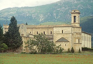
Corfinio is a comune (municipality) and town in the province of L'Aquila, in the Italian region of Abruzzo.
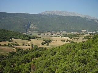
Fagnano Alto is a comune and town in the province of L'Aquila in the Abruzzo region of Italy.

Fontecchio is a comune and town in the Province of L'Aquila in the Abruzzo region of Italy. The small, medieval village is located within the Monte Sirente community and the Sirente-Velino Regional Park.

Fossa is a comune and town in the province of L'Aquila in the Abruzzo region of southern Italy. Bernardino of Fossa was born in the town. The 2009 L'Aquila earthquake contributed to the collapse of a bridge in Fossa, and caused extensive damage to the residential buildings in the town. The town was the epicentre of a major aftershock 5.4 Mw on April 7, 2009.

Molina Aterno is a comune and town in the province of L'Aquila in the Abruzzo region of central Italy. The name derives from Latin molina ("mill"), the second part having been added in 1889 due to the presence of the Aterno river.
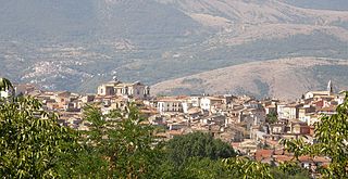
Pratola Peligna is a comune and town in the Province of L'Aquila in the Abruzzo region of Italy. As of 2015, it has a population of 7,652 inhabitants.

Raiano is a town and comune of the province of L'Aquila in the Abruzzo region of Italy.

Rivisondoli is a village and comune in the province of L'Aquila in the Abruzzo region of central Italy. It is a ski resort.
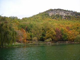
San Demetrio ne'Vestini is a comune and town in the Province of L'Aquila in the Abruzzo region of Italy

Villa Sant'Angelo is a comune and town in the province of L'Aquila, in the Abruzzo region of Italy, which lies in the Aterno River valley near the convergence of the Sirente and the Gran Sasso mountain ranges. Many of the municipal functions are managed cooperatively with adjacent villages, comprising the Comunità Montana Amiternina.

Torre de' Passeri is an Italian town of 3,172 inhabitants in the province of Pescara in Abruzzo. It owes its name to the ancient "Turris Passum", a tower located near the Abbey of San Clemente a Casauria. A prominent feature of Torre de' Passeri is Castello Gizzi, which overlooks the entire town. Historical-enological researches have suggested that the area might be the native land of the Montepulciano vine. Torre de' Passeri is twinned with Manteigas in Portugal.

Morro d'Oro is a town and comune in Teramo province in the Abruzzo region of eastern Italy. Morro d'Oro is an Italian municipality of 3,553 inhabitants in the province of Teramo in Abruzzo, part of the union of the Colline del Medio Vomano municipalities. It is a small town located between the Tordino and Vomano valleys. Its territory extends for 28.18 km²; the inhabitants at the census of 21 October 1991 were 3,015 units; as of 31 December 1995 there were 3,190; a sign that the municipality, after a twenty-year phase of depopulation is in continuous demographic growth. All this thanks to its strategic location and its changed economic conditions: from an exclusively agricultural economy - and mainly sharecropping - to a more integrated agricultural-artisan-industrial one. Therefore, its economy is based, on the one hand, on agriculture, but of an advanced type and on selected crops, in addition to the traditional ones: cereals in general; on the other, on the tertiary sector ; but there is also adequate industrial development, which absorbs a workforce of around 300 units.


