
Abruzzo is a region of Southern Italy with an area of 10,763 square km and a population of 1.3 million. It is divided into four provinces: L'Aquila, Teramo, Pescara, and Chieti. Its western border lies 80 km (50 mi) east of Rome. Abruzzo borders the region of Marche to the north, Lazio to the west and north-west, Molise to the south and the Adriatic Sea to the east. Geographically, Abruzzo is divided into a mountainous area in the west, which includes the highest massifs of the Apennines, such as the Gran Sasso d'Italia and the Maiella, and a coastal area in the east with beaches on the Adriatic Sea.

L'Aquila is a city and comune in central Italy. It is the capital city of both the Abruzzo region and of the Province of L'Aquila. As of 2013, it has a population of 70,967 inhabitants. Laid out within medieval walls on a hill in the wide valley of the Aterno river, it is surrounded by the Apennine Mountains, with the Gran Sasso d'Italia to the north-east.

Leonessa is a town and comune in the far northeastern part of the Province of Rieti in the Lazio region of central Italy. Its population in 2008 was around 2,700.
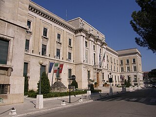
The province of Pescara is a province in the Abruzzo region of Italy. Its provincial capital is the city Pescara, which has a population of 119,483 inhabitants. As of 2017, it has a total population of 319,936 inhabitants over an area of 1,230.33 square kilometres (475.03 sq mi). The provincial president is Antonio Zaffiri and the province contains 46 comuni.

San Benedetto in Perillis is a town and comune in the province of L'Aquila, Abruzzo, central Italy. The town is 43 kilometres (27 mi) from the regional capital, L'Aquila.
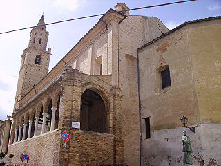
Città Sant'Angelo is a city and comune in the province of Pescara, Abruzzo, Italy.

Amatrice is a town and comune in the province of Rieti, in northern Lazio, and the center of the food-agricultural area of Gran Sasso e Monti della Laga National Park. The town was devastated by a powerful earthquake on 24 August 2016.
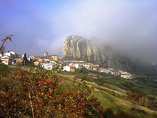
Pizzoferrato is a comune and town in the Province of Chieti in the Abruzzo region of Italy.
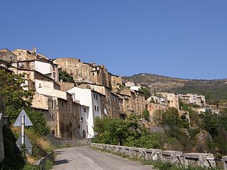
Acciano is a comune in the Province of L'Aquila in the Abruzzo region of Italy. The small, medieval village is in the Subequana valley and is a part of the Sirentina Mountain Community.

Goriano Sicoli is a comune and town in the Province of L'Aquila in the Abruzzo region of Italy.

Ortona dei Marsi is a comune and town in the province of L'Aquila in the Abruzzo region of central Italy. It is included in traditional area of Marsica. The commune is part of the National Park of Abruzzo, Lazio and Molise. Ortona dei Marsi is situated on 1000 meters above sea level and the mountains that surround the valley reach up to 1,800 meters.
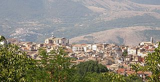
Pratola Peligna is a comune and town in the Province of L'Aquila in the Abruzzo region of Italy. As of 2015, it has a population of 7,652 inhabitants.

Villa Sant'Angelo is a comune and town in the province of L'Aquila, in the Abruzzo region of Italy, which lies in the Aterno River valley near the convergence of the Sirente and the Gran Sasso mountain ranges. Many of the municipal functions are managed cooperatively with adjacent villages, comprising the Comunità Montana Amiternina.

Civitella Casanova is an Italian town of inland mountain of 1,950 inhabitants in the province of Pescara in Abruzzo and belongs to the mountain community Vestina. Listed on the National Park of Gran Sasso and Monti della Laga and the Regional Reserve Voltigno and Valle d'Angri, a regional reserve included in the National Park, the country bases its economy mainly on agriculture. It has pre-Roman origins of repute, the sources of the historian Livy emerges as the town of Civitella was called Cutina or Cingilia.

Stroncone is a comune (municipality) in the Province of Terni in the Italian region Umbria, located about 70 km southeast of Perugia and about 8 km south of Terni.

Borgo Velino is a comune (municipality) in the Province of Rieti in the region Latium, Italy. It is located about 70 kilometres (43 mi) northeast of Rome and about 15 kilometres (9 mi) east of the town Rieti. It has an area of 17.3 square kilometres (6.7 sq mi), and as of 31 December 2010 it had a population of 1,004. Until 1927 Borgo Velino was part of the province of L'Aquila in Abruzzo. It is located near the site of a pre- or early-Roman Sabine village named Viario. Rare ruins of this ancient village, now occupied by a cultivated field, were found near a standing medieval tower. Borgo Velino is the birthplace of Giulio Pezzola, a notorious outlaw of the 17th century.

Tourism in Abruzzo has become one of the most prosperous sectors in the economy of Abruzzo, and in recent years has seen a remarkable growth attracting numerous tourists from Italy and Europe. According to statistics from the Italian institute of statistics (ISTAT), in 2007 arrivals totaled 1,371,155 Italians and 189,651 foreigners. A total of 7,374,646 arrivals were tourists, a figure that puts the region seventeenth among the Italian regions for numbers of tourists per year. According to market analysis and sector studies on tourism in the Abruzzo National Society TurisMonitor 2012, after an increase that was estimated at between 4 and 5% of international tourist arrivals in the Abruzzo region in 2012 was estimated to increase that international arrivals will be around 3/4% by the end of 2012 with staff working in tourism will increase settling at about 25,000 people. Always position first-arrivals from Germany. A moderate support to tourism is also given to the Abruzzo Airport with many low cost and charter flights connecting the entire region with the rest of Europe.

Castello di Ocre is a medieval castle in Ocre, Province of L'Aquila, Abruzzo, southern Italy.

Castello di Carsoli is a medieval castle in Carsoli, Province of L'Aquila (Abruzzo), central Italy.

Eremo di Sant'Onofrio al Morrone is an hermitage located in Sulmona, Province of L'Aquila ., dating back to the thirteenth century. A monk by the name of Pietro Angelerio living at this hermitage later became Pope Celestine V. The hermitage is located at an altitude of 620 meters, and can only be reached via a steep path from the village of Badia, on the eastern edge of the Valle Peligna.


