Goriano Sicoli

Last updated
Goriano Sicoli
Comune di Goriano Sicoli
Goriano Sicoli 2010-by-RaBoe-10.jpg
Location of Goriano Sicoli
Goriano Sicoli
Italy provincial location map 2016.svg
Red pog.svg
Goriano Sicoli
Location of Goriano Sicoli in Italy
Italy Abruzzo location map.svg
Red pog.svg
Goriano Sicoli
Goriano Sicoli (Abruzzo)
Coordinates: 42°4′54″N13°46′33″E / 42.08167°N 13.77583°E / 42.08167; 13.77583
Country Italy
Region Abruzzo
Province L'Aquila (AQ)
Frazioni Castel di Ieri, Cocullo, Prezza, Raiano
Government
  MayorRodolfo Marganelli
Area
[1]
  Total21.75 km2 (8.40 sq mi)
Elevation
720 m (2,360 ft)
Population
 (31 December 2013) [2]
  Total571
  Density26/km2 (68/sq mi)
Demonym Gorianesi
Time zone UTC+1 (CET)
  Summer (DST) UTC+2 (CEST)
Postal code
67030
Dialing code 0864
ISTAT code 066047
Patron saintSanta Gemma Vergine
Saint day11, 12 and 13 May

Goriano Sicoli is a comune and town in the Province of L'Aquila in the Abruzzo region of Italy.

Goriano is a medieval town of about 600 people (2013). [3] The town, which sits on top of a mountain in southeast Abruzzo (about an hour and a half east of Rome and near the Adriatic coast town of Pescara), was made somewhat famous by M. C. Escher in his print of the town which hangs in the National Gallery of Art in Washington.

Italian historical documents reference Goriano beginning around 816, but local residents claim the town is early Roman and existed in some form over 2000 years ago.

Goriano Sicoli (literally, the Goriano of Sicily) lies at the south east end of the Comunità Montana Sirentina region of Abruzzo. This group of mountain towns includes ski resorts, castles, a Roman bridge, water wheels and rural churches. The region runs along both sides of the river Aterno, which flows from the regional capital L'Aquila to the Adriatic Sea.

Climate

Climate data for Goriano Sicoli, elevation 785 m (2,575 ft), (1951–2000)
MonthJanFebMarAprMayJunJulAugSepOctNovDecYear
Record high °C (°F)23.8
(74.8)
21.8
(71.2)
26.9
(80.4)
32.4
(90.3)
33.1
(91.6)
37.5
(99.5)
41.9
(107.4)
39.5
(103.1)
36.3
(97.3)
32.5
(90.5)
27.9
(82.2)
18.9
(66.0)
41.9
(107.4)
Mean daily maximum °C (°F)6.6
(43.9)
8.3
(46.9)
11.9
(53.4)
15.5
(59.9)
20.8
(69.4)
25.0
(77.0)
28.6
(83.5)
28.5
(83.3)
23.9
(75.0)
17.7
(63.9)
11.7
(53.1)
7.6
(45.7)
17.2
(62.9)
Daily mean °C (°F)2.7
(36.9)
4.0
(39.2)
7.0
(44.6)
10.2
(50.4)
14.9
(58.8)
18.5
(65.3)
21.4
(70.5)
21.3
(70.3)
17.7
(63.9)
12.7
(54.9)
7.7
(45.9)
4.1
(39.4)
11.8
(53.3)
Mean daily minimum °C (°F)−1.1
(30.0)
−0.3
(31.5)
2.1
(35.8)
4.9
(40.8)
8.9
(48.0)
12.1
(53.8)
14.3
(57.7)
14.2
(57.6)
11.6
(52.9)
7.7
(45.9)
3.6
(38.5)
0.5
(32.9)
6.5
(43.8)
Record low °C (°F)−16.0
(3.2)
−19.2
(−2.6)
−13.5
(7.7)
−8.0
(17.6)
−4.0
(24.8)
1.5
(34.7)
2.1
(35.8)
3.0
(37.4)
−1.0
(30.2)
−5.0
(23.0)
−11.4
(11.5)
−14.0
(6.8)
−19.2
(−2.6)
Average precipitation mm (inches)78.5
(3.09)
78.5
(3.09)
67.6
(2.66)
75.7
(2.98)
54.6
(2.15)
45.9
(1.81)
26.5
(1.04)
40.2
(1.58)
58.4
(2.30)
81.4
(3.20)
119.5
(4.70)
105.8
(4.17)
832.6
(32.77)
Average precipitation days8.48.58.69.78.16.24.24.46.07.810.09.891.7
Source: Regione Abruzzo [4]

Related Research Articles

<span class="mw-page-title-main">Abruzzo</span> Region in southern Italy

Abruzzo, historically known as Abruzzi, is a region of Southern Italy with an area of 10,763 square km and a population of 1.3 million. It is divided into four provinces: L'Aquila, Teramo, Pescara, and Chieti. Its western border lies 80 km (50 mi) east of Rome. Abruzzo borders the region of Marche to the north, Lazio to the west and north-west, Molise to the south and the Adriatic Sea to the east. Geographically, Abruzzo is divided into a mountainous area in the west, which includes the highest massifs of the Apennines, such as the Gran Sasso d'Italia and the Maiella, and a coastal area in the east with beaches on the Adriatic Sea.

<span class="mw-page-title-main">Castel di Sangro</span> Comune in Abruzzo, Italy

Castel di Sangro is a city and comune of 6,461 people in the Province of L'Aquila, in Abruzzo, central Italy. It is the main city of the Alto Sangro e Altopiano delle Cinque Miglia area.

<span class="mw-page-title-main">Carsoli</span> Comune in Abruzzo, Italy

Carsoli is a town and comune in the province of L'Aquila, Abruzzo. The ancient Roman city lies 4 kilometres (2.5 mi) southwest of the modern town.

<span class="mw-page-title-main">Pescasseroli</span> Comune in Abruzzo, Italy

Pescasseroli is a town and comune in the province of L'Aquila, in Southern Abruzzo, central Italy.

<span class="mw-page-title-main">Scanno, Abruzzo</span> Comune in Abruzzo, Italy

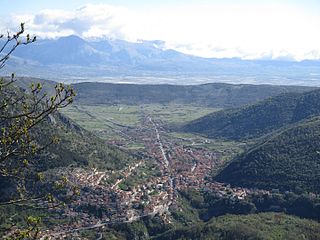
Scanno is a town and district in the province of L'Aquila, in the Abruzzo region of central Italy. It is one of I Borghi più belli d'Italia.

<span class="mw-page-title-main">Balsorano</span> Comune in Abruzzo, Italy

Balsorano is a comune (municipality) and town in the province of L'Aquila in the Abruzzo region of Italy.

<span class="mw-page-title-main">Barisciano</span> Comune in Abruzzo, Italy

Barisciano, is a comune and town in the province of L'Aquila in the Abruzzo region of central Italy. It is located in the Gran Sasso e Monti della Laga National Park.

Barrea is a comune in the province of L'Aquila in the Abruzzo region of Italy.

<span class="mw-page-title-main">Bisegna</span> Comune in Abruzzo, Italy

Bisegna is a comune and town in the Province of L'Aquila in the Abruzzo region of Italy.

<span class="mw-page-title-main">Capistrello</span> Comune in Abruzzo, Italy

Capistrello is a comune and town in the province of L'Aquila in the Abruzzo region of central-southern Italy. It is located at the border between the upper Liri River valley and the Marsica. Capistrello borders the following municipalities: Avezzano, Canistro, Castellafiume, Filettino (Frosinone), Luco dei Marsi, Scurcola Marsicana and Tagliacozzo.

<span class="mw-page-title-main">Cerchio</span> Comune in Abruzzo, Italy

Cerchio is a comune and town in the province of L'Aquila in the Abruzzo region of southern Italy.

<span class="mw-page-title-main">Massa d'Albe</span> Comune in Abruzzo, Italy

Massa d'Albe is a comune and town in the province of L'Aquila in the Abruzzo region of central Italy. It is part of the Marsica.

<span class="mw-page-title-main">Montereale, Abruzzo</span> Comune in Abruzzo, Italy

Montereale is a comune and town in the province of L'Aquila, in the Abruzzo, region of Italy. It is located in the Gran Sasso e Monti della Laga National Park.

<span class="mw-page-title-main">Ovindoli</span> Comune in Abruzzo, Italy

Ovindoli is a village and comune of the province of L'Aquila in the Abruzzo region of central Italy. Close to Rome, it is a resort for both summer and winter sports, including hiking, biking, equestrian activities and downhill and cross-country skiing.

Pescocostanzo is a comune and town of 1038 inhabitants in the Province of L'Aquila in the Abruzzo region of Italy. It is a tourist destination, attracting people from all over Italy due to its landscape and environment. It is part of the Maiella National Park and is one of I Borghi più belli d'Italia. In winter, Pescocostanzo is a destination for skiers and snowboarders, and has its own ski resort. The towns of Roccaraso and Rivisondoli are close by.

<span class="mw-page-title-main">Rocca di Mezzo</span> Comune in Abruzzo, Italy

Rocca di Mezzo is a comune and town in the Province of L'Aquila, in the Abruzzo region of central Italy.

<span class="mw-page-title-main">San Benedetto dei Marsi</span> Comune in Abruzzo, Italy

San Benedetto dei Marsi is a comune and town in the province of L'Aquila in the Abruzzo region of central Italy. It is on the eastern shore of the dried Lake Fucino, 20 kilometres (12 mi) from the remains of another ancient site, Alba Fucens.

<span class="mw-page-title-main">Sante Marie</span> Comune in Abruzzo, Italy

Sante Marie is a comune and town in the province of L'Aquila, in the Abruzzo region of central Italy

<span class="mw-page-title-main">Scurcola Marsicana</span> Comune in Abruzzo, Italy

Scurcola Marsicana is a comune and town in the province of L'Aquila, in the Abruzzo region of central Italy.

<span class="mw-page-title-main">Pietracamela</span> Comune in Abruzzo, Italy

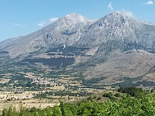
Pietracamela is a town and comune in Teramo province in the Abruzzo region of eastern Italy. It is located at the feet of the Gran Sasso massif, in the natural park known as the "Gran Sasso e Monti della Laga National Park". It is one of I Borghi più belli d'Italia.

References

  1. "Superficie di Comuni Province e Regioni italiane al 9 ottobre 2011". Italian National Institute of Statistics. Retrieved 16 March 2019.
  2. All demographics and other statistics from the Italian statistical institute (Istat)
  3. "Goriano Sicoli - Italy: Information and Town Profile".
  4. "VALORI MEDI CLIMATICI DAL 1951 AL 2000 NELLA REGIONE ABRUZZO" (PDF). Regione Abruzzo. Archived from the original (PDF) on 30 June 2024. Retrieved 30 June 2024.