
The South West Coast Path is England's longest waymarked long-distance footpath and a National Trail. It stretches for 630 miles (1,014 km), running from Minehead in Somerset, along the coasts of Devon and Cornwall, to Poole Harbour in Dorset. Because it rises and falls with every river mouth, it is also one of the more challenging trails. The total height climbed has been calculated to be 114,931 ft (35,031 m), almost four times the height of Mount Everest. It has been voted 'Britain's Best Walking route' twice in a row by readers of The Ramblers' Walk magazine, and regularly features in lists of the world's best walks.
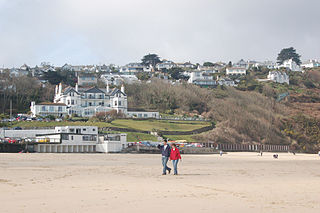
Carbis Bay is a seaside resort and village in Cornwall, England. It lies 1 mile (1.6 km) southeast of St Ives, on the western coast of St Ives Bay, on the Atlantic coast. The South West Coast Path passes above the beach.
Gladden means to bring happiness or to become happier. It may also refer to:

Godrevy is an area on the eastern side of St Ives Bay, west Cornwall, England, United Kingdom, which faces the Atlantic Ocean. It is popular with both the surfing community and walkers. It is part owned by the National Trust, and offshore on Godrevy Island is a lighthouse maintained by Trinity House which is said to be the inspiration for Virginia Woolf's novel To the Lighthouse. Godrevy lies within the Cornwall Area of Outstanding Natural Beauty (AONB) and the South West Coast Path runs around the whole promontory. There are several public car parks on the western side where the National Trust owns and operates a café.

The St Ives Bay Line is a 4.25 miles (6.84 km) railway line from St Erth to St Ives in Cornwall, England, United Kingdom. It was opened in 1877, the last new 7 ft broad gauge passenger railway to be constructed in the country. Converted to standard gauge in 1892, it continues to operate as a community railway, carrying tourists as well as local passengers. It has five stations including the junction with the Cornish Main Line at St Erth.

Aire Point to Carrick Du SSSI is a Site of Special Scientific Interest on the Penwith Peninsula, Cornwall, England. It is 5.98 square kilometres in extent, stretching from grid reference SW360279 to grid reference SW513410. The site is designated both for its biological and its geological interest.

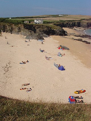
The Hayle Estuary and Carrack Gladden SSSI is a Site of Special Scientific Interest, noted for its biological interest, in west Cornwall, England, UK. It consists of three distinct parts, each of which is covered in a separate article: the Hayle Estuary, the sand-dune system of Porth Kidney Sands and the coastal headland at Carrack Gladden.

Hayle is a port town and civil parish in west Cornwall, England, United Kingdom. It is situated at the mouth of the Hayle River and is approximately seven miles (11 km) northeast of Penzance.
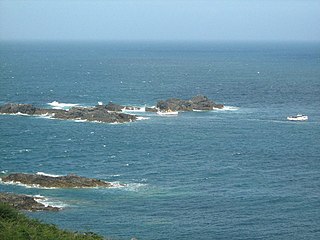
The Carracks and Little Carracks are a group of small rocky inshore islands off the Atlantic north coast of west Cornwall, England, United Kingdom. The name comes from "carrek", the Cornish language word for 'rock'. The Little Carracks were still known as Carrack an Heythen c. 1920. The islands are in Zennor civil parish.

Penwith Hundred was one of ten ancient administrative hundreds of the county of Cornwall, England, UK. The ancient hundred of Penwith was larger than the local government district of Penwith (1974–2009) which took its name. Daphne du Maurier in Vanishing Cornwall suggests that the name, Penwith, has three renderings, "the last promontory," "promontory on the left, and "the headland of slaughter," thus suggesting that this area might have been the site of prehistoric invasions of sea-borne fighters, or perhaps tribal battles. The eastern part became part of Kerrier District.

Lelant or Uny Lelant is a village in the civil parish of St Ives in, west Cornwall, England, UK. It is on the west side of the Hayle Estuary, about 2+1⁄2 miles (4.0 km) southeast of St Ives and one mile (1.6 km) west of Hayle. The village is part of the Lelant and Carbis Bay ward on Cornwall Council, and also the St Ives Parliamentary constituency. The birth, marriage, and death registration district is Penzance. Its population at the 2011 census was 3,892 The South West Coast Path, which follows the coast of south west England from Somerset to Dorset passes through Lelant, along the estuary and above Porth Kidney Sands.

The River Hayle is a small river in West Cornwall, England, United Kingdom which issues into St Ives Bay at Hayle on Cornwall's Atlantic coast.

Towan is found in many placenames in Cornwall. However, The Towans usually refers to the three-mile (5 km) stretch of coastal dunes which extends north-east from the estuary of the River Hayle to Gwithian beach with a midpoint near Upton. The South West Coast Path crosses the towans.
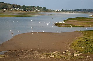
The Hayle Estuary is an estuary in west Cornwall, England, United Kingdom. It is one of the few natural harbours on the north coast of south-west England and during the prehistoric and early medieval periods was important for trade and the movement of people and ideas.
Trevose Head is a headland on the Atlantic coast of north Cornwall, on the south-western coast of Great Britain. It is situated approximately 5 miles (8.0 km) west of Padstow. The South West Coast Path runs around the whole promontory and is within the Cornwall Area of Outstanding Natural Beauty and the Trevose Head Heritage Coast. In clear weather, visitors to Trevose Head can see virtually the whole length of the north Cornwall coast; to the north, the view extends beyond the Cornwall county boundary to Hartland Point, Devon; to the south, it extends beyond St Ives to the headland at Pendeen Watch.
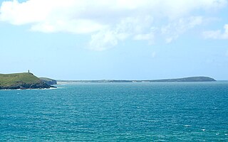
St Ives Bay is a bay on the Atlantic coast of north-west Cornwall, England, United Kingdom. It is in the form of a shallow crescent, some 4 miles or 6 km across, between St Ives in the west and Godrevy Head in the east.
Polventon Bay, Mother Ivey's Bay is a bay and bathing beach on the north coast of Cornwall, United Kingdom. The bay is on east side of the headland, Trevose Head and within the parish of St Merryn. The South West Coast Path, which follows the coast of south-west England from Somerset to Dorset follows the cliff above the bay.

Botallack is a village in west Cornwall, England, United Kingdom. It lies along the B3306 road which connects St Ives in the east to the A30 road, near Land's End. The village is included in the St Just in Penwith division on Cornwall Council. The original 1970s BBC television series Poldark was filmed partly in Botallack, using Manor Farm as Nampara. The Manor House, part of the Tregothnan estate, is a Grade II* listed building, dating from the 17th century.

Carricknath Point to Porthbean Beach is a coastal Site of Special Scientific Interest (SSSI) in Cornwall, England, UK, noted for its biological interest.
