
Fowey is a port town and civil parish at the mouth of the River Fowey in south Cornwall, England, United Kingdom. The town has been in existence since well before the Norman invasion, with the local church first established some time in the 7th century; the estuary of the River Fowey forms a natural harbour which enabled the town to become an important trading centre. Privateers also made use of the sheltered harbourage. The Lostwithiel and Fowey Railway brought China clay here for export.

Charlestown is a village and port on the south coast of Cornwall, England, in the civil parish of St Austell Bay. It is situated approximately 2 miles (3 km) south east of St Austell town centre.

Mevagissey is a village, fishing port and civil parish in Cornwall, England, United Kingdom. The village is situated approximately five miles (8 km) south of St Austell. The parish population at the 2011 census was 2,015, whereas the ward population at the same census was 4,354.

Tywardreath is a small hilltop village on the south coast of Cornwall, England, United Kingdom, about 3 miles (5 km) north west of Fowey. It is located in a sheltered spot overlooking a silted up estuary opposite Par and near the beach of Par Sands. It is on the Saints' Way path.
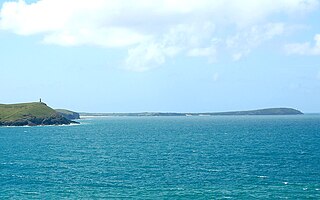
Pentire Head is a headland and peninsula on the Atlantic coast in North Cornwall, England, and is about one mile square. The headland projects north-west with Pentire Point at its north-west corner and The Rumps promontory at its north-east corner.

Rashleigh is a surname of a prominent family from Cornwall and Devon in south western Britain, which originated in the 14th century or before at the estate of Rashleigh in the parish of Wembworthy, Devon. The principal branches were:
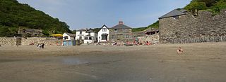
Polkerris is a small village on the south coast of Cornwall, England. It forms part of the civil parish of Fowey.

The North Devon Coast is a designated Area of Outstanding Natural Beauty in Devon, England, designated in September 1959. The AONB contributes to a family of protected landscapes in the Southwest of England and a total of 38% of the region is classified by the International Union for Conservation of Nature as Category V Protected Landscapes. The twelve Areas of Outstanding Natural Beauty extend to 30% of the region, twice the proportion covered by AONBs in England as a whole and a further two National Parks, Dartmoor and Exmoor, cover an additional 7%.
Stepper Point is a headland on the Atlantic coast in north Cornwall, England, United Kingdom. It is at grid reference SW911781. Stepper Point and Pentire Point stand at either side of the mouth of the River Camel; Stepper to the south-west, Pentire to the north-east.

Philip Rashleigh of Menabilly, Cornwall, was an antiquary and Fellow of the Royal Society and a Cornish squire. He collected and published the Trewhiddle Hoard of Anglo-Saxon treasure, which still gives its name to the "Trewhiddle style" of 9th century decoration.

Duporth was situated on Porthpean Road, just outside St Austell in south Cornwall, England, UK. For over 50 years, it was a holiday resort, until its closure in 2006. The site has now been sold to private developers and now contains new houses in the traditional Cornish cottage style.
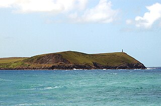
Trevose Head is a headland on the Atlantic coast of north Cornwall, on the south-western coast of Great Britain. It is situated approximately 5 miles (8.0 km) west of Padstow. The South West Coast Path runs around the whole promontory and is within the Cornwall Area of Outstanding Natural Beauty and the Trevose Head Heritage Coast. In clear weather, visitors to Trevose Head can see virtually the whole length of the north Cornwall coast; to the north, the view extends beyond the Cornwall county boundary to Hartland Point, Devon; to the south, it extends beyond St Ives to the headland at Pendeen Watch.


Polmear is a hamlet in Cornwall, England, UK. It is located on the A3082 road close to Par Sands and the village of Par. Part is in the civil parish of Fowey and part in Par and Tywardreath parish. The centre of Fowey is some 3 miles (4.8 km) distant, whilst Par railway station is less than 1 mile (1.6 km) away. Polmear used to be known as East Polmear and West Polmear is now known as Charlestown, and has been since Charles Rashleigh built the harbour there.
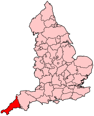
The following outline is provided as an overview of and topical guide to Cornwall: Cornwall – ceremonial county and unitary authority area of England within the United Kingdom. Cornwall is a peninsula bordered to the north and west by the Celtic Sea, to the south by the English Channel, and to the east by the county of Devon, over the River Tamar. Cornwall is also a royal duchy of the United Kingdom. It has an estimated population of half a million and it has its own distinctive history and culture.
Presented below is an alphabetical index of articles related to Cornwall:
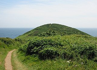
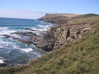
Black Head is a headland at the western end of St Austell Bay, in Cornwall, England. It is owned by the National Trust.


