Cedar Avenue

Last updated
Cedar Avenue
North end Hennepin County 152.svg Washington Avenue, Minneapolis
South endGreenvale Avenue, Northfield

Cedar Avenue is a roadway that runs from Minneapolis to Northfield in the U.S. state of Minnesota. The roadway is known as Minnesota State Highway 77 in the busiest portion of the route, from Minneapolis to Apple Valley. The portions north and south of this are county roads, Hennepin County 152 and Dakota County 23, respectively. Its northern terminus in Minneapolis is at Washington Avenue in Cedar-Riverside, though its alignment is briefly interrupted by an interchange at Hiawatha Avenue to the south.

Contents

Route description

Cedar Avenue at East 24th Street in Minneapolis, looking southbound. Cedar Avenue at East 24th Street in Minneapolis, Minnesota.jpg
Cedar Avenue at East 24th Street in Minneapolis, looking southbound.

Cedar Avenue begins as a two-lane, undivided road in the northwestern edge of Northfield at Greenvale Avenue. It goes north, following the Falk Avenue-Eveleth Avenue plane into Dakota county, jogs west to Foliage Avenue at 320th St and west again to Galaxie Avenue at 280th Street. From 280th Street northward, Cedar Avenue is relatively continuous, with official signage first showing the name near 250th Street. There is a small rural commercial district between 250th Street and Lakeville, containing multiple greenhouses and a Buddhist temple. In Lakeville just south of 215th Street, Cedar becomes a wider four-lane roadway, and gradually more urban as it enters Lakeville. In Apple Valley Cedar goes to six lanes, and becomes a main suburban thoroughfare. At the north end of Apple Valley, near 140th Street, the county road portion ends, and Cedar becomes Minnesota State Highway 77.

Cedar Avenue Bridge over Minnesota River in Bloomington Cedar Ave Bridge over Minnesota River - Straight On.jpg
Cedar Avenue Bridge over Minnesota River in Bloomington

Cedar Avenue continues north through Eagan and across the Minnesota River at the Cedar Avenue Bridge in Bloomington. North of East Old Shakopee Road, the Cedar Avenue name is not officially signed. Cedar Avenue passes the Mall of America near its junction with Minnesota State Highway 5/Interstate 494. It continues as a freeway on the east edge of Richfield before entering Minneapolis as a two-lane city street. At the southern border of Minneapolis, its designation at Highway 77 ends and it becomes Hennepin County Road 152. Cedar continues straight north, directly across a causeway over Lake Nokomis. At Lake Street, it passes the Pioneers and Soldiers Cemetery. At Hiawatha Avenue, the road jogs slightly east to facilitate an interchange. Traffic then goes west again, and north through the Cedar-Riverside neighborhood, named after the avenue. The final junction of Cedar is at Washington Avenue. This final terminus is known as Seven Corners. Hennepin County Road 152 continues into downtown Minneapolis on Washington Avenue South.

The portion south of 250th St W in Eureka Township is no longer signed as Cedar Avenue for compliance with the Dakota County grid. Nevertheless, it remains Dakota County 23 and is usually referred to as Cedar Avenue [1] (example [2] ).

Historical changes

In Dakota County, Cedar Avenue was re-routed between Interstate 35E and the Minnesota River, to accommodate the freeway and new river crossing. The old Cedar Avenue is now known as Nicols Road.

In Hennepin County, Cedar Avenue was rebuilt slightly east of its old alignment. The old alignment is known as Old Cedar Avenue, and is no longer continuous; it is interrupted at Highway 5/494, 66th Street, and Minnesota State Highway 62. Old Cedar Avenue and Cedar Avenue merge at Edgewater Boulevard in Minneapolis.

At Hiawatha Avenue, Cedar Avenue was rerouted slightly east to accommodate an interchange.

Downtown, Cedar Avenue used to cross the Mississippi River at what is now the 10th Avenue Bridge; instead, it now ends at Washington Avenue.

Cultural district

In 2020, Minneapolis officials designated a portion Cedar Avenue South as one of seven cultural districts in the city. [3] The district's boundaries were centered around the intersection of Cedar and Riverside avenues in the Cedar-Riverside neighborhood. The purpose of the cultural district was to promote racial equity, preserve cultural identity, and promote economic growth. [4] [5]

Bus Rapid Transit

Between Mall of America and 155th Street, Cedar Avenue houses the Red Line, previously known as the Cedar Avenue Bus Rapid Transitway.

Major intersections

CountyLocationmi [6] [7] kmDestinationsNotes
Rice Northfield 0.731.17Greenvale AvenueSouthern terminus; CSAH 43 signage continues until Forest Avenue
RiceDakota
county line
1.05
0.000
1.69
0.000
End plate.svg
County 43 square.svg
Begin plate blue.svg
County 23 (MN).svg
CSAH 43 ends / CSAH 23 begins / North Avenue
Street assumes CSAH 23 mileage
Dakota Greenvale Township 0.9171.476East plate.svg
County 96 square.svg
CR 96 east (320th Street)
Northern end signed Eveleth Avenue; south end of CR 96 overlap
2.0003.219West plate.svg
County 96 square.svg
CR 96 west (320th Street)
Southern end signed Foliage Avenue; north end of CR 96 overlap
GreenvaleEureka
township line
6.31710.166East plate blue.svg
County 86 (MN).svg
CSAH 86 east (280th Street) Castle Rock
Northern end signed Foliage Avenue; south end of CSAH 86 overlap
6.51710.488West plate blue.svg
County 86 (MN).svg
CSAH 86 west (280th Street)
Southern end signed Galaxie Avenue; north end of CSAH 86 overlap
Eureka Township 8.83314.215East plate blue.svg
County 80 (MN).svg
CSAH 80 east (255th Street)
South end of CSAH 80 overlap
9.51415.311East plate blue.svg
County 80 (MN).svg
CSAH 80 east (250th Street)
Southern end signed Cedar Avenue; northern end signed Galaxie Avenue; north end of CSAH 80 overlap
Lakeville 13.36421.507East plate blue.svg
County 50 (MN).svg
CSAH 50 east (Lakeville Boulevard)
South end of CSAH 50 overlap; formerly MN 50
14.25922.948West plate blue.svg
County 50 (MN).svg
CSAH 50 west (202nd Street)
North end of CSAH 50 overlap
Apple Valley 19.493–
19.500
31.371–
31.382
County 42 (MN).svg CSAH 42
20.612
0.000
33.172
0.000
End plate blue.svg
County 23 (MN).svg
Begin plate blue.svg
MN-77.svg
CSAH 23 ends / MN 77 begins / 138th Street
Street assumes MN 77 mileage
1.5712.528County 38 square.svg CR 38  Zoo
1.9773.182127th Street / Palomino DriveSouthbound exit and northbound entrance only
Eagan 2.566–
3.122
4.130–
5.024
I-35E.svg I-35E  St. Paul, Albert Lea I-35E exit 92
3.6925.942County 32 (MN).svg CSAH 32 (Cliff Road)
4.7077.575County 30 square.svg CR 30 (Diffley Road)
5.2018.370 Cedar Grove Transit Station Buses only; left exits
5.4468.764MN-13.svg MN 13  St. Paul, Shakopee
Hennepin Bloomington 7.58712.210County 1 (MN).svg CSAH 1 (Old Shakopee Road)
8.41513.543Killebrew Drive / Lindau Lane
Unorganized Territory of Fort Snelling 8.176–
9.735
13.158–
15.667
I-494.svgMN-5.svg I-494  / MN 5 I-494 exits 2B-C
10.03716.153Diagonal BoulevardSouthbound exit and entrance only
10.55916.993County 53 (MN).svg CSAH 53 (66th Street)
11.393
17.628
18.335
28.370
MN-62.svgEnd plate blue.svg
MN-77.svg
Begin plate blue.svg
County 152 (MN).svg
MN 62  / MN 77 ends / CSAH 152 begins
Street assumes CSAH 152 mileage
Minneapolis 14.01722.558County 3 (MN).svg CSAH 3 (Lake Street)
13.254–
13.187
21.330–
21.222
MN-55.svg MN 55
12.780–
12.723
20.567–
20.476
East plate blue.svg
I-94.svg
I-94 east
Access to eastbound I-94 only
12.360–
12.301
19.891–
19.797
U of M East Bank / 3rd Street CSAH 122 / formerly MN 122
12.22519.674 Washington Avenue Northern terminus; CSAH 152 continues on Washington Avenue westbound
1.000 mi = 1.609 km; 1.000 km = 0.621 mi

See also

Related Research Articles

<span class="mw-page-title-main">Minnesota State Highway 55</span>

Minnesota State Highway 55 is a highway in west-central, central, and east-central Minnesota, which runs from the North Dakota state line near Tenney and continues east and southeast to its eastern terminus at its intersection with U.S. Highway 61 in Hastings.

<span class="mw-page-title-main">Minnesota State Highway 65</span> Highway in Minnesota

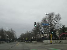
Minnesota State Highway 65 is a highway in the east–central and northeast parts of the U.S. state of Minnesota, which starts at its split from I-35W, skipping past the downtown Minneapolis core, only to resume at the intersection with Washington Avenue at the north end of downtown Minneapolis to continue north to its northern terminus at its intersection with U.S. Highway 71 (US 71) in Littlefork near International Falls.

<span class="mw-page-title-main">Minnesota State Highway 7</span> Highway in Minnesota

Minnesota State Highway 7, or Trunk Highway 7, is a state highway in Minnesota, which runs from its intersection with MN 28 near Beardsley and continues east to its terminus with MN 100 and County Road 25 (CR 25) in St. Louis Park. The highway runs east–west for approximately 194.2 miles (312.5 km) through mostly rural farmland in the central part of the state. On its western end, it is part of the Minnesota River Valley Scenic Byway where it runs northwest–southeast along the Minnesota River and associated lakes near the border with the adjoining state of South Dakota. For roughly 24 miles (39 km) of its route, it runs concurrently with U.S. Highway 59 (US 59) between Appleton and Montevideo. In Montevideo, the highway turns to the east cutting across the state. It passes through several small towns before entering the Twin Cities metropolitan area. In the metro area, MN 7 follows an expressway through several suburbs before terminating in St. Louis Park. Two different segments have been listed on the National Highway System, system of roads considered important to the country.

<span class="mw-page-title-main">Minnesota State Highway 77</span> Highway in Minnesota

Minnesota State Highway 77 (MN 77) is a 11.403-mile-long (18.351 km) highway in Minnesota, which runs from its intersection with 138th Street in Apple Valley and continues north to its northern terminus at its interchange with State Highway 62 in Minneapolis. MN 77 is also known as Cedar Avenue.

<span class="mw-page-title-main">County State-Aid Highway 42 (Minnesota)</span> Highway in Minnesota, U.S.

County State-Aid Highway 42 (CSAH 42), usually called County Road 42 (CR 42), is a 33.347-mile-long (53.667 km) county highway in Dakota and Scott counties in the southeastern part of the U.S. state of Minnesota. It is a primary arterial highway in the two counties. These two counties form the southernmost portion of the 13-county Twin Cities metropolitan area, although CSAH 42 travels across the northern reaches of the two counties.

<span class="mw-page-title-main">Lake Street (Minneapolis)</span>

Lake Street is a major east-west thoroughfare between 29th and 31st streets in Minneapolis, Minnesota United States. From its western most end at the city's limits, Lake Street reaches the Chain of Lakes, passing over a small channel linking Bde Maka Ska and Lake of the Isles, and at its eastern most end it reaches the Mississippi River. In May 2020, the Lake Street corridor suffered extensive damage during local unrest over the death of George Floyd. In August of the same year, city officials designated East Lake Street as one of seven cultural districts to promote racial equity, preserve cultural identity, and promote economic growth.

<span class="mw-page-title-main">Midtown Greenway</span> Shared-use path in Minneapolis, USA

The Midtown Greenway is a 5.7-mile (9.2 km) rail trail in Minneapolis, Minnesota that follows the path of an abandoned route of the Milwaukee Road railway. It is considered under segregated cycle facilities.

<span class="mw-page-title-main">Interstate 35E (Minnesota)</span> Interstate Highway in Minnesota, United States

Interstate 35E (I-35E) is an Interstate Highway in the US state of Minnesota, passing through downtown Saint Paul. It is one of two through routes for I-35 through the Twin Cities of Minneapolis and Saint Paul, the other being I-35W through Minneapolis. Thus, both ends of I-35E are shared with I-35W and I-35.

<span class="mw-page-title-main">Minnesota State Highway 101</span>

Minnesota State Highway 101 is a state highway in the U.S. state of Minnesota. The present day route currently has two separate segments. The roadway was a continuous route until 1988.

<span class="mw-page-title-main">U.S. Route 52 in Minnesota</span> Section of U.S. Highway in Minnesota, United States

U.S. Highway 52 (US 52) enters the state of Minnesota at the unincorporated community of Prosper, north of the town of Burr Oak, Iowa. The route is marked north–south in Minnesota along its independent segment from the Iowa state line to downtown St. Paul. US 52 is not signed along the length of its concurrency with Interstate 94 (I-94) from downtown St. Paul to the North Dakota state line at Moorhead and Fargo.

<span class="mw-page-title-main">County Road 81 (Hennepin County, Minnesota)</span> Highway in Hennepin County, Minnesota, US

County State-Aid Highway 81, also known as County Road 81, (County 81) is a county highway in Hennepin County, Minnesota, which runs from its interchange with Interstate 94 (I-94), CR 66, and CR 152 in the city of Minneapolis, and continues northwest to its terminus at Main Street in suburban Rogers. CR 81 is approximately 20 miles (32 km) long.

<span class="mw-page-title-main">South Dakota Highway 11</span> State highway in South Dakota, United States

South Dakota Highway 11 (SD 11) is a 77.724-mile (125.085 km) state highway in eastern South Dakota, United States. It connects the northern part of the Sioux City metropolitan area with the Sioux Falls metropolitan area.

<span class="mw-page-title-main">Minnesota State Highway 62 (Hennepin–Dakota counties)</span> Eastern highway in Minnesota

Minnesota State Highway 62 (MN 62) is a highway in the Twin Cities region of Minnesota. The route was part of County Road 62 (CR 62) until 1988, when a portion of the route was inherited by the state. The western terminus of the highway is at Interstate 494 (I-494) in Eden Prairie, where the roadway continues west as CR 62 to CR 101. The eastern terminus of the route is at the junction with I-494 in Inver Grove Heights. Locally, the original portion of the route in Hennepin County is known as "the Crosstown Highway" or simply "the Crosstown," though signage with this name does not appear on the highway itself, but only on local streets adjacent to the road. It is also used as an alternate name, even by the Minnesota Department of Transportation (MnDOT). The route is 18.6 miles (29.9 km) in length.

<span class="mw-page-title-main">County Road 122 (Hennepin County, Minnesota)</span> Highway in Minneapolis, Minnesota, US

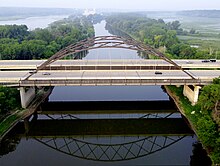
Hennepin County Road 122 (CR 122) or County State-Aid Highway 122 (CSAH 122) is an unsigned county state-aid highway within the city of Minneapolis, Hennepin County, Minnesota, United States, crossing the Mississippi River on the Washington Avenue Bridge.

<span class="mw-page-title-main">U.S. Route 169 in Minnesota</span> Section of U.S. Highway in Minnesota, United States

U.S. Highway 169 (U.S. 169) is a major north–south highway in the U.S. state of Minnesota, connecting the Minnesota River valley with the Twin Cities and the Iron Range. Much of the route is built to expressway or freeway standards.

<span class="mw-page-title-main">U.S. Route 212 in Minnesota</span> Section of U.S. Highway in Minnesota, United States

U.S. Highway 212 (US 212) within the state of Minnesota travels from the South Dakota state line in the west, crosses the southwestern part of the state, to the Minneapolis–Saint Paul metropolitan area in the east and end at its interchange with US 169 and State Highway 62 (MN 62) in the Minneapolis suburb of Edina. US 212 in Minnesota has an official length of 161.8 miles (260.4 km). It is an urban freeway within the Minneapolis–Saint Paul area and is mostly a two-lane rural road elsewhere in the state.

The MN&S Spur is a 18.5-mile (29.8 km) railroad line operated by the Progressive Rail Inc. The route runs through suburbs immediately west of Minneapolis, Minnesota, from MN&S Junction in Crystal south to Auto Club Junction in Bloomington near the Minnesota River. This path is parallel to Minnesota State Highway 100, which is about half a mile east of the rail line.

Lyndale Avenue is a major street in the U.S. state of Minnesota that traverses the cities of Minneapolis, Brooklyn Center, Richfield, and Bloomington. A noncontiguous portion also exists in Faribault, part of Highway 21. There are several commercial districts along the street, including Lyn-Lake in South Minneapolis, Shops at Lyndale in Richfield, and the Oxboro area in Bloomington. Portions of both Interstate 94 and Interstate 35 run on the right-of-way of Lyndale Avenue.

<span class="mw-page-title-main">County Road 61 (Hennepin County, Minnesota)</span> Highway in Hennepin County, Minnesota, US

Hennepin County Road 61 or County State-Aid Highway 61 is a 24.853-mile-long (39.997 km) major route along the east side of Interstate 494 (I-494) in Hennepin County, Minnesota. The route travels through the west suburbs of the Twin Cities through Maple Grove, Plymouth, Minnetonka, Hopkins and Eden Prairie.

References

  1. "Map of Northfield" (PDF). Rice County. Archived from the original (PDF) on 2011-09-27.
  2. "Neighbors ask for a speed reduction and get increase instead". Northfield News.
  3. Staff (2020-08-14). "Minneapolis City Council Approves 7 New Cultural Districts To Advance Equity, Fuel Economic Growth". WCCO . Retrieved 2020-11-25.
  4. "Cultural Districts ordinance (2020-00446)" (PDF). City of Minneapolis. 2020-08-22.
  5. "City Council approves boundaries for seven new Cultural Districts". City of Minneapolis News. 2020-08-14. Retrieved 2020-12-14.
  6. "Trunk Highway Log Point Listing - Construction District 5" (PDF). Minnesota Department of Transportation. August 20, 2010. Archived from the original (PDF) on June 27, 2011. Retrieved November 14, 2010.
  7. "Logpoint Listings". Minnesota Department of Transportation. Archived from the original on March 4, 2022. Retrieved February 3, 2022.