Hennepin County is a county in the U.S. state of Minnesota. Its county seat is Minneapolis, the state's most populous city. The county is named for the 17th-century explorer Louis Hennepin. It extends from Minneapolis to the suburbs and outlying cities in the western part of the county. Its natural areas are covered by extensive woods, hills, and lakes.

Saint Anthony Falls, or the Falls of Saint Anthony, located at the northeastern edge of downtown Minneapolis, Minnesota, is the only natural major waterfall on the Mississippi River. Throughout the mid-to-late 1800s, various dams were built atop the east and west faces of the falls to support the milling industry that spurred the growth of the city of Minneapolis. In 1880, the central face of the falls was reinforced with a sloping timber apron to stop the upstream erosion of the falls. In the 1950s, the apron was rebuilt with concrete, which makes up the most visible portion of the falls today. A series of locks were constructed in the 1950s and 1960s to extend navigation to points upstream.

Louis Hennepin, OFM was a Belgian Catholic priest and missionary best known for his activities in North America. A member of the Recollects, a minor branch of the Franciscans, he travelled to New France and proselytised to several Native American tribes.

The Seward neighborhood in Minneapolis, Minnesota, United States, is a neighborhood in the Longfellow community of Minneapolis located geographically southeast of downtown. It consists of the land bordered by the Hiawatha Avenue industrial district to the west, Minneapolis Midtown Greenway to the south, the Mississippi River to the east, and Interstate 94 to the north.

Holland is a neighborhood in the Northeast community in Minneapolis. It is one of ten neighborhoods in Ward 1 of Minneapolis, currently represented by Council President Elliott Payne.

Minneapolis is officially defined by its city council as divided into 83 neighborhoods. The neighborhoods are historically grouped into 11 communities. Informally, there are city areas with colloquial labels. Residents may also group themselves by their city street suffixes, North, Northeast, South, Southeast, and Southwest.

Nicollet Island is an island in the Mississippi River just north of Saint Anthony Falls in central Minneapolis, Minnesota. According to the United States Census Bureau the island has a land area of 194,407 square metres (0.075 sq mi) and a 2000 census population of 144 persons. The island makes up a large part of the city-designated Nicollet Island/East Bank neighborhood. The island is named for cartographer Joseph Nicollet, who mapped the Upper Mississippi in the 1830s.

The Grand Rounds National Scenic Byway is a linked series of park areas in Minneapolis, Minnesota, United States, that takes a roughly circular path through the city. The Minneapolis Park and Recreation Board developed the system over many years. The corridors include roads for automobile traffic plus separate paths for pedestrians and bicycles, and extend slightly into neighboring cities. About 50 miles (80 km) of roadway and paths are in the system, and much of it was built in the 1930s as part of Civilian Conservation Corps projects.

The Cooper neighborhood resides along the west shore of the Mississippi River in south Minneapolis. It is bound by 34th St. E. on the south, 38th Ave. S. on the west, 27th St. E. on the north, and the river gorge to the east. Bordering neighborhoods are Seward to the north, Longfellow to the west, and Howe to the south. St. Paul's Merriam Park neighborhood is just across the Mississippi River to the east.
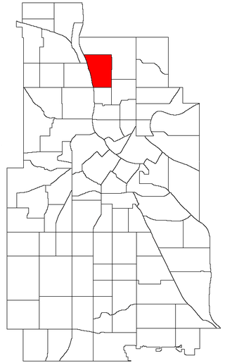
The Audubon Park neighborhood is located in the Northeast community in Minneapolis. Audubon Park is one of ten neighborhoods in Ward 1 of Minneapolis, currently represented by Council President Elliott Payne. The neighborhood is bounded by Saint Anthony Parkway to the north, NE Stinson Parkway to the east, NE Lowry Avenue to the south, and Central Avenue to the west. Stinson Parkway and St. Anthony Parkway are both part of the Grand Rounds National Scenic Byway. Stinson Parkway is also the city's border with St. Anthony.
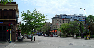
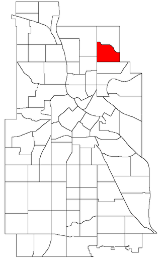
Northeast is a defined community in the U.S. city of Minneapolis that is composed of 13 smaller neighborhoods whose street addresses end in "NE". Unofficially it also includes the neighborhoods of the University community which have "NE" addresses, and the entirety of the Old Saint Anthony business district, which sits on the dividing line of "NE" and "SE" addresses. In the wider community, this business district, which is the oldest settlement in the city, is often identified as the heart of Northeast, in part because it lies across the Mississippi River from Downtown Minneapolis. Northeast is sometimes referred to as "Nordeast", reflecting the history of northern and eastern European immigrants and their language influence.
Nicollet Island/East Bank is a neighborhood in the University community of Minneapolis. It is a part of Minneapolis City Council Ward 3, represented by Michael Rainville.

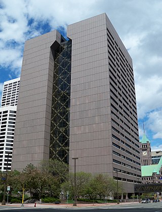
Downtown West is an official neighborhood in Minneapolis, part of the larger Central community. It is the heart of downtown Minneapolis, containing the bulk of high-rise office buildings in the city, and is what comes to mind when most Minneapolitans think of "downtown". The neighborhood is split between Wards 3 and 7 of the Minneapolis City Council, represented by Michael Rainville and Katie Cashman, respectively.

Marcy-Holmes is a neighborhood in the University community of Minneapolis. The majority of the area is residential and sits upon a bluff overlooking the river and the city skyline. A small section of the neighborhood along the river is an industrial zone.

Beltrami is a neighborhood in the Northeast community in Minneapolis. Its boundaries are Broadway Street NE to the north, Interstate 35W to the east, East Hennepin Avenue to the south, and Central Avenue and Harrison Street NE to the west. Beltrami neighborhood and park are named after Giacomo Constantino Beltrami, an early 19th-century Italian jurist, scholar and explorer.

Columbia Park is a neighborhood in the Northeast community in Minneapolis. Its boundaries are 37th Avenue NE to the north, Central Avenue to the east, 27th Avenue NE to the south, and both University Avenue & Saint Anthony Parkway streets to the west. It is one of ten neighborhoods in Ward 1 of Minneapolis, currently represented by Council President Elliott Payne.

Waite Park is a neighborhood in the Northeast community in Minneapolis, Minnesota. Its boundaries are 37th Avenue NE to the north, NE Stinson Boulevard to the East, Saint Anthony Parkway to the south, and NE Central Avenue to the west. It is the furthest northeast neighborhood within Minneapolis. It is one of ten neighborhoods in Ward 1 of Minneapolis, currently represented by Council President Elliott Payne, and falls under the jurisdiction of the second precinct of the Minneapolis Police Department.
Marshall Terrace is a neighborhood in the Northeast community in Minneapolis. It is one of ten neighborhoods in Ward 1 of Minneapolis, currently represented by Council President Elliott Payne.

Northeast Park is a neighborhood in the Northeast community in Minneapolis, Minnesota. Its boundaries are 18th Avenue NE and New Brighton Boulevard to the north, the city limits to the northeast, Interstate 35W to the southeast, Broadway Street NE to the south, and Central Avenue to the west. It is one of ten neighborhoods in Ward 1 of Minneapolis, currently represented by Council President Elliott Payne.

Sheridan is a neighborhood in the Northeast community of Minneapolis.

