Central, Minneapolis

Last updated
Central
MinneapolisCentralCommunity.PNG
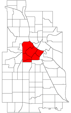
Location of Central Minneapolis in Minneapolis
Country United States
State Minnesota
County Hennepin
City Minneapolis
Neighborhoods
Area
[1]
  Total3.024 sq mi (7.83 km2)
Population
 (2023) [2]
  Total58,409 [3]
  Density19,315/sq mi (7,458/km2)
Time zone UTC-6 (CST)
  Summer (DST) UTC-5 (CDT)
ZIP Code
55401, 55402, 55403, 55404, 55405, 55411, 55415, 55454, 55487
Area code 612
Historical population
CensusPop.Note
1980 18,952
1990 21,15811.6%
2000 24,14914.1%
2010 29,72523.1%
2020 53,09378.6%
2023 (est.)58,409 [3] 10.0%
The skyline of Minneapolis in July 2008 2008-0712-MPLS-panorama.JPG
The skyline of Minneapolis in July 2008

Central is a defined community in Minneapolis that consists of six smaller official neighborhoods around the downtown and central business core. It also includes the many old flour mills, the Mill District, and other historical and industrial areas of downtown Minneapolis. It also includes some high-density residential areas surrounding it, excluding areas east of the Mississippi River. Businesses and government buildings are based in the Central area include the corporate headquarters of the Star Tribune , Target, US Bancorp, the Hennepin County Government Center, Minneapolis Central Library, Minneapolis City Hall, and the broadcast facilities of the Minnesota CBS station WCCO-TV.

Contents

Central neighborhoods

44°58′35″N93°16′26″W / 44.9763°N 93.2739°W / 44.9763; -93.2739 [4]

See also

Related Research Articles

<span class="mw-page-title-main">Hennepin County, Minnesota</span> County in Minnesota, United States

Hennepin County is a county in the U.S. state of Minnesota. Its county seat is Minneapolis, the state's most populous city. The county is named in honor of the 17th-century explorer Father Louis Hennepin. The county extends from Minneapolis to the suburbs and outlying cities in the western part of the county. The county's natural areas are covered with extensive woods, hills, and lakes.

<span class="mw-page-title-main">Minneapolis–Saint Paul</span> Metropolitan area in Minnesota, United States

Minneapolis–Saint Paul is a metropolitan area in the Upper Midwestern United States centered around the confluence of the Mississippi, Minnesota and St. Croix rivers in the U.S. state of Minnesota. It is commonly known as the Twin Cities after the area's two largest cities, Minneapolis and Saint Paul. Minnesotans often refer to the two together simply as "the cities". The area is Minnesota's economic, cultural, and political center.

<span class="mw-page-title-main">IDS Center</span> Skyscraper in Minneapolis

The IDS Center is an office skyscraper located at 80 South 8th Street in Minneapolis, Minnesota. Completed in 1973, it is the tallest building in Minneapolis, and the tallest building in the state at a height of 792 feet (241 m). It originally stood 775 feet 6 inches (236.37 m), though a 16-foot (4.9 m) garage for window washing equipment was added between 1978 and 1979. The structure rises to 910 feet (10,900 in) when including communications spires on the roof, indisputably the highest points in the city. The IDS was constructed as the headquarters of Investors Diversified Services, Inc.—now Ameriprise Financial. It also housed the headquarters of Dayton Hudson Corporation from 1972 until 2001.

<span class="mw-page-title-main">Capella Tower</span> Skyscraper

Capella Tower is an office skyscraper in Minneapolis, Minnesota, United States. The building opened in 1992 as First Bank Place, replacing One Financial Plaza as the headquarters for First Bank System. In 1997, First Bank System acquired US Bancorp and changed the name of the building to US Bancorp Place. The headquarters of US Bancorp moved into the US Bancorp Center in 2000, whereupon the tower changed to 225 South 6th Street. In March 2009, the building took its present name.

<span class="mw-page-title-main">Minneapolis City Hall</span> United States historic place

Minneapolis City Hall and Hennepin County Courthouse, designed by Long and Kees in 1888, is the main building used by the city government of Minneapolis, as well as by Hennepin County, in the U.S. state of Minnesota. The structure has served as mainly local government offices since it was built, and today the building is 60 percent occupied by the city and 40 percent occupied by the County. The building is jointly owned by the city and county and managed by the Municipal Building Commission. The Commission consists of the chair of the County Board, the mayor of the City of Minneapolis, a member of the County Board and a member of the Minneapolis City Council. The County Board chair serves as the president of the Commission and the mayor serves as the vice president. The building bears a striking resemblance to the city hall buildings in Cincinnati and Toronto. The City Hall and Courthouse was added to the National Register of Historic Places in 1974.

<span class="mw-page-title-main">Wells Fargo Center (Minneapolis)</span> Office in Minneapolis, Minnesota

The Wells Fargo Center, formerly known as Norwest Center, is the third-tallest building in Minneapolis, Minnesota, after the IDS Center and the Capella Tower. Completed in 1988, it is 774 feet (236 m) tall. For many years, this was believed to be one foot shorter than Capella, but that structure actually had a different height. Norwest Center was designed with a modernized art deco style by César Pelli, reflecting nearby structures such as the nearby CenturyLink Building and the Foshay Tower, which is several blocks away. It is also considered by many to be a homage to 30 Rockefeller Plaza in New York City.

<span class="mw-page-title-main">Lowry Hill East, Minneapolis</span> Neighborhood in Hennepin, Minnesota, United States

Lowry Hill East, also known as the Wedge, is a neighborhood in southwest Minneapolis, Minnesota, United States, part of the Calhoun Isles community. Lowry Hill East developed in the 1880s along a horse-drawn streetcar line built by Thomas Lowry. The interior of the neighborhood is residential, with large early 20th century homes and multi-unit apartment buildings, while the border streets are lined with bars, restaurants, grocery stores, coffeeshops, and other small businesses. Most housing is renter-occupied.

<span class="mw-page-title-main">Hennepin County Government Center</span> Government building in Minneapolis

Hennepin County Government Center is the courthouse and primary county government administration building for Hennepin County in the U.S. state of Minnesota. It is located in downtown Minneapolis, the county seat of Hennepin County. Before its construction, the Hennepin County government offices were housed in the Minneapolis City Hall-Hennepin County Courthouse. The building was opened in 1974 and occupied in stages in 1975.

<span class="mw-page-title-main">Soo Line Building</span> United States historic place

The Soo Line Building is a 19-story residential highrise in Minneapolis, Minnesota which was the tallest commercial building in the city from the time it was completed in 1915 until the 26-story Foshay Tower was built in 1929.

<span class="mw-page-title-main">Nicollet Island/East Bank, Minneapolis</span> Neighborhood in Hennepin, Minnesota, United States

Nicollet Island/East Bank is a neighborhood in the University community of Minneapolis.

<span class="mw-page-title-main">Downtown West, Minneapolis</span> Neighborhood in Hennepin, Minnesota, United States

Downtown West is an official neighborhood in Minneapolis, part of the larger Central community. It is the heart of downtown Minneapolis, containing the bulk of high-rise office buildings in the city, and is what comes to mind when most Minneapolitans think of "downtown".

<span class="mw-page-title-main">Downtown East, Minneapolis</span> Neighborhood in Hennepin, Minnesota, United States

Downtown East is an official neighborhood in Minneapolis, Minnesota, United States. Within Downtown East is the Mill District, which contains former industrial buildings left over from the days when Minneapolis was the flour milling capital of the world. Many of these old mills and factories are being converted to housing, bringing a residential population to a neighborhood that beforehand didn't have many residents. Because of this, the Mill District in Downtown East is one of the fastest growing areas of the city.

<span class="mw-page-title-main">Como, Minneapolis</span> Neighborhood in Hennepin, Minnesota, United States

Como is a neighborhood within the University community of Minneapolis. It is sometimes referred to as Southeast Como, due to many of its streets ending in SE, and possibly to differentiate it from the Como neighborhood in neighboring Saint Paul. Its boundaries are East Hennepin Avenue to the north, 33rd Avenue Southeast to the east, the Southeast Industrial Area to the south, and Interstate 35W to the west.

<span class="mw-page-title-main">Gateway District (Minneapolis)</span> Human settlement in Minneapolis, Minnesota, US

The Gateway District of Minneapolis is centered at the convergence of Hennepin Avenue, Nicollet Avenue, and Washington Avenue. Its borders are not officially designated or recognized, but are visible as the Mississippi River to the northeast, Cedar Lake Trail and the railroad tracks to the northwest, Fifth Avenue South to the southeast. and Fourth Street South to the southwest. The district includes a significant part of the Downtown West neighborhood and abuts the North Loop.

<span class="mw-page-title-main">History of Minneapolis</span> History of a US city

Minneapolis is the largest city by population in the U.S. state of Minnesota, and the county seat of Hennepin County. The origin and growth of the city was spurred by the proximity of Fort Snelling, the first major United States military presence in the area, and by its location on Saint Anthony Falls, which provided power for sawmills and flour mills.

<span class="mw-page-title-main">Minneapolis Skyway System</span> Pedestrian skyway system in downtown Minneapolis, Minnesota, United States

The Minneapolis Skyway System is an interlinked collection of enclosed pedestrian footbridges that connect various buildings in 80 full city blocks over 9.5 miles (15.3 km) of Downtown Minneapolis, enabling people to walk in climate-controlled comfort year-round. The skyways are owned by individual buildings in Minneapolis, and as such they do not have uniform opening and closing times. The 9.5 miles of skyway are comparable to the Houston tunnel system, the systems in Canadian cities such as Toronto's PATH, Montreal's Underground City, Calgary's 11-mile +15 system and the 8-mile Edmonton Pedway system.

<span class="mw-page-title-main">U.S. Bank Plaza (Minneapolis)</span>

The US Bank Plaza is a two-tower high-rise building complex in Minneapolis, Minnesota. US Bank Plaza I is a 561-foot (171 m) tall, 40-floor skyscraper. US Bank Plaza II is a 321-foot (98 m) tall, 23-floor skyscraper. Originally called Pillsbury Center, the complex was completed in 1981. The complex has a 500 car parking garage below and is connected by skyway to the Capella Tower, Hennepin County Government Center, Canadian Pacific Plaza, and the McKnight Building. Tower I served as the corporate headquarters of the Pillsbury Company from its 1981 completion until Pillsbury's acquisition by General Mills in 2001. The name of the building was changed to US Bank Plaza in 2004. The towers are clad in travertine marble and have bronze-tinted reflective windows.

<span class="mw-page-title-main">U.S. Bancorp Center</span> Skyscraper in Minneapolis, Minnesota

The US Bancorp Center is a 467-ft tall skyscraper in Minneapolis, Minnesota, United States. Completed in 2000, the 32-story building is the 15th-tallest in the city. It serves as corporate headquarters for US Bancorp and Piper Sandler. A skyway connects the building to the former Macy's/Daytons department store building, and Target. Several low-rise buildings were demolished to make way for this building, including the 808 Building. This is one of the three contiguous blocks designed by Ellerbe Becket from 1998 to 2001. The other two are 900 Nicollet Plaza and Target Plaza. It is the second-tallest office building completed in the United States in 2000, after the Ameriprise Financial Center, also in Minneapolis. The building was among those damaged by rioting during the George Floyd protests in Minneapolis–Saint Paul in May 2020. U.S. Bancorp Center has twice been awarded the International Outstanding Building of the Year award for office buildings in 2014 and 2023.

<span class="mw-page-title-main">Canadian Pacific Plaza</span>

Canadian Pacific Plaza is a 383-ft tall skyscraper in Minneapolis, Minnesota. It was completed in 1960 and has 28 floors. It is the 21st-tallest building in the city. It is the first major post-World War II skyscraper built in Minneapolis. It is also the city's tallest building completed in the 1960s. A skyway connects the building to the Rand Tower, Soo Line Building, and US Bank Plaza.

References

  1. "Greater Central neighborhood in Minneapolis, Minnesota (MN), 55401, 55402, 55403, 55404, 55415 detailed profile". City-Data. 2011. Retrieved 2013-11-12.
  2. "Minneapolis Community Profile: Central" (PDF). Minnesota Compass. October 2011. Retrieved 2013-11-12.
  3. 1 2 "Downtown Minneapolis Population Grew 2.9% in 2023". 7 February 2024.
  4. Central, Minneapolis, MN. Google Earth. Retrieved 2011-03-09.
  5. Central, Minneapolis, MN. Google Earth. Retrieved 2011-03-09.