| Qahar Right Rear Banner 察哈尔右翼后旗 • ᠴᠠᠬᠠᠷᠪᠠᠷᠠᠭᠤᠨᠭᠠᠷᠤᠨᠬᠣᠶᠢᠲᠤᠬᠣᠰᠢᠭᠤ | |
|---|---|
| Banner | |
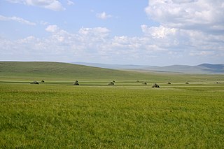
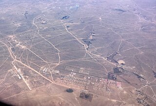
Aerial view over central parts of the county, with agriculture and Guangmingcun open-pit mine. | |
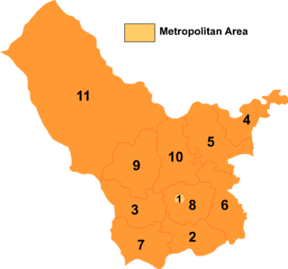
Ulanqab's divisions: Chahar Right Rear Banner is 10 on this map | |
| Coordinates: 41°26′N113°11′E / 41.433°N 113.183°E Coordinates: 41°26′N113°11′E / 41.433°N 113.183°E | |
| Country | People's Republic of China |
| Region | Inner Mongolia |
| Prefecture-level city | Ulaan Chab |
| Administrative Centre | Baiyinchagan Town |
| Elevation | 1,440 m (4,720 ft) |
| Time zone | China Standard (UTC+8) |
Chahar Right Rear Banner (Mongolian: ᠴᠠᠬᠠᠷᠪᠠᠷᠠᠭᠤᠨᠭᠠᠷᠤᠨᠬᠣᠶᠢᠲᠤᠬᠣᠰᠢᠭᠤ; Цахар баруун гарын хойд хошуу; Čaqar Baraɣun Ɣarun Qoyitu qosiɣu; simplified Chinese :察哈尔右翼后旗; traditional Chinese :察哈爾右翼後旗; pinyin :Cháhā'ěr Yòuyì Hòuqí) is a banner of Inner Mongolia, People's Republic of China, bordering Shangdu County to the northeast, Xinghe County to the southeast, Chahar Right Front Banner to the south, Zhuozi County to the southwest, Chahar Right Rear Banner to the west, Siziwang Banner to the northwest, and Xilin Gol to the north. It is under the administration of Ulaan Chab City, which lies to the south along the G55 Erenhot–Guangzhou Expressway. The most important settlement in the banner is Baiyinchagan.
The Mongolian languageMoŋɣol kele; in Mongolian Cyrillic: монгол хэл, mongol khel) is the official language of Mongolia and both the most widely-spoken and best-known member of the Mongolic language family. The number of speakers across all its dialects may be 5.2 million, including the vast majority of the residents of Mongolia and many of the Mongolian residents of the Inner Mongolia Autonomous Region. In Mongolia, the Khalkha dialect, written in Cyrillic, is predominant, while in Inner Mongolia, the language is dialectally more diverse and is written in the traditional Mongolian script. In the discussion of grammar to follow, the variety of Mongolian treated is Standard Khalkha Mongolian, but much of what is to be said is also valid for vernacular (spoken) Khalkha and for other Mongolian dialects, especially Chakhar.
Simplified Chinese characters are standardized Chinese characters prescribed in the Table of General Standard Chinese Characters for use in mainland China. Along with traditional Chinese characters, they are one of the two standard character sets of the contemporary Chinese written language. The government of the People's Republic of China in mainland China has promoted them for use in printing since the 1950s and 1960s to encourage literacy. They are officially used in the People's Republic of China and Singapore.
Traditional Chinese characters are Chinese characters in any character set that does not contain newly created characters or character substitutions performed after 1946. They are most commonly the characters in the standardized character sets of Taiwan, of Hong Kong and Macau, and in the Kangxi Dictionary. The modern shapes of traditional Chinese characters first appeared with the emergence of the clerical script during the Han Dynasty, and have been more or less stable since the 5th century.
Chahar, also known as Chaha'er, Chakhar, or Qahar, was a province of the Republic of China in existence from 1912 to 1936, mostly covering territory in what is part of eastern Inner Mongolia. It was named after the Chahar Mongolians.
A banner is an administrative division of the Inner Mongolia Autonomous Region in the People's Republic of China, corresponding to the county level.
The Chahar People's Anti-Japanese Army (察哈尔民众抗日同盟军) consisted mostly of former Northwestern Army units under Feng Yuxiang, troops from Fang Zhenwu's Resisting Japan and Saving China Army, remnants of the provincial forces from Jehol, Anti-Japanese volunteers from Manchuria and local forces from Chahar and Suiyuan. Even the Japanese puppet Liu Guitang switched sides, joining the Chahar People's Anti-Japanese Army, as did the Suiyuan bandit leader Wang Ying.
Hongort is a town (镇) of the Chahar Right Back Banner, which in turn is part of Ulanqab prefecture-level city in Inner Mongolia, China. It is located about 30 km northwest of Shangdu county. In 2000, when it was still classified as township (乡), it had 11860 inhabitants.
Ergun, formerly Ergun Right Banner, is a county-level city in Inner Mongolia, containing the autonomous region's northernmost point. Administratively, Ergun is part of the prefecture-level city of Hulunbuir. It occupies 28,400 km2 (11,000 sq mi) on the right (south-eastern) bank of the Argun River, which forms China's border with Russia's Zabaykalsky Krai.
Bairin Right Banner is a banner of eastern Inner Mongolia, China. It is under the administration of Chifeng City, 143 kilometres (89 mi) to the south-southeast. Baarin Mongols live here. The distinct Mongolian dialect of this region is Baarin Mongolian.
Horqin Left Middle Banner, formerly known as Darhan hoshuu, is a banner of eastern Inner Mongolia, People's Republic of China, bordering Jilin province to the east. It is under the administration of Tongliao City, 101 kilometres (63 mi) to the southwest. The local Mongolian dialect is Khorchin Mongolian.
Horqin Left Rear Banner is a banner of southeastern Inner Mongolia, People's Republic of China, bordering Liaoning province to the south. It is under the administration of Tongliao City, 75 kilometres (47 mi) to the north. The local Mongolian dialect is Khorchin Mongolian.
New Barag Right Banner, also romanized as Xin Barag Youqi, is a banner of northern Inner Mongolia, People's Republic of China, bordering Mongolia in all directions but the east. It is also located not too far from the shores of Hulun Lake, and is under the administration of Hulunbuir City.
Xinghe County is a county of south-central Inner Mongolia, People's Republic of China, bordering the provinces of Hebei to the east and Shanxi to the south. It is under the administration of Ulaan Chab City, and is situated on the China National Highway 110 between Ulaan Chab and Zhangjiakou in Hebei province. Bordering county-level divisions include Fengzhen City to the southwest, Chahar Right Front Banner to the west, Chahar Right Back Banner to the northwest, and Shangdu County to the north.
Chahar or Qahar Right Front Banner is a Banner of Inner Mongolia, People's Republic of China, surrounding Jining District and bordering Xinghe County to the east, Fengzhen City to the south, Zhuozi County to the west, and Chahar Right Back Banner to the north. Its territory includes Lake Huangqi. It is under the administration of Ulaan Chab City. Its most important settlement is Tuguiwula, where Tuguiwula Railway Station is located.
Chahar Right Middle Banner is a banner of Inner Mongolia, People's Republic of China, bordered by Chahar Right Back Banner to the east, Zhuozi County to the south, and Siziwang Banner to the northwest. It is under the administration of Ulaan Chab City.
Horqin Right Front Banner is a banner in the east of Inner Mongolia, China, bordering Jilin province to the southeast. It is under the administration of Hinggan League. The local Mongolian dialect is Khorchin Mongolian.
Horqin Right Middle Banner is a banner in the east of Inner Mongolia, China, bordering Jilin province to the east. It is under the administration of Hinggan League. The local Mongolian dialect is Khorchin Mongolian.
Sonid Right Banner is a banner of Inner Mongolia, China, bordering Dornogovi Province of the Republic of Mongolia to the northwest. It is under the administration of Xilin Gol League. Sunud Mongols live here.
Alxa Right Banner is a banner in the southwest of Inner Mongolia, China, bordering Gansu province to the south and southwest. It is under the administration of Alxa League.
Alxa Right Banner Badanjilin Airport is a regional airport serving the town of Badanjilin, the seat of Alxa Right Banner in Inner Mongolia, China.
Lake Huangqi, also known by its Chinese name as the Huangqi Hai, is a lake in Chahar Right Front Banner, Ulanqab Prefecture, Inner Mongolia, China.
Xinbarag Youqi Baogede Airport is a general aviation airport serving New Barag Right Banner in Hulunbuir, Inner Mongolia, China. It is located northeast of the Baogede Wula Mountains, after which it is named. It is 13.5 kilometres (8.4 mi) from Alatan'emole Town, the seat of the banner, and 83 kilometres (52 mi) from the tri-border area of China, Mongolia, and Russia.
Sanchakou Township is a township under the administration of Qahar Right Front Banner in Inner Mongolia, China. As of 2018, it has 18 villages under its administration.
| Wikimedia Commons has media related to Chahar Right Rear Banner . |
| This Inner Mongolia location article is a stub. You can help Wikipedia by expanding it. |