
Inner Mongolia or Nei Mongol, officially the Inner Mongolia Autonomous Region or Nei Mongol Autonomous Region (NMAR), is one of the autonomous regions of the People's Republic of China, located in the north of the country. Its border includes most of the length of China's border with Mongolia. The rest of the Sino–Mongolian border coincides with part of the international border of the Xinjiang autonomous region and the entirety of the international border of Gansu province and a small section of China's border with Russia. Its capital is Hohhot; other major cities include Baotou, Chifeng, and Ordos.
Hulunbuir or Hulun Buir is a region that is governed as a prefecture-level city in northeastern Inner Mongolia, China. Its administrative center is located at Hailar District, its largest urban area. Major scenic features are the high steppes of the Hulun Buir grasslands, the Hulun and Buir lakes, and the Khingan range. Hulun Buir borders Russia to the north and west, Mongolia to the south and west, Heilongjiang province to the east and Hinggan League to the direct south. Hulunbuir is a linguistically diverse area: next to Mandarin Chinese, Mongolian dialects such as Khorchin and Buryat, the Mongolic language Daur, and some Tungusic languages are spoken there.

Ulanqab or Ulan Chab is a region administered as a prefecture-level city in south-central Inner Mongolia, People's Republic of China. Its administrative centre is in Jining District, which was formerly a county-level city. It was established as a prefecture-level city on 1 December 2003, formed from the former Ulanqab League.
The Hinggan League is a prefecture-level subdivision of the Inner Mongolia Autonomous Region of the People's Republic of China. It borders Hulun Buir to the north, the Republic of Mongolia and Xilingol League to the west, Tongliao to the south and the provinces of Jilin and Heilongjiang to the east. The name is derived from the Greater Khingan mountain range that crosses the league from the northwest to the southeast.

Hsingan refers to a former province, which once occupied western Heilongjiang and part of northwest Jilin provinces of China. The name is related to that of the Greater Khingan Mountains. Another name used for this land was Barga, which is also the name used for the western part of the province, the Barga district.
Tongliao is a prefecture-level city in eastern Inner Mongolia, People's Republic of China. The area is 59,535 square kilometres (22,987 sq mi) and population is 3,139,153 ; the city proper has 898,895 inhabitants (2010). The city was the administrative centre of the defunct Jirem League.
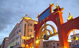
Manzhouli is a sub-prefectural city located in Hulunbuir prefecture-level city, Inner Mongolia Autonomous Region of China (PRC). Located on the border with Russia, it is a major land port of entry. It has an area of 696.3 square kilometres (268.8 sq mi) and a population of almost 250,000.
The Nen River or Nenjiang, or Nonni is a river in Northeast China. The Nen River flows through the northern part of Heilongjiang Province and the northeastern section of Inner Mongolia, some parts of the river forming the border between the two regions. At 1370 kilometres (850 mi) in length, the Nen River is the longest tributary of the Songhua River.
Ewenki Autonomous Banner is an autonomous banner that lies on the border between northwestern Greater Khingan and Hulun Buir grasslands and directly south of the urban district of Hailar in the prefecture-level city of Hulunbuir, People's Republic of China. It has an area of 19,111 km2 (7,379 sq mi). By 2013, there are 143,415 inhabitants with a population density of 7.5 inhabitants per km². Its seat is the town of Bayan Tohoi (巴彦托海镇). The most populous town in Ewenki Autonomous Banner, Dayan Town, which was once Dayan Mining Area as an administrative division and is now the main part of an industrial district also named Dayan Mining Area, has an area of 443 square kilometres and a population of about 73,000.

Yakeshi is a county-level city of Hulunbuir, Inner Mongolia, People's Republic of China.

Jalaid Banner, officially Jalaid Qi Zhalaite Banner, Hinggan League is a banner under the jurisdiction of Hinggan League in the northeast of the Inner Mongolia Autonomous Region, People's Republic of China. Jalaid Mongols live here.

Ergun, formerly Ergun Right Banner, is a county-level city in Inner Mongolia, containing the autonomous region's northernmost point. Administratively, Ergun is part of the prefecture-level city of Hulunbuir. It occupies 28,400 km2 (11,000 sq mi) on the right (south-eastern) bank of the Argun River, which forms China's border with Russia's Zabaykalsky Krai.

Shuangliao is a city in western Jilin, People's Republic of China, bordering Liaoning and Inner Mongolia. It is under the administration of Siping City.

Genhe (Gegengol), formerly Ergun Left Banner or Ergun Zuoqi, is a city in the far northeast of Inner Mongolia, People's Republic of China. It is administratively a county-level city of Hulunbuir City.

Nenjiang–Greater Khingan Forest railway or Nenlin railway, is a single-track railroad in northeastern China between Nenjiang and the town of Gulian, in Mohe County. It is also known as the Nenjiang–Mohe railway or Nenmo railway (嫩漠铁路). Both of the railway's terminals are located in Heilongjiang Province. In between, the line traverses the Greater Khingan range of Inner Mongolia. Much of the line is located within the jurisdiction of the Greater Khingan Forest District, a special forestry prefecture that covers parts of both Inner Mongolia and Heilongjiang.
Gan River or Gan He is a tributary of the Nen River in Inner Mongolia, China. It flows 446 km from the east flank of the Greater Khingan Range into the Nen River at Nenjiang, through the Morin Dawa Daur and the Oroqin Autonomous Banner of the vast Hulunbuir Municipality. It drains an area of over 20,000 km2 of mostly hills and plains. The Gan River basin is traditionally home to semi-nomadic Daur and Oroqen people.

The Yalu River is a river straddling the Chinese regions of Heilongjiang and Hulunbuir near the eastern border with Russia. As a right tributary of the Nen River, the Yalu starts on the eastern slopes of the Greater Khingan Range, and flows in the general south-eastern direction through Zalantun in Hulunbei'er and Qiqihar in Heilongjiang. The Yalu flows from the west into the Nen River some 100 kilometres (62 mi) south of Qiqihar.
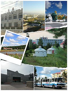
Xinghua Subdistrict is a subdistrict and the seat of Zhalantun, Inner Mongolia, China. As of 2011, it has five residential communities (居委会) under its administration.
Jalainur District or Zhalainuo'er District, an urban district under Manzhouli's administration, is listed as a district of Hulunbuir officially and located in the northeast of Inner Mongolia.


