Chatata

Last updated

Chatata, meaning "clear water", [1] is the original Cherokee name of an area located in Bradley County, Tennessee. Today the name survives in references to a number of locations in Bradley County, most notably Chatata Valley in the northeastern part of the county. Chatata was also the original name of an unincorporated community in this region now known as Tasso.

Contents

Description

Farms in Chatata Valley Chatata valley.jpg
Farms in Chatata Valley

The area originally called Chatata by the Cherokee consists of a geographical area located predominantly in northeastern Bradley County, but can also refer to locations west of this area. The name is best recognized in Chatata Valley, as well as Chatata Creek, which flows through this valley into the Hiwassee River to the north, and Little Chatata Creek, which flows in the next valley to the west. This area is located in the Ridge and Valley physiographic province of the Great Appalachian Valley, with a series of paralleling ridges running approximately north-northeast with valleys in between. The Hiwassee forms the northern boundary of Bradley County, and the Chatata area contains some of the lowest elevations in the county. [2]

Chatata Valley and portions of the surrounding valleys reportedly contain some of the most fertile soils in the region, which were originally cultivated by the Cherokee. The region contains a number of sites that were significant to the Cherokee, including Rattlesnake Springs and Beeler Spring. [3]

Today, Chatata Valley and the surrounding valleys remain some of the most productive agricultural areas in the region, with many large farms that raise cattle and grow crops including corn, soybeans, tobacco, and fruits and vegetables, as well as some dairy farms.

History

Before the arrival of the first European settlers, this area was inhabited by the Cherokee. A number of Cherokee settlements were located in the Chatata region, including a settlement called Fishtown, which was located two miles south of present day Tasso in present day Cleveland. [4] The Cherokee reportedly held council at Rattlesnake Springs and Beeler Spring, and a number of Cherokee burial grounds are known to be located in the region including at Rattlesnake Springs and on Beeler Ridge. [5] The Chatata region was reportedly a preferred farming region to the Cherokee, due to its fertile soils and excellent water sources.

In the early nineteenth century European settlers began moving into the Chatata region in anticipation of the forced removal of the Cherokee, and in 1821, the Indian Agency, the official liaison between the U.S. government and the Cherokee Nation, was established in present day Charleston on the Hiwassee River in northern Bradley County. [6] The Chatata region played a significant role during the Cherokee removal, with operations headquartered at Fort Cass in Charleston and several internment camps located in the region, with one of the largest at Rattlesnake Springs. [7]

The legislation creating Bradley County by the Tennessee General Assembly on February 10, 1836 mandated that county governmental activities be held at McCaslin's Methodist Campground in Chatata Valley until the location for the county seat of Cleveland was chosen. As part of the United States Bicentennial celebration, the Bradley County Quarterly Court held a meeting at this location in 1976. [8] Early on, Chatata Valley had mills, stores, churches, two schools, and a physician. [1] The Chatata Seminary, a boarding school, was established in Chatata Valley in 1867, and operated until about 1878. [9] The name Chatata was given to the Tasso community at some point before the American Civil War, before being renamed in 1905. [10] The railroad was constructed between Cleveland and Charleston in phases during the 1850s. Today, the Chatata region contains a number of historical sites, including a few homes that predate the Civil War. [11]

During the Civil War, Union troops under the command of general William T. Sherman camped in the valley directly east of Tasso and the railroad on multiple occasions in 1863. These troops reportedly abandoned at least one cannon in Little Chatata Creek south of Tasso after it got stuck in the creekbed while they were crossing. [12] This was also near the location of an unsuccessful attempt in the spring of 1864 by Confederate troops to destroy a passing union train with an explosive placed on the tracks, which instead resulted in the destruction of a passing Confederate train. A Confederate cavalry sword believed to have been from this wreck was accidentally discovered by a teenager in 1970. [13] Troops under the command of Sherman also camped at the Blue Springs Encampments and Fortifications in southern Bradley County.

The name Chatata is also archaeologically, geologically, and paleontologically significant because of the so-called Chatata Wall excavated in 1891 in northwestern Bradley County. That year, Isaac Hooper noticed a line of sandstone rocks protruding from the surface of his farm every 10 metres (33 ft) or so over a gently curving arc about 300 metres (980 ft) long. Unusual symbols seemed to be inscribed on one of these surface stones. [14] [15]

Visiting New York City professor Albert Leighton Rawson took an interest in this outcropping of rocks. Rawson (1829–1902) was a historian, writer and spiritualist who was the author of many late 19th century religious tracts and books including Evolution of Israel's God. He had participated in and organized outdoor religious meetings set among areas of striking natural and geological beauty in New York, most notably the 1878 Watkins Glen Freethinkers Convention. Intrigued by the Chatata site, he funded excavations there. A 1 metre (3.3 ft) high three-ply sandstone wall was unearthed with markings located on one surface of the middle layer. Rawson believed these markings to be Hebrew and claimed to have translated several chapters of the Old Testament from them, evidence to him that one or more of the Ten Lost Tribes of Israel had arrived in Tennessee before Europeans or possibly even the Cherokee. Subsequent visits to the site by other scientists, and samples from the Wall displayed for a time at the Smithsonian Institution, failed to generate support for Rawson's claims. The Chatata Wall faded from the public limelight, and today its exact location is effectively unknown. Eventually, the Chatata Wall was ultimately judged to be a natural phenomenon with only a minority of amateur investigators looking for evidence of ancient human origins for the markings. [14] [15]

See also

Related Research Articles

<span class="mw-page-title-main">Polk County, Tennessee</span> County in Tennessee, United States

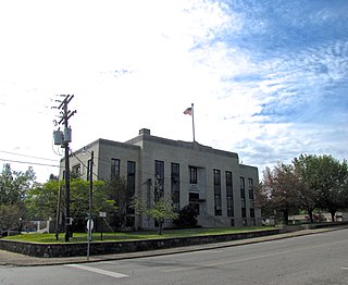
Polk County is a county located in the southeastern corner of the U.S. state of Tennessee. As of the 2020 United States census, its population was 17,544. Its county seat is Benton. The county was created on November 28, 1839, from parts of Bradley and McMinn counties, after final removal of most Cherokee from the region that year. The county was named after then-governor James K. Polk. Polk County is included in the Cleveland, Tennessee Metropolitan Area Statistical Area, which is also included in the Chattanooga–Cleveland–Dalton, TN–GA–AL Combined Statistical Area.

<span class="mw-page-title-main">Bradley County, Tennessee</span> County in Tennessee, United States

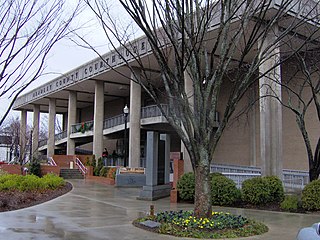
Bradley County is a county located in the southeastern portion of the U.S. state of Tennessee. As of the 2020 census, the population was 108,620, making it the thirteenth most populous county in Tennessee. Its county seat is Cleveland. It is named for Colonel Edward Bradley of Shelby County, Tennessee, who was colonel of Hale's Regiment in the American Revolution and the 15th Regiment of the Tennessee Volunteers in the War of 1812. Bradley County is included in the Cleveland, Tennessee Metropolitan Statistical Area, which is also included in the Chattanooga-Cleveland-Dalton, TN-GA-AL Combined Statistical Area.

<span class="mw-page-title-main">Charleston, Tennessee</span> City in Tennessee, United States

Charleston is a city in Bradley County, Tennessee, United States. The population was 664 at the 2020 census. It is included in the Cleveland Metropolitan Statistical Area.

<span class="mw-page-title-main">Cleveland, Tennessee</span> City in Tennessee, United States

Cleveland is the county seat of and largest city in Bradley County, Tennessee. The population was 47,356 at the 2020 census. It is the principal city of the Cleveland metropolitan area, Tennessee, which is included in the Chattanooga–Cleveland–Dalton, TN–GA–AL Combined Statistical Area.

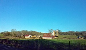
Hopewell is a census-designated place (CDP) and unincorporated community in Bradley County, Tennessee, United States. The population was 2,087 at the 2020 Census. It is included in the Cleveland, Tennessee Metropolitan Statistical Area.

<span class="mw-page-title-main">Calhoun, Tennessee</span> Town in Tennessee, United States

Calhoun is a town in McMinn County, Tennessee, United States. It is part of the Athens Micropolitan Statistical Area. The population was estimated at 536 in 2020.

<span class="mw-page-title-main">East Tennessee</span> Geographic region of Tennessee

East Tennessee is one of the three Grand Divisions of Tennessee defined in state law. Geographically and socioculturally distinct, it comprises approximately the eastern third of the U.S. state of Tennessee. East Tennessee consists of 33 counties, 30 located within the Eastern Time Zone and three counties in the Central Time Zone, namely Bledsoe, Cumberland, and Marion. East Tennessee is entirely located within the Appalachian Mountains, although the landforms range from densely forested 6,000-foot (1,800 m) mountains to broad river valleys. The region contains the major cities of Knoxville and Chattanooga, Tennessee's third and fourth largest cities, respectively, and the Tri-Cities, the state's sixth largest population center.

<span class="mw-page-title-main">Hiwassee River</span> River in Georgia, North Carolina and Tennessee

The Hiwassee River originates from a spring on the north slope of Rocky Mountain in Towns County in the northern area of the State of Georgia. It flows northward into North Carolina before turning westward into Tennessee, flowing into the Tennessee River a few miles west of what is now State Route 58 in Meigs County, Tennessee. The river is about 147 miles (237 km) long.

<span class="mw-page-title-main">Georgetown, Tennessee</span> Unincorporated community in Tennessee, United States

Georgetown is an unincorporated community at the junction of Bradley, Hamilton, and Meigs counties, Tennessee. The community is located along State Route 60 near its intersection with State Route 58.

Fort Cass was a fort located on the Hiwassee River in present-day Charleston, Tennessee, that served as the military operational headquarters for the entire Cherokee removal, an forced migration of the Cherokee known as the Trail of Tears from their ancestral homelands in the Southeast to Indian Territory in present-day Oklahoma. Fort Cass housed a garrison of United States troops who watched over the largest concentration of internment camps where Cherokee were kept during the summer of 1838 before starting the main trek west to Indian Territory, and served as one of three emigration deports where the Cherokee began their journey west, the others of which were located at Ross's Landing in Chattanooga and Gunter's Landing near Guntersville, Alabama.

<span class="mw-page-title-main">Red Clay State Historic Park</span> State park in Tennessee, United States

Red Clay State Historic Park is a state park located in southern Bradley County, Tennessee, United States. The park preserves the Red Clay Council Grounds, which were the site of the last capital of the Cherokee Nation in the eastern United States from 1832 to 1838 before the enforcement of the Indian Removal Act of 1830. This act resulted in a forced migration of most of the Cherokee people to present-day Oklahoma known as the Cherokee removal. At the council grounds, the Cherokee made multiple unsuccessful pleas to the U.S. government to be allowed to remain in their ancestral homeland. The site is considered sacred to the Cherokees, and includes the Blue Hole Spring, a large hydrological spring. It is also listed as an interpretive center along the Trail of Tears National Historic Trail.

<span class="mw-page-title-main">Blythe Ferry</span> United States historic place

Blythe Ferry was a ferry across the Tennessee River in Meigs County, Tennessee, United States. In 1838, the ferry served as a gathering point and crossing for the Cherokee Removal, commonly called the Trail of Tears, in which thousands of Cherokee were forced to move west to Oklahoma from their homeland in the southeastern United States.

<span class="mw-page-title-main">Walker Valley High School</span> Public high school in Bradley County, Tennessee, United States

Walker Valley High School (WVHS) is a public high school in the Bradley County Schools system located in the northern part of Bradley County, Tennessee near Charleston. The school serves about 1,600 students in grades 9–12.

<span class="mw-page-title-main">Blue Springs Encampments and Fortifications</span> United States historic place

Blue Springs Encampments and Fortifications is the site of a Civil War military encampment in Bradley County, Tennessee. Union Army forces commanded by General William Tecumseh Sherman camped at this location between October 1863 and April 1865. Entrenchments built on the crests of ridges overlooking the camps are still visible on the site. Stone reinforcements are present in some sections of the entrenchments.

<span class="mw-page-title-main">Bradley County Schools</span> School district in Tennessee

Bradley County Schools is a public school system based in Bradley County, Tennessee. All students living in the county attend these schools, except for those living in Cleveland; students in Cleveland attend schools in the Cleveland City Schools district.

Tasso is an unincorporated community located in Bradley County, Tennessee approximately five miles north-northeast of the business district of Cleveland. Its coordinates are approximately 35.212 N, 84.804 W and its elevation is approximately 814 feet. It appears in the East Cleveland US Geological Survey records. Tasso is included in the Cleveland metropolitan statistical area.

Candies Creek Ridge, also known as Clingan Ridge, is a geographic feature ridge located primarily in Bradley County, Tennessee, on the southeastern border of the state. It overlooks Candies Creek and is in north Cleveland, Tennessee.

<span class="mw-page-title-main">Rattlesnake Springs</span> United States historic place

Rattlesnake Springs is a historic site in Bradley County, Tennessee listed on the National Register of Historic Places (NRHP) in 1975.

The Hiwassee River Heritage Center is a history museum located in Charleston, Tennessee which was established in 2013. The museum chronicles the region's Cherokee and Civil War history. It is a certified interpretive center on the Trail of Tears National Historic Trail.

Hiwassee Island, also known as Jollys Island and Benham Island, is located in Meigs County, Tennessee, at the confluence of the Tennessee and Hiwassee Rivers. It is about 35 mi (56 km) northeast of Chattanooga. The island was the second largest land mass on the Tennessee River at 781 acres before the Tennessee Valley Authority created the Chickamauga Lake as a part of the dam system on the Tennessee River in 1940. Much of the island is now submerged, leaving 400 acres above the waterline.

References

  1. 1 2 Lillard 1980, p. 37.
  2. East Cleveland, Tennessee (Map). US Geological Survey. 1976. Retrieved November 12, 2017.
  3. Corn 1959, p. 66-76.
  4. Corn 1959, p. 20.
  5. Hardy 1962, p. 19.
  6. Lillard 1980, p. 11.
  7. Corn 1959, p. 70.
  8. Lillard 1980, p. 18.
  9. Hardy 1962, p. 31.
  10. Lillard 1980, p. 40.
  11. Lillard 1980, p. 117.
  12. Hardy 1962, p. 53.
  13. Jameson, W.C. (1997). Lost and Buried Treasures of the Civil War. Lyons Press. p. 78. ISBN   1493040758 via Google Books.
  14. 1 2 Rawson, Albert L. (1892). "The Ancient Inscription on a Wall at Chatata, Tennessee". Transactions of the New York Academy of Sciences . 11: 26–29. Retrieved 2020-02-02 via Google Books.
  15. 1 2 Rawson, Albert L. (1892). "The Ancient Inscription at Chatata, Tennessee". The American Antiquarian and Oriental Journal . 14: 221–223. Retrieved 2020-02-02 via Google Books.

Bibliography

35°12′42″N84°48′15″W / 35.21167°N 84.80417°W / 35.21167; -84.80417