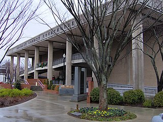
Bradley County is a county located in the southeastern portion of the U.S. state of Tennessee. As of the 2010 census, the population was 98,963, making it the thirteenth most populous county in Tennessee. Its county seat is Cleveland. It is named for Colonel Edward Bradley of Shelby County, Tennessee, who was colonel of Hale's Regiment in the American Revolution and the 15th Regiment of the Tennessee Volunteers in the War of 1812. Bradley County is included in the Cleveland, Tennessee Metropolitan Statistical Area, which is also included in the Chattanooga-Cleveland-Dalton, TN-GA-AL Combined Statistical Area.

Cleveland is the county seat and largest city of Bradley County, Tennessee, United States. The population was 41,285 at the 2010 census. It is the principal city of the Cleveland, Tennessee metropolitan area, which is included in the Chattanooga–Cleveland–Dalton, TN–GA–AL Combined Statistical Area.

Fort Pillow State Historic Park is a state park in western Tennessee that preserves the American Civil War site of the Battle of Fort Pillow. The 1,642 acre (6.6 km²) Fort Pillow, located in Lauderdale County on the Chickasaw Bluffs overlooking the Mississippi River, is rich in both historic and archaeological significance. In 1861, the Confederate army built extensive fortifications and named the site for General Gideon Johnson Pillow of Maury County. It was attacked and held by the Union Army for most of the American Civil War period except immediately after the Battle of Fort Pillow, when it was retaken by the Confederate Army. The battle ended with a massacre of African-American Union troops and their white officers attempting to surrender, by soldiers under the command of Confederate Major General Nathan Bedford Forrest. Interpretive sites are part of the park.

The Battle of Chalk Bluff, also known as the Skirmish at Chalk Bluff, was a military engagement of the American Civil War. The battle was fought near Chalk Bluff, northwest of St. Francis, where U.S. Brigadier General William Vandever, commanding the Second Division of the Army of the Frontier, was repulsed in an attempt to prevent Confederate General John S. Marmaduke's Division from crossing the St. Francis River. Though a Confederate victory, Marmaduke suffered considerable casualties and his momentum had been checked, forcing him to abandon his second expedition into Missouri.

Moccasin Bend Archeological District is an archeological site in Chattanooga, Tennessee, that is part of the Chickamauga and Chattanooga National Military Park unit. The National Park Service refers to it as one of the "most unique units found in the entire National Park Service." The area contains remnants of 12,000 years of continuous human habitation and therefore serves as a fascinating area with a rich history and unique cultural significance. For many years, there was little recognition of the historical significance of the area, and years of industrial development occurred on and around sites of archeological importance. After decades of campaigning by concerned citizens, private organizations, local officials, the Friends of Moccasin Bend National Park, and finally a state representative, the area was officially recognized as a National Archeological District in 2003. Moccasin Bend is currently undergoing a process of renovation and restoration that will allow the area to fulfill the National Park Service's mission of preserving "natural and cultural resources" for the "enjoyment, education, and inspiration of this and future generations."
Chatata, meaning "clear water", is the original Cherokee name of an area located in Bradley County, Tennessee. Today the name survives in references to a number of locations in Bradley County, most notably Chatata Valley in the northeastern part of the county. Chatata was also the original name of an unicorporated community in this region now known as Tasso.
Fort Cass, was a fort located on the Hiwassee River in present-day Charleston, Tennessee, that served as the military operational headquarters for the entire Cherokee removal, an forced migration of the Cherokee known as the Trail of Tears from their ancestral homelands in the Southeast to Indian Territory in present-day Oklahoma. Fort Cass housed a garrison of United States troops who watched over the largest concentration of internment camps where Cherokee were kept during the summer of 1838 before starting the main trek west to Indian Territory, and served as one of three emigration deports where the Cherokee began their journey west, the others of which were located at Ross's Landing in Chattanooga and Gunter's Landing near Guntersville, Alabama.

Red Clay State Historic Park is a state park located in southern Bradley County, Tennessee established in 1979. The park is also listed as an interpretive center along the Cherokee Trail of Tears. It encompasses 263 acres (1.06 km2) of land and is located just above the Tennessee-Georgia stateline.

The Confederate Monument in Danville, located between Centre College and the Presbyterian Church of Danville at the corner of Main and College Streets in Danville, Kentucky, is a monument dedicated to the Confederate States of America that is on the National Register of Historic Places. The monument was dedicated in 1910 by the surviving veterans of the Confederacy of Boyle County, Kentucky and the Kate Morrison Breckinridge Chapter of the United Daughters of the Confederacy. The monument consists of a granite pedestal and a marble statue resting thereon. The marble figure depicts Captain Robert D. Logan, who actually came from Lincoln County, Kentucky, but lived after the war in Boyle County. Captain Logan served under John Hunt Morgan in the 6th Kentucky Cavalry's Company A, and was captured after Morgan's Raid in Cheshire, Ohio on July 20, 1863, and spent much of the war afterwards in prison camps, particularly the Ohio State Penitentiary. He died on June 25, 1896, fourteen years before the construction of the monument. The granite pedestal is twelve feet tall, and uses pairs of Doric columns to decorate it. The main inscription reads: C. S. A. 1861 - 1865 What They Were the Whole World Knows.

The history of Idaho in the American Civil War is atypical, as the territory was far from the battlefields.

Camp Nelson Heritage National Monument, formerly Camp Nelson National Monument and before that Camp Nelson Civil War Heritage Park, is a 525-acre (2.12 km2) national monument, historical museum and park located in southern Jessamine County, Kentucky, United States, 20 miles (32 km) south of Lexington, Kentucky. The American Civil War era camp was established in 1863 as a depot for the Union Army during the Civil War. It became a recruiting ground for new soldiers from Eastern Tennessee and enslaved people, many of whom had fled their living conditions to be soldiers.

Broad Street United Methodist Church is a historic Methodist church located at 155 Central Ave NW in Cleveland, Tennessee, United States.

Fort Granger was a Union fort built in 1862 in Franklin, Tennessee, south of Nashville, after their forces occupied the state during the American Civil War. One of several fortifications constructed in the Franklin Battlefield, the fort was used by Union troops to defend their positions in Middle Tennessee against Confederate attackers. The Second Battle of Franklin in 1864, part of the Franklin-Nashville Campaign in the Western Theater, was the most notable engagement of this area during the Civil War.

Roper's Knob Fortifications were constructed by Union Army forces between February and May 1863 in Franklin, Tennessee. According to Tennessee Archaeology, "Roper's Knob served as part of a chain of signal stations that provided a communications link from Franklin to Murfreesboro. Additionally the knob had a large redoubt capable of holding four large artillery pieces, a blockhouse, cisterns, and a magazine. ... "
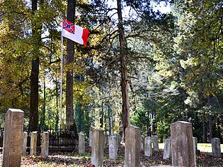
The Camp White Sulphur Springs Confederate Cemetery is an American Civil War cemetery in Arkansas. It is located northeast of the village of Sulphur Springs, also known as White Sulphur Springs, in Jefferson County.

The Hair Conrad Cabin is a historic log cabin in Bradley County, Tennessee, United States, and the oldest residential structure in the county.
Tasso is an unincorporated community located in Bradley County, Tennessee approximately five miles north-northeast of the business district of Cleveland. Its coordinates are approximately 35.212 N, 84.804 W and its elevation is approximately 814 feet. It appears in the East Cleveland US Geological Survey records. Tasso is included in the Cleveland metropolitan statistical area.

Rattlesnake Springs is a historic site in Bradley County, Tennessee listed on the National Register of Historic Places (NRHP) in 1975.

The Henegar House is a historic house in Charleston, Tennessee. Constructed in 1849, it is the oldest remaining brick structure in Bradley County. It was listed on the National Register of Historic Places (NRHP) in 1976.
The Hiwassee River Heritage Center is a history museum located in Charleston, Tennessee which was established in 2013. The museum chronicles the region's Cherokee and Civil War history. It is a certified interpretive center on the Trail of Tears National Historic Trail.
