Citico (Cherokee town)

Last updated

Citico
Citico-timberlake-detail1.jpg
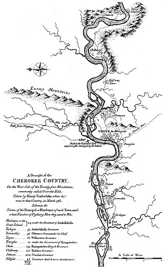
Citico ("Settacoo") on Henry Timberlake's 1762 "Draught of the Cherokee Country"
Location Monroe County, Tennessee
Nearest city Vonore
Coordinates 35°32′56″N84°5′56″W / 35.54889°N 84.09889°W / 35.54889; -84.09889
Built1000–1500 CE
NRHP reference No. 78002614
Added to NRHP1978

Citico (also "Settaco", "Sitiku", and similar variations) is a prehistoric and historic Native American site in Monroe County, Tennessee, in the southeastern United States. The site's namesake Cherokee village was the largest of the Overhill towns, housing an estimated Indian population of 1,000 by the mid-18th century. [1] The Mississippian village that preceded the site's Cherokee occupation is believed to have been the village of "Satapo" visited by the Juan Pardo expedition in 1567.

Contents

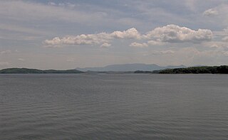
The Citico (Cherokee : ᏏᏘᎫ, romanized: Sitigu) site is now submerged by the Tellico Lake impoundment of the Little Tennessee River, created by the completion of Tellico Dam at the mouth of the river in 1979. The modern community of Citico Beach has developed along the shoreline above the ancient site. The lake is managed by the Tennessee Valley Authority and the Tennessee Wildlife Resources Agency.

Geography

Tellico Lake covers the lower 33 miles (53 km) of the Little Tennessee River, which flows down from the mountains to the south and traverses parts of Blount, Monroe, and Loudon counties before emptying into the Tennessee River near Lenoir City. The Citico site was situated along the southwest bank of the river immediately below the river's confluence with Citico Creek, which empties into the river approximately 31 miles (50 km) upstream from the river's mouth. Citico is located in an area where the Great Smoky Mountains and the Unicoi Mountains give way to the Appalachian Ridge-and-Valley Province.

Citico Beach is located along Highway 455 approximately 14 miles (23 km) south of Vonore. The Citico site is also visible from the Harrison Branch boat ramp, which is located just off U.S. Route 129 2 miles (3.2 km) south of Pumpkin Center.

History

Satapo

On October 16, 1567, an expedition led by Spanish explorer Juan Pardo arrived at a village known as "Satapo" while en route to Coosa, a powerful chiefdom centered in modern northern Georgia. Research conducted by anthropologist Charles Hudson in the 1980s suggests that Satapo was situated at the Citico site in Monroe County, and that the two names are linguistically related. According to Hudson, the Pardo expedition left Olamico (on Zimmerman's Island, now submerged by Douglas Lake) on October 13 and traveled southwest across the foothills of the Great Smokies, crossing Little River at modern-day Walland and traversing Happy Valley to arrive at "Chalahume" (Chilhowee) in the Little Tennessee Valley on October 15. After the expedition made its way to Satapo the following day, a friendly native warned Pardo of a plot against him, and the expedition returned to Olamico shortly thereafter. [2]

Hudson speculates that when the Cherokee replaced Satapo's Muskogeean-speaking Mississippian inhabitants, the Cherokee kept the site's name. However, as the Cherokee language lacks bilabial stops, the "p" sound in "Satapo" was replaced with a "k" sound, giving the site its Cherokee name.

The Cherokee period

The Cherokee believed that a cliff overlooking Citico was once home the "Tlanuwas"— two giant hawks that terrorized people in the valley until a high priest managed to rob their nest and drop their eggs in the water below, where they were devoured by the Uktena. [3] A Cherokee village thrived at Citico when English explorers and traders began entering the Tennessee Valley in large numbers in the early 18th century. Citico's "head man" was among the 'chiefs' who met with Colonel George Chicken at Tanasi in 1725 to form an alliance against the hostile Creeks. Citico appears on George Hunter's 1730 map of the Cherokee region and is mentioned by Alexander Cuming that same year as being one of the Overhill towns headed by a "prince" (i.e., not headed by a "king," and thus not a "mother town"). [4]

Captain Henry Timberlake, who visited the Overhill towns on a peace mission (the Timberlake Expedition) in 1761–1762, reported 204 warriors at Citico, the most of any Overhill town. Cheulah, the head man of Citico, greeted Timberlake with a ceremonial dance involving 400 townspeople and presented Timberlake with a string of beads. At a pipe-smoking ceremony held afterward at the Citico townhouse, Timberlake recalled smoking so many peace pipes that he "could not stir for several hours." [5]

Decline and Early European Settlement

The now-submerged former site of Citico Citico-creek-mouth-tennessee.jpg
The now-submerged former site of Citico

The Overhill Cherokee consistently found themselves at odds with encroaching Euro-American settlers. After the Cherokee aligned themselves with the British in the American Revolution, the colonies dispatched forces under Colonel William Christian and General Griffith Rutherford to subdue the Overhill towns in 1776. When War Chief Dragging Canoe refused to settle for peace, Christian burned five Overhill towns, including Citico. [6] The town burned had already been deserted because its entire population had chosen to follow Dragging Canoe's move to the southwest, where they re-established themselves at the mouth of a small creek in a town of the same name in what is now Chattanooga. Historian J. G. M. Ramsey reported a conference between militia commander John Sevier and Cherokee Chief Hanging Maw held at the original Citico in 1782 in which the two sides agreed to a truce. Ramsey goes on to relate a violent encounter two years later between Major James Hubbard and Untoola— a Cherokee "head man" known as the "Gun Rod of Citico"— that left Untoola dead and led to a warrant being issued for Hubbard's arrest. [7]

In the late 1780s, a company of scouts led by Captain John Fain was collecting (or stealing) apples at the former site of Citico when they were ambushed by a band of Cherokees. Sixteen of Fain's men were killed, and 4 were wounded. A militia force led by Captain Nathaniel Evans arrived shortly thereafter to find several scalped and disemboweled bodies. Evans eventually linked up with Sevier's larger force, and the combined force set out in pursuit of the Cherokee responsible for the slaughter. [8]

Citico Baptist Church Citicobaptistchurch.jpg
Citico Baptist Church

In the early 19th century, Scots-Irish, English, and German families increasingly began to settle along the isolated ridges and hollows of the Citico Creek Wilderness. Citico Baptist Church, founded in the 1840s by the Rev. William Clinton Millsaps, is the burial site for many of these early settlers.

Archaeology

While Paleo-Indian fluted points and Archaic period (8000–1000 BCE) artifacts were uncovered at Citico and a substantial Woodland period (1000 BCE–1000 CE) site was located at nearby Harrison Branch, Citico probably did not rise to prominence until the 16th century. [9] Around this time, Citico is believed to have superseded Toqua as the dominant Dallas phase (ca. 1300–1550 CE) Mississippian village in the Little Tennessee Valley. [10]

In the 1880s, a mound survey conducted by the Smithsonian Institution reported eight mounds— one "temple" mound and seven smaller mounds— at the Citico site. The temple mound contained at least 91 burials. A brief excavation carried out by the Knoxville Chapter of the Tennessee Archaeological Society uncovered several Woodland, Mississippian, and Cherokee artifacts, including shell gorgets and knife blades. The chapter also reported a Cherokee burial accompanied by a musket, knife, steatite pipe, and glass beads. [11]

In anticipation of the flooding of the site by Tellico Lake, University of Tennessee researchers conducted excavations at Citico in the late 1960s and late 1970s. Excavators uncovered the posthole patterns of 11 domestic structures, 55 burials, 119 features, and over 30,000 ceramics. The structures included two rectangular summer house/circular winter house pairings characteristic of Overhill Cherokee dwellings, a small circular structure, a square structure, and five rectangular structures. One of the rectangular structures was associated with the site's Mississippian occupation, while the other 10 structures dated to the Cherokee period. [12] [13] These excavations also uncovered Spanish materials, including Clarksdale bells, lending further evidence to the theory that Citico was indeed the Satapo visited by the Pardo expedition in 1567. [14] [15] An analysis of faunal remains from the Cherokee period showed a heavy reliance upon deer and bear for meat supplements which gradually gave way to a reliance upon domesticated animals, such as hogs and chickens, due to increased adoption of Euro-American agricultural methods. [16]

Related Research Articles

<span class="mw-page-title-main">Monroe County, Tennessee</span> County in Tennessee, United States

Monroe County is a county located on the eastern border of the U.S. state of Tennessee. As of the 2020 census, the population was 46,250. Its county seat is Madisonville, and its largest city is Sweetwater.

<span class="mw-page-title-main">Vonore, Tennessee</span> Town in Tennessee, United States

Vonore is a town in Monroe County and Blount County, Tennessee, in the southeastern portion of the state. The population was 1,574 as of the 2020 census. The city hall, library, community center, police department, and fire department are located on Church Street.

<span class="mw-page-title-main">Little Tennessee River</span> River in the United States of America

The Little Tennessee River is a 135-mile (217 km) tributary of the Tennessee River that flows through the Blue Ridge Mountains from Georgia, into North Carolina, and then into Tennessee, in the southeastern United States. It drains portions of three national forests— Chattahoochee, Nantahala, and Cherokee— and provides the southwestern boundary of the Great Smoky Mountains National Park.

<span class="mw-page-title-main">Tuskegee (Cherokee town)</span> Former Overhill Cherokee town in Monroe County, Tennessee

Tuskegee was an Overhill Cherokee town located along the lower Little Tennessee River in what is now Monroe County, Tennessee, United States. The town developed in the late 1750s alongside Fort Loudoun, and was inhabited until the late 1770s. It was forcibly evacuated and probably burned during the Cherokee–American wars.

<span class="mw-page-title-main">Chota (Cherokee town)</span> United States historic place

Chota is a historic Overhill Cherokee town site in Monroe County, Tennessee, in the southeastern United States. Developing after nearby Tanasi, Chota was the most important of the Overhill towns from the late 1740s until 1788. It replaced Tanasi as the de facto capital, or 'mother town' of the Cherokee people.

<span class="mw-page-title-main">Tanasi</span> Historic Cherokee village in Tennessee, USA

Tanasi was a historic Overhill settlement site in present-day Monroe County, Tennessee, in the southeastern United States. The village became the namesake for the state of Tennessee. It was abandoned by the Cherokee in the 19th century for a rising town whose chief was more powerful. Tanasi served as the de facto capital of the Overhill Cherokee from as early as 1721 until 1730, when the capital shifted to Great Tellico.

<span class="mw-page-title-main">Unicoi Mountains</span> Mountain range in North Carolina, United States

The Unicoi Mountains are a mountain range rising along the border between Tennessee and North Carolina in the southeastern United States. They are part of the Blue Ridge Mountain Province of the Southern Appalachian Mountains. The Unicois are located immediately south of the Great Smoky Mountains and immediately west of the Cheoah Mountains. Most of the range is protected as a national forest, namely the Cherokee National Forest on the Tennessee side and the Nantahala National Forest on the North Carolina side— although some parts have been designated as wilderness areas and are thus more strictly regulated.

<span class="mw-page-title-main">Fort Loudoun (Tennessee)</span> 18th century British fort in North America

Fort Loudoun was a British fort located in what is now Monroe County, Tennessee. Constructed from 1756 until 1757 to help garner Cherokee support for the British at the outset of the French and Indian War, the fort was one of the first significant British outposts west of the Appalachian Mountains. The fort was designed by John William Gerard de Brahm, while its construction was supervised by Captain Raymond Demeré; the fort's garrison was commanded by Demeré's brother, Paul Demeré. It was named for the Earl of Loudoun, the commander of British forces in North America at the time.

<span class="mw-page-title-main">Icehouse Bottom</span> Archeological site in East Tennessee

Icehouse Bottom is a prehistoric Native American site in Monroe County, Tennessee, located on the Little Tennessee River in the southeastern United States. Native Americans were using the site as a semi-permanent hunting camp as early as 7500 BC, making it one of the oldest-known habitation areas in Tennessee. Analysis of the site's Woodland period artifacts shows evidence of an extensive trade network that reached to indigenous peoples in Georgia, North Carolina, and Ohio. This was later an area of known Cherokee settlements, the people encountered by Anglo-European settlers in the 18th and 19th centuries.
<span class="mw-page-title-main">Overhill Cherokee</span> 18th century Cherokee people who lived on the west side of the Appalachian Mountains

Overhill Cherokee was the term for the Cherokee people located in their historic settlements in what is now the U.S. state of Tennessee in the Southeastern United States, on the western side of the Appalachian Mountains. This name was used by 18th-century European traders and explorers from British colonies along the Atlantic coast, as they had to cross the mountains to reach these settlements.

Henry Timberlake was a colonial Anglo-American officer, journalist, and cartographer. He was born in the Colony of Virginia and died in England. He is best known for his work as an emissary from the British colonies to the Overhill Cherokee during the 1761–1762 Timberlake Expedition.

<span class="mw-page-title-main">Toqua (Tennessee)</span> Prehistoric Native American site in Monroe County, Tennessee, United States

Toqua was a prehistoric and historic Native American site in Monroe County, Tennessee, located in the Southeastern Woodlands. Toqua was the site of a substantial ancestral town that thrived during the Mississippian period. Toqua had a large earthwork 25-foot (7.6 m) platform mound built by the town's Mississippian-era inhabitants, in addition to a second, smaller mound. The site's Mississippian occupation may have been recorded by the Spanish as the village of Tali, which was documented in 1540 by the Hernando de Soto expedition. It was later known as the Overhill Cherokee town Toqua, and this name was applied to the archeological site.

<span class="mw-page-title-main">Tomotley</span> United States historic place

Tomotley is a prehistoric and historic Native American site along the lower Little Tennessee River in Monroe County, Tennessee, in the southeastern United States. Occupied as early as the Archaic period, the Tomotley site was occupied particularly during the Mississippian culture period, which was likely when its earthwork platform mounds were built. It was also occupied during the eighteenth century as a Cherokee town. It revealed an unexpected style: an octagonal townhouse and square or rectangular residences. In the Overhill period, Cherokee townhouses found in the Carolinas in the same period were circular in design, with,
<span class="mw-page-title-main">Citico Creek Wilderness</span> Wilderness area in Tennessee, U.S.

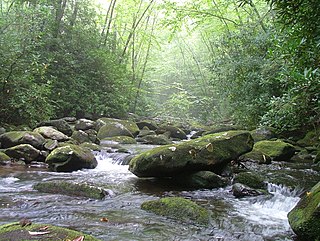
Citico Creek Wilderness is a 16,226-acre (66 km2) wilderness area within the Cherokee National Forest in the U.S. state of Tennessee. The wilderness contains the entire upper drainage of Citico Creek, which consists of the north and south forks and at least eight tributaries. Three steep-sided ridges descend west from the crest of the Unicoi Mountains — Brush Mountain, Pine Ridge, and Sassafras Ridge.

<span class="mw-page-title-main">Chilhowee (Cherokee town)</span> Cherokee village site in Blount and Monroe Counties, Tennessee

Chilhowee was a prehistoric and historic Native American site in present-day Blount and Monroe counties in Tennessee, in what were the Southeastern Woodlands. Although now submerged by the Chilhowee Lake impoundment of the Little Tennessee River, the Chilhowee site was home to a substantial 18th-century Overhill Cherokee town. It may have been the site of the older Creek village "Chalahume" visited by Spanish explorer Juan Pardo in 1567. The Cherokee later pushed the Muscogee Creek out of this area.

<span class="mw-page-title-main">Mialoquo (Cherokee town)</span> United States historic place

Mialoquo is a prehistoric and historic Native American site in Monroe County, Tennessee, in the southeastern United States. The site saw significant periods of occupation during the Mississippian period and later as a Cherokee refugee village. While the archaeological site of Mialoquo was situated on the southwest bank of the Little Tennessee River, the village's habitation area probably included part of Rose Island, a large island in the river immediately opposite the site. Rose Island was occupied on at least a semi-permanent basis as early as the Middle Archaic period.

<span class="mw-page-title-main">Tallassee (Cherokee town)</span> Native American settlement

Tallassee is a prehistoric and historic Native American site in present-day Blount and Monroe counties, Tennessee in the southeastern United States. Tallassee was the southernmost of a string of Overhill Cherokee towns that existed along the lower Little Tennessee River on the west side of the Appalachian Mountains in the 18th century. Although Tallassee receives scant attention in primary historical accounts, it is one of the few Overhill towns to be shown on every major 18th-century map of the Little Tennessee Valley.
<span class="mw-page-title-main">Chiaha</span> Mississippian culture chiefdom in Tennessee

Chiaha was a Native American chiefdom located in the lower French Broad River valley in modern East Tennessee, in the southeastern United States. They lived in raised structures within boundaries of several stable villages. These overlooked the fields of maize, beans, squash, and tobacco, among other plants which they cultivated. Chiaha was at the northern extreme of the paramount Coosa chiefdom's sphere of influence in the 16th century when the Spanish expeditions of Hernando de Soto and Juan Pardo passed through the area. The Chiaha chiefdom included parts of modern Jefferson and Sevier counties, and may have extended westward into Knox, Blount and Monroe counties.
<span class="mw-page-title-main">Bussell Island</span> United States historic place

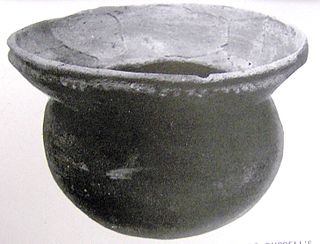
Bussell Island, formerly Lenoir Island, is an island located at the mouth of the Little Tennessee River, at its confluence with the Tennessee River in Loudon County, near the U.S. city of Lenoir City, Tennessee. The island was inhabited by various Native American cultures for thousands of years before the arrival of early European explorers. The Tellico Dam and a recreational area occupy part of the island. Part of the island was added in 1978 to the National Register of Historic Places for its archaeological potential.

The Dallas phase is an archaeological phase, within the Mississippian III period, in the South Appalachian Geologic province in North America.

References

  1. "Settico Site on the Little Tennessee River." Tennessee Archaeologist 16, no. 2 (Autumn of 1960), 93.
  2. Charles Hudson, The Juan Pardo Expeditions: Explorations of the Carolinas and Tennessee, 1566–1568 (Tuscaloosa, Ala.: University of Alabama Press, 2005), 36–40.
  3. James Mooney, Myths of the Cherokee and Sacred Formulas of the Cherokee (Nashville, Tenn.: C and R Elder, 1972), 315–316.
  4. Samuel Cole Williams, Early Travels in the Tennessee Country, 1540–1800 (Johnson City, Tenn.: The Watauga Press, 1928), 102, 114, 122.
  5. Henry Timberlake, Samuel Cole Williams (ed.), Memoirs, 1756–1765 (Marietta, Georgia: Continental Book Co., 1948), 63–65.
  6. Kurt Russ and Jefferson Chapman, Archaeological Investigations at the Eighteenth Century Overhill Cherokee Town of Mialoquo (40MR3) (University of Tennessee Department of Anthropology Report of Investigations 37, 1983), 18–19.
  7. J.G.M. Ramsey, The Annals of Tennessee (Johnson City, Tenn.: Overmountain Press, 1999), 272, 301–304.
  8. Ramsey, The Annals of Tennessee, 422.
  9. Jefferson Chapman, Tellico Archaeology: 12,000 Years of Native American History (Tennessee Valley Authority, 1985), 3, 37, 48, 65, 77.
  10. Richard Polhemus, The Toqua Site — 40MR6 Vol. 2 (Tennessee Valley Authority, 1987), 1242.
  11. "Settico Site on the Little Tennessee River." Tennessee Archaeologist 16, no. 2 (Autumn of 1960), 93–95.
  12. Gerald Schroedl (ed.), Overhill Cherokee Archaeology at Chota-Tanasee (University of Tennessee Department of Anthropology, Report of Investigations 38, 1986), 539, 544.
  13. William Baden, Tomotley: An Eighteenth Century Cherokee Village Archived 2011-06-08 at the Wayback Machine (Tennessee Valley Authority, 1983), 144–180. Retrieved: 11 April 2008.
  14. John Burch, "Citico Archaeological Sites." The Encyclopedia of Appalachia (Knoxville, Tenn.: University of Tennessee Press, 2006), 298.
  15. Polhemus, The Toqua Site (Vol. 2), 1246.
  16. Arthur Bogan, "Faunal Remains from the Historic Cherokee Occupation at Citico (40MR7), Monroe County, Tennessee." Tennessee Anthropologist 8, no. 1 (Spring of 1983), 30–44.